Cherireen Sar, first ascent, via west ridge
Pakistan, Karakoram, Virjerab Muztagh
I met Lukas Woerle (Austria) in 2022 at Gasherbrum base camp. Two years later, by coincidence, we met again at the same spot, and he joined me and Tom Livingstone for acclimatization climbs while we prepared for our ascent of Gasherbrum III (AAJ 2025). After that trip, Lukas and I decided to visit the Shimshal Valley together.
Originally, we planned to go in May, when we expected more snow and lower temperatures; however, after I suffered a severe ankle injury, the trip was postponed, and Lukas, his brother Vincent, and I did not make it to Shimshal until July. The journey there is spectacular: You drive on a road no more than two meters wide, carved into steep and at times overhanging terrain. It was built more than 20 years ago by local volunteers—without a single bag of cement.
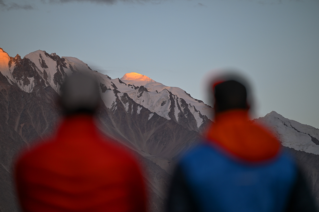
After three short days of walking, we arrived at an excellent base camp at 3,800 meters on the lateral moraine of the Khurdopin Glacier. Since the weather was fantastic and my ankle wasn’t complaining too much, Lukas and I immediately climbed to 5,000 meters for acclimatization. We ascended the valley that led toward our original goal and the highest peak in the area, Khurdopin Sar (6,310m on maps, but climbers measured it by GPS as 6,458 meters later in the year—see report here), then cut up onto the west ridge of neighboring Cherireen Sar and descended that ridge to base camp.
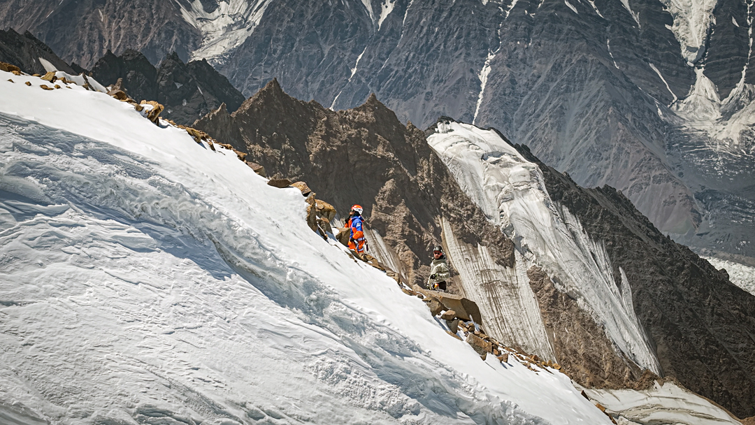
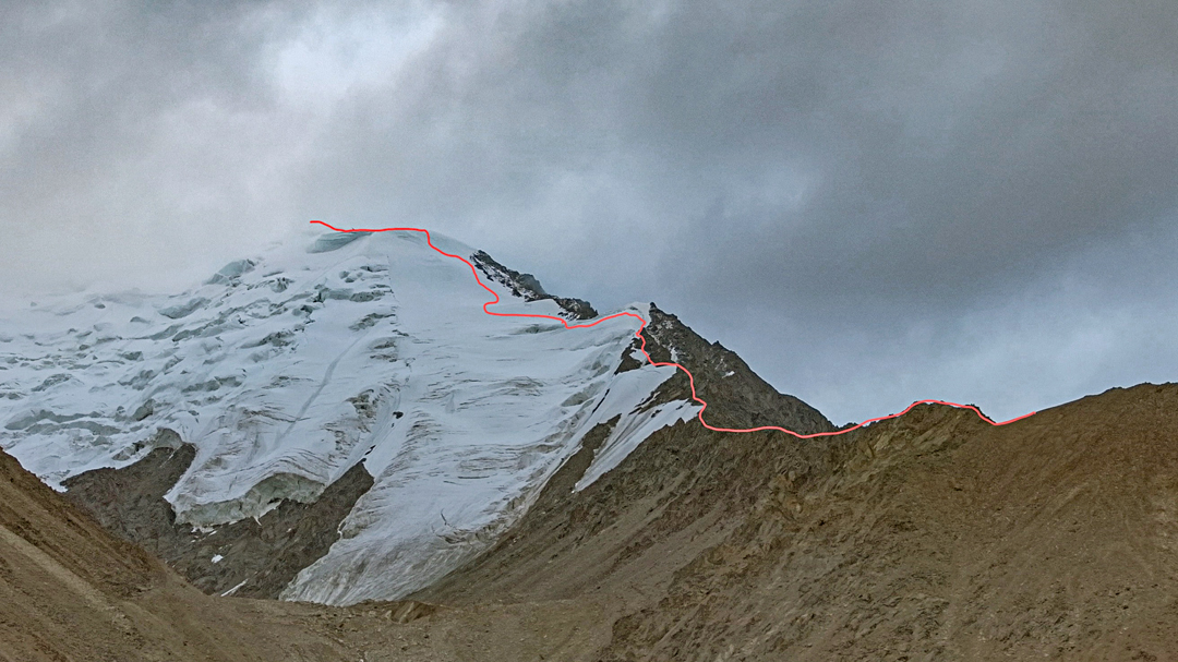
We quickly decided that we would not be climbing Khurdopin Sar: The summit ridge had massive cornices, and to avoid these, we would need to spend too much time under a large serac. Our best option was to try the west ridge of Cherireen Sar (6,083m on the Wala map, 36°15’59.80”N, 75°32’36.11”E). After a week of bad weather that tested our patience and a false start aborted by rain at 4,700 meters, Lukas and I set out for an attempt on July 27. By late afternoon, we arrived on a small, rocky ridge at 5,000 meters. There was no place to pitch our little tent, so despite light rain in the evening, we made an open bivouac.
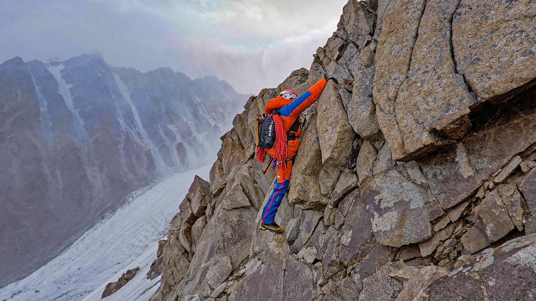
We set off again at 2:30 a.m. on July 29. The weather was not promising, but when we reached the upper, glaciated part of the mountain, it began to improve. We reached the summit (which we measured at 6,224m GPS) in early afternoon. The descent to base camp took us well into the evening and required much attention, particularly on the very unstable rocky terrain below 5,500 meters.
We called our route Chicken Run (2,400m, D 80°). Technically, it was not an exceptional achievement, but I am happy to have made the first ascent of this mountain. We took what we could get, and I don’t regret for one moment our decision not to try Khurdopin Sar, which would have been unreasonably dangerous at the time.
—Aleš Česen, Slovenia
Media Gallery