Hemar Ri, Northwest Ridge
India, Ladakh
 In preparation for a higher trek in the Pologongka Group, Claudia Bäumler, 15-year-old Nina Bielefeldt, Nuhbu Gojing, and I made a three-day trek from Kanji via the Yogma La and Shinguche La to the Spang Nala (valley). Ascents by others in the region have appeared in the 2016 and 2020 AAJs. Since the purpose of the trek was acclimatization, we climbed only an easy peak near the entrance to the valley.
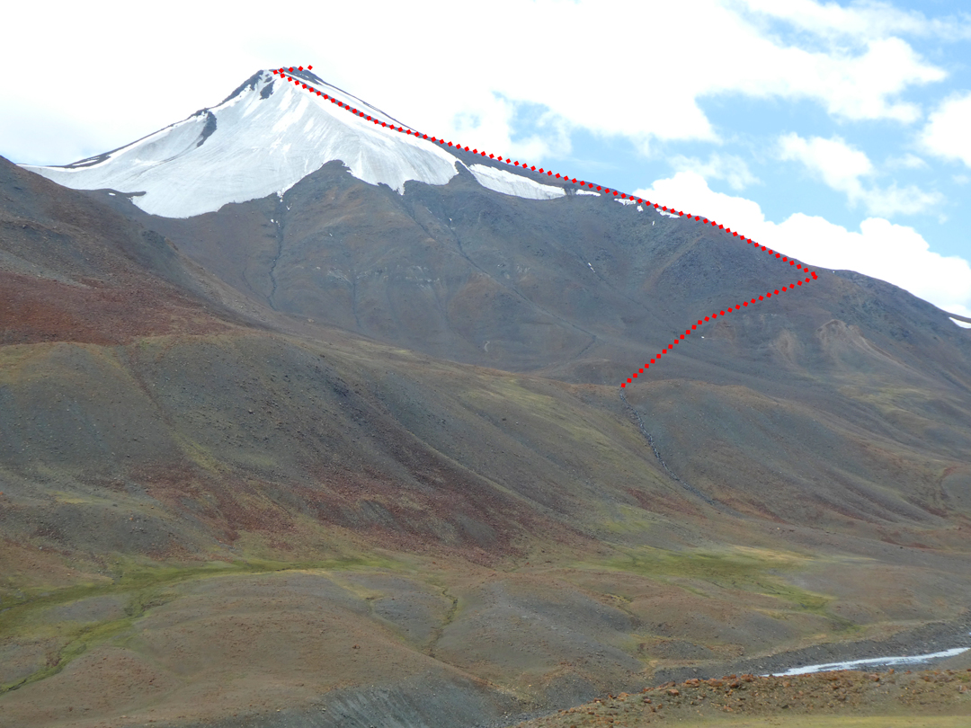
On August 8, from a camp near Spang Nala as marked on the Survey of India (SoI) map at 4,840m, we ascended a peak to the south, on the east rim of the valley. We hiked easily up the northwest ridge—mostly a scree slope—until it turned south. Scrambling, with little elevation gain, took us to the summit, which we measured as 5,699m. Astonishingly, we found no sign of a previous visit, such as a cairn or prayer flags. This peak has no name on the Olizane or OpenTopo maps. On the free version of the SoI map (143K12) there is a Hemar Glacier marked just to the north of the peak. We therefore suggest the name Hemar Ri (34°03'46" N, 76°44'30"E). In terms of alpine trekking/hiking, the grade was T3/T4.
—Hartmut Bielefeldt, Germany
Media Gallery