Mt. Pratt, First Recorded Ascent, via Northwest Glacier; Castle Mountain, North Face
Alaska, Coast Mountains, Stikine Ice Cap
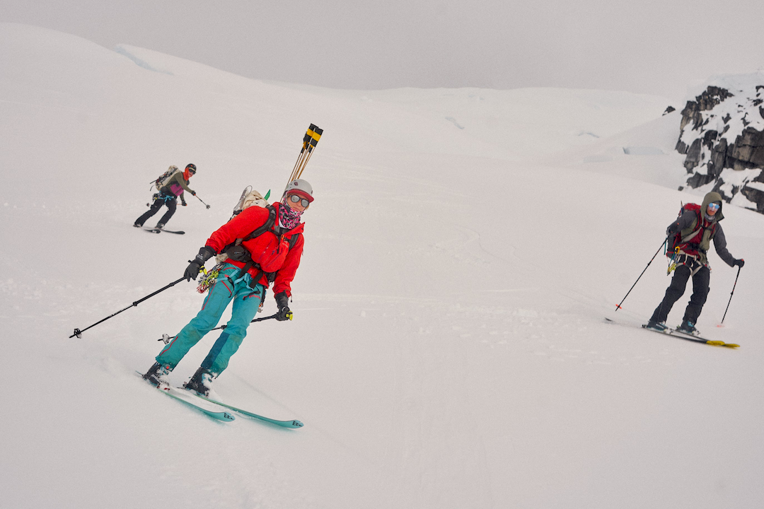
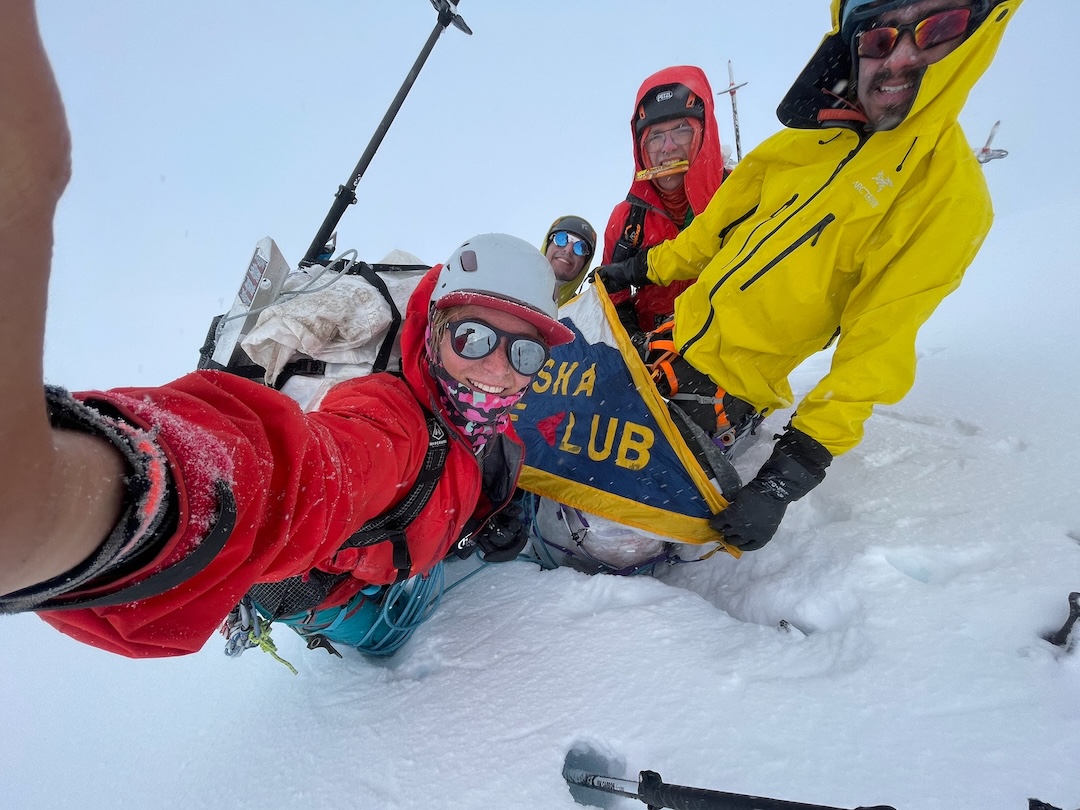
Leo Nordman, Hazel Probst, Simeon Ramirez, and I arrived in Petersburg on May 5 with the main objective of climbing Kates Needle (10,106’). We were met with unseasonably rainy weather, which scuttled our plan to be helicoptered onto the Patterson Glacier, near the Stikine-LeConte Wilderness boundary. Instead, on May 11, we took a floatplane to Patterson Lake, then laboriously ferried gear and 23 days of food through dense alder onto the toe of the Patterson Glacier.
A mile up-glacier we encountered extensive crevassing that precluded further progress with our heavy sleds. Luckily, the weather briefly turned sunny, and we were able to arrange a bump by helicopter to 3,700 feet on the main branch of the Patterson. From there, we rapidly progressed south over the Stikine Ice Cap, then north again, making base camp at 4,300 feet on the northeast branch of the LeConte Glacier.
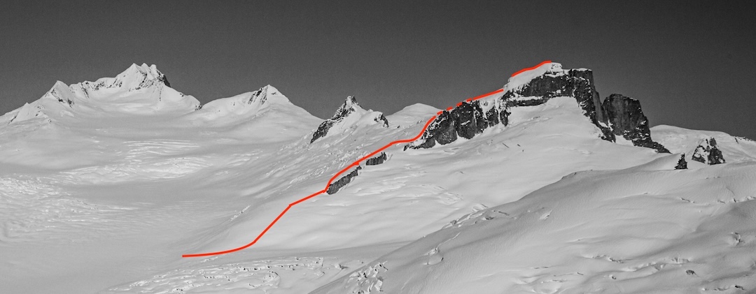
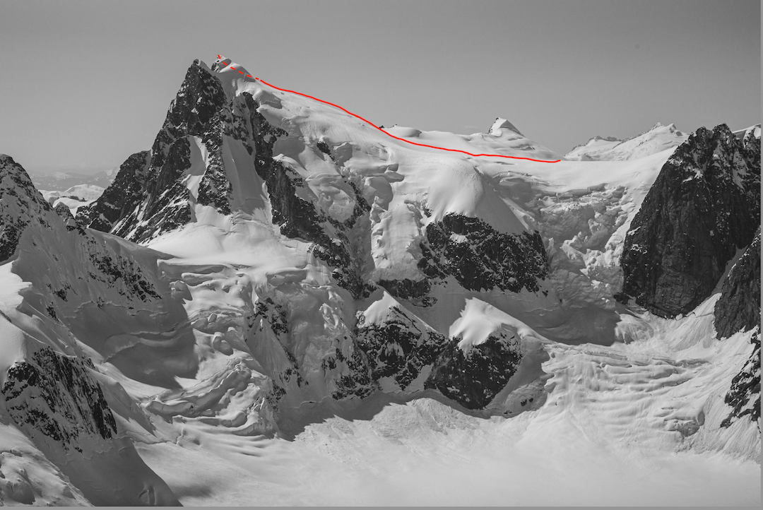
We then waited for a weather window to attempt Kates Needle, but it never materialized. The clouds would occasionally part, though, and we were afforded brief views of Mt. Pratt (7,950’, 56.954583, -132.127389), directly above camp. The route to the summit seemed straightforward, giving us the confidence to attempt it despite the peak being enveloped in clouds. On May 18 we completed what we believe to be the first ascent.
We skirted north of the icefall at the base, then skied up moderate slopes to the rocky northwest ridge. We stayed north of the ridge crest, and at approximately 6,300 feet left our skis as the slope steepened and more careful navigation through the crevasse field was required. About 400 feet below the summit, we had to skirt east away from the ridge to circumvent a large crevasse, and from there proceeded on moderate snow to the top. We descended in a complete whiteout, guided by wands we had placed. The Northwest Glacier (3,500’, moderate snow) took about seven hours camp to camp.
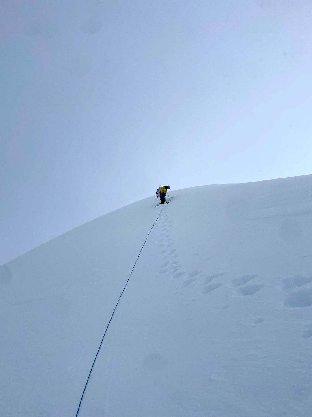
On May 20, we climbed Castle Mountain (ca 7,333’, 56.873583, -132.123472) by its north face. This was the second ascent of the peak, after Fred Douglas and Paul Starr climbed it from the Shakes Glacier in 1970, following a long, arcing route over a southwestern satellite peak and finishing up the northwest ridge (see AAJ 1971). We probably climbed their descent route.
As on Pratt, we climbed the peak in a complete whiteout. We skied to within 300 feet of the summit and from there climbed steep snow to the top. The ski down was engaging because of the poor visibility. At one point, we looked back to discover we had skied directly over a crevasse that was open except for the short bridge we had crossed. The ascent was about 14 miles and 12 hours camp to camp (1,100’, 50°–55°).
Back in base camp, we received word that a lengthy storm system was set to arrive in 48 hours. On May 21, we skied out to our landing zone on the Patterson Glacier. The next day, the clouds briefly opened up and the helicopter just made it through to whisk us back to Petersburg.
It should be expected that access to the ice cap, as well as the climbing routes themselves, will continue to change in the face of rapid ice loss. For example, more than five years ago, it would have been impossible to land a plane at the toe of the Patterson. Due to glacial recession, a new lake has formed, enabling float plane landings. Expeditions planning to ascend the Patterson from sea level will likely need to employ an airdrop to avoid hauling sleds through the complex glacial terrain. Alternatively, a ski plane could easily land on the northeast branch of the LeConte.
This trip was made possible by the guidance of Dieter Klose, the hospitality provided by Vanessa Martin in Petersburg, and the Peter MacKeith Grant.
—Torin Hooge
Media Gallery