Little Podju and McAlpine Peak, First Ascents
Alaska, Chugach Mountains
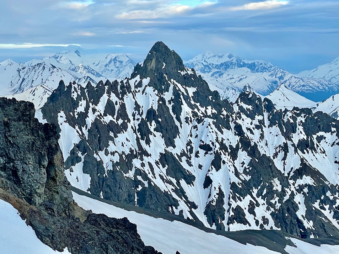
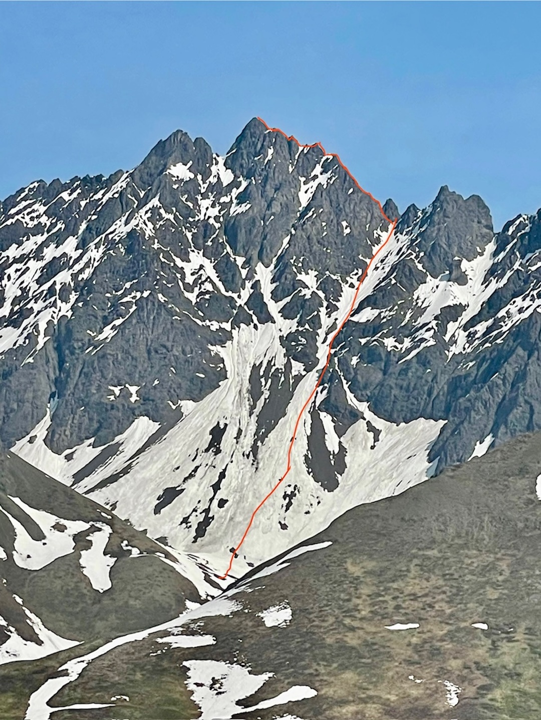
The west face of Little Podju as seen from Big Ramp. Photo by Joda Hankins
On June 20, Travis Powell and I took an afternoon helicopter bump from Hunter Creek, where we both live, to a basin at 3,500 feet on the west side of a mountain that Martin Martinez (a longtime local with many first ascents) calls Little Podju (6,340’, 61.553472, -148.666889). This peak is just west of Friday Creek in the Chugach Mountains.
I’ve spent the past few winters exploring the Knik on a snowmachine, specifically seeking out access to this peak through Friday Creek for an over-land approach. However, we reluctantly settled on chopper access to bypass Friday Creek’s deep water, bears, and tight canyon walls.
After setting up camp, we started toward the 1,000-foot snow couloir that leads to a col just south of the summit. The solstice-warmed snow made for excellent travel, and the terrain rarely breached 45°. We reached the saddle two and a half hours after leaving camp and swapped out boots for rock shoes. We carried an assorted rack of cams, pins, and nuts—uncertain at what we might encounter, though expecting overall poor rock quality.
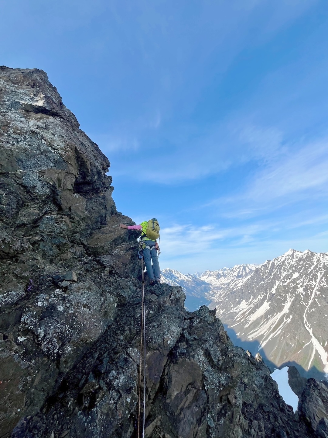
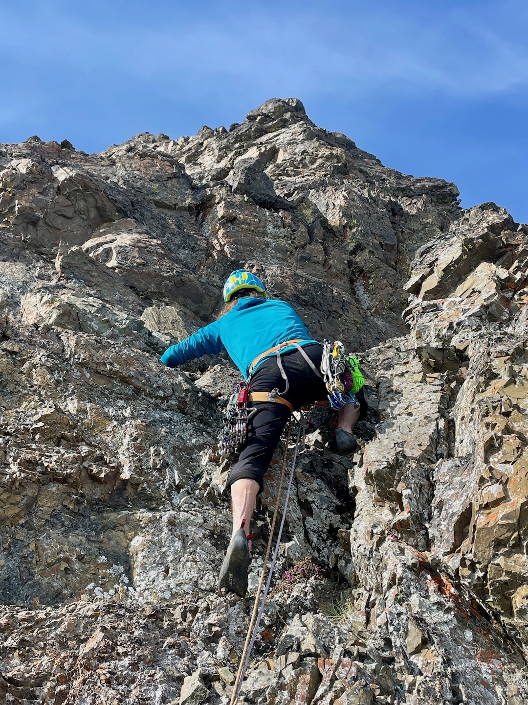
The initial pitch leaving the snow proved to be the steepest, climbing for roughly 100 feet through pockets of micro-stable terrain in an otherwise balanced choss pile held together by turf and sand up to 80°. It was likely 5.6, but our focused movement made it feel harder.
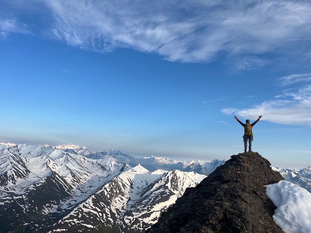
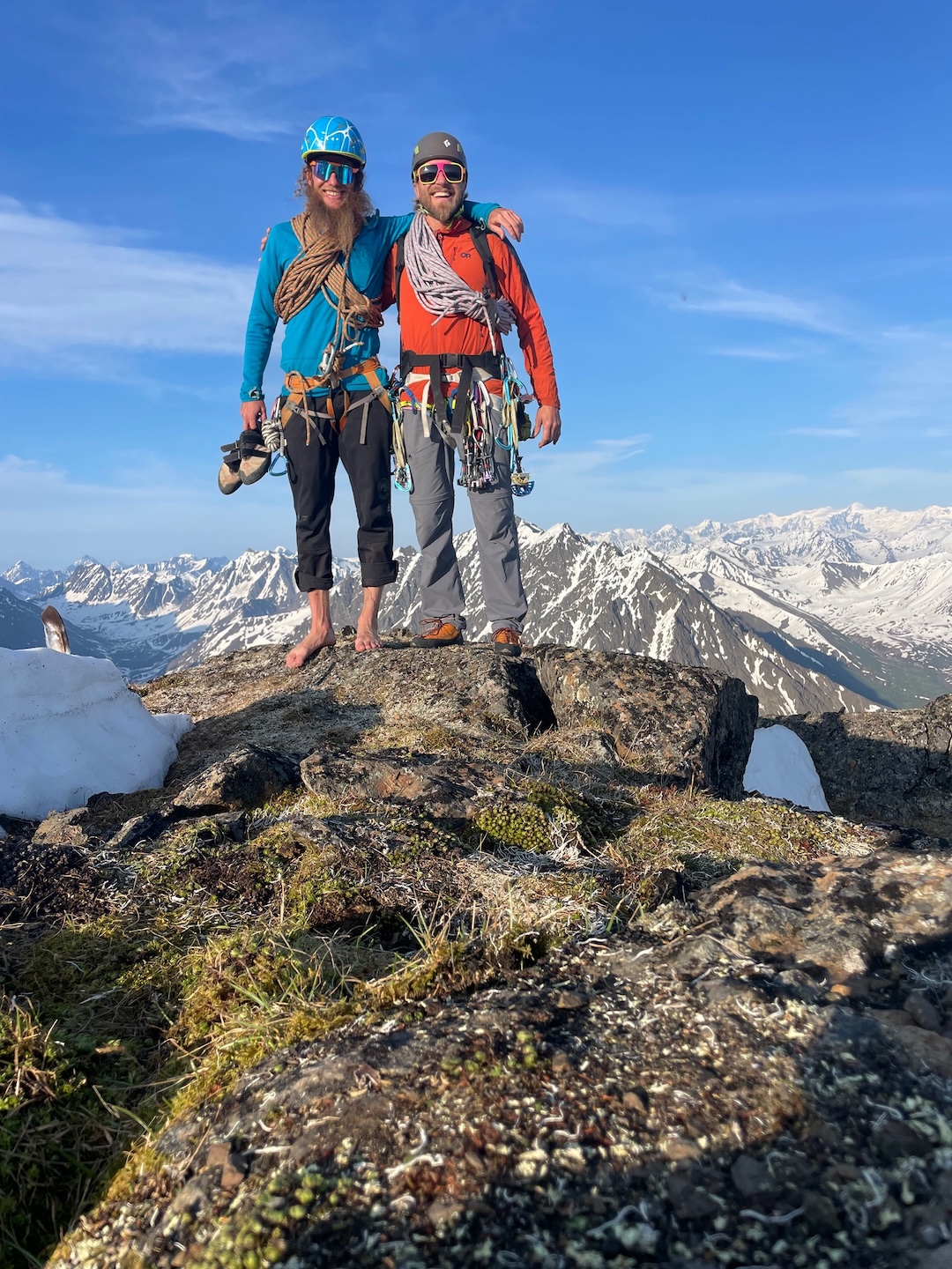
After skirting above steep snow to the west of the ridge, we ascended a steep gully for about 40 feet and found that, though the blocks became larger, their precarious nature did as well. Continuing up the ridge and avoiding a few large leaning blocks, we reached the picnic table–sized summit at 9:30 p.m., two hours after leaving the col. The Knik Glacier glowed beautifully to the southeast. We pointed out our houses and the lines we’ve done over the years in our “backyard,” and called our neighbors and family, who spotted us from scopes in our yards.
With a bird’s-eye view of the surrounding area, we planned our route for the next day, then retraced our steps, down-leading bouldery, engaging terrain and loose gullies. At the top of the first steep pitch, we slung a boulder and rappelled back to the col. From there, it was heavy heel plunges to camp and a cool stream soak for the feet.
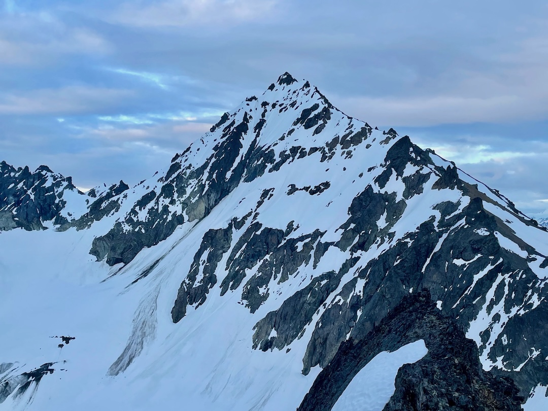
We enjoyed a very leisurely morning on June 21 and eventually launched for Big Ramp (7,060’, first climbed in 1996 by Richard Baranow, Jeff Jablonski, and Martin Martinez from the west) and unnamed and unclimbed Peak 6,650’ (61.572028, -148.701333). Gentle snow slopes brought us to the saddle between Little Podju and Big Ramp. We broke northwest, climbing the ridge toward Big Ramp, before making a westerly traverse to gain snow and more favorable travel 800 feet below the summit. After filling up on water with snowmelt, we gained the west ridge proper, ditched our packs, and took the sharply gendarmed ridge across the skyline toward the top.
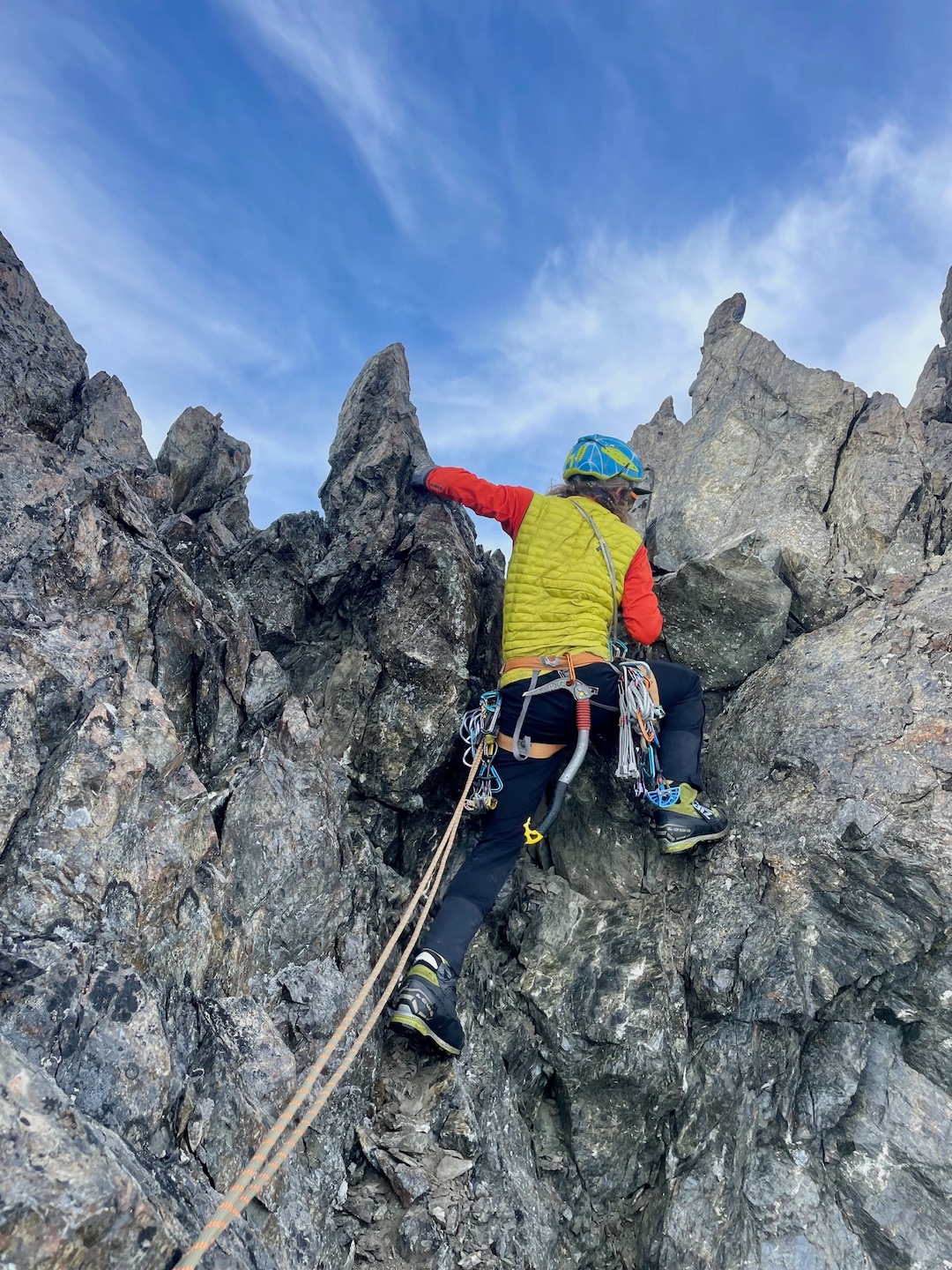
The terrain here was more undulating than on Podju, with numerous balanced downclimbs on teetering boulders and much steeper snow crossings to the north of the ridge. We remained in boots and ran eight or so half-rope-length pitches of mixed rock and snow to the razor-back summit. The route was 4th class with a few 5.8 moves. The poor rock quality and exposure kept us engaged and smiling. The perspective of Little Podju and surrounding Knik and Matanuska Valley peaks was absolutely gorgeous and likely rarely seen from this position.
We began our descent around 9 p.m., retracing half the ridge to a low point and a large gendarme above a gully that we had identified as our safest retreat. We rappelled 100 feet to the south, avoiding much of the steeper (and looser) rock we had ascended earlier, and carefully downclimbed the gully for another 100 feet. Implementing an additional rappel here was discussed, though the sharp, loose rock and lack of reliable anchors seemed to pose a higher likelihood for trouble than a fall. This gully led back to a steep scree slope above our water-fill location. We traversed it to the west, reascended to the ridge, gathered our packs, and discussed the intricacies of the terrain ahead.
We then continued west toward Peak 6,650’, about 1.4 miles away, climbing steep snow on the north side of the ridge. Terrain to the south was broken by very steep rock shelves, interspersed with deep gullies that drained more than 2,000 feet to the valley floor. After pushing the north-side snow as far as we could, we broke through a saddle on the ridge at 6,200 feet, just east of the summit of Peak 6,650’, and began picking our way through low-angle ramps and bouldery steps on the south side of the ridge.
We spotted what we hoped would be a continuous snow-filled gully for our descent, and, continuing a westerly heading, climbed toward it to investigate. The entrance to this gully was capped by a steep, 30-foot headwall of loose choss and was absent of continuous snow, revealing ledges that would take time to navigate, though we felt it was our most direct option and that we’d figure out the entrance later.
As with Big Ramp, the final 350 feet of climbing brought much larger boulders and gendarmes that made climbing on the ridge proper very difficult and presented terrain that we opted to pitch out. Digging through moss and dirt, we were able to unearth cracks that would hold bodyweight protection for the bouldery moves around the exposed summit ridge blocks.
The true summit of Peak 6,650’ sits at the northern point of the summit block. After squeezing and tip-toeing our way across the ridge, we were forced to rappel 40 feet from a gendarme onto a snow-covered chockstone and make an acrobatic move back to the ridge proper. With the summit in sight a mere 150 feet ahead, a swooping, gusting noise broke the midnight air and Travis and I looked up to see almost 40 ravens circling around and directly above us. We hadn’t seen any ravens throughout the day, let alone an entire rave, and figured this solstice magic to be the warm presence of our past beloved friend, climbing partner, and neighbor, Travis McAlpine. We hooted and hollered as we squeezed up a final 15-foot chimney to the summit of what we in the Knik Valley now know as McAlpine Peak.
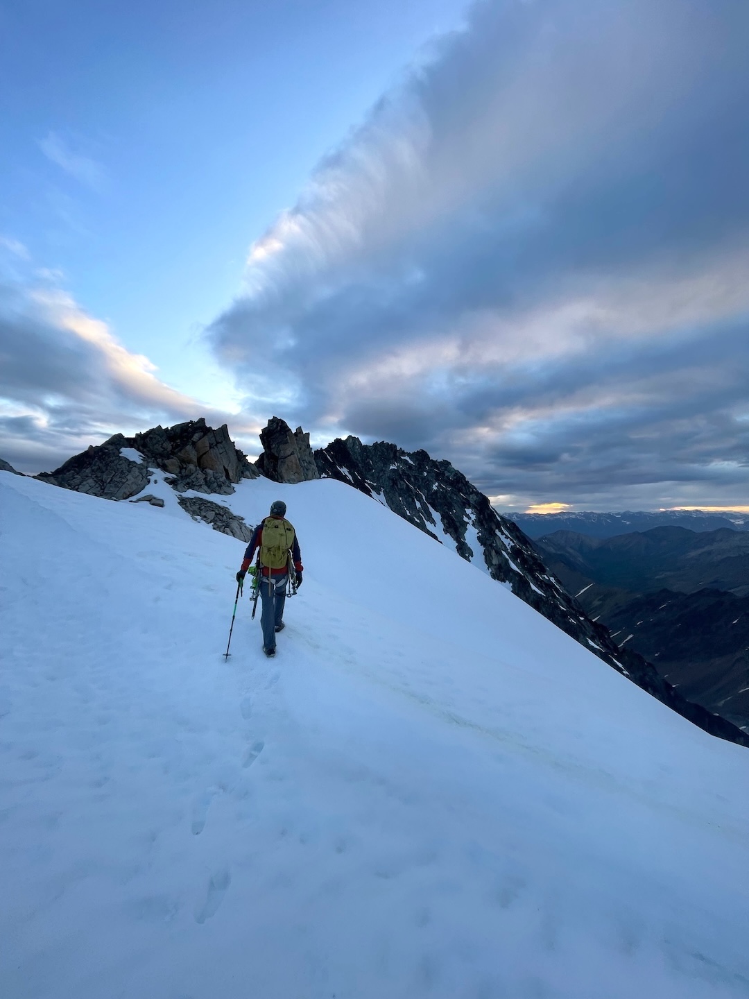
Photo by Joda Hankins
Around 12:30 a.m., we began retracing our route toward a descent gully. The entrance proved to be the steepest and most delicate downclimbing thus far. Once in the gully, we continued down, mainly on snow, for 2,600 feet, arriving at camp around 3 a.m. We laid our boots to dry in the morning sun before tucking in for a rest.
Like much of the terrain we had covered, we weren’t exactly sure of what awaited us on the route back to town (a hellish shwhack?). The next morning, we started contouring west, crossing a main tributary to Friday Creek, and ascended a lush hillside to a low point on a ridge at 4,000 feet. We walked this gentle ridge south, completely in the alpine, and followed moose tracks to a four-wheeler trail for 5.5 miles until we reached the Jim Creek Road at the mouth of Friday Creek. We forded a few waist-deep braids of Jim Creek and the surrounding tributaries before hitching a ride in the back of a totally beat Toyota truck—part of a bachelor party caravan on the way back from the Knik Glacier—all the way back to the trailhead in the Butte, where we called for a ride home.
For us, the meaning of these climbs wasn’t rooted in remoteness (we could see our houses almost the entire time), technicality, or in the pursuit of a “first,” but in the celebration of two buddies sharing time on peaks we see every day, above a valley we feel so thankful to call home. Over the last 15 years, we’ve shared a rope and bootpack on many peaks throughout Alaska, and these few days will remain a favorite of mine for a long time. It was a local adventure that we were mindful to leave adventurous for others. We downclimbed as much as safely possible, left only two rap cords, ran belays where we appreciated protection, pitched out high-consequence sections, and ditched the rope entirely when we needed a buzz. Our exit route of interspersed four-wheeler and game trails, with some creative bushwhacking through gullies, gives access to the alpine. If there’s ever a next time, we’ll go for the human-powered approach.
—Joda Hankins
Media Gallery