The Batwing (Peak 9,020’), Southeast Face, and Other Climbs
Alaska, Hayes Range
Detailed trip planning is usually antecedent to a successful trip into the mountains. But sometimes life conspires to steal that time and you just have to make do with your hopes, dreams, and skills. In Eli Sturm’s and my case, late-hour derailments had us changing our threesome into a pair and switching objectives from the Cassin Ridge to The Handicapped Ramp on Mt. Balchen (11,140’). Armed with little more than a terse but alluring trip report and 12 days of food, we pulled the trigger on the Hayes Range.
On May 23, the plan was to fly into the east branch of the Gillam Glacier beneath Mt. Balchen, but clouds clinging to the giants of Mt. Deborah (12,339’) and Hess Mountain (11,940’) made that path impossible. Dan McGregor of Denali Air was undeterred. He flew us back around the north side, where he snuck up the Gillam Glacier in poor weather as far as he reasonably could, finally landing us at about 5,000 feet on the east branch.
Our hasty planning meant we hadn’t brought sleds. Single-carrying heavy loads six miles up-valley to base camp was utterly crushing, and I learned the difficult lesson that clipping your foam helmet to the outside of your pack will quickly reduce it to shards when you sit on your pack to rest every half mile. But the periodically beautiful weather buoyed our spirits, especially upon finally reaching our spectacular base camp at 6,900 feet.
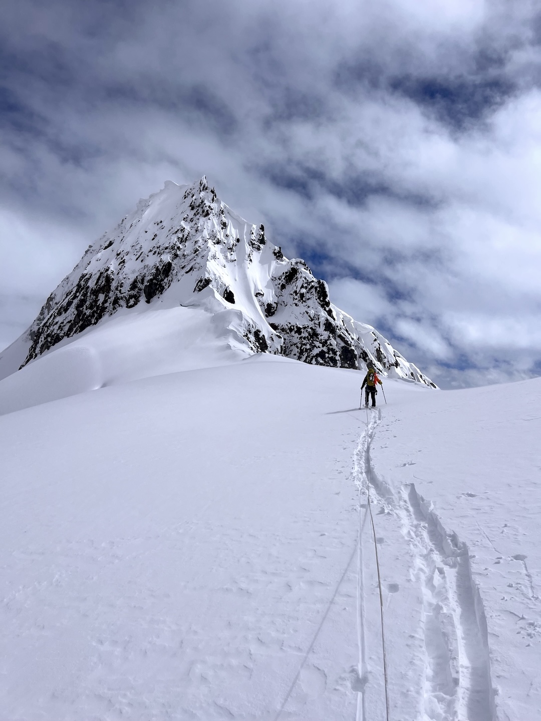
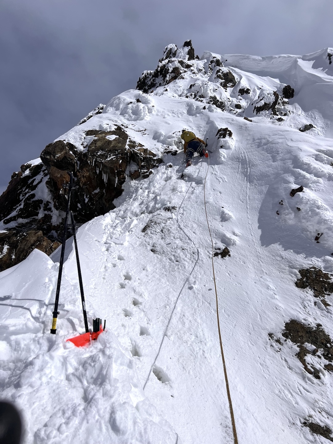
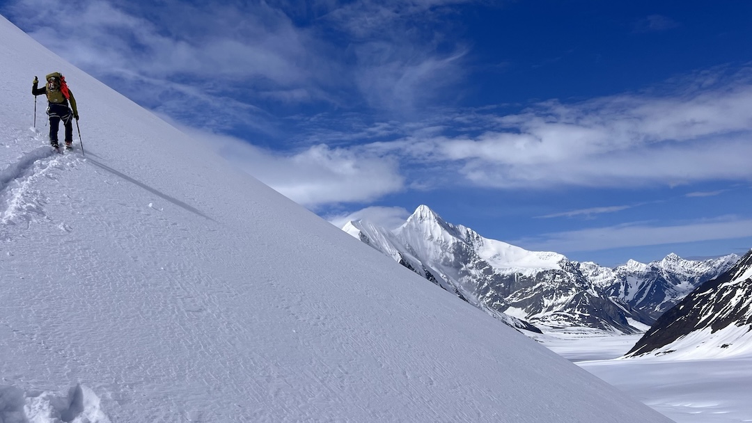
With only ten days available, we got right to the prime objective the next morning—the clean, perfect granite on the south ridge of Mt. Balchen. The Handicapped Ramp, named by first ascensionists Seth Adams, Jeff Benowitz, and Jed Brown because of Benowitz’s injured leg (May 2005; see photo in AAJ 2006), appeared to be a moderately difficult snow-rock-ice route that they graded 5.4c—because ratings are for hotels, I guess. Skinning past the first icefall and entering the basin at 8,000 feet, it soon became clear there would be significant overhead hazard until we reached the south ridge proper at 9,400 feet.
I’m not sure if it was something I ate, the brutal carry the day before, or maybe constipation, but I didn’t make it that far on day one before turning back to camp. But the next day soon found us past our high point and onto the ridge, though in much more inclement weather this time. After plowing upward through thigh-deep snow and finding the rock covered in rime and the cracks choked with snow, we eventually called it quits about 300 feet below where the angle would mellow at 10,500 feet.
Back at camp, the next day again dawned clear and promising, so we set out to attempt Point 8,350’, a little less than a mile northwest of Peak 9,073’. Eli bravely led the first 60-meter pitch on the west ridge without a single piece of gear, barely sinking his tools into the dirt, turf, and choss until he could finally bury a picket that was about as useful as my now yarmulke-sized helmet. Realizing there would be absolutely no rock, ice, or snow worthy of a rappel anchor if we carried on, we cut a bollard and went back to the saddle. However, a quick jaunt up the adjacent Point 8,092’ (about a quarter-mile northwest of Point 8,350’) provided some solace and gave respite from the avalanche-prone skiing we would soon face going back to camp.
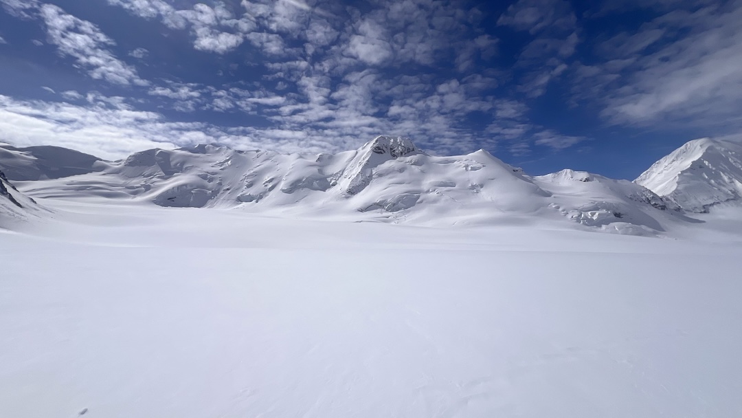
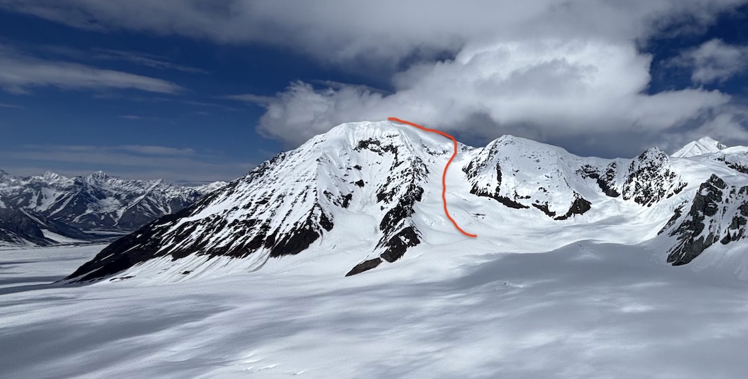
Our final objective was the striking Peak 9,020’ (63.63452, -146.96485), some three miles due west of Mt. Geist (10,720’). The large basin southeast of the broad summit ridge seemed to promise an easy ascent, and it delivered.
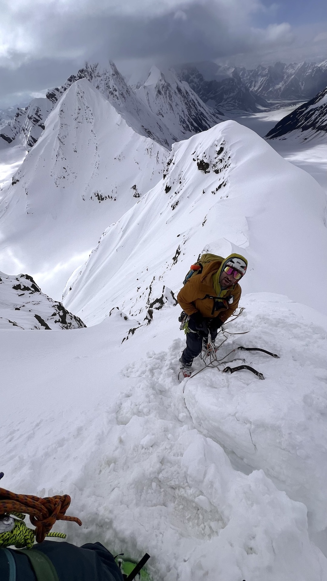
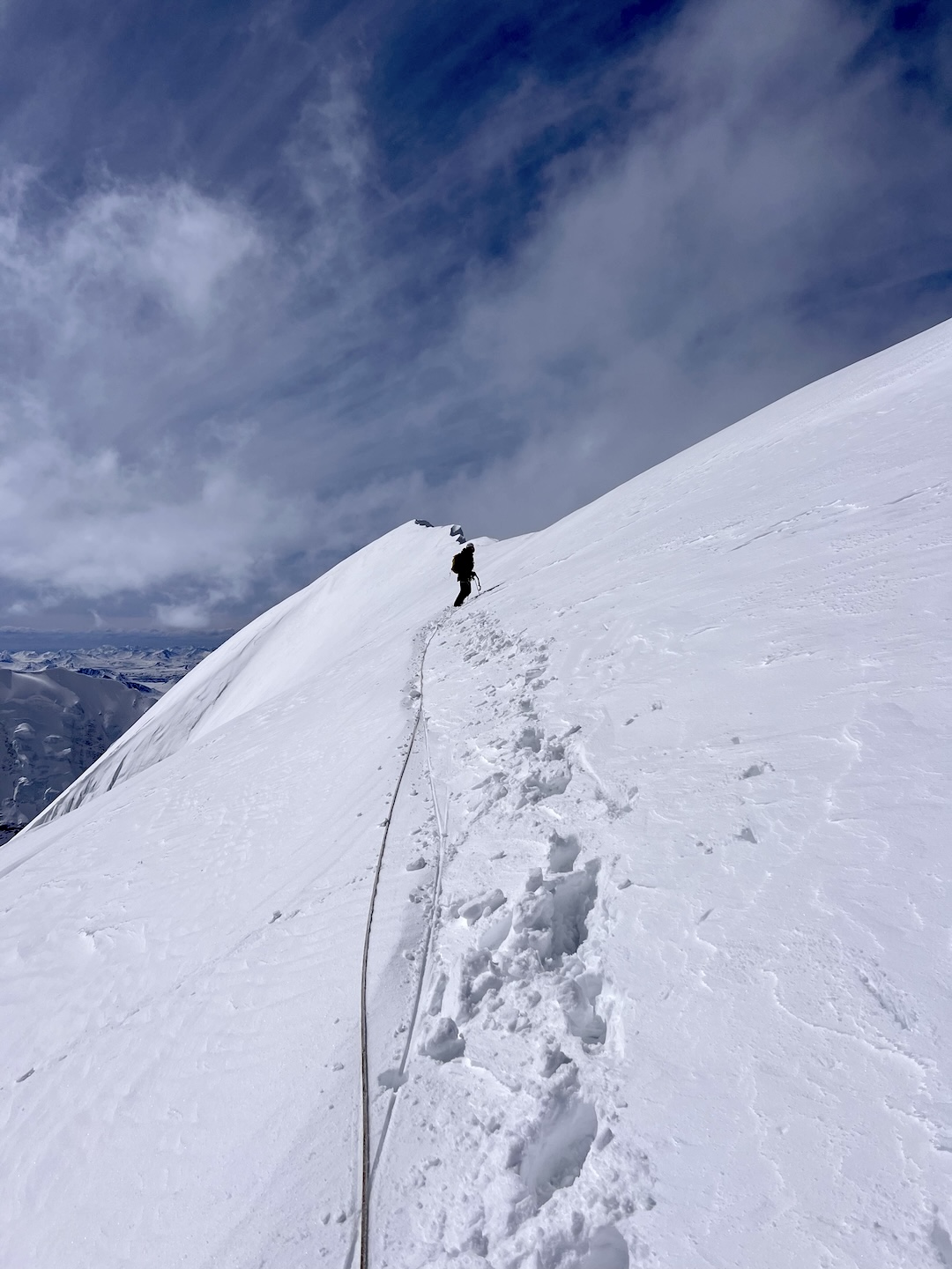
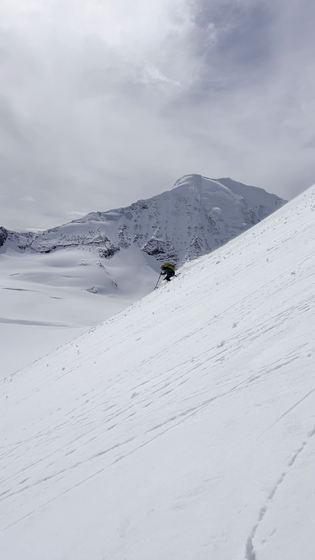
On May 28, we skinned out of camp to the west under sunny skies and cool temperatures. With a little bootpacking up the icy headwall to 8,600 feet, we switched to crampons and ditched the skis. We swung running belays up to the ridge crest and then across it, first west and then south, aiming for the highest point along the severely corniced ridge. After four or five half-rope pitches, Eli grabbed the pickets and set off for the final subtle rise. Suddenly the entire summit plateau whoomphed beneath us, sending our egos into our underwear. Deciding that another 30 horizontal meters might only buy us a few feet of elevation, we turned tail back to our skis and descended under glorious sun with near-perfect corn beneath our sticks.
Proud to finally have reached a significant unclimbed peak, we basked in vitamin-D-soaked glory back at our camp. Since we kept referring to Mt. Balchen as Mt. Ballsack and the entire upper east branch of the Gillam Glacier complex resembled a scrotum, we decided the long, thin summit of Peak 9,020’ was most appropriately called the Batwing (and could still be said in polite company). Our laughter turned more hurried, however, when we looked at the forecast, which had quickly turned grim. We inReached Denali Air to see if they might be able to pull off a quick extrication—we had to be at work in just a few days. They agreed but noted that our chances would be better in the changeable weather if we could return to our original location beneath Hess Mountain.
Before we could even finish packing, the tide indeed turned. Now shouldering mere 100-pound packs, we set off down-glacier in a complete whiteout. The wind turned so fierce that we couldn’t hear each other’s shouts along the rope, and the twinkling vertigo sparkles began. We experienced an extremely disorienting—and seemingly pointless—glacier descent, only to accept that we still weren’t getting picked up for days to come. But after only two additional days of tent time, the clouds lifted just enough and our heroic buddy Nat Shepherd came scud-running up the Gillam in his Cessna 180.
The trip hadn’t quite rewarded us with the second known ascent of The Handicapped Ramp, but we did manage a few cool climbs and were proud of our effort in challenging conditions in a seldom-visited part of the Hayes Range.
— Robes Parrish
Media Gallery