Machu Riti, South Face
Peru, Cordillera Vilcanota
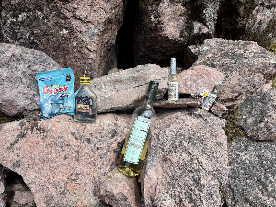
In August 2025, my partner, Carrie Adams, and I traveled to southern Peru to spread a parcel of my late wife Giselle Field’s ashes at the base of the mountain where, on July 13, 2021, she died in a tragic rappelling accident as we were descending from a previously unclimbed summit in the Cordillera Carabaya. This was my first time returning to the area, and it was very healing; it also happened to be Carrie’s first time visiting Peru and her first proper expedition.
On the day of Giselle’s memorial ceremony, August 12, I reunited with the local family homesteading the drainage below the mountain, a generous group who had kindly aided in the recovery four years prior. It was really nice to catch up with them; I even finally learned, from the grandfather, his name for the 5,185-meter mountain where Giselle’s accident occurred. It bears the Quechua name of Jirruchullo, which translates to Gorra de Hierro in Spanish or “Iron Hat” in English—a satisfyingly fitting name for the smooth, helmet-shaped dome. [The Fields had called this rock tower Kawri Orcco, Quechua for "Monster Peak.")
While in Macusani, we also participated in a monthly memorial service at the gravesite of my late friend Ronald Gutierrez, former governor of Carabaya Province, who passed away in a motorcycle accident just a few months prior, on May 13. Ronald was an incredibly kind-hearted man who had supported me and Giselle on several expeditions. He was a quintessential steward of the region and the founder of the only museum in town. Ronald’s widow, Karin, graciously hosted us at her house at the Casa Museo in Macusani for the duration of our trip.
After these events, Carrie and I embarked on a self-supported trek between the towns of Corani (4,000m) and Ollachea (2,785m). This area is part of a subrange in the eastern Cordillera Vilcanota—what Peruvian geographers call a nudo, a “knot” or “lump,” and Westerners might call a massif. The nudo is separated from the adjacent Cordillera Carabaya by the deep gorge cut by the Río San Gabán. The high point of the nudo is Machu Riti (5,357m). One of our goals was to explore the vestigial glacier on the south face—the only remaining glacier in the entire nudo—for a new route of moderate difficulty. [The first ascent of Machu Riti was in 2020, by Nathan Heald, Thomas Schilter, and Maximiliano Taylor, who climbed from the west; see AAJ 2021.]
On August 13, Karin and her friendly neighbor Hernando drove me and Carrie through the spectacular rock forests around Corani and then partway up a steep, switchbacking road to drop us off at the remote homestead marked as Jayunuma (4,390m) on the UGEL map. A friendly shepherd named Antonio greeted us at the entrance of the valley. Carrie and I explained that we intended to take seven days to walk directly over the top of the mountains to get to Ollachea. Eyeing our 70-pound backpacks, he expressed that our idea sounded a little crazy; nonetheless, he supported our goal. The next day, farther up the valley, we would cross paths with Antonio again—this time, accompanied by his wife, their son, and their herd of what Carrie and I estimated to be well over 1,000 animals: alpacas, llamas, sheep, and sheepdogs.
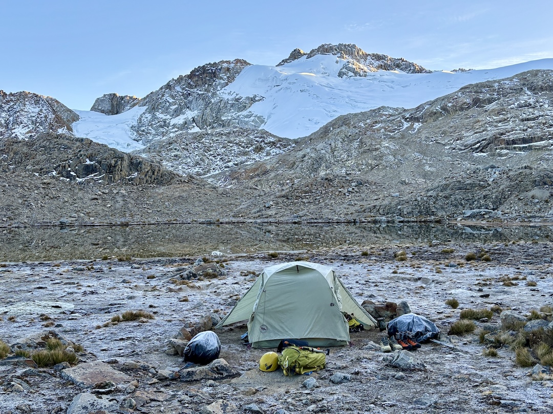
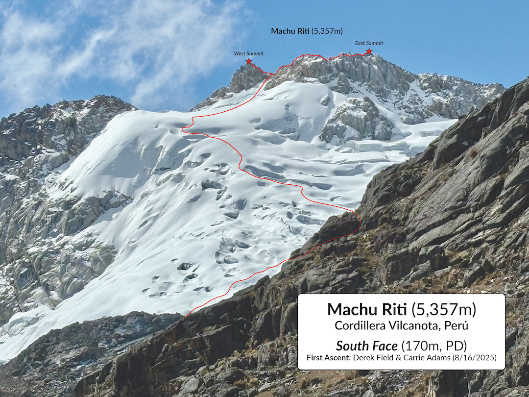
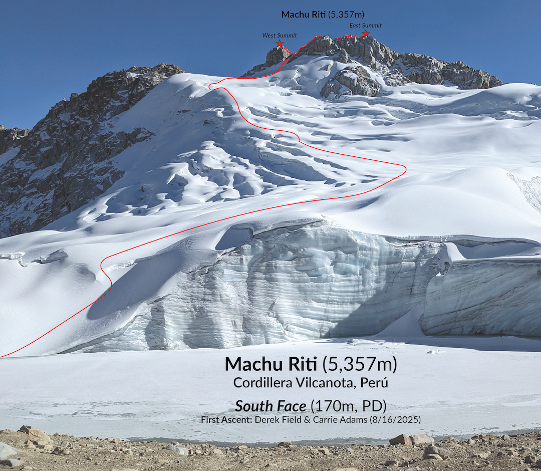
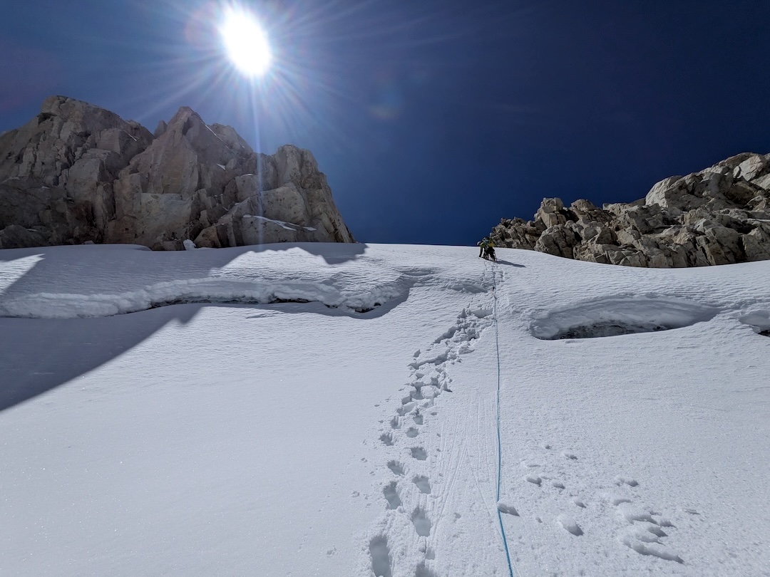
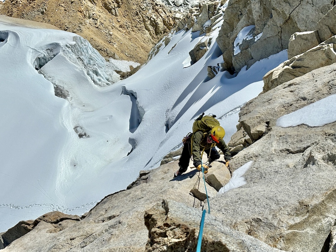
Shortly after 7 a.m. on August 16—the fourth day of the trek—Carrie and I departed our high camp (5,012m) and scrambled up moraine to the base of the south face of Machu Riti. We donned crampons at the toe of the glacier (5,136m) and wove past crevasses to reach the base of the twin summit horns around 11:30 a.m. We gained the saddle between the horns by a 30-meter pitch of 60°–70° snow, punctuated by two body lengths of subvertical névé, protected by ice screws and snow pickets. It was unclear which was the higher of the two summits, so we visited both, each accessed by exposed 4th-class scrambling on compact granite. According to our GPS, both summits are exactly 5,357 meters. I rated the route PD.
After soaking in the 360° panorama, we descended the glacier back to camp and proceeded to spend three incredible days connecting shepherd trails, ancient Inca trails, and empty dirt roads all the way down to the cloud forest. The final day of our trek, August 19, was particularly memorable: We started out watching the sunrise on top of the west summit (4,993m) of Padre Orcco and finished our day—16 hours, 2,200 vertical meters, and 30 knee-crushing kilometers later—at a rooftop barbecue in the town of Ollachea (2,785m) at the edge of the Amazon rainforest. The next afternoon, we found ourselves floating blissfully in hot springs and casually strolling about town, reflecting upon the incredible journey we had just completed together.
—Derek Field, USA
Media Gallery