Machu Riti, West Ridge and Other Exploration; Nevado Kishuarniyoq, West Face, Night of the Mukis
Peru, Cordillera Vilcanota
I have been exploring the Cordillera Vilcanota in southeastern Peru for 10 years, climbing all of its 6,000m peaks and many 5,000m peaks. At the northeastern edge of the range, beyond Yayamari (6,049m) and the Ritipampa de Quelcaya, are many peaks that only have had one ascent, and there are a few unclimbed summits. Here, rivers drop abruptly for 3,600m—northeast to the Amazon and southeast to the San Gabán River (which divides the Vilcanota from the Cordillera Carabaya in Puno).

Researching past ascents of these peaks is quite difficult. The only recorded ascents date back to the 1950s–1970s, though they include notable climbers such as Piero Ghiglione, Olaf Hartmann, Faye Kerr, and John Ricker.
As I pieced together reports and maps, the principal mountains of the area revealed themselves. East of Yayamari and north of the Quelcaya Icecap, there are several groups of glaciated peaks: Alccachaya (5,780m), San Braullo (5,674m), Sombreruni (5,645m), Imata (5,475m), Chimboya (5,550m), Kishuarniyoq (5,665m), Kiscalaya (5,645m, a.k.a. Taltoquere), Taipicala (5,485m), Kellurata (5,500m, a.k.a. Chilimoco), Huinccocha (5,315m); the Huallanhuañusca group, including Ocororopata (5,031m) and Yanaruna I and II (5,302m); the Ayachincana group (a.k.a. Llushcarite or Chuquichanca), which includes Quiruyoq (5,250m) and Huayacauri (5,240m); and the Pomachanca group with Huamanlipani Grande (5,305m). I made note of one peak further east, Machu Riti (5,310m), which appeared untouched. This is the final glaciated peak before the San Gabán River, located a few kilometers north of the mining town of Corani.
 In October 2018, Thomas Schilter and I attempted to reach Machu Riti, taking a 4WD truck over Chimboya Pass to Corani. From there, we turned north into a valley with a couple of large lagoons that are southeast of Machu Riti. A day later, we reached 5,000m but retreated due to snow and thick clouds. In December 2019, Thomas, Maximiliano Taylor, and I explored the Rock Forest of Jayllua, just south of Corani, and got to know the area a bit better.
In October 2020, Thomas, Maximiliano Taylor, and I decided to give Machu Riti another try and explore other peaks in the area. After studying satellite images, we decided to go to the western side of the peak. From Urubamba, we followed dirt roads to the town of Quichu and herder community of Alto Chia (4,800m), located between the Pomachanca and Machu Riti.
The peak above our camp turned out to be a false summit. In any case, there was little visible snow or ice, so we left the ice screws and snow stakes, but took one ice axe each and rock gear just in case. On October 10, we traversed the west ridge (staying on its northern side) over a few false summits and the last remnants of glacier close to the summit. There are a few rocky tops, and we tagged the two highest, obtaining a GPS elevation of 5,310m (13°47'39.21"S, 70°37'11.27"W). The way up was relatively easy, with no technical, roped climbing but great scrambling and a few exposed moves on the summit.
The next day, we moved camp to Chimboya Pass (5,150m). On October 12, we climbed the peak Imata (5,475m), just north of the pass; it is a southern outlier of San Braullo (5,674m). Thomas took the opportunity to bring his unicycle to the top and complete the highest descent on record in Peru!
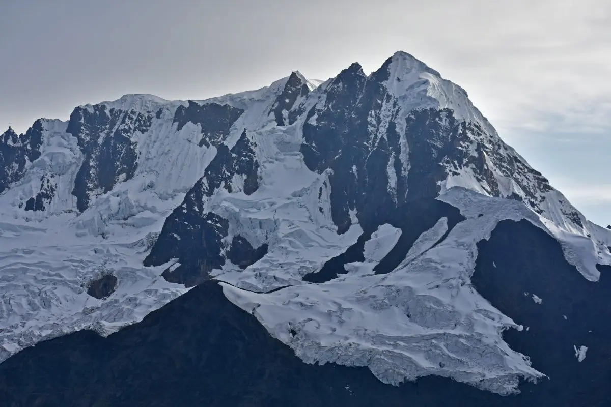
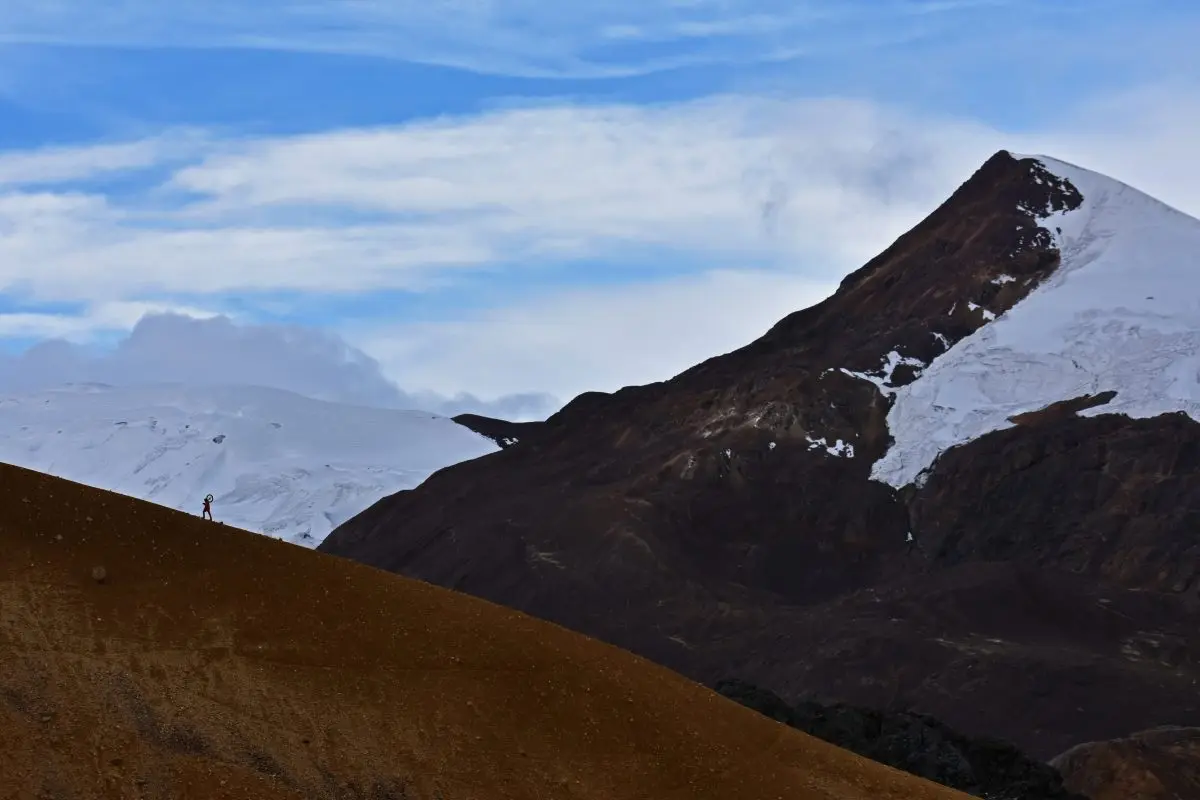
 That same day, we packed up camp and descended with the truck toward the town of Phinaya. From there, we turned north on the road below the east flank of Alccachaya (5,780m); this impressive dirt road runs to the Abra Laccopata Pass (5,200m) and through sandy dunes to a gap in the Suyuparina Glacier to reach one head of the Marcapata River. We were blessed with savage views to the north side of Yayamari (6,049m) and our final objective, extending north along the ridgeline from Yayamari: the west face of Kishuarniyoq (5,665m) and the impressive tooth-like Kellurata (5,500m).
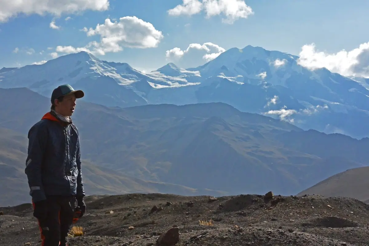
We found a family pasturing their alpacas at 4,800m. Though wary at first, they soon offered their warm, Andean hospitality and a spot to park near their earthen home. The next day, we hired Luis Alberto to help us portage our gear to the base of Kishuarniyoq (also spelled Kishuarnioq). Our hopes were high, but it snowed all night and we decided that we would not climb. Kellurata (5,500m) and Kishuarniyoq (5,665m) have had one known ascent each from the other side (east side); the west faces are unclimbed. It took only an hour to return to Luis Alberto’s house, where we gifted food and some carabiners to his kids. To exit, we headed to the Interoceanic Highway at Marcapata and drove over Pirhuayani Pass toward Cusco.
 One month later, Luis Crispin, Thomas Schilter, and I returned to Kishuarniyoq (13°44'3.30"S, 70°53'44.50"W). We were not certain which of three possible summits was the highest. However, after studying the Barry-Hartmann (1969) ascent, along with Google Earth imagery, we were convinced that the central summit was highest. On November 24, we drove toward Marcapata and up the valley we had descended a month earlier. We parked the truck with the same family and rested through the afternoon, then left the truck at 11 p.m. that same day.
Once on the glacial ice below the west face, we navigated several large crevasses and had to jump a gap to reach the steep wall. Luis and Thomas took turns leading 350m of ice runnels (60°). The final pitch steepened to a consistent 80° and included one 5m vertical step. As Luis set out on the crux lead, I saw his boot soles bending a bit. I asked him why he hadn’t brought his technical boots, and he replied, “It didn’t look this difficult from the photo!"
As we topped out on the ridge, the summit came into view only about 50m away. Supposedly November is the “off season,” but this day was crystal clear. Our balcony above the clouds of the Amazon provided spectacular views of the remote peaks of the northern Vilcanota, many of them having been explored only once. We descended on V-threads and made it back to the truck at dusk, 19 hours after leaving. We called our route to the central (main) summit, Night of the Mukis (600m, D+ WI4) and estimate the summit to be 5,720m (GPS).
— Nathan Heald, Peru

Media Gallery