Sangar Tower, southwest face; Billee Kangri, northwest face
Pakistan, Karakoram, Western Saltoro Mountains
I first saw a photo of the stunning north buttress of unclimbed Dansam (a.k.a. K13, 6,666m, 35°12'12.24"N, 76°45'36.47"E) in 2021. At the time, it felt like a distant dream, but it became my compass and helped guide the direction of my climbing for the next few years. After my trip to Yashkuk Sar (AAJ 2025), I felt ready, and in 2025 the government of Pakistan granted permission for the first time in several years. Blake Berghoff and Cody Winckler were game, and at the beginning of September we flew to Pakistan.
The day after our arrival at base camp, the skies cleared and we started up the Mingling Glacier. As the north face of Dansam came into view, however, inspiration turned to trepidation: The nearly 2,000-meter central buttress, the only line sheltered from serac fall, looked terrible. Recent debris littered the base, and what had looked from photos like perfect granite was decomposing munge, freshly scarred and lacking in natural features.
A line of ice stretched up the right flank, and the climbing looked reasonable, but was it safe? We watched the face for two days. Small serac avalanches mostly missed the line, but some came down the initial gully. We all contemplated our own truths, and I found my dream slowly slipping away. I’d come to these mountains to test my skill and my fortitude, not my luck. Then, as we began to tuck in for our second night below the face, a huge haymaker of an avalanche roared down the gully. There was now no doubt in our minds: The dream was gone. [The main (central) summit of Dansam is unclimbed, but the 6,600-meter west summit has been reached twice, in 1981 and 2021; see reports here and here.]
As we headed down toward base camp the next day, excitement unexpectedly replaced our feeling of aimlessness. A striking fang of granite appeared up a side valley. After further reconnaissance, we knew we had an objective.
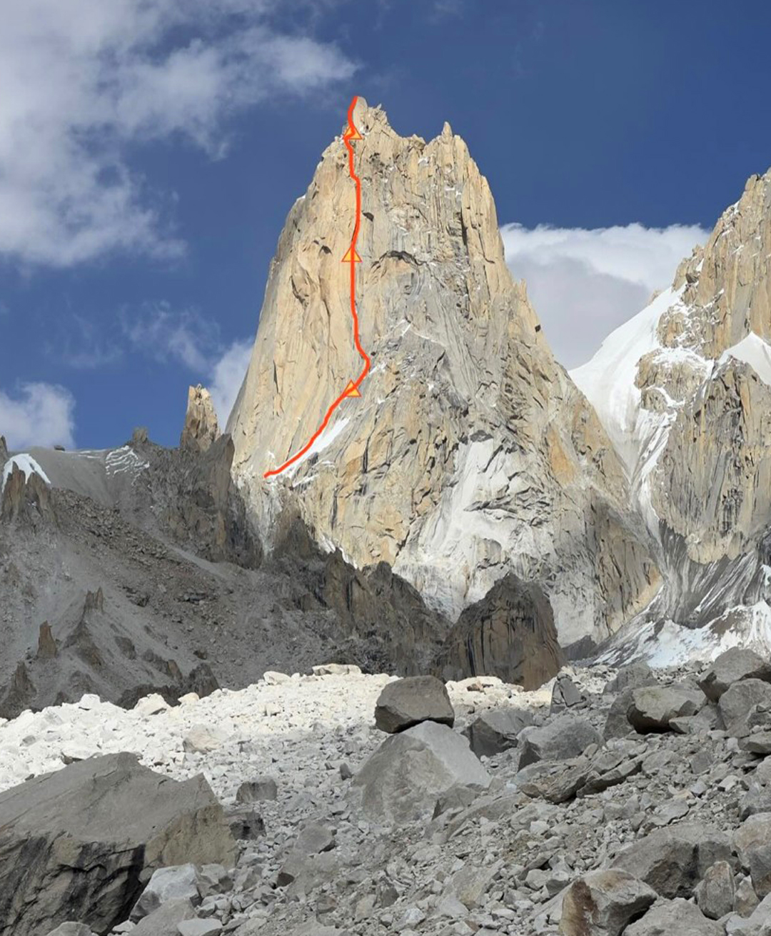
A few days later, we hiked back up the side valley with a massive array of gear, including inflatable portaledges and a rivet kit. We camped at the head of a small glacier, made two load shuttles up a scree ridge that guarded the tower, then at midday on September 21 started our climb.
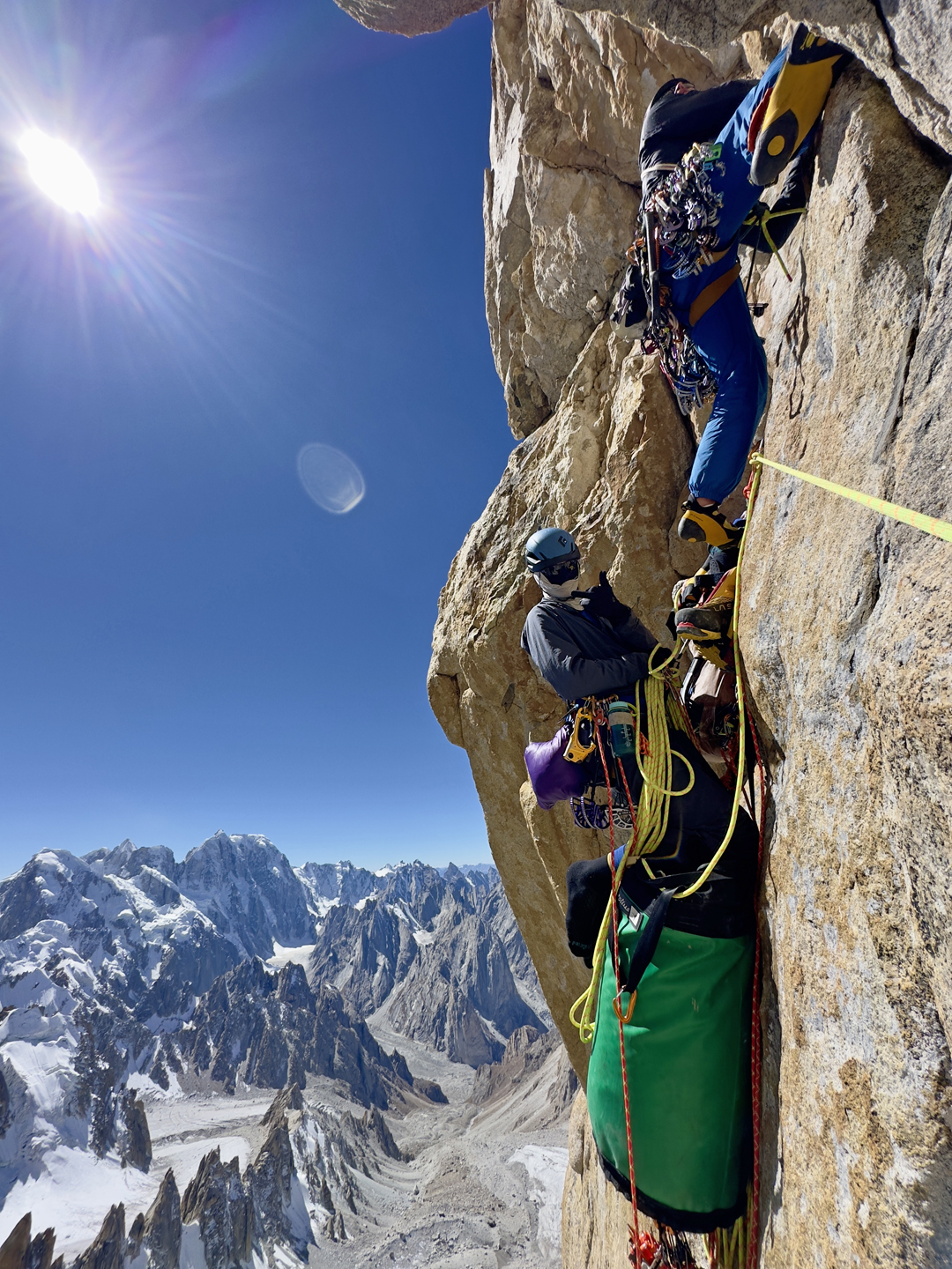
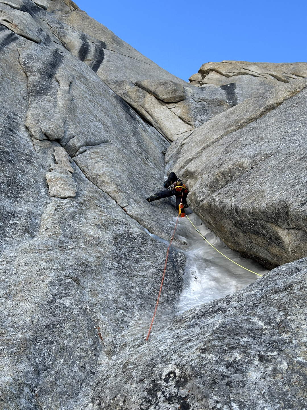
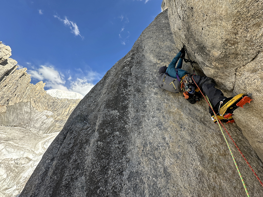
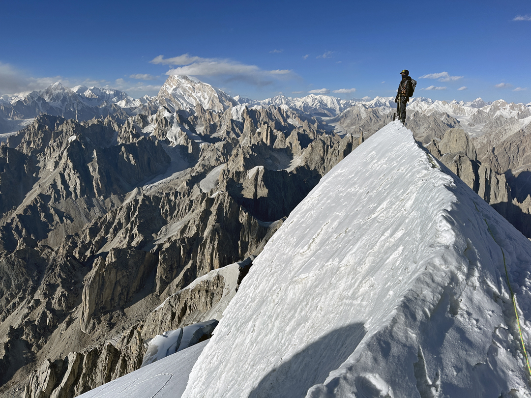
We spent three nights on the face and were amazed by the high quality and varied nature of the climbing. We found ice-filled chimneys, ice tool/rock shoe combo climbing, funky aid climbing, steep sunny cracks, and strange swirly face climbing. We placed eight rivets: six at anchors and two for progression across the route’s one blank swath of stone. On the 23rd, we shared a magical sunset on the tippy top of the tooth, Blake’s first Karakoram summit, and measured it with GPS at 6,082 meters (35°16’29.44”N, 76°49’30.45”E). We named the 500-meter route Sabertooth Direct (5.10 A2+ AI4 M6).
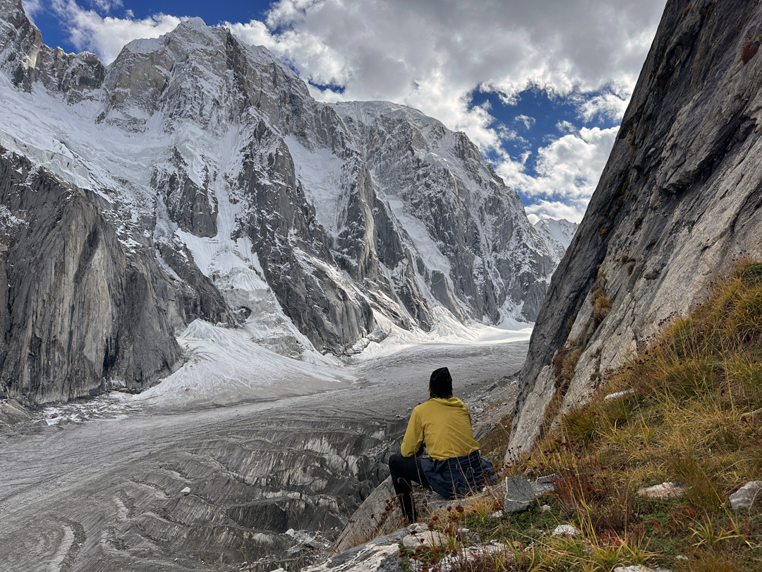
Now thoroughly acclimatized, we found ourselves craving an aesthetic, objectively safe, technically demanding, and exploratory climb on a big, icy mountain—the experience we’d come so far to seek. The unnamed 6,300-meter peak at the head of the valley, dominating the view from base camp, had a north-northwest buttress that fit the bill. The base was guarded by an impassable-looking icefall, but by studying satellite maps, the way became apparent: We would hike up a smoother branch of the Mingling Glacier to the north and cross an icy col to reach the correct branch and a gap between icefalls that appeared to lead directly to our buttress.
The skies had been clear for the last three weeks, but this would not last forever. We learned a big storm was on the way and that we had around six good days left. It would be now or never. Blake, dealing with numb toes from the spring season in Alaska—made worse by our first climb—chose to sit this one out.
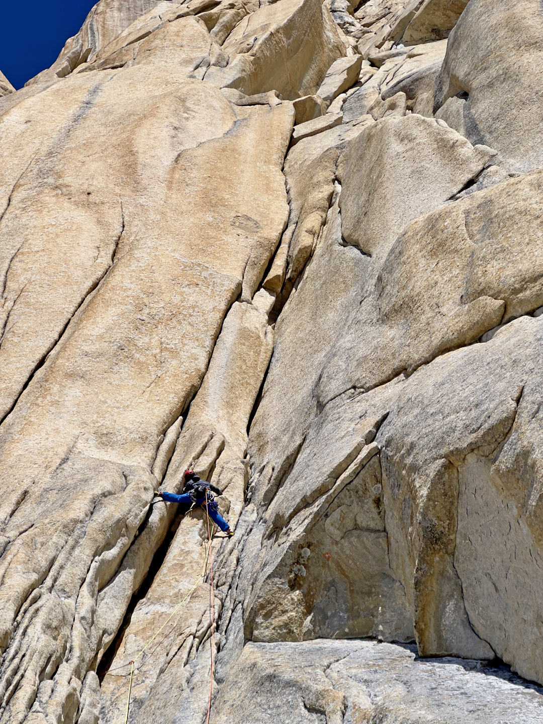
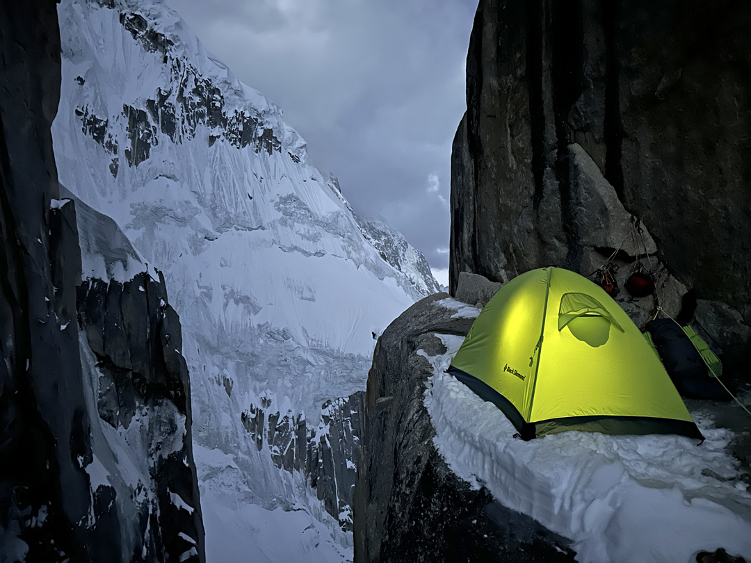
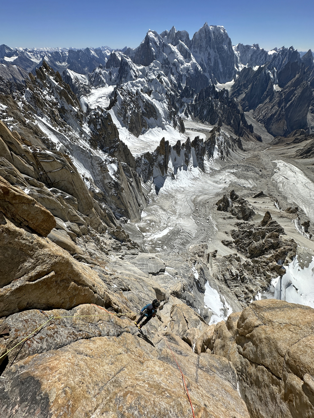
Cody and I set off on September 29, ascended the side glacier, crossed the col, and traversed a mellow glacier to the base of the buttress. Steep, splitter dry-tooling took us to the top of the first of three rock bands. As the sun set, we were amazed to discover a harness-off bivouac site.
The second rock band was guarded by one of the more tenuous slab pitches I’ve climbed in crampons. Above, pleasant névé streaks took us to another ice band, where a long traverse across ribs of glassy ice, covered by sugary snow, brought us to a chimney that split the final rock band. Steep ice pitches blurred together as daylight faded. Just before dark, we found another miraculously good bivouac behind a granite tower.
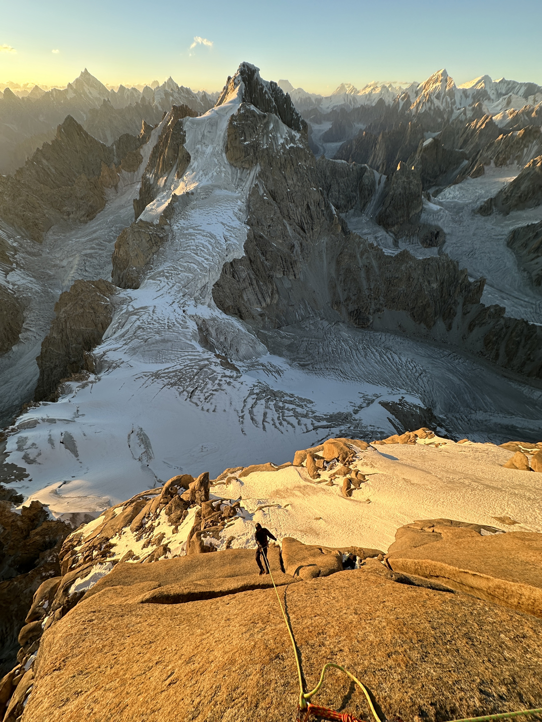
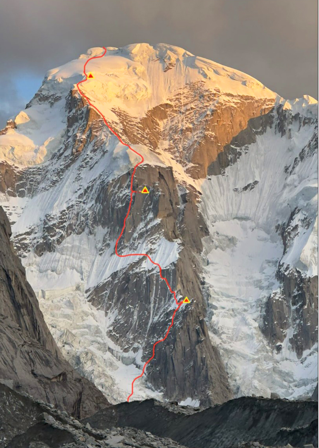
The third day began with more steep ice, then eased as we climbed up the low-angle side of the small serac perched atop the buttress. From there, a long ice arête led to the summit glacier, where we pitched our tent before ascending glaciated slopes to the knife-edged summit (6,310m GPS, 35°13’10.71”N, 76°47’40.87”E).
We returned to the tent at sunset and woke the next morning to thick clouds and snowfall, 24 hours earlier than predicted. As we descended the route, however, the weather cleared. After 25 rappels, we were back on the glacier. We regained our trekking poles on the far side of the icy col, and Blake met us near the toe of the glacier. We were back at base camp as darkness fell on October 2. We named the route Mamba Buttress (1,450m, M7 C1 AI4).
The next morning, it began to snow again and continued for the next six days. It was time to go home.
After thoroughly inquiring with the local people about the name of either peak, we eventually were informed the first was Shetan Tower and the second Dozak Brakk. Later, when we told this to our local crew in Skardu, they were appalled by the names—the villagers had pulled a prank on us, and the names meant “Satan Tower” and “Hell Mountain,” terms the Islamic world found far more offensive than we from the West might. After some discussion with our Pakistani friends, we chose Sangar (“tiger” in Balti) Tower for the first peak, and Billee Kangri for the second. Billee is Urdu for “cat,” as well the name of my own sweet kitty back home.
—Dane Steadman, USA
HISTORICAL NOTES ON DANSAM: The main (central) summit of Dansam was the goal of a Japanese expedition in 1981. Climbing from the west, they reached the 6,600-meter west summit (AAJ 2022). The west summit was also reached, this time via the north face, by a Franco-Spanish team in 2021 (AAJ 2022). The same year, the north face of the main summit was attempted to 5,550 meters, where it became clearly too dangerous to continue (AAJ 2022).
Media Gallery