Pico Simón Bolívar, South Face Variation and Elevation Measurements
Colombia, Sierra Nevada de Santa Marta
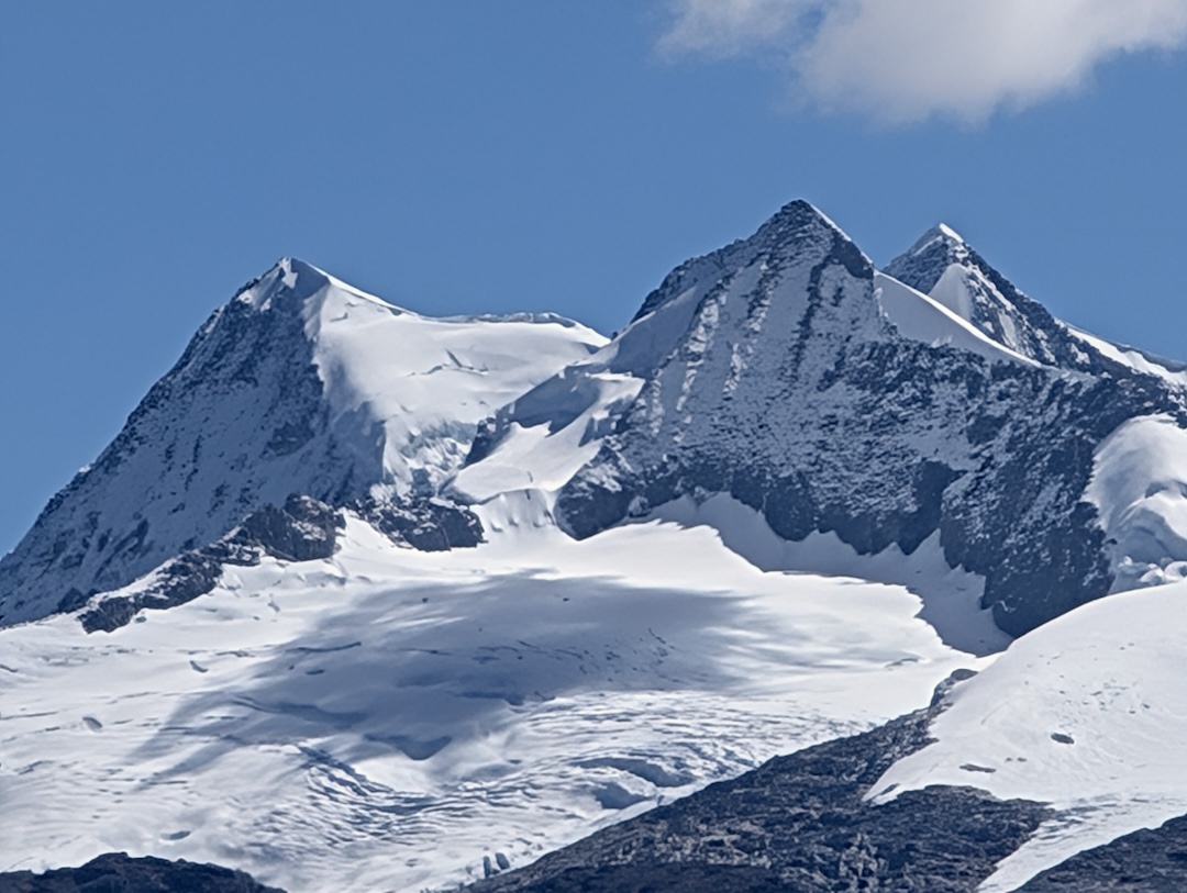
Until now, Colombia’s highest mountain was thought to be Pico Cristóbal Colón, surveyed in 1939 at 5,775m. A neighboring peak, Pico Simón Bolívar, 650m to the west, was surveyed at 5,773m and was considered the second-tallest peak in the country.
Since the late 1990s, accessing this area has been difficult, as local communities have largely prohibited climbing the peaks for religious reasons. In 2021, however, the Arhuaco community started granting permission to select groups to climb Colón and Bolívar, and I was fortunate to join an expedition there in December 2024.
My goal was to reach Colombia’s high point, but I suspected it might no longer be Pico Colón. In Washington state, I’d recently discovered that Mt. Rainier has melted down seven meters since it was last measured (see report here), and I suspected something similar or even more extensive might be occurring in Colombia.
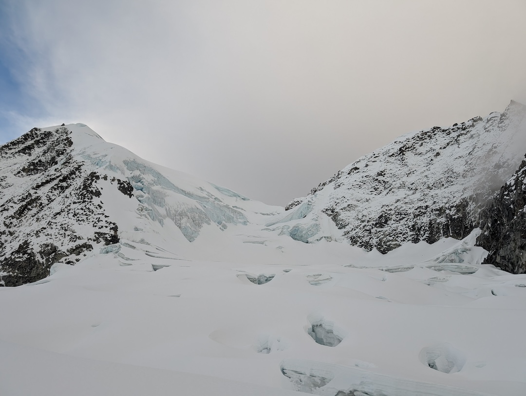
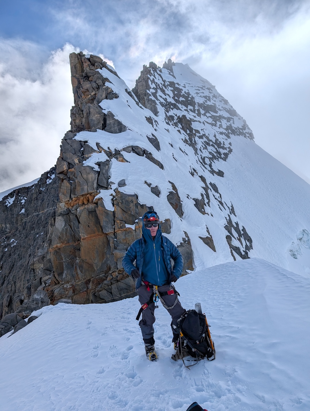
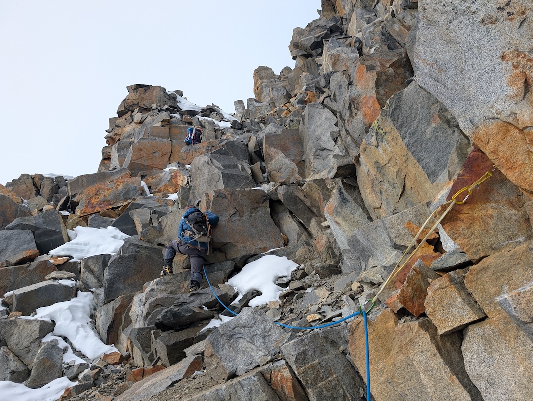
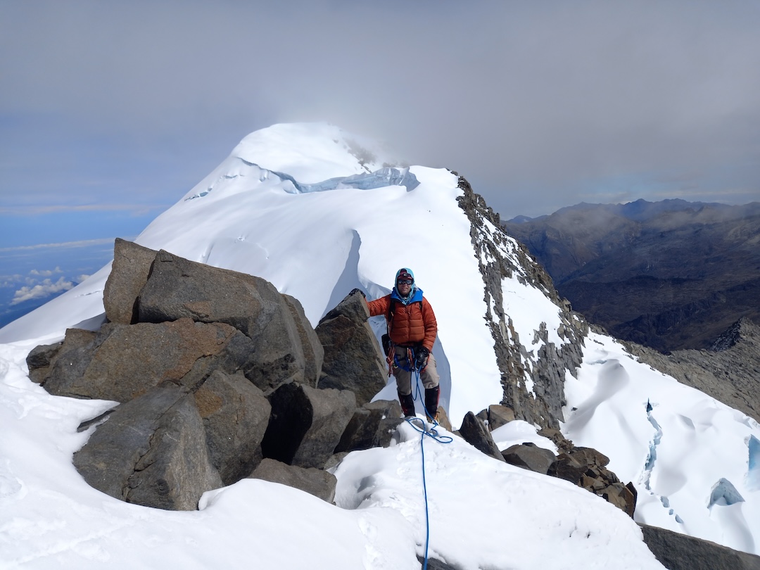
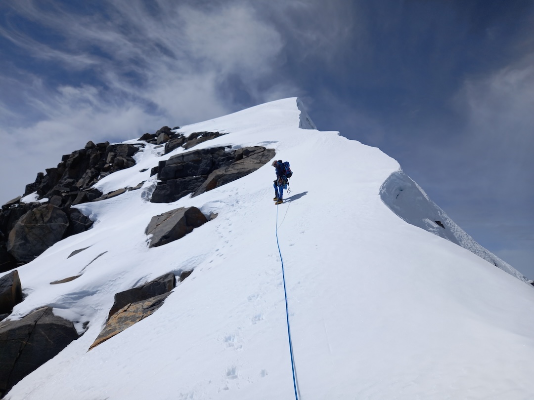
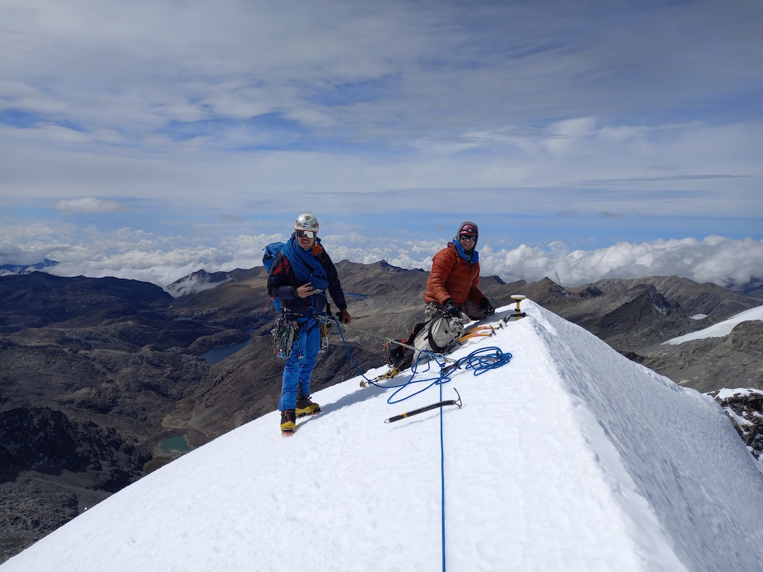
On December 15, the team left from Santa Marta and met five local Arhuaco members who’d help porter gear. We hiked for six days over several 4,000m passes, reaching base camp on December 21. On December 22, Ginge Fullen, Jonathan Suarez, and I ascended the Colón Glacier and climbed a WI2 and steep snow pitch (50°–60°) to the Colón-Bolívar col. We then downclimbed the south side of the col, following a route climbed by Ricardo Rubio and his party four days earlier (see report above). We climbed low-fifth-class rock and snow, following ledges and traversing across the south face for three pitches, until arriving directly below the upper of two rock steps on the east ridge.
From here, Rubio’s route continued traversing snowy ledges, but we took a direct rock line straight to the top of the upper step, then followed the east ridge to the summit. We propose a grade of 5.6 M2 for our line from the col. In descent, we downclimbed and rappelled the route, reaching base camp after a 21-hour push.
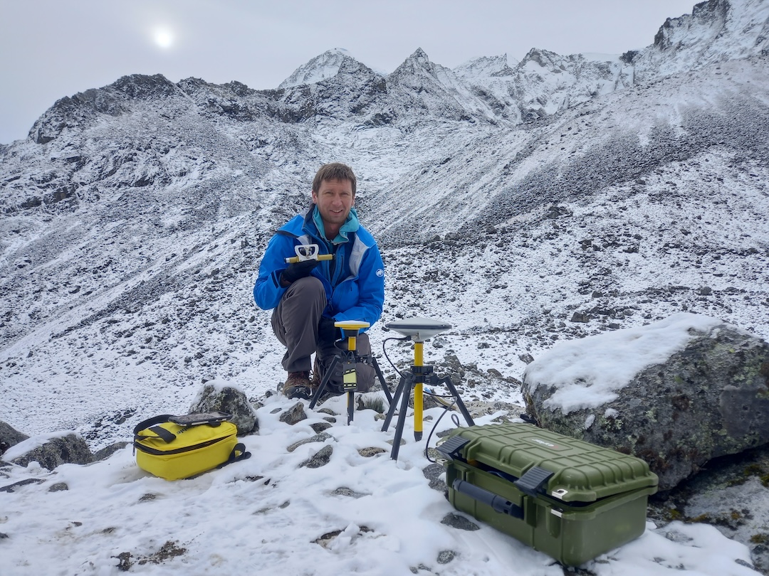
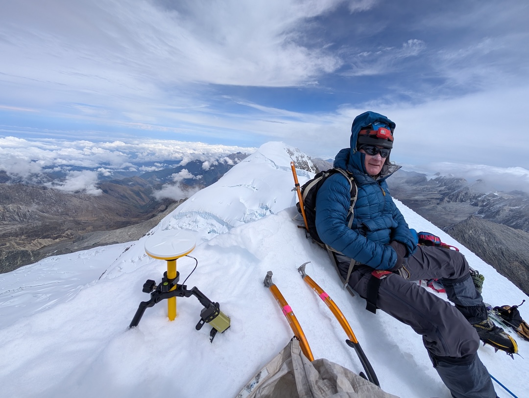
While on Bolívar’s summit, I took a 45-minute, highly precise dGPS reading as well as measurements with an Abney level from the summit of Bolívar to the summit of Colón. All five of the independent measurements showed that Bolívar is taller than Colón—it is Colombia’s new high point. Bolívar now measures 5,720.42m, with rocks visible two meters below the summit, and Colón measures 5,712.79m, with rock three meters below the summit—meaning Colón has melted down 62m and Bolívar 53m since 1939. If this rapid melting continues, the summits soon will be rock-covered—and Bolívar will remain Colombia’s high point.
—Eric Gilbertson, USA
Media Gallery