Pico Cristóbal Colón and Pico Simmonds, New Routes from the North
Colombia, Sierra Nevada de Santa Marta
The Sierra Nevada de Santa Marta is a range near Colombia’s Caribbean coast, with around 17 peaks. During an expedition from January 13 to 27, 2023, Daniel Anzola, Sergio Garcia Gomez, and I climbed two new routes there, one on Pico Cristóbal Colón and another on Pico Simmonds.
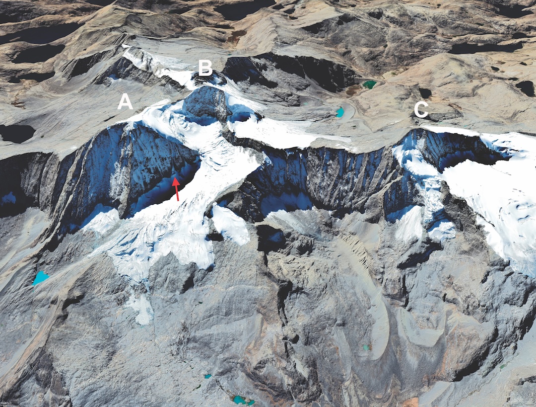
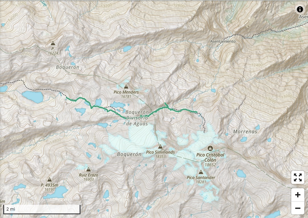
From Santa Marta, we took a 4WD truck to the Arhuaco indigenous community of Yerba Buena. The next morning, we traveled 18km with horses and camped at a lake at 3,600m. We then trekked four days to reach Carcuina Lake at 4,600m and established base camp. The next day, we crossed a 4,900m pass to an advanced camp at the toe of the Colón Glacier. Our first objective was Pico Colón (10°50’21.3”N, 73°41’10.7”W), whose north face rises 600m from the bergschrund to the summit at 5,713m. [Pico Cristóbal Colón was surveyed in 1939 at 5,775m, but substantial melting of the summit ice cap and a recent survey now put the elevation at 5,713m; see report here.]
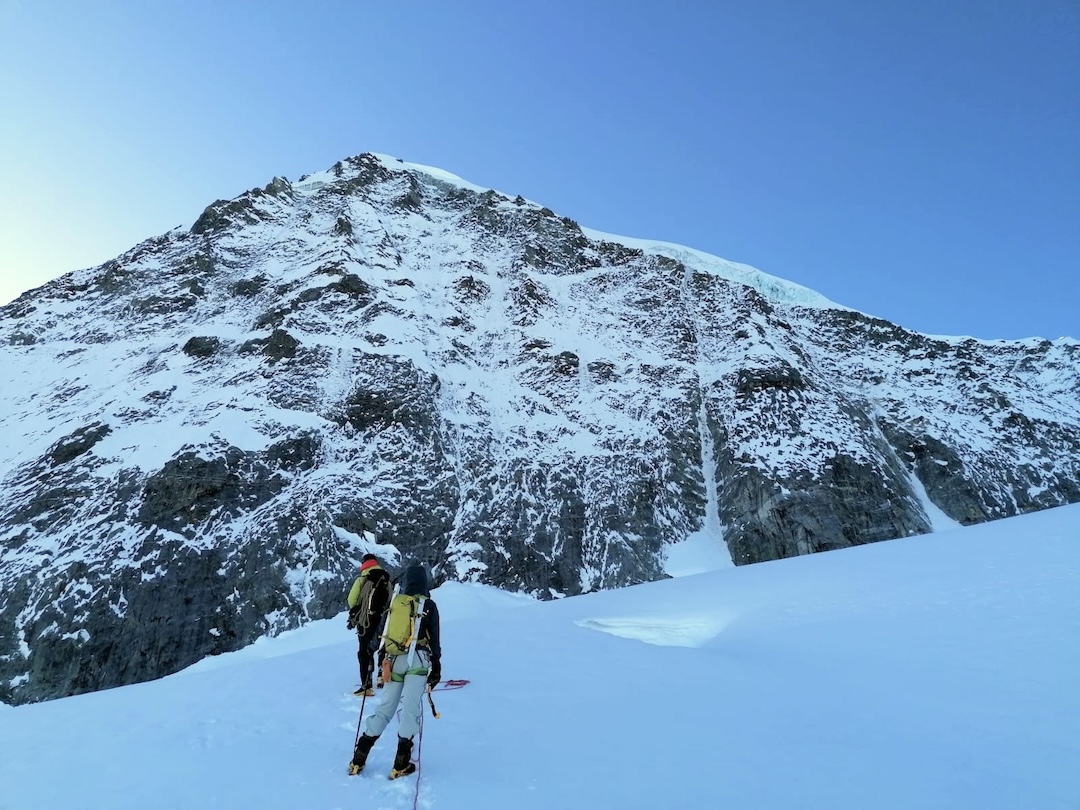
The line we’d planned to climb was blocked by the bergschrund, so starting at 8 a.m. on January 21 we climbed an obvious gully on the right side of the northeast face. The route consisted of nine 50m pitches with an average angle of 65°–70°, with vertical steps; we felt it was rated D+. The ice took screws, and the granite offered solid protection with cams and nuts. From the top of the gully, we moved onto the easier northwest face and followed this to the summit, which we reached at 3:30 p.m. We descended the northwest face and Colón Glacier to return to camp. As far as we could determine, there were no prior routes up Colón’s steep north side.
The next day, we decided to attempt the north ridge of Pico Simmonds (5,594m, 10°50’27”N, 73°42’20”W) and camped below the ridge in the high pass we had crossed earlier to reach Pico Colón. At 4 a.m. on January 23, Sergio and I started up the glacier; Daniel stayed back because of knee pain. Upon reaching the ridge, we pitched out the climb, taking care because of loose rock in the ice. The difficulty was AD, and we reached the summit around 9 a.m. We believe this was the first ascent of the ridge.
We hiked down the mountain via the snowy west ridge. On this same day, we met with the Arhuaco team at the Carcuina Lake base camp to celebrate and organize our return to Santa Marta.
The Colombian government officially has closed these mountains to the public, but rangers don’t visit the area because the mountains’ real owners are the indigenous communities. A special thank-you to the Arhuaco, Kogi, Wiwa, and Kankuamo communities—the real authorities of this land. [In recent years, thanks to cooperative arrangements between guiding companies, the Arhuaco, and other indigenous communities, some expeditions have been granted access to these mountains, employing local people as support staff. See the reports here and here.]
—Alex Torres, Colombia
Media Gallery