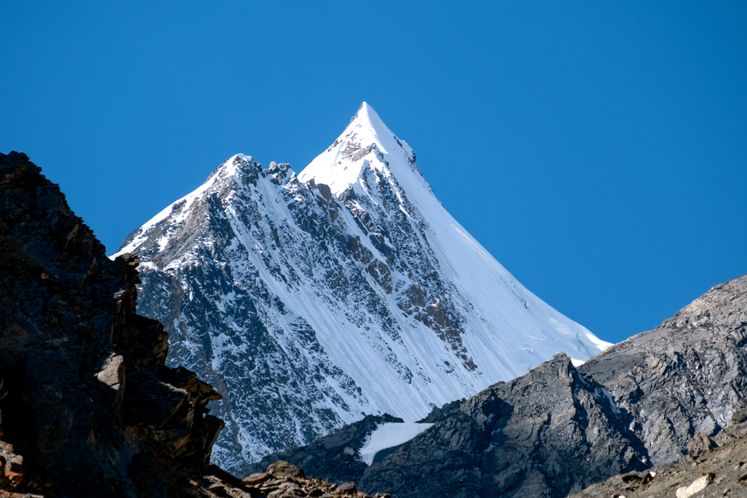
Yazpurs Sar, First Ascent, via West Face
Pakistan, Karakoram, Ghujerab Mountains
Murilo Lessa and I visited the Ghujerab Valley, north of Shimshal, in September, with a view to attempting peaks around Dih Sar from their north side. After a three-day trek via Boesam Pass (5,000m), a base camp was made at the herder settlement of Avduzhi (4,060m, 36°38’40”N, 75°20’42”E), where several hundred goats and sheep became our neighbors. From there, the Yazpurs, Shalghagin, and Zangaish valleys were all accessible, albeit with moderately long approaches and height gains.
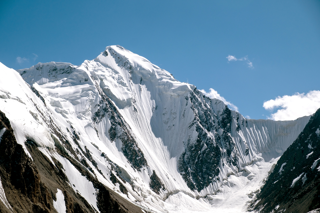
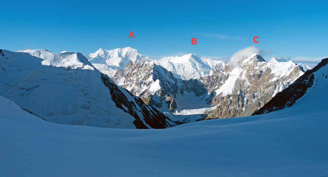
With a fine weather outlook, we immediately made an attempt on the 6,000m peak at the head of the Yazpurs Glacier: Peak 41 (6,175m) on the Wala map; 36°34’52”N, 75°19’01”E. [This peak was attempted unsuccessfully by the east ridge in 2017; see AAJ 2018.]
We spent the first night midway up the glacier at 5,040m on the eastern lateral moraine and made a second bivouac at 5,400m on the western moraine, beneath a rocky buttress and its neighboring scree gully. That night, rocks cartwheeled past the tent as close as 25m away. A pit between the gully and our tent swallowed any rocks that deviated in our direction, but there was always the fear that one might breach the defenses.
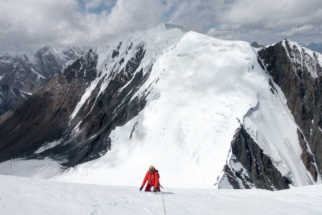
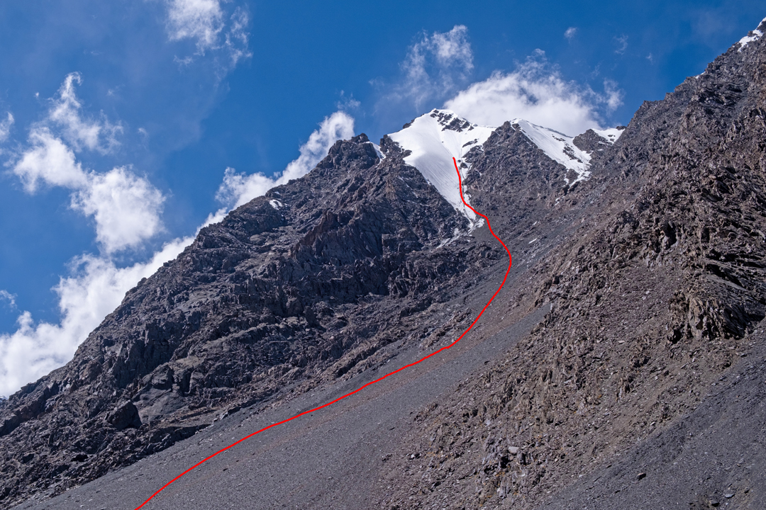
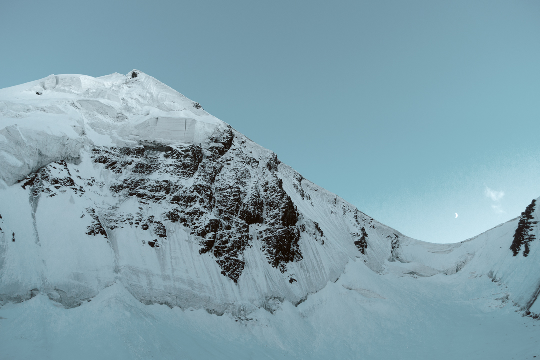
On the 9th, we left the bivouac at 3:30 a.m. and gained the Yazpurs Col (5,650m) at the head of the valley. This involved one pitch of 55° snow below the cornice and some brief exposure to large seracs. From the col, we followed the left edge of the west face (40°–50°). The face was firm névé and often icy, requiring pitching and/or simul-climbing with ice screw protection.
We reached the top at 12 p.m. (6,030m GPS), stopping just below the highest point due to a cornice of unknown magnitude. After discussion with local porters, Yazpurs Sar seemed the logical name for the peak. The route difficulties felt around AD+.
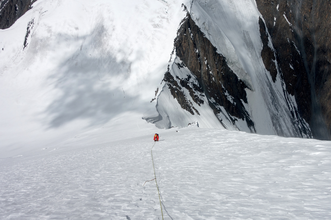
The descent proved to be a slow affair: We had underestimated the difficulties and brought only one 60m half rope. Murilo abseiled first, placing a few screws as he went, then I downclimbed. Both of us fell through crevasses up to the thigh. We reached the bivouac site at around 5 p.m. and moved the tent away from the rockfall zone and onto the glacier. The next day, we descended to base camp.
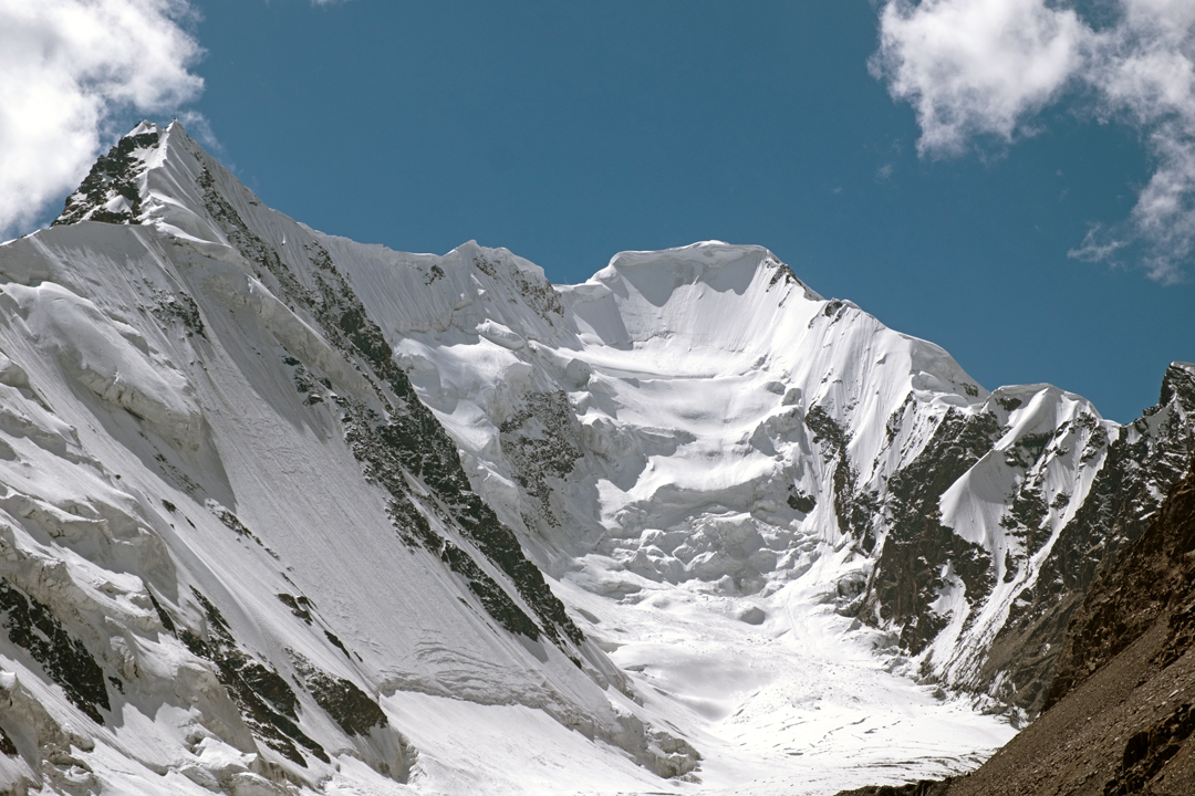
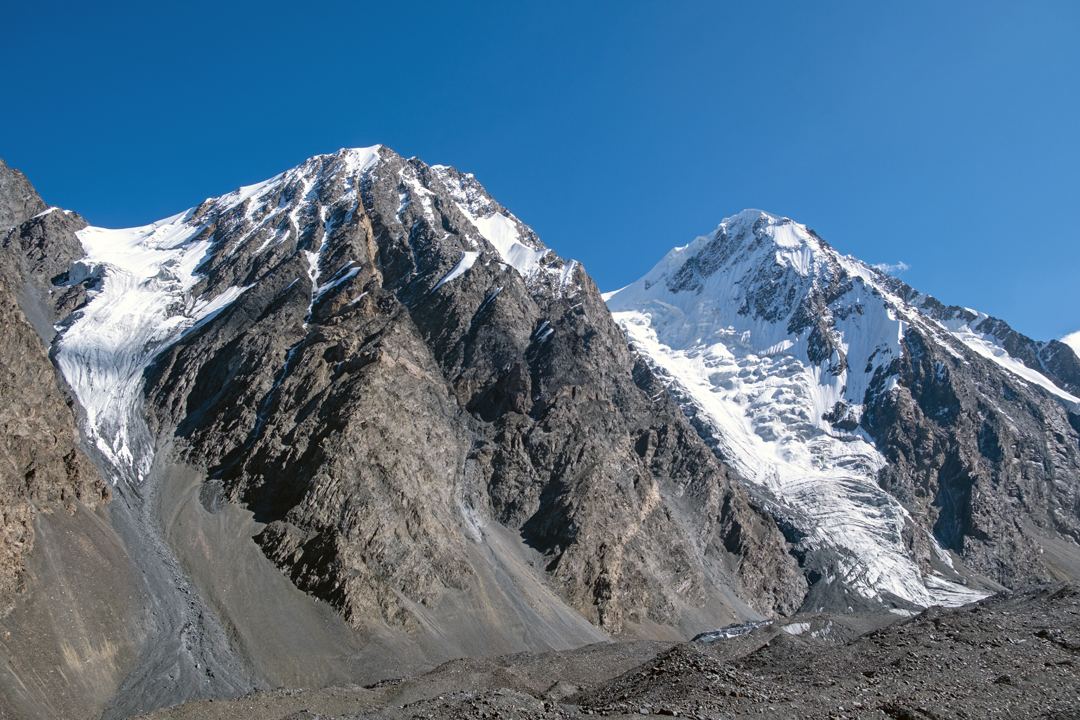
On the 16th, we attempted a 6,050m peak (36°36’22”N, 75°18’20”E) from a bivouac at 5,040m on the neighboring Shalghagin Glacier. Initially, the climb involved 380m of scree ascent to reach the snowline, which was much higher than the previous season (see AAJ 2024). We soloed the snow face as high as 5,730m before abandoning the attempt due to lack of energy.
I then reconnoitered the Zangaish Glacier, and we decided to attempt the 6,030m peak at the head of the western branch (36°36’57”N, 75°15’21”E). We made two attempts to reach the base of the mountain, but both were aborted due to a similar lack of energy.
—Lee Harrison, Norway
Media Gallery