Sharphu III, Attempt, and Clarifications on the Sharphu Peaks
Nepal, Ohmi Kangri Himal
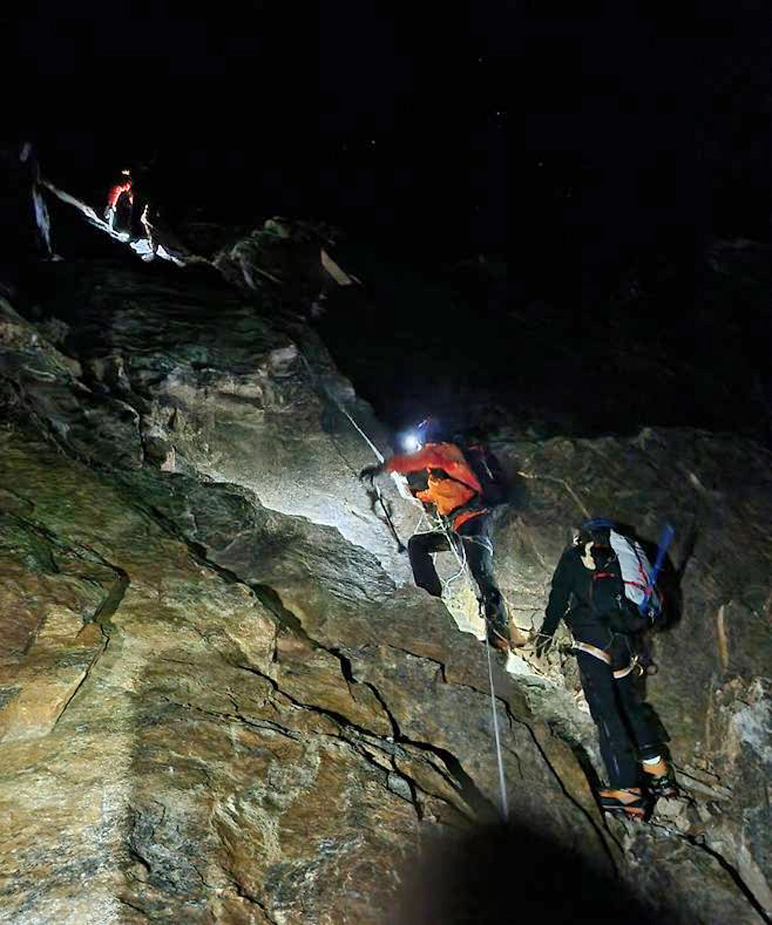
On October 30, a Korean expedition led by Jo Moon-yong, with three Sherpa climbers, claimed to have made the first ascent of Sharphu V. This claim was bolstered by a summit certificate from the Nepalese government.
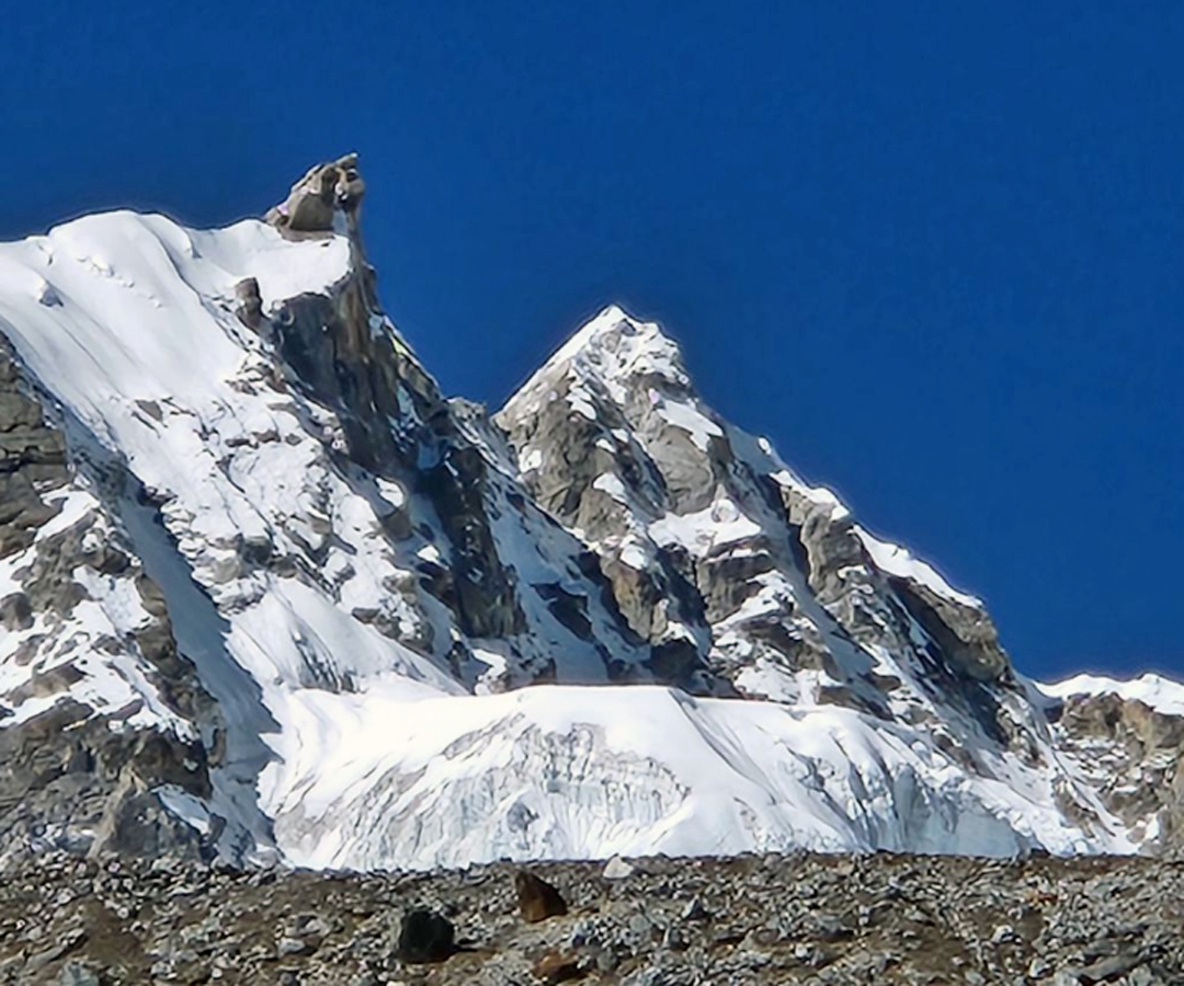
However, no credible evidence exists to confirm the successful ascent of Sharphu V. Their purported summit photo fails to show climbers standing on top of any peak; they are grouped below a large rock tower, and Jo mentioned a big rock formation at the very top, which they were unable to climb due to lack of aid gear.
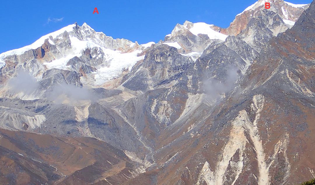
Closer examination of their photographs has shown the Korean team approached from the east up the Namphumba Glacier and climbed a relatively steep mixed wall to reach the broad pass between Sat Peak and unclimbed Sharphu III (27°43’50.29”N, 87°54’17.78”E). From here, they followed the gentle, south-southeast snow ridge of Sharphu III to a foresummit (the large rock tower in the photo). Beyond lies another pointed snow summit considered to be a little higher, though this may not have been obvious to the Korean team from their vantage point.
—Oh Young-hoon, Korea
Sharphu Peaks, Standardizing Nomenclature and Elevations
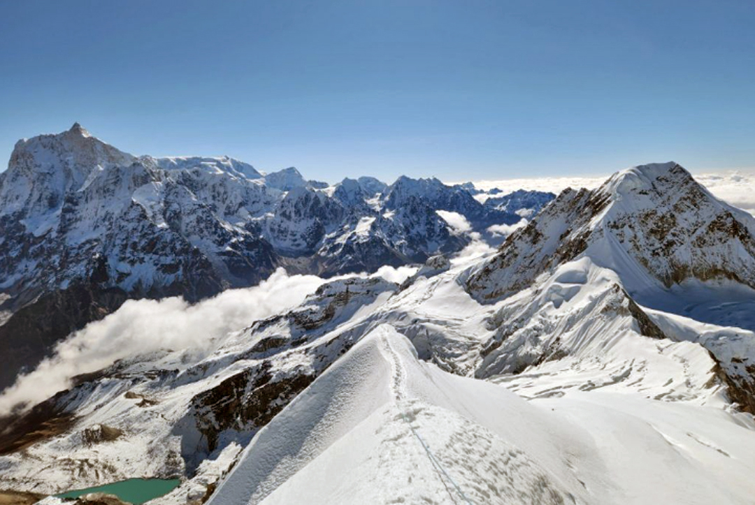
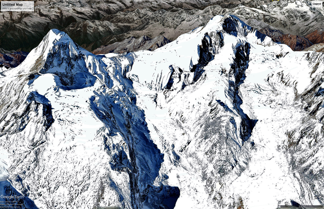
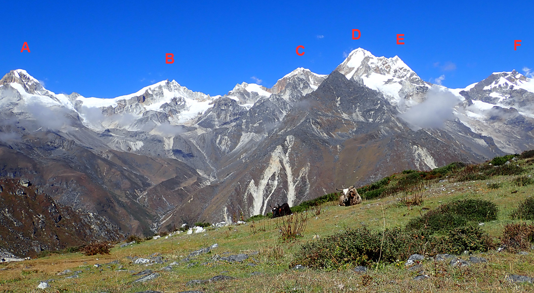
The Sharphu group is a collection of peaks on a north-south ridge to the west of Kambachen village, forming the watershed between the Ghunsa and Yangma valleys. Over the years, there has been much confusion over the naming of the individual summits in this group and their relationship to each other, including in the AAJ.
For consistency among the AAJ, the Himalayan Database, and the Nepalese government, we will define the main summits—from north to south—as follows:
Sharphu IV (6,172m), summited in 1962 by Japanese climbers, who gave it the name Nupchu after the glacier to the southeast.
Sharphu VI (6,076m), unclimbed but attempted from the north.
Sharphu II (6,328m, Tanga II on some maps), climbed in 2018 by an American-Lithuanian team.
Sharphu I (6,433m, Tanga I on some maps), climbed in 1963 by Japanese.
Sharphu V (6,158m, Tanga III), unattempted.
Sharphu III (6,220m, called Marson on some maps, after a pass of that name to the west), attempted but unclimbed.
Sat Peak (6,164m), attempted but unclimbed.
On the ridge northwest of Sharphu VI stands the smaller peak of Tha Nagphu (5,980m), which has been climbed.
All heights cited here are from the HMG-Finn map and Himalayan Database but do not agree with the elevations used by the Nepalese government, which for some peaks are dramatically inflated.
The Nepalese Mountaineering Association (NMA), in collaboration with the Ministry of Culture, Tourism and Civil Aviation, has created an online portal of Nepal’s peaks to aid with permits and other matters, and this portal’s list of coordinates for the six Sharphu peaks agrees, approximately, with the nomenclature above. However, it lists Sharphu I at 7,070m and Sharphu III as 6,885m—some 600m higher than the actual elevations. The 7,070m altitude for Sharphu I came from the successful 1963 team, which claimed the altitudes assigned to these peaks were far too low. They are not.
These exaggerated heights presented a problem in 2022 for an Italian team that planned to attempt Sharphu III but was informed a few days before leaving for Nepal that the ministry’s higher altitude figure would require a permit far too expensive for their budget. They went elsewhere.
—Lindsay Griffin, AAJ, and Rodolphe Popier, Himalayan Database
Editor's Note: This story was updated in May 2026 to change one mountain's name to Sat Peak (called Sato Peak in the print edition of AAJ 2025).
Media Gallery