

Northern Patagonian Icefield Exploration
Argentina-Chile, Northern Patagonia
In late 2017, with the mountain guide Gabriel Fava and porter Joaquin Gomez (both from Argentina), I traveled to the central-eastern part of the little-visited Northern Patagonian Icefield, approximately 20km north of Cerro Arenales. We were familiar with a few climbing-focused expeditions to this area, which encompasses the zone around Cerro Cachet, by New Zealand climbers in 1969–1970 and 1971–1972 and Chilean climbers in 2007. The modern-day Patagonian explorer Camilo Rada was a part of this latter expedition—most of the info we obtained before our trip was firsthand knowledge that Camilo transmitted to Gabriel.
From Coyhaique, we drove 280km south to Puerto Bertrand, a small village of 50 inhabitants. From there, we traveled west, using a boat to cross the Bertrand and Plomo lakes. We walked three days, crossing rivers and streams—some by foot and others, like the Soler and Cacho rivers, by riding our packhorses—to reach the eastern bank of the Nef Glacier. We crossed this 4km-wide and very crevassed glacier to establish a camp at 966m on the moraine of the glacier’s western bank.
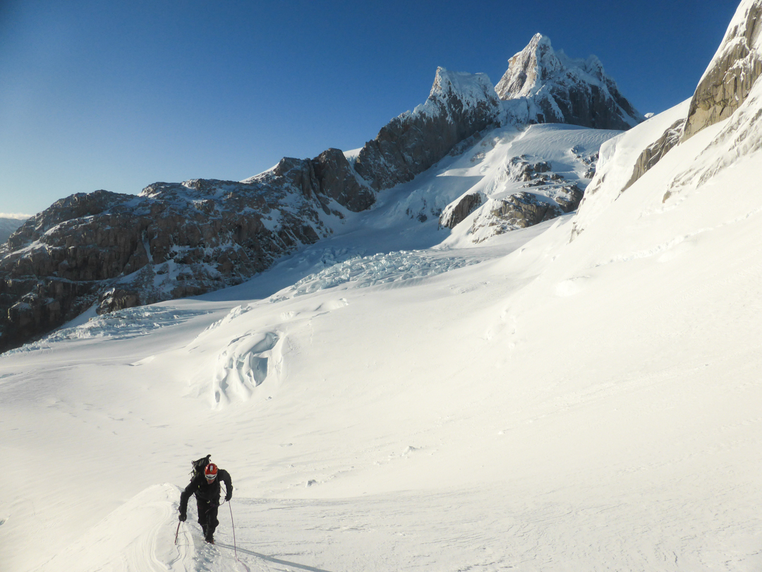
On November 17, after six days of storms, Gabriel and I ascended to a 1,616m col, from which we reached the ice field, satisfied to learn this was possible because we had not found any information about past expeditions who had reached the ice field by this col. Looking west across the ice field to the Cordón Aysén, mountains covered with snow from the last storms dominated the horizon—many of these peaks are unclimbed.
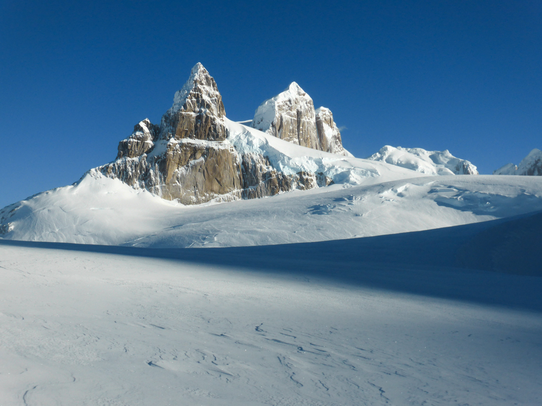
In front of us, we could see our objective, an unclimbed mountain called Pantagruel (2,537m). Its west and southeast aspects are most prominent, all steep and sheer rock faces. Unfortunately, we found our planned route up its north face covered with dangerous, wind-affected snow. As a consolation, we climbed a non-technical snow ramp up a peak just to the north, situated between Pantagruel and Gargantua (ca 2,500m) which we called Punta Anna (2,365m, 46°59’38.11”S, 73°23’16.30”W). A storm arrived that night, just as we finished the 10km hike back to our tent.
This wild and remote area deserves to be visited, as it offers both promising exploratory potential and steep, technical objectives on unclimbed peaks. Of course, visitors have to rely on luck to get windows of good weather. More information (in Spanish), a map, and photos can be found in the recent article “Campo de Hielo Norte,” by Natalia Martínez and Camilo Rada, in the Argentine magazine KÓOCH, Issue 56, December 2017.
– Henry Bizot, France
Media Gallery


