

Judl Peak, Northwest Ridge
Pakistan, Karakoram, Honboro Group
The Honboro Group, with a high point at Honboro Peak (6,459m), lies northwest and west of the Hushe Valley, between the Hushe and Thalle (a.k.a. Yarkhor or Thalay) valleys. In 2011, Simón Elias accompanied Ester Fresnada and Berta Terres, two members of the Spanish female national climbing team, to investigate the Apobrok River valley, northwest of Kande, leading to the Kande Glacier. From the upper Kande Glacier they made the first ascent of Kande Peak (5,470m, AAJ 2012), which lies on the ridge between the Third and Fourth Kande cwms, as designated on Jerzy Wala’s 2004 sketch map of the Honboro Group, at approximately 35°25'25.12"N, 76°13'05.63E (Peak 119 on the Wala map).
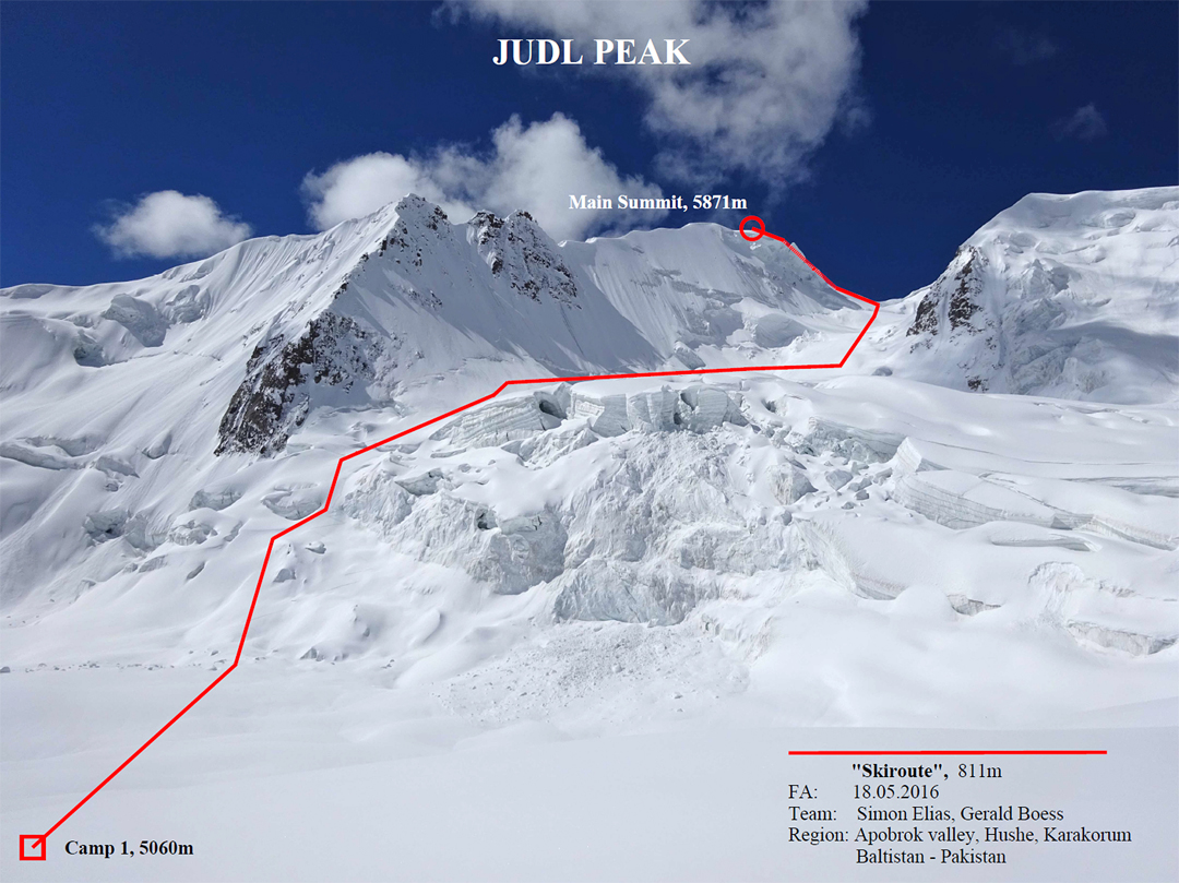
In May 2016, Elias returned with Gerald Boess to explore the possibility of ski ascents in the area. The pair reached the upper Kande Glacier and then headed southwest into the First Kande Cwm. From a camp in the cwm at 5,060m, the pair climbed northeast-facing glacier slopes to reach the watershed ridge with the Thalle Valley, then followed the northwest ridge of Peak 5,871m to the summit. The pair was unable to ski from the highest point because of a large crevasse cutting across the slope. The mountain has been named Judl Peak (35.385584°N, 76.210153°E, Peak 146 on the Wala map), and the 800m ascent was called Skiroute.
Information supplied by Simón Elias, Spain
Media Gallery

