Kanjeralwa, Historical Ascent of South Top
Nepal, Kanjiroba Himal
Kanjeralwa (6,612m, 29°13'56.57"N, 82°52'27.22"E) lies in Shey Phoksundo National Park, in Dolpo, immediately northwest of Phoksundo Lake. On the HMG-Finn map it is erroneously named Kanjiroba Himal.
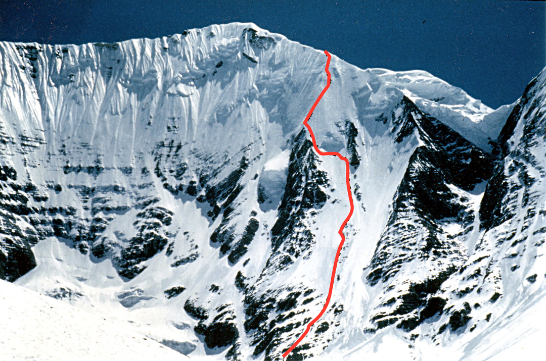
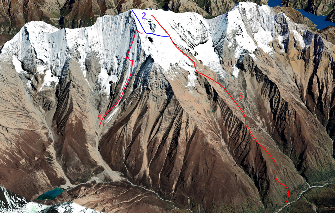
A Japanese team made the first and only ascent of Kanjeralwa’s main summit in the spring of 1973, when they employed fixed rope and Sherpa support to climb the south ridge/south face. They entered the area using an official permit for nearby Kanjiroba, but this peak was never their intention—an early use of this tactic. The expedition established three camps on the ridge, at around 4,900 meters, 5,300 meters, and 5,800 to 5,900 meters. The south ridge falls from a subsidiary south top or shoulder marked at 6,426 meters on the map, but from their top camp the Japanese climbers slanted left toward the southwest ridge, then climbed to the summit via a vague snow and ice rib, without crossing the south top. The summit was reached on consecutive days by a total of five Japanese and three Sherpa climbers.
The peak has rarely been attempted since. In 1989, a French team climbed the north ridge to one of the northern summits, likely Peak 6,278m. In 1991, a French-Spanish expedition made an alpine-style ascent of the steep and icy northwest face to the upper southwest ridge at 6,300 to 6,400 meters, then traversed to the south ridge and descended the Japanese route. The Franco-Spanish team found the upper section of this ridge tricky due to serac walls, but farther down it was much easier. A Swiss team tried to climb the southwest ridge in 1996 but gave up low on the route due to deep snow.
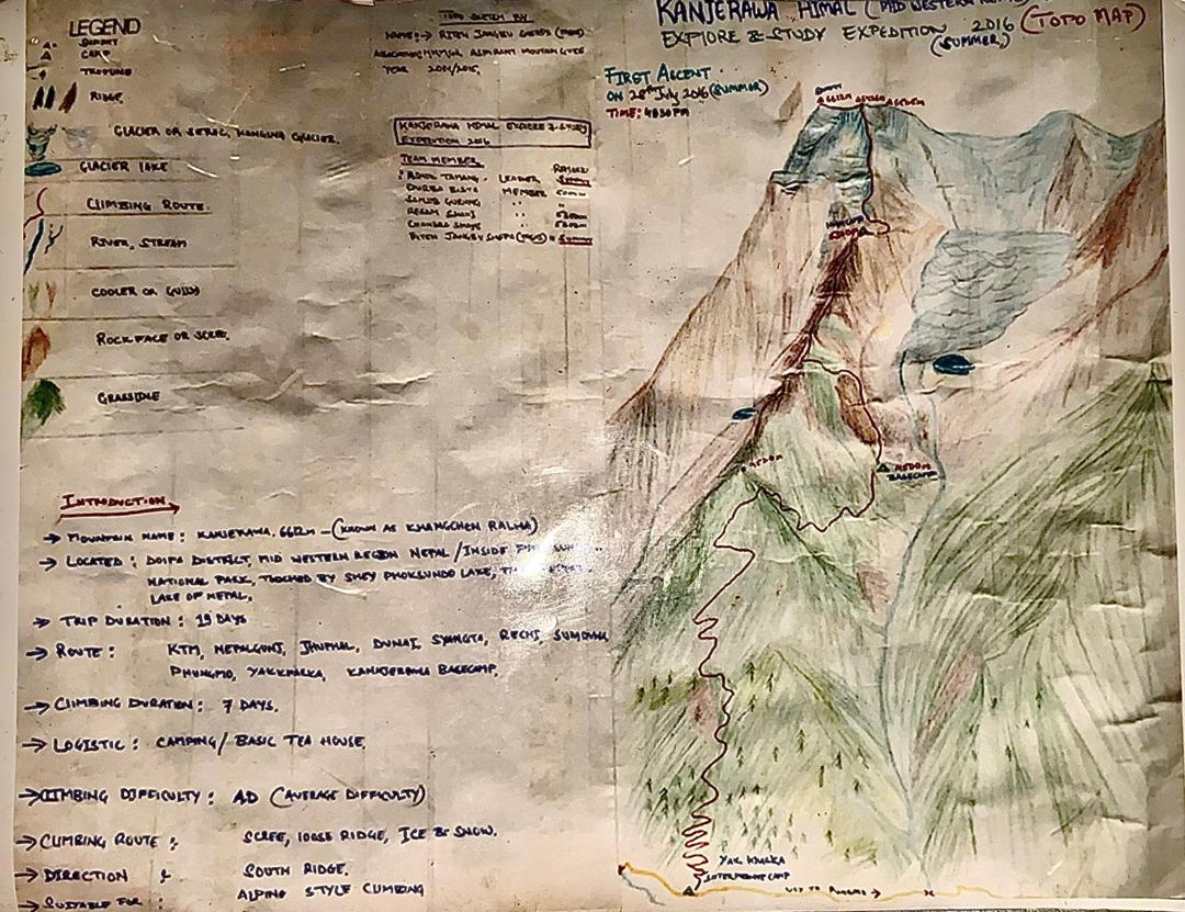
In the summer of 2016, the Nepali team of Dhruba Bista, Sanjib Gurung, Rinjen Jangbu Sherpa, and Askok Thokar Tamang left the main valley of the Pugma Khola, close to Daja, southwest of the mountain, and climbed the rocky ridge between the Naure and Charajan valleys, more or less following the 1973 Japanese route. At around 4,500 meters, however, they slanted down the east flank to gain the Charajan Valley and made a camp at 4,500 meters.
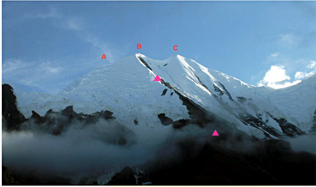
Higher up the valley, under the threat of icefall from the glacier above, they climbed back onto the ridge and made a second camp at around 5,300 meters. Their detour had avoided about 500 meters of the ridge climbed by the Japanese that was tricky and friable. The Nepali climbers camped at around 5,800 to 5,900 meters (a similar location to the Japanese high camp), and the next day, July 28, continued up the south ridge to reach the previously unclimbed south shoulder at 6,426 meters.
Despite the angle of the slopes above being quite gentle, the time was now 4:30 p.m. and the weather poor, so the team descended from this point without continuing to the main summit. The climb was rated AD and carried out in alpine style.
—Lindsay Griffin, AAJ, with help from Rodolphe Popier, Himalayan Database
Media Gallery