Tumladen Sar, first ascent, via northwest face
Karakoram, Virjerab Muztagh
After consultation with Janusz Majer, who informed us that most peaks in the area were unclimbed and there was huge potential for new lines, Michał Nowicki, Maks Parys, Matej Prcin, Marco Schwidergall, and I (all Polish except for Prcin, who is Slovakian) decided to visit the Virjerab Valley. We took a good sketch map, thanks to Jerzy Wala, and an excellent satellite map (SharpMap) provided by Lukasz Stempek, who helped a lot with our expedition.
We left Shimshal on September 1, and by the 5th we were at the so-called Polish Base Camp (4,115m), where Krzysztof Wielicki’s expedition had camped in 2012 (AAJ 2014). The weather was stable, so between the 6th and 11th, we established advanced base at 4,323 meters, then carried out a reconnaissance and acclimatized. During that period, Marco and I climbed a tower of 6,031 meters (36°13’24.69”N, 75°37’50.75”E) on the southeast ridge of Peak 50 (6,172m) on the Wala map, north of the Second West Virjerab Glacier. We named it Bozz Yozh, which means “eagle’s nest” in Wakhi.
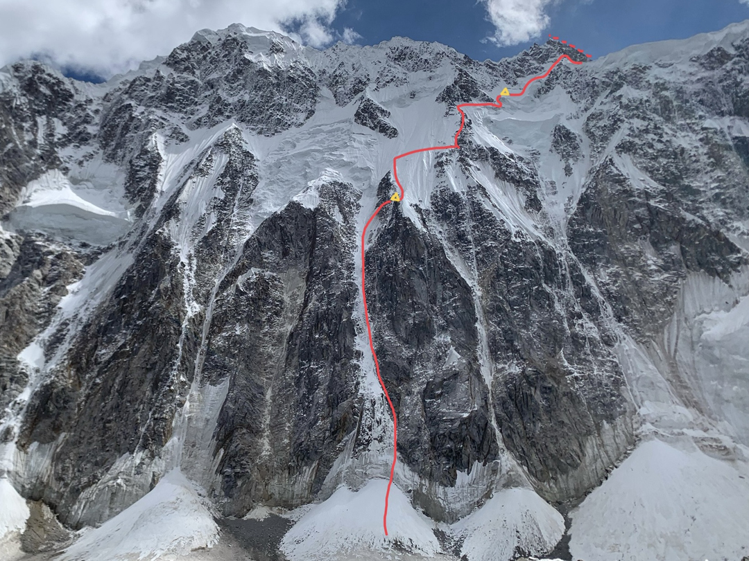
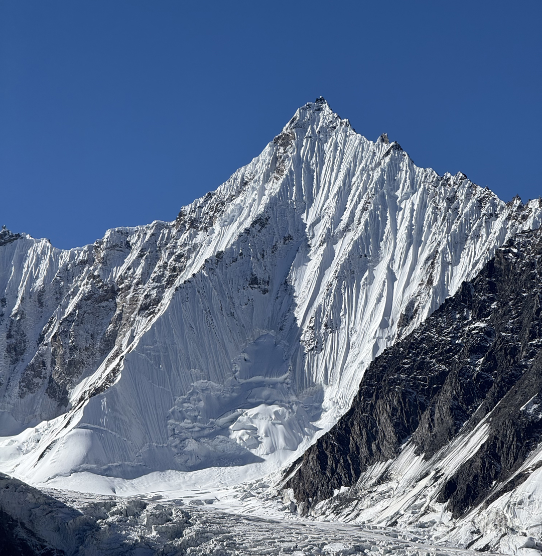
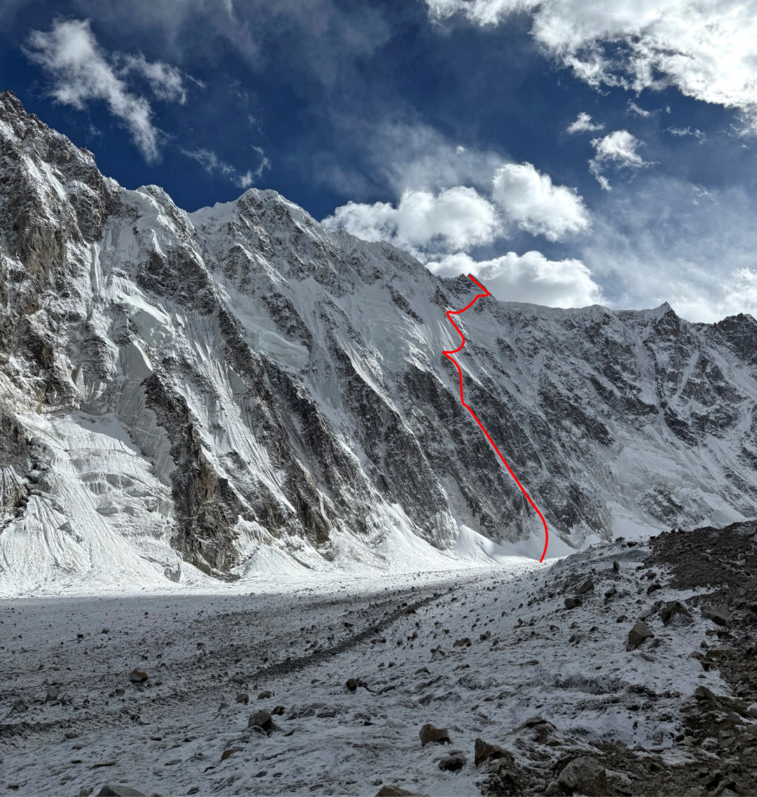
By the time we had returned to base camp on September 11, Marco, Matej, and I knew we wanted to climb the northwest face of Peak 49 (6,315m) on Jerzy Wala’s map. The safest route to this summit, located above the First West Virjerab Glacier, appeared to start up an obvious couloir and then continue on the pillar above and to the right. We hoped to complete the route in two days.
Two major issues bothered us. Firstly, seracs hung above our couloir; secondly, reconnaissance had shown the way down the other side of the mountain would lead through a difficult, broken glacier. After some discussion, we decided the seracs seemed stable, and that we would rappel back down the northwest face.
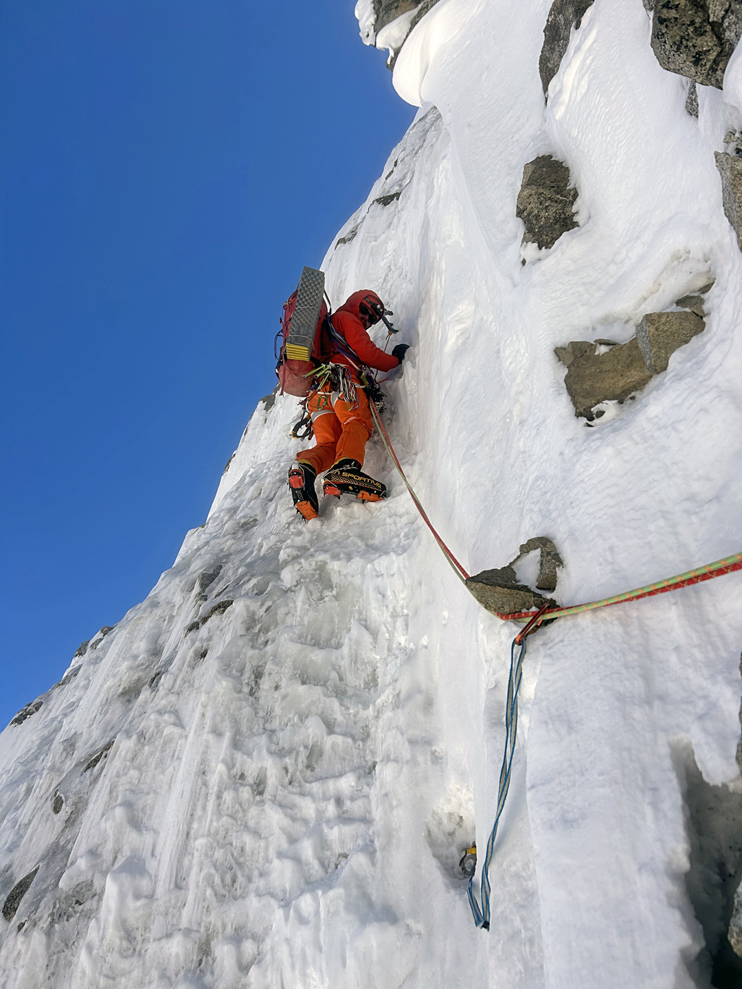
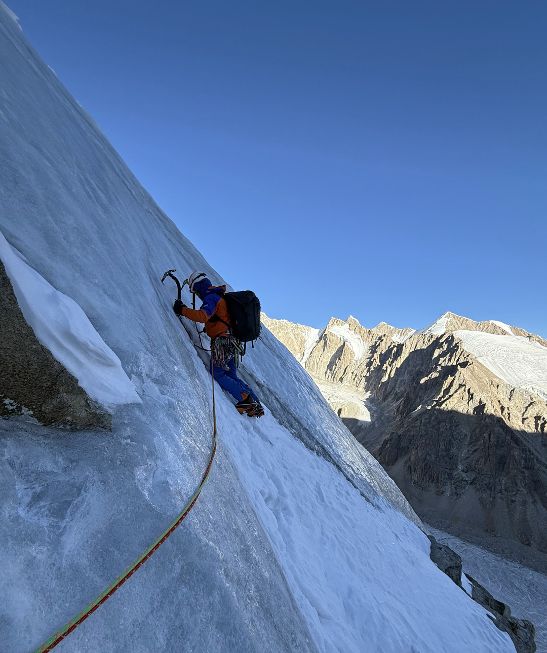
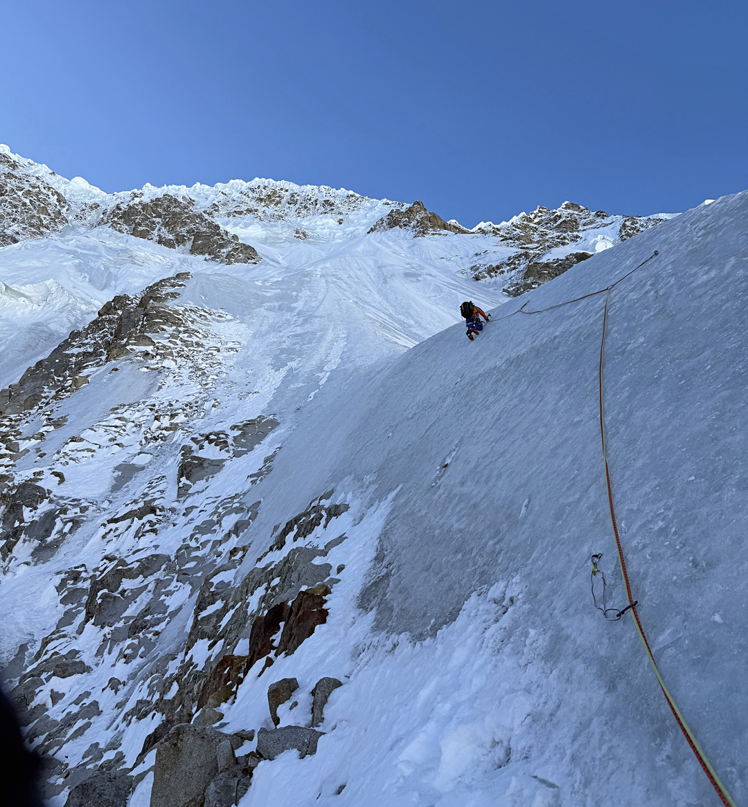
The weather was bad until September 18, and we only managed to cache some gear at the bottom of the face. We moved up toward the face on the 19th, and the next day watched the seracs that hung above our couloir. As they seemed stable, we started up the couloir before dawn on September 21. We realized quite quickly that we could not climb simultaneously, as there was too much spindrift. We climbed 13 mixed pitches, then dug a ledge and subsequently endured a very uncomfortable sitting bivouac.
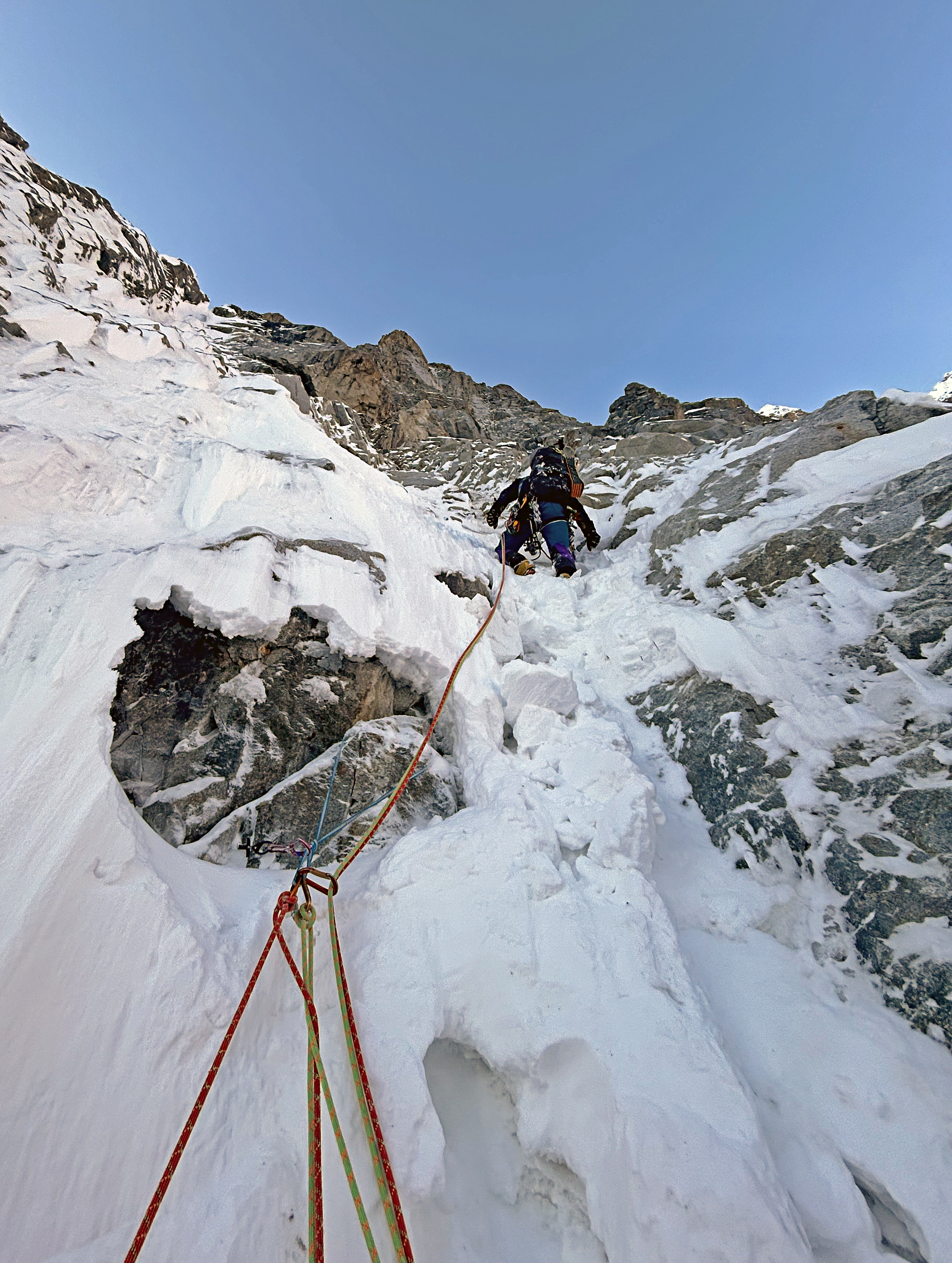
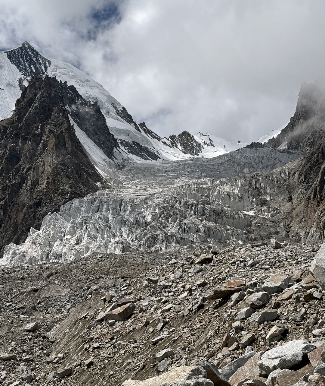
Moving slower than planned, we realized we needed to change our strategy and traverse to the right, aiming toward the lower Peak 48 (36°12’58.48”N, 75°36’0.36”E) before the spell of good weather ended. We also concluded that rappelling the face we had climbed would be too dangerous and that we would have to descend to the south and through a difficult, broken glacier.
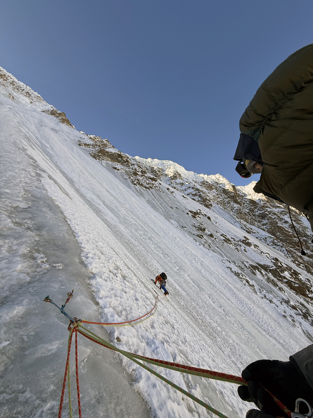
On the 22nd, we climbed mainly hard ice at 50°–80°, making 12 pitches, some of them 80 to 100 meters in length (moving together with intermediate protection), to reach the top of a serac. We were very dehydrated, and digging a platform for our bivouac seemed like a never-ending nightmare. However, we were only 300 meters below the summit.
The next day, exhausted, we chose the wrong route, deciding to go to the right of the summit and climb back up to the top via the west ridge. This lowered the aesthetics of the line and slowed us down, so we only reached the summit at 2:30 p.m. Our inReach showed an altitude of 6,232 meters.
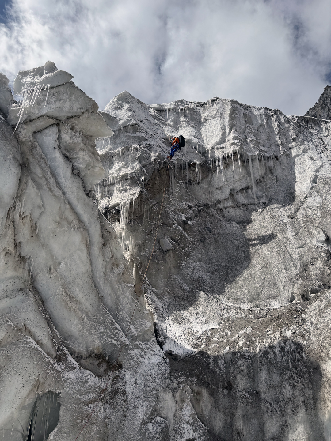
After some downclimbing and ten rappels on the south ridge, we reached the upper section of the broken glacier and pitched our tent for the night. The next day brought snowfall, but we managed to descend east through all the crevasses, making two rappels, and eventually reached the Second West Virjerab Glacier. We returned to base camp on September 25. We have named the mountain Tumladen Sar—all of us are big fans of Tolkien’s novels.
Unfortunately, our other three friends were unable to complete any ascents. In my opinion, there are no other safe routes to be climbed from the First West Virjerab; we chose the only line not prone to falling rock or ice. However, there are beautiful unclimbed peaks in the Second West Virjerab, notably Sharp Peak (6,401m, 36°8’42.41”N, 75°38’0.01”E), halfway up the glacier, and others toward the top. These would require a base camp in the Second West Virjerab, which would in turn require high-altitude porters, as our Shimshali porters refused to carry any higher than Polish Base Camp.
—Tomasz Rodzynkiewicz, Poland
Media Gallery