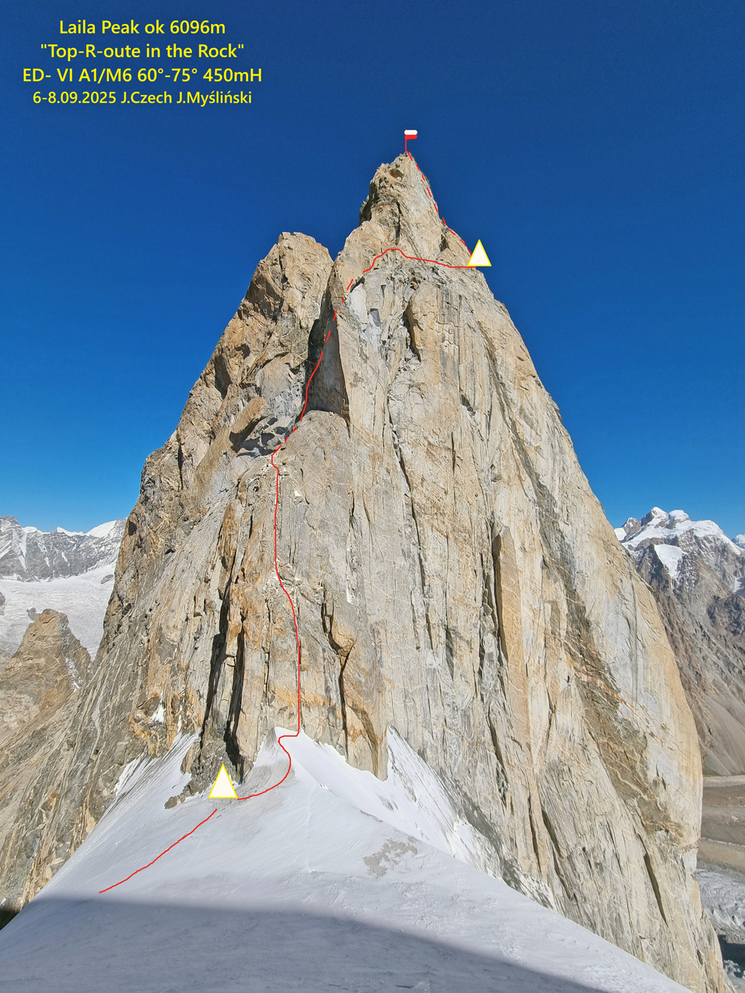
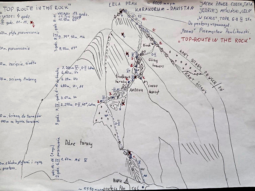
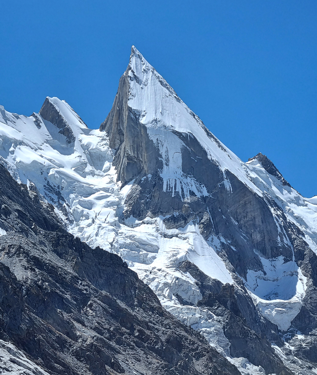
Laila Peak, southeast face, Top-R-oute in the Rock
Pakistan, Karakoram, Masherbrum Range
Between August 18 and September 15, Jacek Czech, Przemyslaw Pawlikowski, and I, from the Tatra Volunteer Search and Rescue Team (TOPR), visited the Karakoram with financial help from the Kukuczka Foundation. Our goal was the unclimbed southeast face of Laila Peak (6,096m, 35°35'29.83"N, 76°24'38.70"E), where a lack of good photos or information on how to reach the wall added to the adventure.
From Skardu, we drove to Hushe and then walked for one day (around 20 kilometers and 1,000 meters elevation gain) to a base camp at 4,150 meters on the popular trekking route over the Gondokoro La. As the trekking season had finished, we had the place to ourselves.
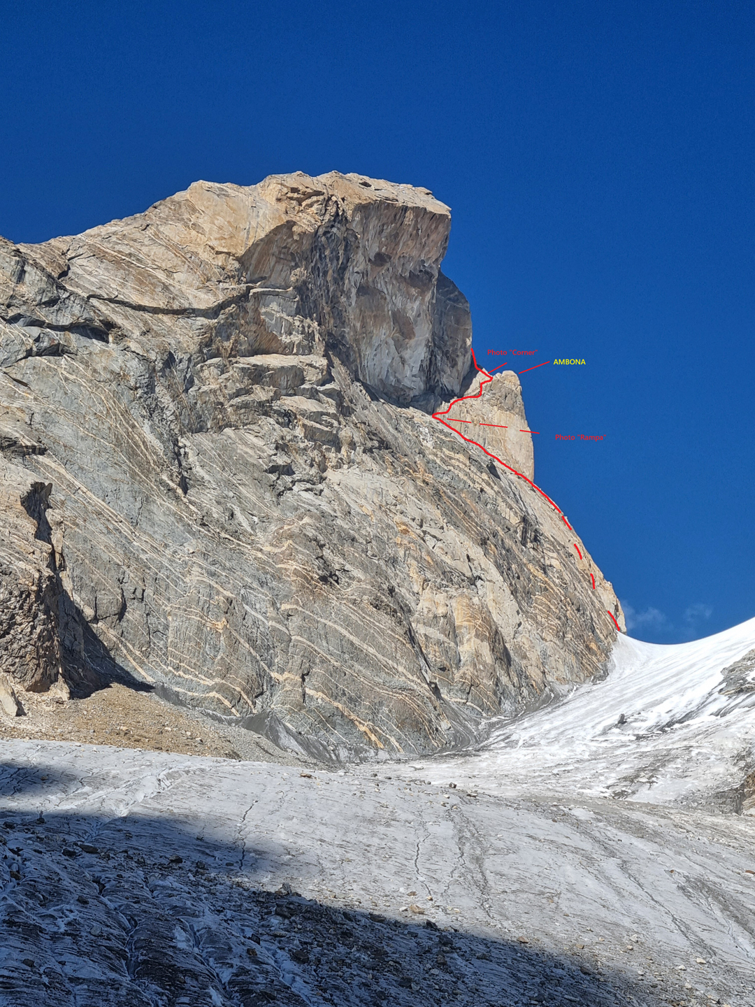
We first needed to find a safe route up to the col between Laila and the 5,809-meter peak to the southeast known as Little Laila or Laila’s Little Sister. We chose the next big, glaciated valley south of the one used to climb Laila’s standard route on the northwest face. This approach could only be traveled in the morning due to rockfall, both in the narrow valley and on the glacier later in the day.
On August 28, we made an advanced base on terminal moraine at 4,850 meters and the next day reached the col below Laila’s southeast face at 5,500 meters. We then descended to base camp for a rest and waited out some bad weather. On September 5 we regained advanced base. The next morning, Przemek, who had been struggling with health problems, decided to return to base camp.
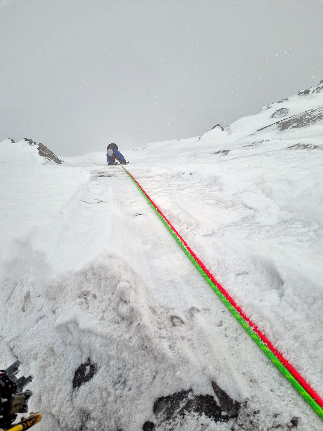
Jacek and I reorganized gear and set off, reaching the col before the sun hit the glacier. After pitching the tent and eating, I led the first two pitches of the wall, rising almost directly above the col. The first was M6 with axes but without crampons, and the second pure rock at UIAA IV. We left our ropes in place and descended to the tent.
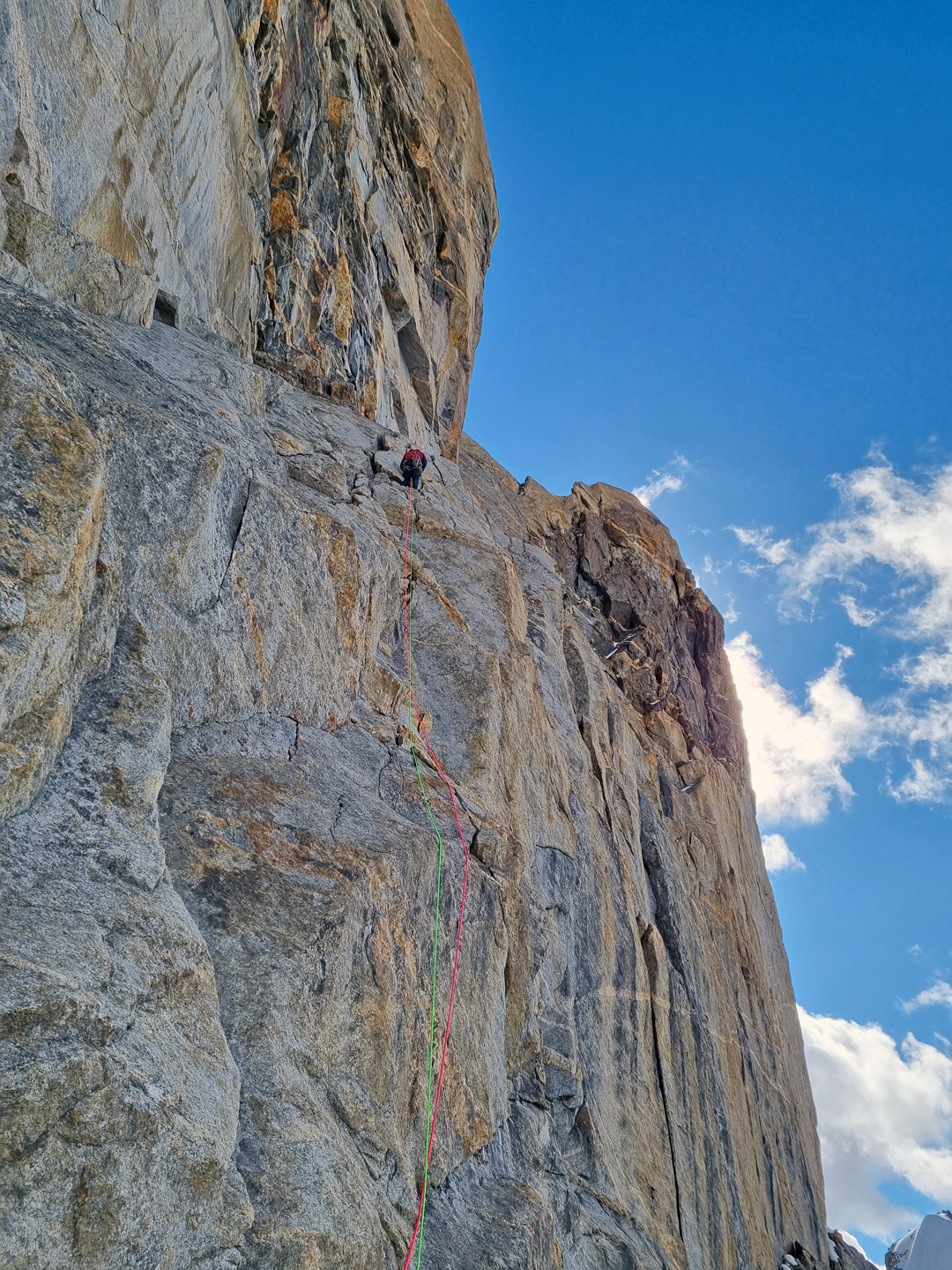
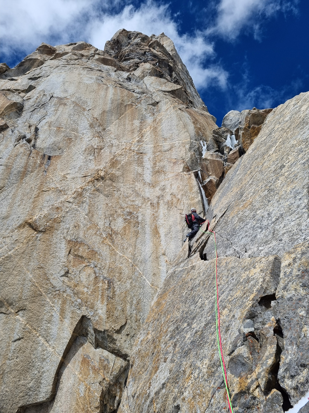
On September 7, a beautiful day, we ascended our ropes and moved up straightforward terrain for around 250 meters to a stance below the main rock difficulties. Jacek led this section of around four pitches, up to VI- with five meters of A1. Slanting to the right arête, we reached a small saddle behind a pulpit on the ridge, where we left some gear. We then followed a less difficult but exposed traverse onto the icy east side of the peak. On almost the last rock ledge, we made a warm but uncomfortable bivouac. Clouds increased during the night, and it began to snow lightly.
In the morning, I started to lead the last section. Our watch altimeters suggested we still had 250 meters to go, so we were delighted to reach the summit after only three 60-meter pitches, with maximum difficulties of M4 75° ice.
The descent was a different story and proved very stressful. We collected our gear from the saddle partway down and reached the tent at the col, but due to worsening weather and increased precipitation, we thought it wise to continue down. As darkness fell, we cached our gear below the end of the glacier and eventually reached base camp around 10 p.m. Przemek and I collected that gear two days later.
On the lower part of the wall, we found three old rappel anchors (slings). Although the first ascensionists, who climbed from the northeast side in 1987, rappelled somewhere in this vicinity, these slings looked much more recent. Locals in Hushe told us they knew of one team that had rappelled this face, though they had no details. On the steep sections of the route, the rock was good granite; elsewhere it could be brittle and produce rockfall when in the sun.
Przemek didn't climb with us, but his hard work in ferrying equipment during the early stages was integral to the success of our expedition. Without him, the whole operation would have taken much longer, and we probably wouldn't have completed the ascent.
—Jędrzej Myśliński, Poland
Media Gallery