Eye Ri, first ascent, via northwest face and west ridge; Latok III, southeast ridge, attempt
Pakistan, Karakoram, Panmah Muztagh
Jon Griffin, Thomas Huber, and I had visited the Choktoi Glacier in 2024, our goals the west summit of Suma Brakk and the southeast pillar of Latok III. Initially, the weather was stunning, but as our preparation was beginning to pay off, we were hit by five weeks of wet and restless weather. Our objectives quickly became out of reach.
On July 14, 2025, the three of us reconvened in Skardu. [This expedition was supported in part by a Cutting Edge Grant from the AAC.] The approach this time to base camp, at around 4,400 meters on the east side of the glacier, was challenging due to hot weather and raging river crossings.
Then, five days into our stay at base camp, Thomas and I were called to assist in the rescue of Laura Dahlmeir on Laila Peak. [The German athlete was a two-time Olympic biathlon champion and a friend of Huber’s. She was retreating from the peak when she was fatally hit by rockfall at around 5,700 meters.] Along with Jackson Marvell and Alan Rousseau, who were on another expedition in Pakistan, we were airlifted to the peak, where we located the body from the air and realized any attempt to retrieve it would be futile. We hiked out to Hushe, then were helicoptered back to our Choktoi base camp on August 2.
Two days later, we made an acclimatization trip to 5,700 meters near Suma Brakk. At 12:30 a.m. on August 9, we set off from base camp for the climb.
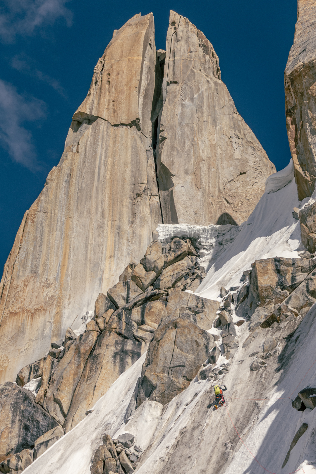
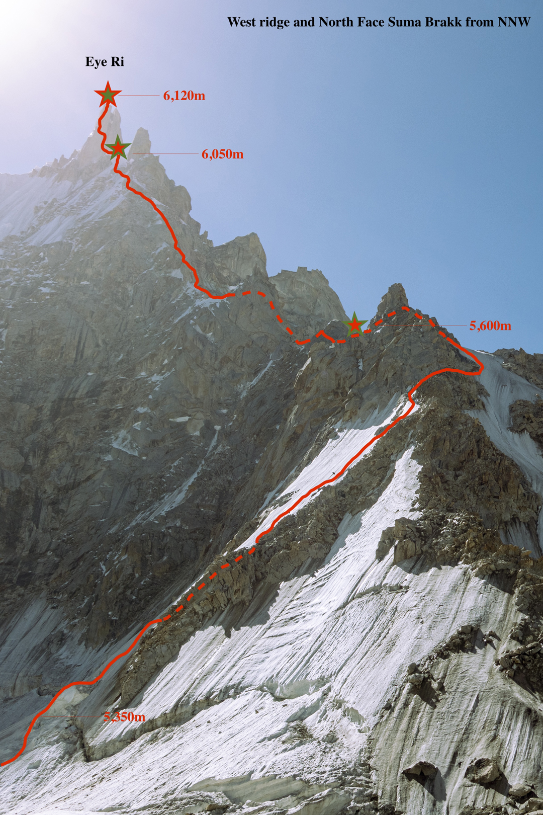
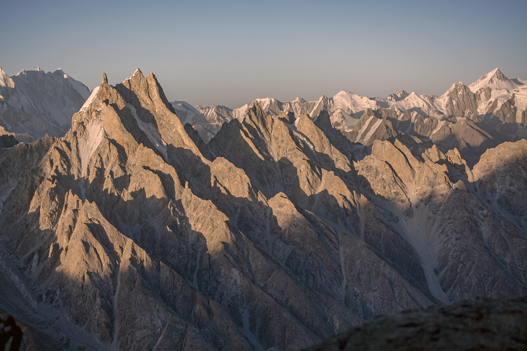
Suma Brakk is a triple-summited peak that has been climbed at least a couple of times by different routes. [The first ascent of the central and highest summit (6,166m) was made in 2007 via the southern slopes and southeast ridge (AAJ 2008). In 2018, the south ridge gave over 2,200 meters of climbing—more than 56 pitches—to the summit (AAJ 2019).] The west summit, which we dubbed Eye Ri (6,120m, 35°57’13.18”N, 75°55’38.15”E), was unclimbed. It appears as a spectacular needle when seen from the Choktoi side; moving around the peak to the west exposes a gash splitting the entire summit tower. There is a giant chockstone wedged 15 to 20 meters from the top that mimics the Eye of Sauron.
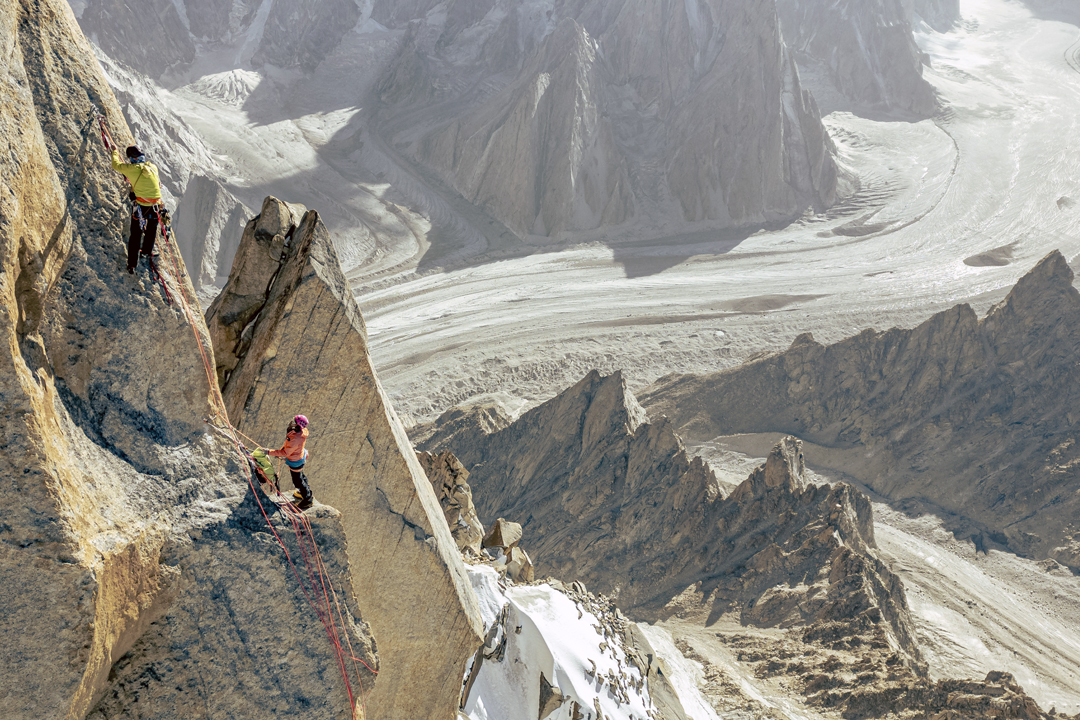
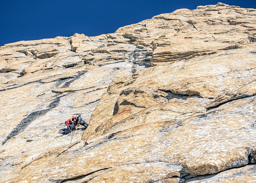
We started up loose ribs and even looser rock gullies just left of a 300-meter icefall blocking access to a hanging glacier at the base of Eye Ri’s northwestern aspect. We had been here the year before, so we knew where to find the best path to the notch providing access to the upper glacial basin. The climbing ranged from steep walking to scrambling. A hike up the glacier, then steep snow and névé with occasional stretches of ice and mixed (50°–75°), took us to the previous year’s high point at 5,600 meters on the west ridge, between the first and second gendarmes. While I chopped out a site for the tent, Jon and Thomas took our two single ropes and a tag line and fixed three pitches to the top of the second gendarme.
The next day, we continued past three more gendarmes to a bivouac below the final tower. There were a few rock pitches up to 5.10+ on textured golden granite, and ice up to 80°, and we needed the full quiver of alpine tactics and trickery to get our under-acclimatized bodies up to 6,000 meters.
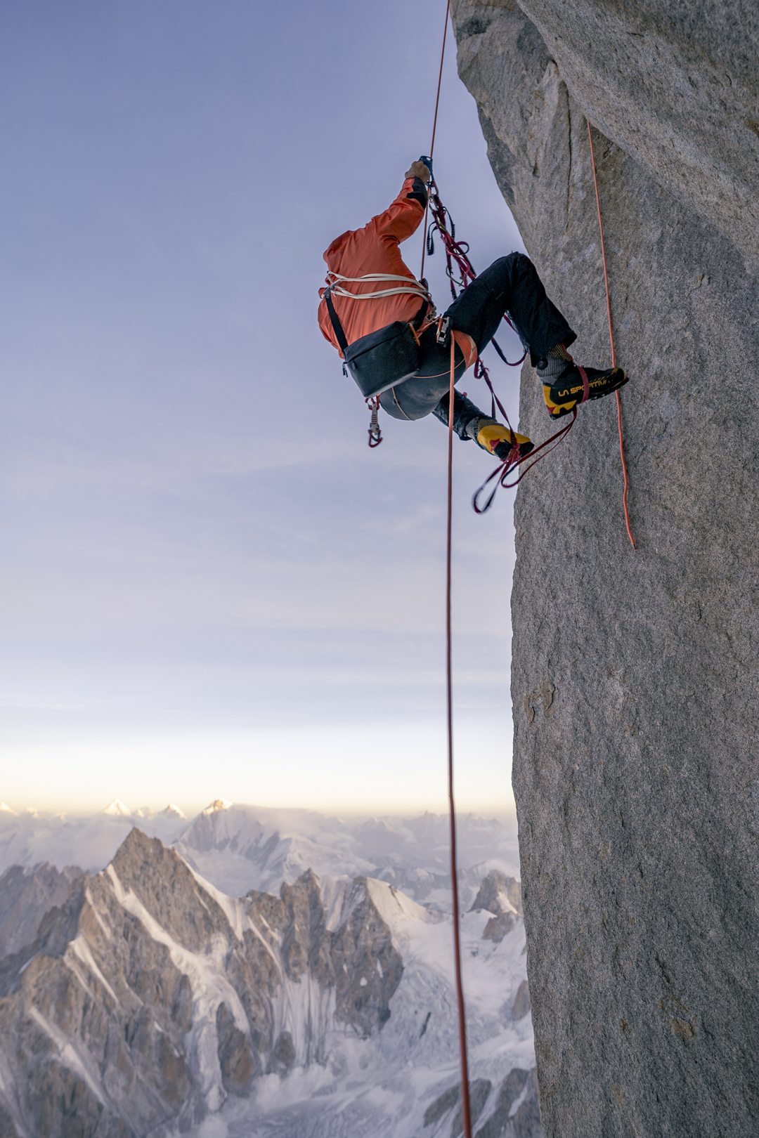
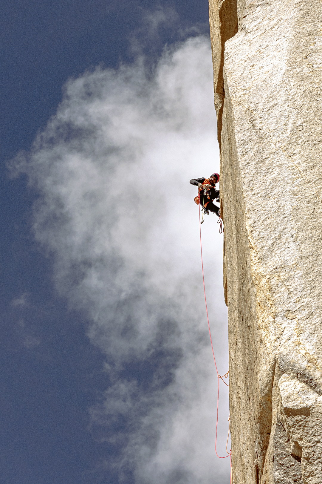
In the morning, we climbed three challenging pitches up the tower, utilizing 12 bolts for protection and anchors. Free climbing up to 5.11, we also employed a variety of aid tactics. At a bus-sized platform four meters below the top of the tower, we fixed lines and rappelled 85 meters to our camp.
On the 12th, we jugged our lines and did a short boulder problem to the summit, for what appears to be its first ascent. We laughed, danced, and cried a little as we soaked in the expansive vista, then descended all the way to our 5,600-meter camp, making at least 15 rappels. With the heat maxing out, we were incredibly thankful to be on a ridge, as the mountain was exploding on all sides. The following day, we retraced our steps to base camp. We named the route HmlaA (1,000m, 5.11 A3 80°).
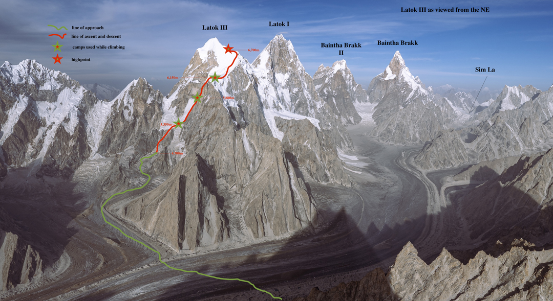
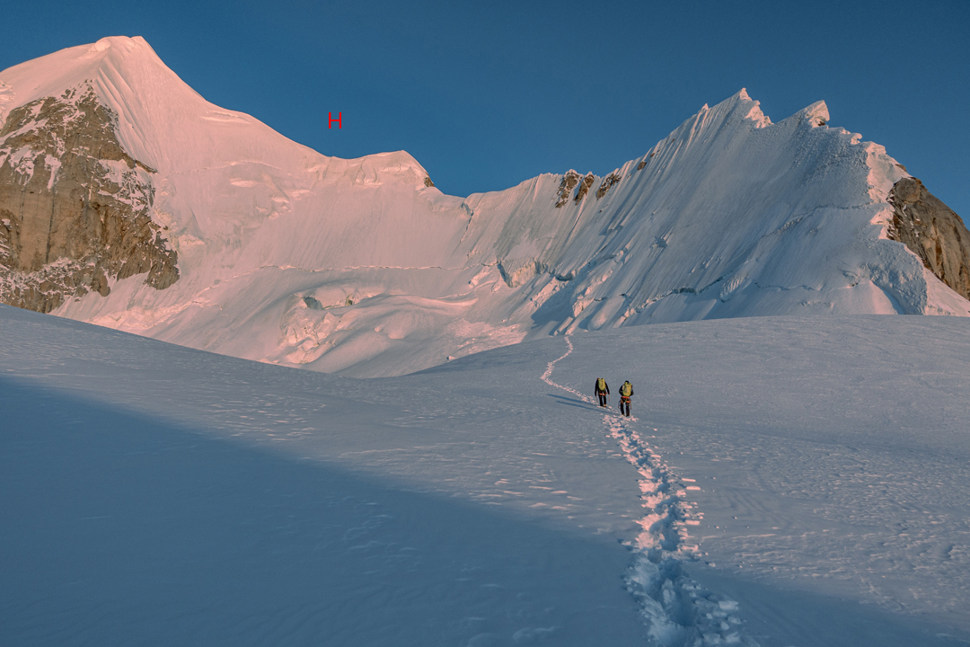
For the next couple of weeks, the weather was unstable and we made the most of the amenities close to base camp: climbs from 5.8 cracks to 8c sport projects, a slackline, and a little lake—the headquarters of the “Choktoi Yacht Club.” Then the weather cleared, the temperature dropped, and on August 28 we left camp at midnight for Latok III (6,949m, 35°55’11.92”N, 75°50’18.85”E).
Crossing the Choktoi Glacier under the cloak of darkness, we entered a 400-meter couloir just before first light. This was the most serious part of our proposed route up the southeast ridge. The couloir leads to a glacier basin that can get obliterated by serac fall. Although no debris comes down the couloir, the energy caused by exploding ice can send hurricane-force winds and spindrift down the gully. We had endured such a blast while camped near the base of the couloir in 2024. The couloir ends at a notch on a rock rib. We followed this rib for a few minutes, then climbed a couple of short ice steps to a campsite at 5,300 meters.
In 2024, Thomas and I had climbed to around 5,600 meters on the pillar above and left a few lines fixed on the initial pitches. While I prepared camp, Jon and Thomas checked the old lines and hung new ones for the following day.
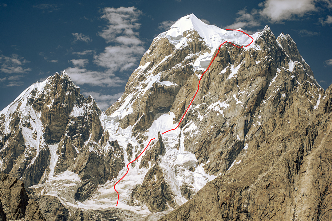
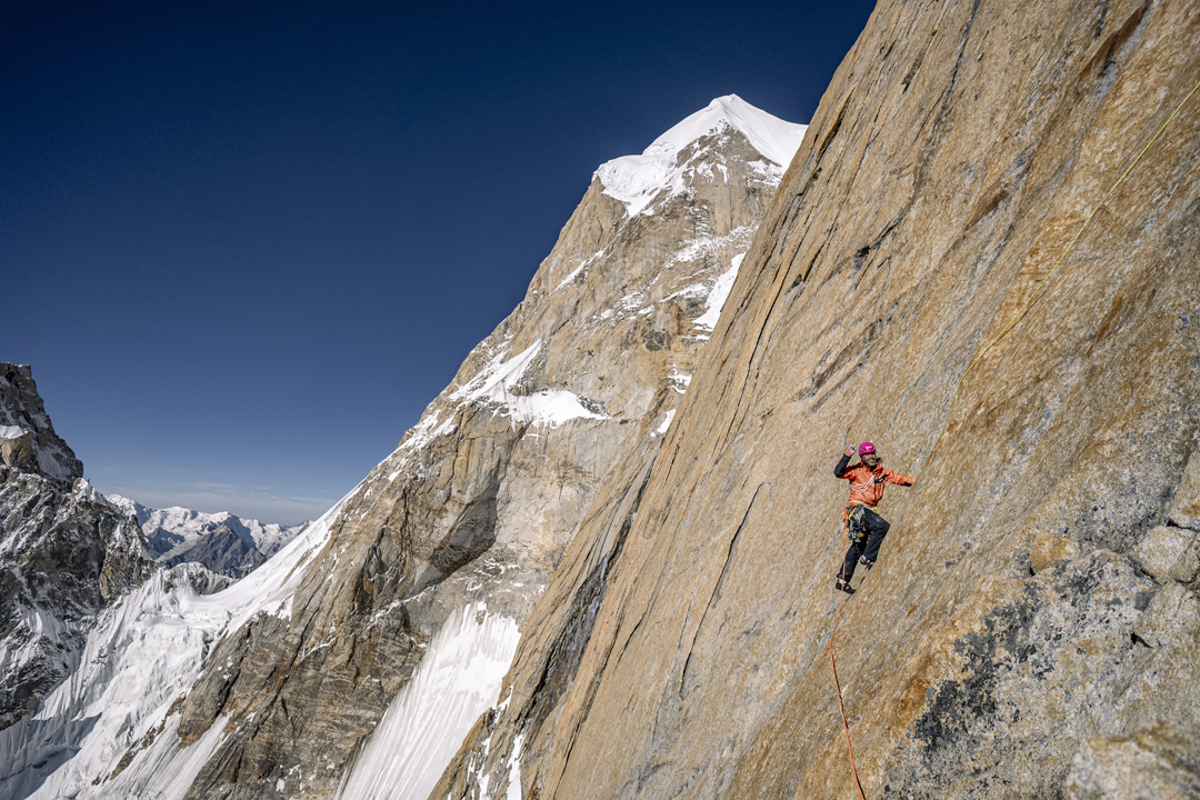
We left well before dawn and used the fixed ropes to ascend mixed terrain and a few pitches of steeper rock (up to 5.9) to a point where we took a little siesta until the sun warmed our bodies. The next seven pitches were immaculate. Several large corner systems of stunning orange granite traced the left edge of the pillar. The rock was strewn with fissures, and the climbing ranged from 5.8 to 5.11, with two or three points of C1. A little after midday, we arrived at the only suitable tent platform on the pillar, at 5,880 meters. Practicing our amateur masonry, we soon had the tent up.
The next day, our third on the route, we climbed to the top of the pillar at 5.10/5.11, reached the snow shoulder that caps it, then climbed a few long snow pitches to the upper basin, where we camped at 6,150 meters. At this stage, hypoxia and fatigue were beginning to take their toll.
We woke at 4 a.m. on August 31 and were on the move at dawn. Conditions were tricky, with breakable crust over sugar snow. Once it got steeper, ice was hard to come by. The climbing was arduous and rarely inspired confidence, with minimal protection. Working our way up 50°–75° terrain, we joined the north ridge at around 6,730 meters—and this is where we turned around, for a multitude of reasons. The terrain was more involved and conditions were slower, trickier, more tiresome, and more nerve-racking than we had anticipated. The sky looked ominous as weather moved into the Biafo. Given the circumstances, going down was the sensible thing to do.
We had ascended almost 2,000 meters and climbed 29 pitches on the pillar, up to 5.11 C1 70°, reaching a point a little more than 200 meters below the top. Had we reached the summit, it would have been the first route completed on Latok III from the Choktoi Glacier. [Huber, with other partners, had attempted this same line on Latok III several times, starting in 2015.]
Over the last few years, a Henry Miller quote has frequented my psyche: “One’s destination is never a place but rather a new way of looking at things.”
—Tad McCrea, USA
Media Gallery