Chumik Kangri, first ascent, via south face
Pakistan, Karakoram, Eastern Saltoro Mountains
From September 12 to 14, Wadim Jabłoński (Poland), Adam Kaniak (Slovakia), and I made the first ascent of Chumik Kangri (35°12’39.03”N, 76°59’23.94”E), a peak located right on the Line of Control between Pakistan and India.
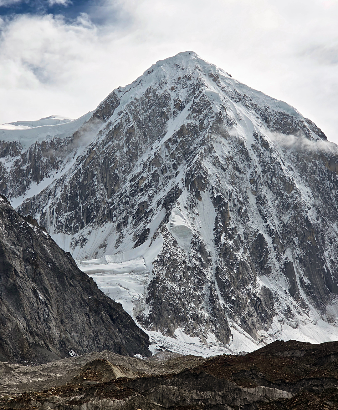
Chumik Kangri had caught my attention many times while I searched on Google Earth for potential objectives. The only image I could find online showed a beautiful pyramid-shaped mountain, with orange granite suggesting high-quality rock and exciting climbing. However, due to its location directly on the border, I knew obtaining a permit would be nearly impossible.
When we learned that the Kondus Valley had recently been opened for climbing, we began organizing an expedition through Ali Saltoro (Alpine Adventure Guides). While confirming our base camp location and dates, Ali informed me that several new peaks had been opened for climbing by the government, Chumik Kangri among them. We didn’t hesitate for a moment.
From the Pakistan side, the mountain can be approached in two ways. After passing through Goma (3,300m), below and southeast of Dansam, it is possible to branch north and reach the Chumik Glacier on the north side of the peak or continue up the Gyong Valley and approach the mountain from the south. Since another impressive unclimbed peak, Gharkun (6,620m, 35°5’2.80”N, 76°58’4.30”E), lies on the opposite side of the Gyong Valley, we decided to establish our base camp there, giving us more climbing options.
We left Skardu on August 25 and arrived at base camp (4,130m, 35°09’10”N, 76°58’23”E) the same day. Due to the ongoing tensions with India, the area remains heavily militarized, and the army infrastructure made logistics surprisingly straightforward; our base camp was accessible by vehicle and lay a short distance below an army camp visible on Google Earth. We were fortunate to be the first climbers to visit this valley since it was closed to tourism and mountaineering 45 years ago.
Most of our acclimatization took place in the valley leading toward Chumik Kangri, which offered convenient opportunities to gain altitude safely and study the final approach, which appeared complex and challenging. Additionally, we made a one-day walk into the valley beneath Gharkun to see the mountain up close—its striking 1,700-meter north face promises a serious alpine undertaking. We decided to focus our efforts on the south face of Chumik Kangri, which appeared both safer and better suited to our abilities and style.
We approached the mountain on September 10, reaching the lower glacier at around 5,200 meters. (We found shepherds’ paths to around 4,700 meters but nothing beyond.) The next morning, we set off early to climb the rocky barrier between the lower and upper glaciers before the heat of the day. This involved several steep passages and could have been dangerous in poor conditions. We established advanced base on the upper glacier at approximately 5,600 meters.
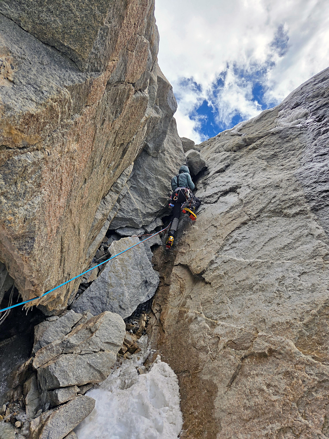
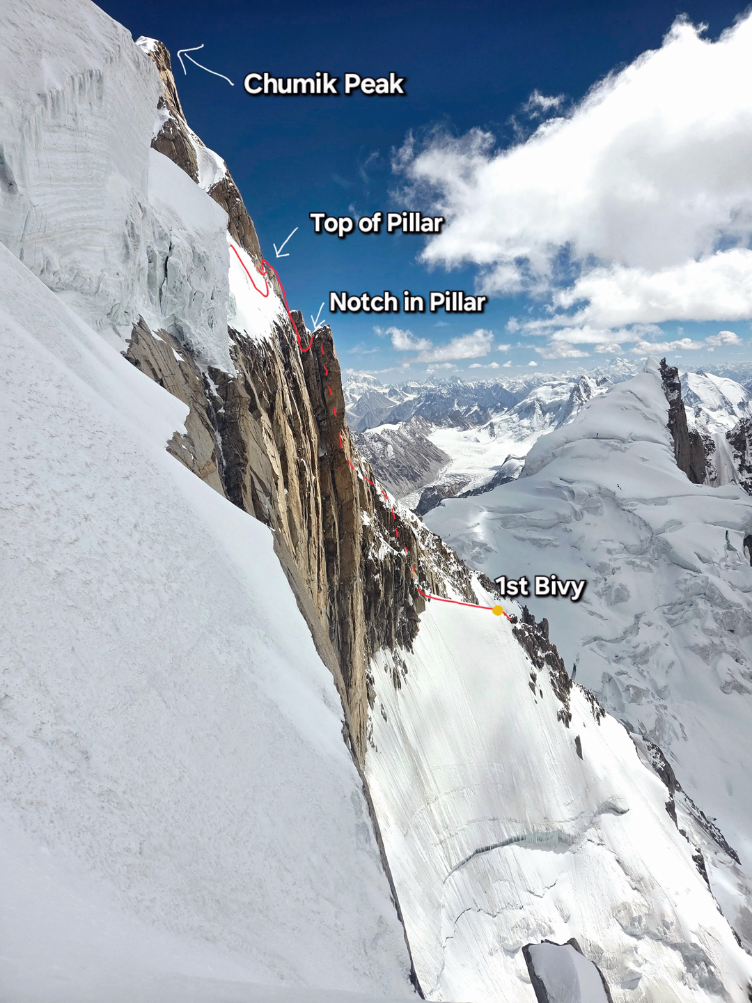
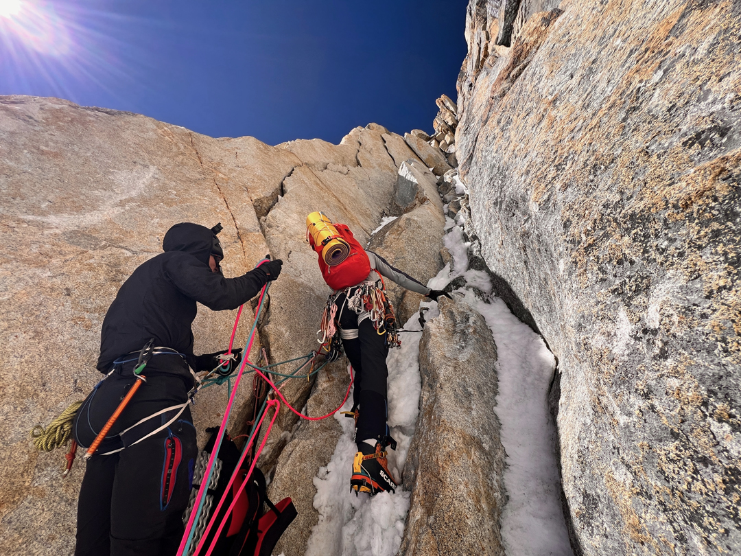
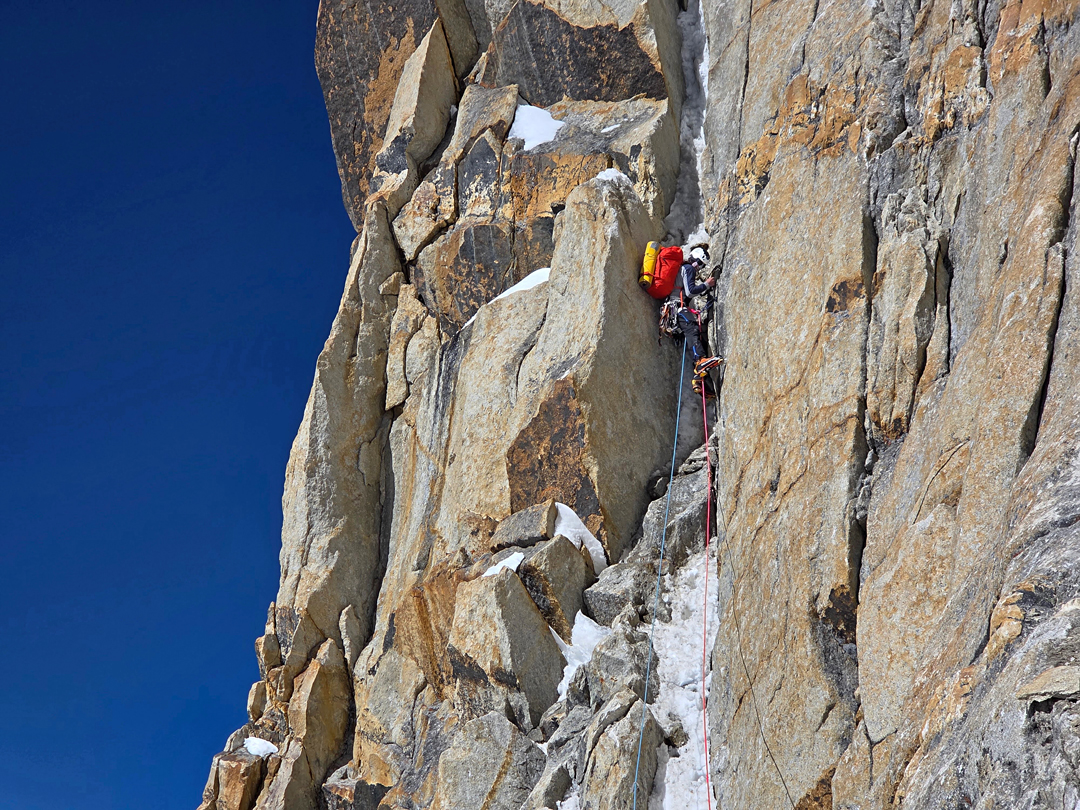
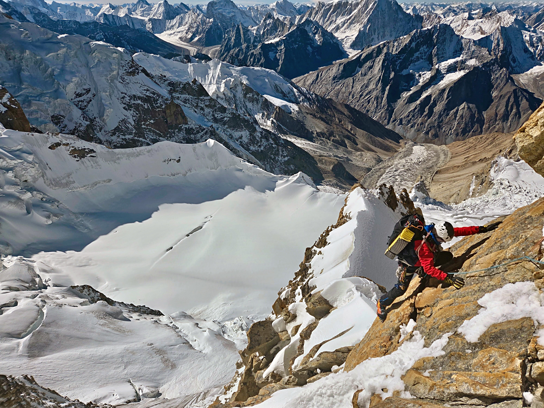
At 3 a.m. on September 12, we started up the initial icefield, aiming for a prominent spur on its right side, which appeared to offer the safest line up the face. After about ten pitches of mixed and rocky terrain, we reached a snow ridge that, with some work, provided a comfortable bivouac site at around 6,200 meters.
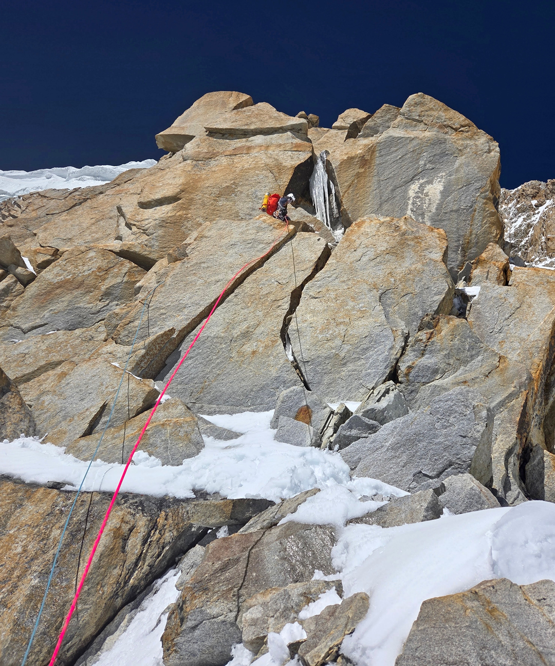
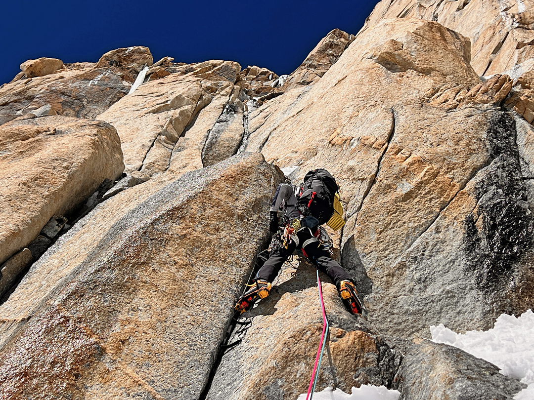
At sunrise the following morning, we resumed climbing. As the spur steepened, we negotiated snow and ice ramps. However, due to the high temperature, we sometimes had to opt for harder but safer alternatives. The final pitches on the spur were spectacular—steep climbing on excellent rock with impressive exposure.
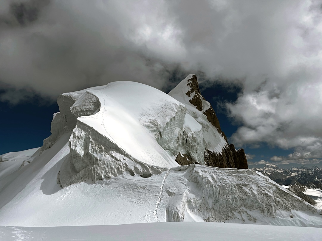
The biggest uncertainty of the route was how to transition from the end of the spur to the summit snowfields. This was solved by a brief, exposed traverse followed by a short rappel. Climbing the final snowfield by headlamp, we reached the summit ridge late in the evening and bivouacked comfortably at around 6,600 meters. The next day, the final 150 meters were straightforward snow climbing, and at 8 a.m. on September 14 we stood on the summit.
Our descent involved downclimbing and rappelling the west ridge as far as possible, then rappelling back to the upper glacier, where our advanced base was located. We were lucky with good snow conditions and clear weather, despite observing thunderclouds nearby. The final 400 meters of rappels were completed during the night to minimize the risk of rockfall, as we had previously observed significant debris and dust beneath the entire face. We returned to base camp the following afternoon, six days after our departure.
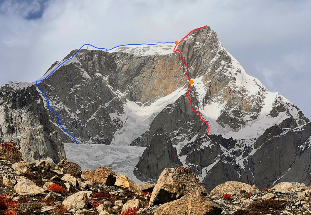
We named our route The Great Gig in the Sky (1,000m, ED M6 AI4 A1). The aid section was short, and with rock shoes and dry conditions, it could likely be climbed free at around 6c. The entire ascent was done in alpine style, without external assistance above base camp or any fixed ropes.
—Michał Czech, Poland
Media Gallery