Sumna Himal, first ascent, via the north ridge, north face, and west ridge
Nepal, Changla Himal
We (Andrew Attfield and James O’Sullivan) flew to the town of Simikot in western Nepal in early September. From there, we headed east, then north, up the Dojam Valley, eventually branching left into the Nin Khola. On reaching a spot known as Sumna (approximately 30°12'39.79"N, 81°59'15.48"E), we headed west up the Sumna Valley.

After a total of 55 kilometers of walking from Simikot with our four mules (we had wanted two but were told four were the minimum), we established base camp at about 4,800 meters at a grassy site sheltered in the lee of a lateral moraine. We were accompanied by our trekking guide, Chhimel Lama, and our muleteer, Dhan Bahadur Shai, both excellent companions.
To acclimatize, we attempted what we expected to be a straightforward peak of 5,575 meters (30°12'17.53"N, 81°56'30.01"E) immediately above base camp. However, we were foiled just shy of the summit by a large cleft in the ridge. This would have required a 10-meter rappel followed by a steep 40-meter rock pitch to the summit. With poor weather and inadequate gear, we returned to camp.
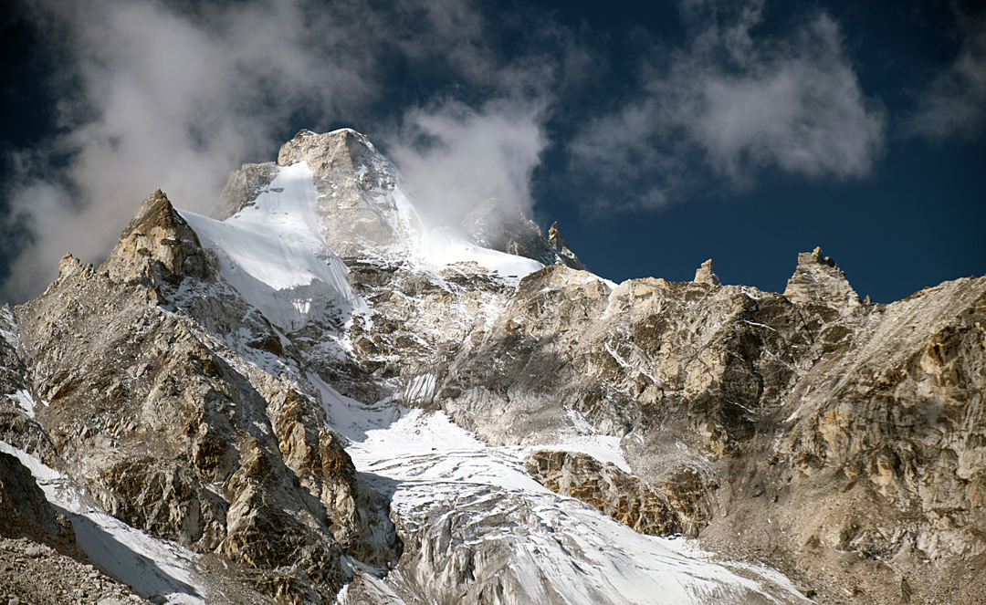
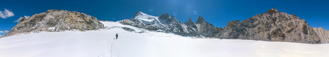
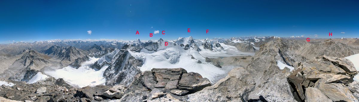
We then turned to the high peak at the head of the valley: Sumna Himal (6,084m, 30°11’12"N, 81°53’35"E). We established a high camp at 5,200 meters on a glacial silt plain halfway up the northern branch of the valley.
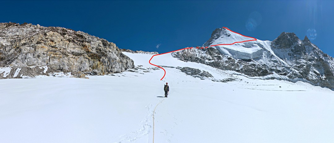
At 4:30 a.m. on September 23, we left high camp and followed a stream until it reached the snout of what remained of the glacier (substantially less than shown on maps). Moraine led onto the glacier, which was generally flat, clear of snow and, as far as we could see, crevasse free. This took us to the north ridge of Sumna Himal.
After a steep scramble over a large boulder field, we reached the upper glacier on the west side of the ridge. We followed the glacier into a cirque at 5,500 meters, then climbed onto the north ridge, which for the most part was wide and easy. In the middle, a rock section required a little scrambling.
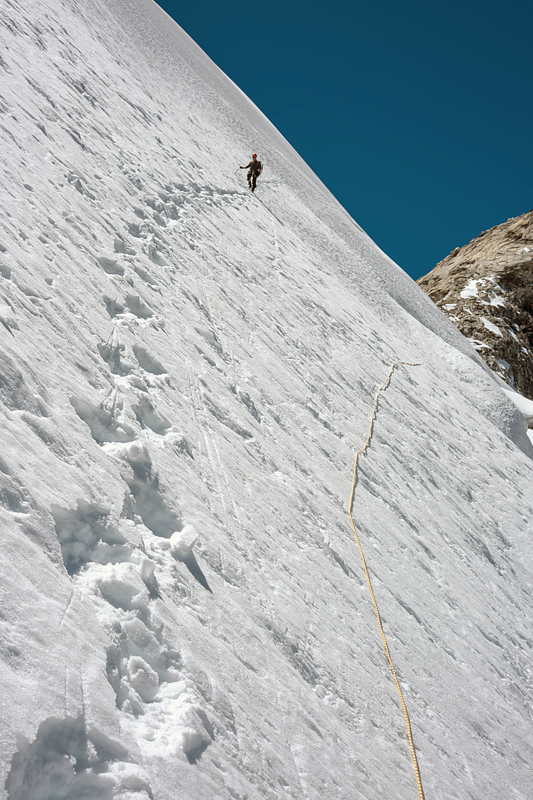
When the ridge petered out below the headwall, we made an exposed traverse across the north face on 45° snow to a col in the west ridge at 6,000 meters. This ridge began wide and snowy, but higher became rocky, though still at a fairly gentle angle. Passing a plateau, we climbed a short rocky ridge to the summit, a collection of precariously stacked slabs. The time was 11:30 a.m. and the view exceptional due to perfect weather, with neither a breath of wind nor any cloud. We retraced our route and returned to high camp at 4:30 p.m. We estimate the grade to be PD.
Before leaving the valley, we trekked up another of the easy peaks behind base camp, reaching the 5,450-meter summit (30°12'10.76"N, 81°56'58.51"E). We were accompanied by Chhimel, who was the first on top. He suspects this peak was also unclimbed prior to our ascent.
A note on names: While researching Peak 6,084m, we found that it was unofficially known as Sumdo Himal, as mentioned in the report by a French team that climbed nearby Phasang Peak (6,065m) and other summits (AAJ 2019). It seems likely that Sumdo is a mis-recording of Sumna, and Chhimel certainly considered Sumna Himal to be the appropriate name.
—James O’Sullivan, France, and Andrew Attfield, U.K.
Media Gallery