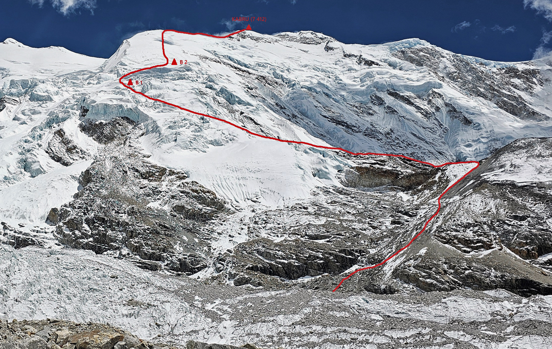
Kabru, northwest face and north ridge
Nepal, Kangchenjunga Himal
On April 11, Romano Benet, Peter Hámor, and I established base camp at 5,100 meters on the Yalung Glacier’s rocky terrace directly beneath the northwest side of Kabru (7,412m, 27°38'03"N, 88°07'06"E). Our objective was twofold: to climb the northwest face of Kabru and then, capitalizing on our acclimatization, make a single-push ascent of the southeast spur of Yalung Peak (7,590m), which we had previously attempted in 2024. [Yalung Peak was first climbed in October 1965 by Yugoslavs and Nepalese, approaching from the north.]
Throughout our expedition, the weather was never ideal, with a day-to-day merry-go-round of snowstorms and strong winds. Our first attempt on Kabru terminated at 6,000 meters on April 19, when the wind and snow conditions became too dangerous. We spent one night at that altitude before returning to base camp.
We then had to sit out a long period of bad weather, so it wasn’t until May 2 that we began a second attempt, reaching 6,000 meters that day. On the 3rd, we continued upward. The next section was much longer than we had anticipated, full of hidden crevasses and dangerous seracs. We eventually weaved a route through deep snow to 6,300 meters, where we found a relatively safe spot for our tent.
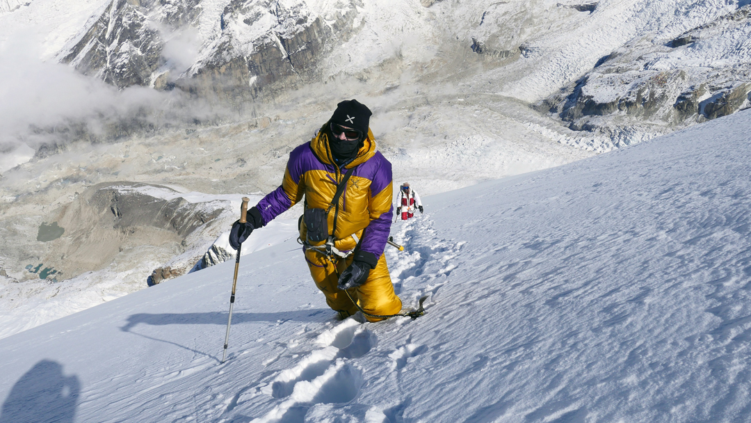
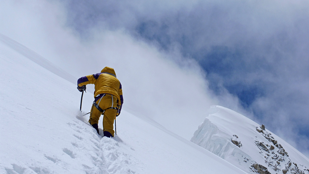
At 3 a.m. on the 4th, we left for the summit, with more than 1,100 meters of ascent in front of us. The forecast was optimistic, and the night had been calm but cold. However, the snowfall over the last ten days made for a tiring and serious ascent through crusty, knee-deep snow.
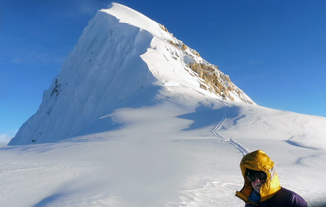
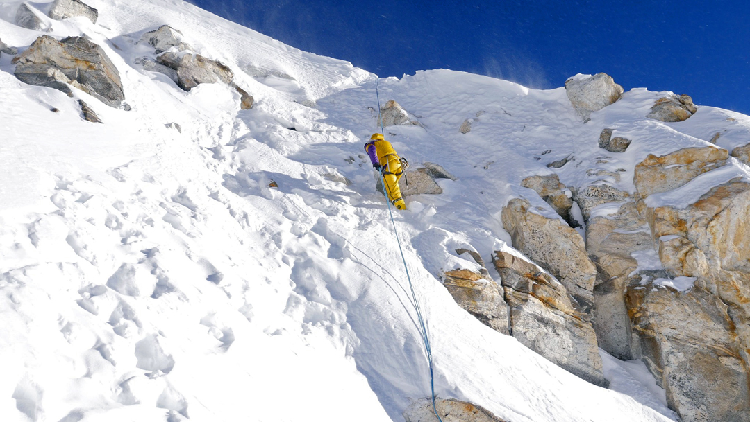
Dawn caught us just below the north ridge, which leads from Kabru toward Talung. Here, the terrain was more straightforward but still dangerous due to avalanche risk. The wind began to strengthen, and clouds covered the sky. We continued up the ridge, taking turns to break trail. We safely negotiated the badly corniced ridge and the last steep sections of rock and ice, until, at 5 p.m., in poor visibility, we reached the top.
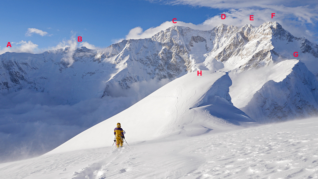
Swept by a blizzard, we quickly took pictures, then began the descent. We could see nothing in the whiteout, but as we lost height the storm weakened, the sky began to open, and finally we had a wonderful view of Kangchenjunga and surroundings.
We could still see our footprints and descended quite easily through the twilight, but once it became properly dark, we realized our tracks from the morning had been eradicated by wind and snowfall. Finding our tent was not easy, and at 11 p.m. we were relieved to crawl inside and finally warm up, eat, and drink after 20 hours on the go. The next morning, we descended to base camp with all our equipment and garbage.
Our ascent was made in lightweight alpine style: one 60m rope and a few snow stakes and screws, no fixed ropes, no oxygen, and no fixed camps or hired help. Although our route, Himalayan Trad (D, 50°–60°), had no significant technical difficulties, it is long, has complex glacier slopes, and this year featured large amounts of bad snow. Yet it proved very satisfying for all of us.
We had been keeping an eye on Yalung Peak, which rose on the opposite side of the Yalung Glacier, north of base camp. When we arrived, the southeast face had hard blue ice due to an extremely dry winter. Once the weather changed, the mountain gradually became covered in a thick layer of unconsolidated snow. Given the conditions, we decided it was too dangerous.
—Nives Meroi, Italy

EARLY CLIMBS ON KABRU: In a little-known attempt on Kabru in 1953, British mountaineers John Kempe and Gilmour Lewis (who were ostensibly making a reconnaissance of Kangchenjunga) and an unidentified Sherpa climber climbed the northwest face to the frontier ridge north of Kabru. Photographs show they reached an altitude of at least 7,120 meters, following the same route used by the climbers in 2025. While Kempe and Lewis felt they could have continued to the top of Kabru, they had misgivings about the continued stability of a fragile snow bridge they had crossed lower down and decided to return. To around 6,200 meters, this same route also was used, in 1964, to make the first ascent of Talung (7,349m), north of the Kabru massif. To around 6,200 meters, this same route also was used, in 1964, to make the first ascent of Talung (7,349m), north of the Kabru massif. To around 6,200 meters, this same route also was used, in 1964, to make the first ascent of Talung (7,349m), north of the Kabru massif.
As noted in AAJ 2024, Kabru is a collection of high tops on a 2.5-kilometer summit plateau. The three defined tops would be best named, from north to south: Kabru Main (7,412m on HMG-Finn and other maps); Kabru Central (27°37'22"N, 88°07'02"E, not marked on the Finn map but 7,338 meters on the Swiss Foundation for Alpine Research map); and Kabru South (7,318m, HMG-Finn map, 27°36'29"N, 88°06'41"). However, currently, the 7,338-meter top is traditionally referred to, somewhat confusingly, as Kabru North.
In May 1994, an Indian expedition reached Kabru’s 2.5-kilometer summit plateau from Sikkim to the east, then, circumventing “Kabru North,” climbed the south ridge of the main peak, putting a total of seven climbers on top. Until 2025, this was the only confirmed ascent of Kabru’s highest point.
Or was it?
The year 1883 is generally accepted to be the first that an expedition went to the Himalaya purely to climb for fun, rather than having to justify it with either scientific research or survey work. William Graham (U.K.), with Swiss guides Emil Boss and Ulrich Kaufmann, spent most of that year wandering through the Indian Himalaya, climbing peaks of relatively high altitude.
By the time they arrived on the Sikkim side of Kabru, they were undoubtedly very fit and well acclimatized. They claimed to have climbed Kabru from the east, though for reasons mainly political (but also because of the physiological difficulty of their reported ascent and some inconsistencies in their description), many of the most prominent climbers of the day refused to believe it. The terrain is easy, but the team made a pure alpine-style ascent and on their summit day claim to have climbed 1,800 meters, which was thought impossible at the time. They were presumed to have confused mountains and summited the much lower Forked Peak (6,108m) instead. However, later events and more recent research, published in the Alpine Journal and Himalayan Journal, find their scenario plausible, with no cogent reason to doubt their word.
If they did reach one of the tops on the summit plateau, by far the most likely is Kabru North, which had its first confirmed ascent in 1935. Some Norwegian climbers who in 1909 reached 7,270 meters on this same peak, also from the east, had little doubt that Graham could have climbed it. We will most likely never know the turnaround point reached in 1883, but it may well be the highest ascent by man at that time.
—Lindsay Griffin, AAJ
Media Gallery