Chuchepo, First Ascent, via Northeast Face
China, Tibet, Nyanchen Tanglha East
The Nyanchen Tanglha East is a vast area of unclimbed 6,000-meter peaks, some of which are spectacular. In the southwest section, south of the Niwu Valley, lies Nenang (6,870m), the second-highest mountain in the Nyanchen Tanglha East and the highest of its unclimbed peaks. (The highest, 6,956-meter Sepu Kangri in the northwest sector, was climbed in 2002 by an American expedition.) The only known attempt on Nenang took place in 2007, when an Anglo-American team reached 6,570 meters on the southeast ridge, approaching from the south.
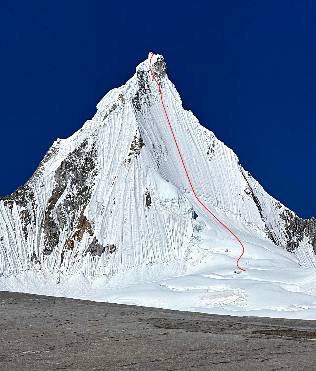
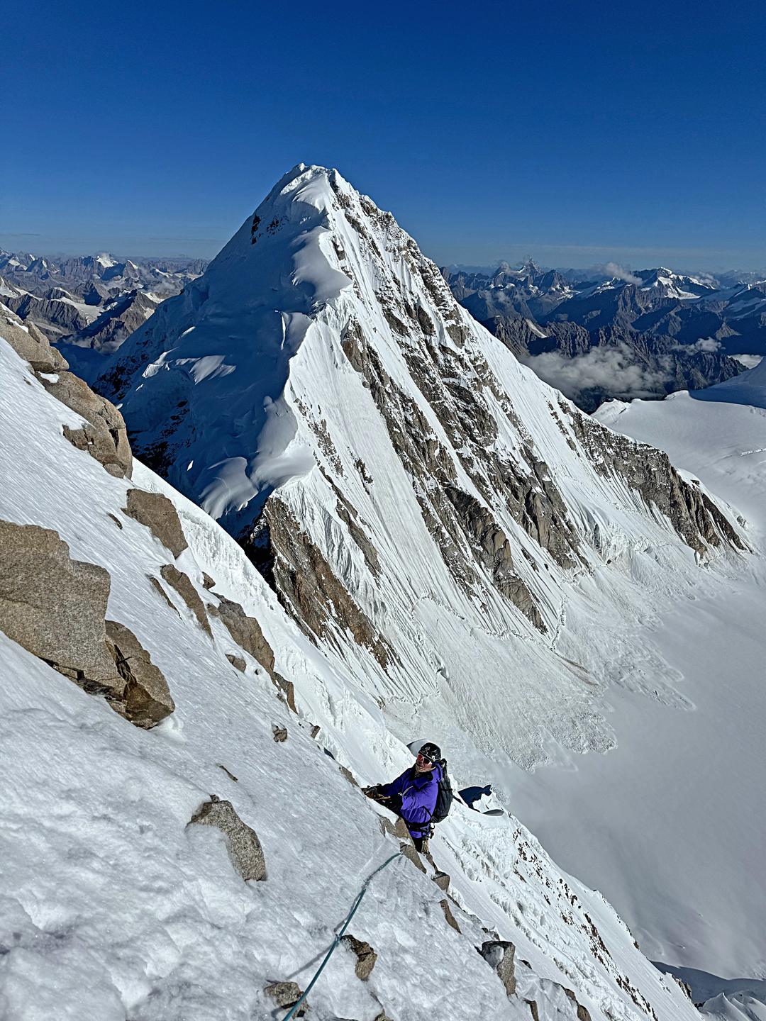
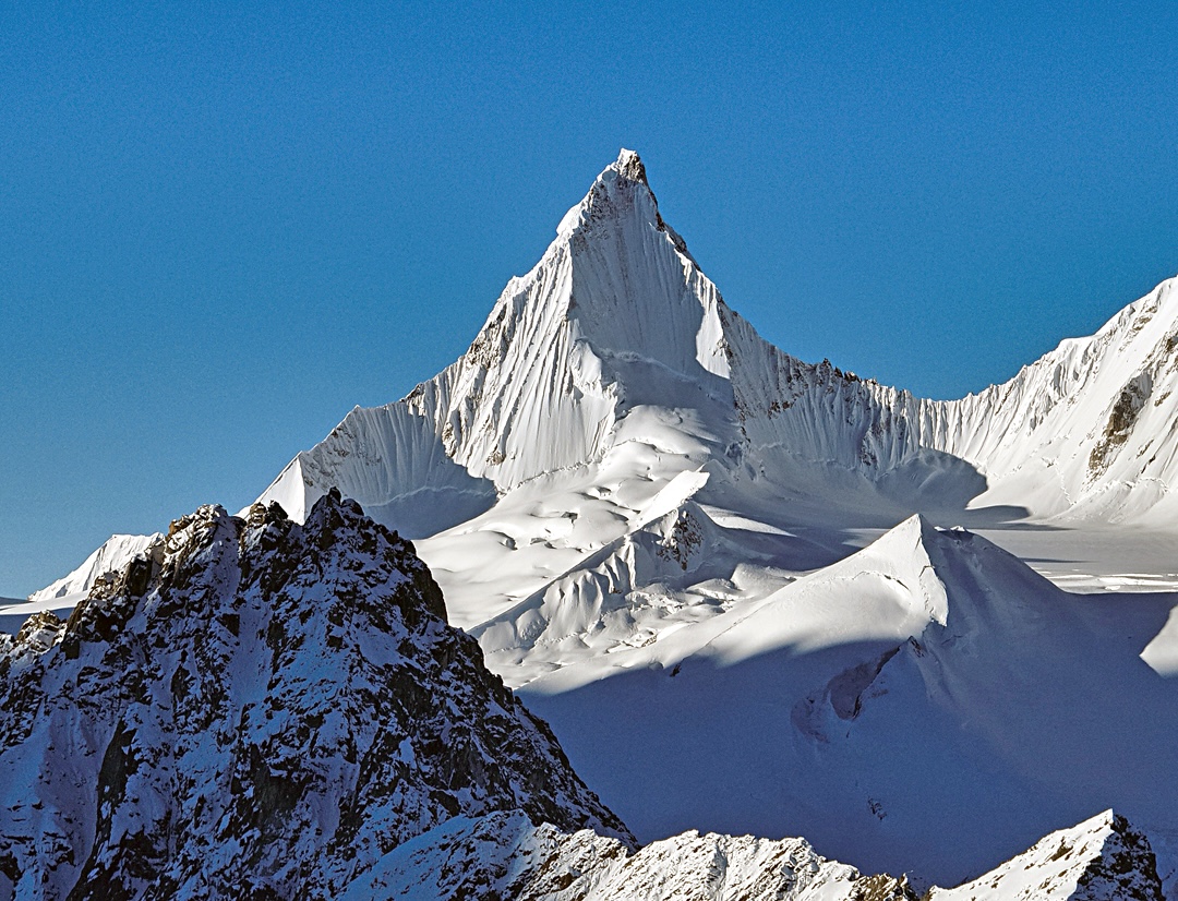
Around 10km from Nenang to the west and east stand two spectacular mountains: Chuchepo (6,613m or 6,650m, 30°17'45.84"N, 93°32'47.46"E), west of Nenang, and Jiongmudashi (6,590m, 30°17'36.74"N, 93°46'50.55"E) to the east.
Both peaks were noted in AAJ 2007, and a few years before that a team of New Zealanders were turned down in a permit request for Chuchepo. No known attempts were made on either peak until August 2024, when Tong Haijun and Wang Yongpeng from China climbed Chuchepo by a direct route up the northeast face.
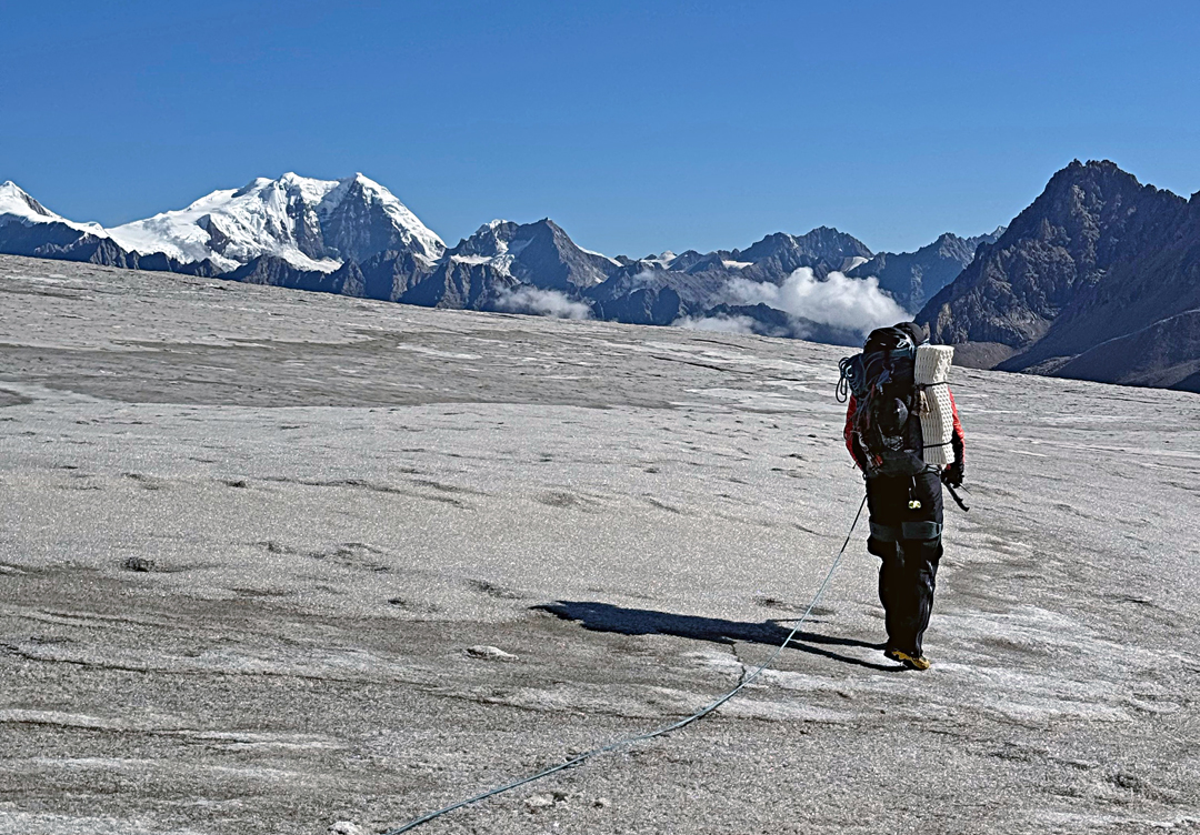
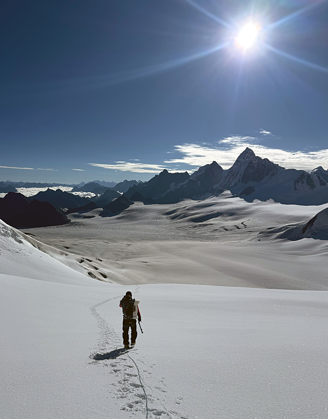
On August 16, the two began their approach from the Niwu Valley to the north, starting the trek from around 3,900 meters at the end of the Aigagon (a.k.a. Yiga) Glacier. They bypassed seracs on the right, climbing through a steep, broken rock barrier, and established advanced base at 5,300 meters after an 11-hour day. From there they saw a feasible line up the northeast face, with a crux that appeared to be a couple of pitches of steep, thin ice a little below the summit.
The next day, the pair spent seven hours crossing the snow-covered, crevassed glacier before camping at 5,900 meters. Progress had been slow due to soft snow caused by strong midday sunshine, but they were encouraged to see that no rock or ice fell down their planned route.
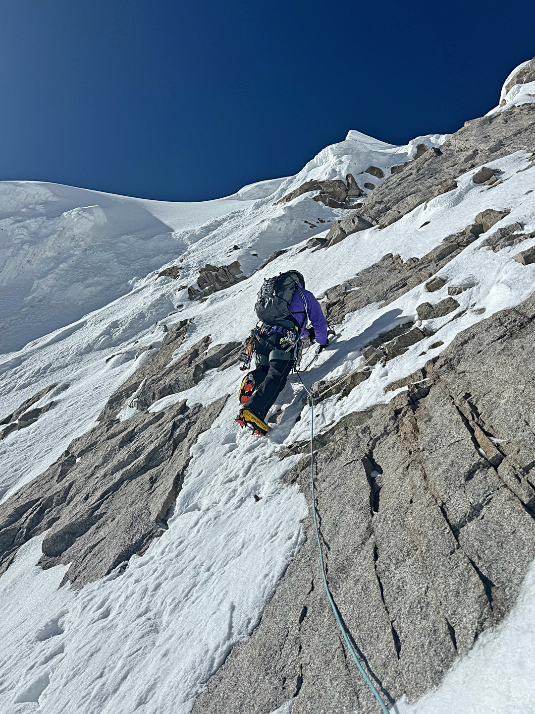
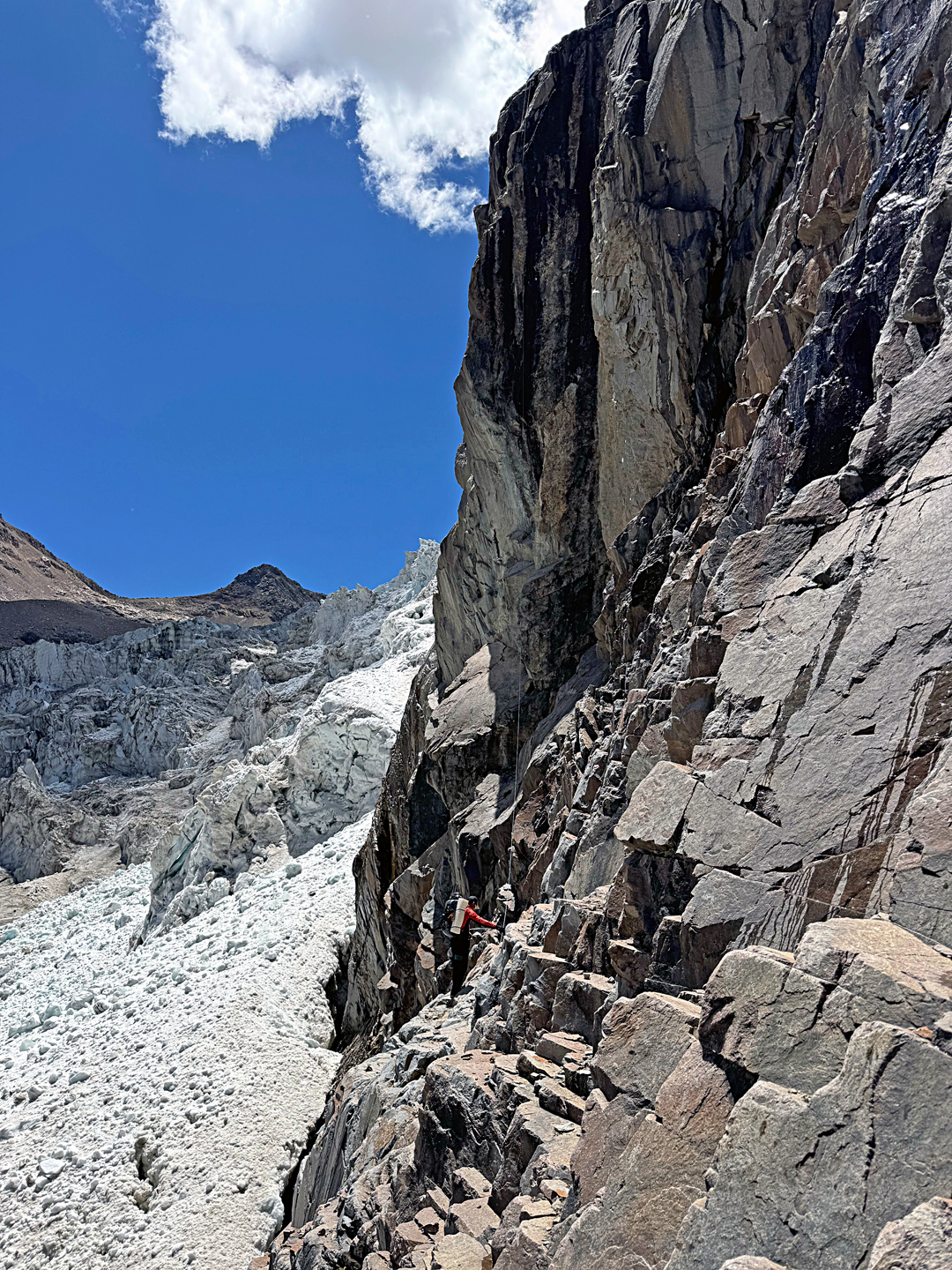
On the 18th, the two left at 3 a.m. One hour later, they reached the bergschrund, which provided a hard pitch: loose snow followed by a four-to-five-meter wall of vertical ice. Above, the angled eased and, alternating leads, they reached 6,230 meters before sunrise.
The major technical difficulties now followed. Wang led a pitch where the ice was too thin to place screws and the rock too compact for cams. Tong then climbed a very run-out pitch on snow-covered compact rock.
After this, the snow became deeper and the difficulties eased. Wang made a final belay in deep snow a couple of meters below the summit ridge. Tong then tunneled through the cornice, continued up left to the highest point, a stable part of the cornice, and brought up Wang. The 700-meter route was graded D+, M4 AI3 75°.
In order to make the first rappel, a buried ice axe was used as an anchor. The pair then continued down the route and reached their 5,900-meter camp at 2 p.m., before there was any serious risk of rockfall. On the 19th, they continued down the glacier, at the end keeping more to the rock and making four rappels down its steep face to finish. They reached Yiga village at 6:30 p.m.
—Xia Zhongming, Germany
Media Gallery