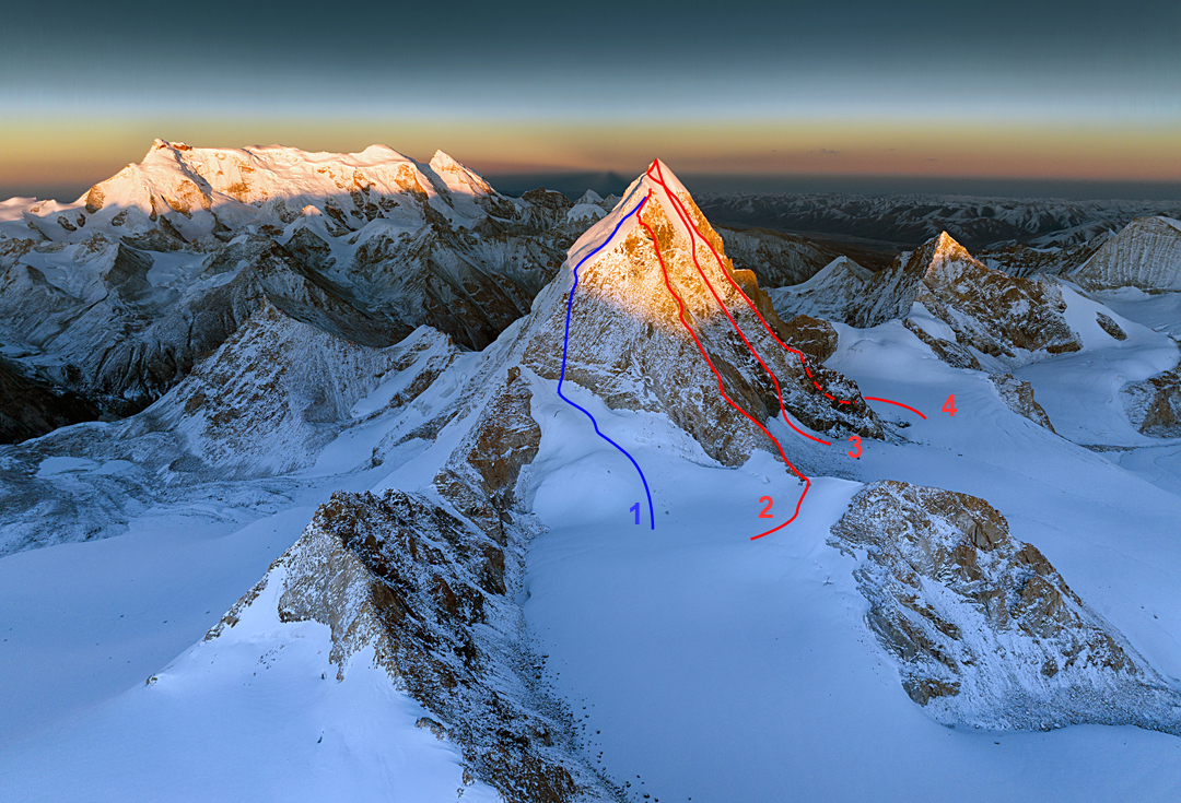
Sir Duk (Golden Dragon), Southwest Ridge to West Shoulder
China, Tibet, Nyanchen Tanglha West
Sir Duk (Golden Dragon Peak, 6,614m on the Desheng map*) is a shapely pyramid located in the Langbu Qu at 30°18'13.50"N, 90°28'44.11"E. This valley is the third to the southwest of 7,162-meter Nyanchen Thanglha I (Main), about 95 kilometers northwest of Lhasa.
The peak was first climbed in 2000 by an Austrian group, via the south ridge, with Erich Gatt and Hansjörg Pfaundler first to reach the summit, followed a day or two later by Christian Hass climbing alone. They gave it the Tibetan name Sir Duk, but the original Tibetan name is thought to be Arjionggalabu. They also quoted a height of 6,653 meters.
The valley was visited again in 2009, when, among other climbs, Guy McKinnon (NZ), Bruce Normand (UK), and Yan Dongdong (China) climbed a couloir on the south-southwest face of Sir Duk, finishing up the final snow slopes a little left of the Gatt-Pfaundler route. From the summit, they descended the northwest ridge. No more new ascents were recorded before 2024, and there are still unclimbed 6,000-meter peaks in this valley.
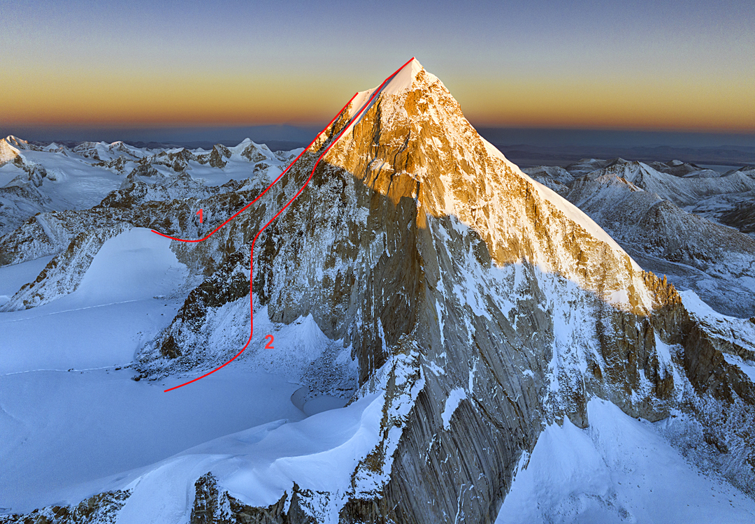
On November 6, 2024, Feng Yupeng, Tong Zhanghao, and Xu Hong left the village of Yangbajing, reached a smaller village at the entrance to the Langbu Qu at 4,750 meters, and from there continued up the valley to a base camp at 5,700 meters beside a moraine lake southwest of Sir Duk. On the 8th, the three set off a 5 a.m. and 1.5 hours later reached the start of the glacier flowing from mountain. Another 1.5 hours got them below the west face.
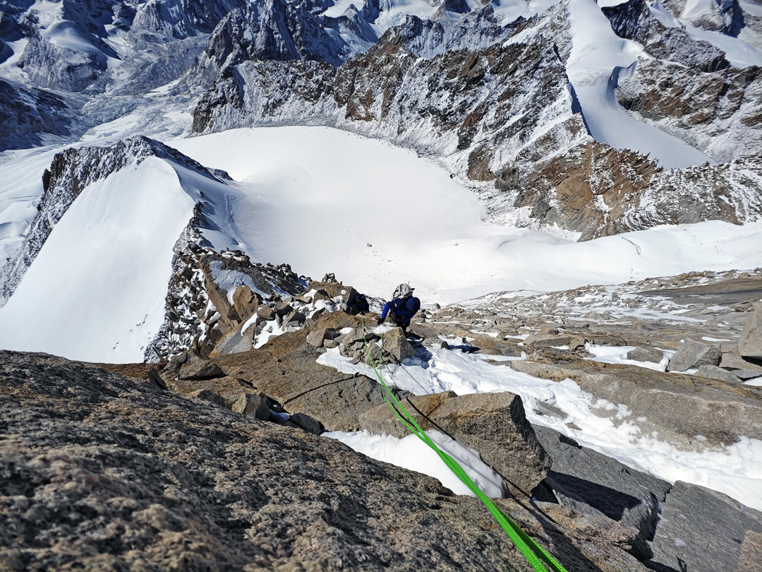
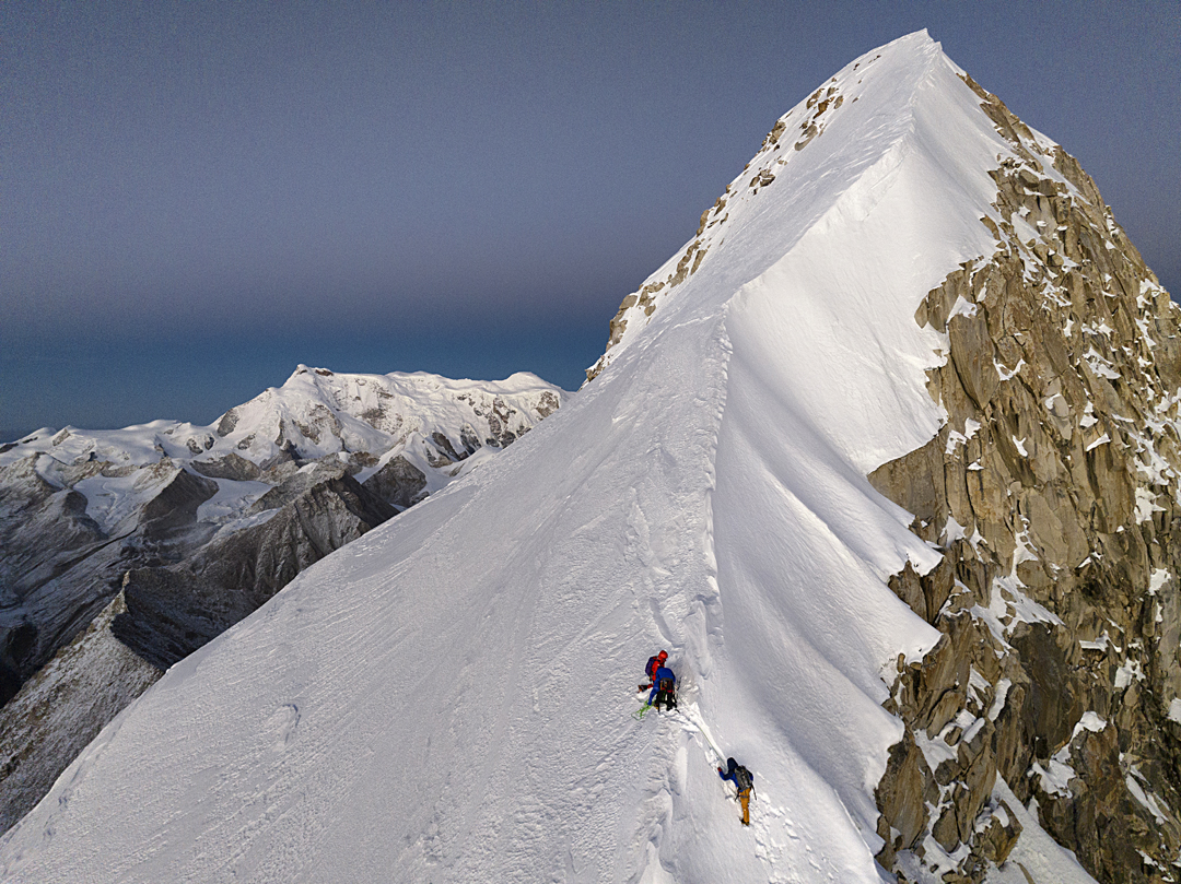
From here, they climbed up right for 100 meters on a 40° snow slope to reach the start of the southwest ridge at around 6,100 meters. With Tong mostly in the lead, they climbed 13 pitches of around 30m each, with maximum difficulties of M4.
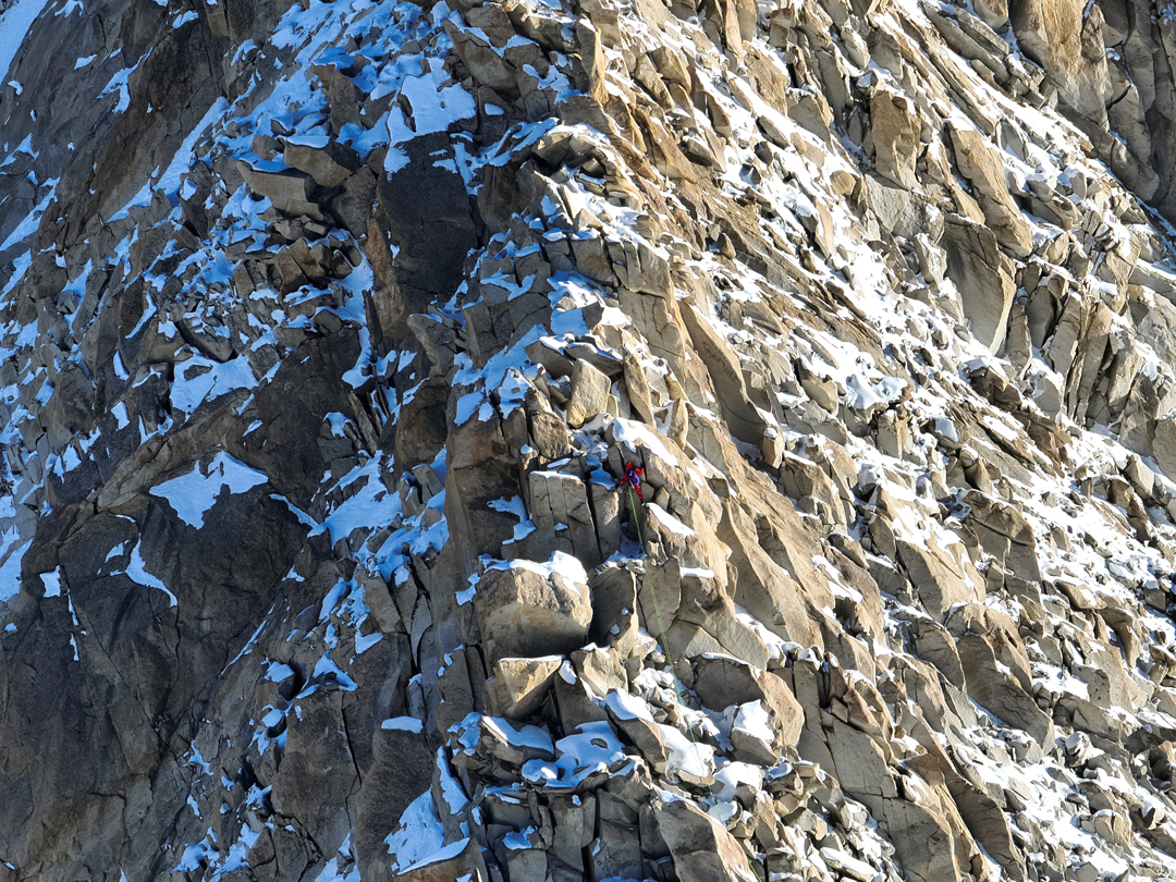
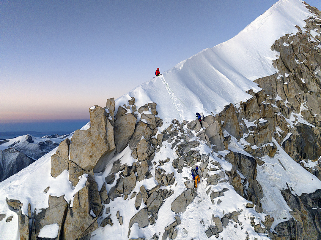
They were now at approximately 6,500 meters and, above, the terrain steepened abruptly. It was 5:30 p.m. As they had no bivouac gear, the three decided to make a push for the summit and descend through the night. However, the next three pitches, leading to the western shoulder, proved to be the crux, with pitches of M5 over snow-covered granite. A 55° snow slope brought them to the west shoulder (6,591m, GPS), where they found that the summit ridge—which had appeared from below to be straightforward—was covered in unstable, one-meter-deep powder.
At 7:45 p.m. they decided to retreat. Unable to find any meaningful anchor, the had to downclimb a pitch before they could make three rappels from snow anchors to reach the rock section. After four more rappels, they were on the glacier. Base camp was regained at midnight. They graded their 800-meter route to the shoulder TD M5.
—Xia Zhongming, Germany
* The definitive Mi Desheng maps of mountains in Tibet appeared in Immortal Mountains in the Snow Region, published in 1995.
Media Gallery