Djangart Range, Line Peak
Kyrgyzstan, Tien Shan, Central Kokshaal-too
In September, Małgorzata Ilkiewicz and I traveled to the Djangart area in the Central Kokshaal-Too. We crossed Djangart Pass on September 4. To our surprise, the road over the pass was in good condition, allowing us to cross into the valley on the far side in a UAZ truck.
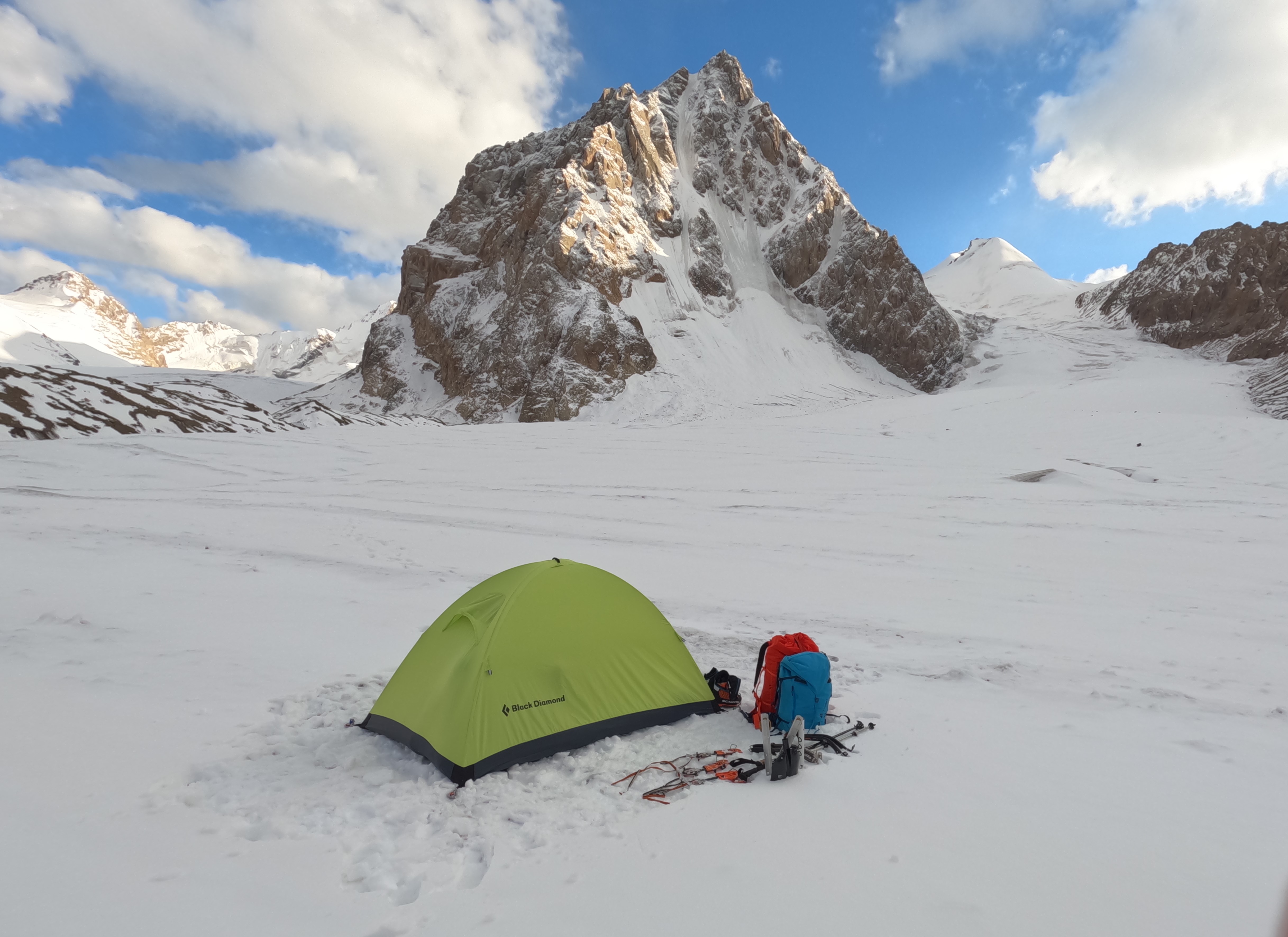
We set up a base camp on the river bank (41°42'02"N, 78°51'57"E) and embarked on some acclimatization trips to the upper valleys. After a hot summer, the river level was high, making it difficult to cross. However, after some cooler days the water level dropped, making the crossing a bit easier. Similar observations pertain to rockfall—there were some in the first week, but the following cooler weeks proved quieter.
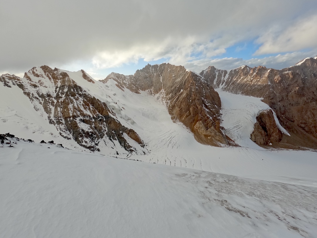
We focused our activity on the western of the two long arms of the Djangartynbashi Glacier. Using satellite pictures and Soviet maps, as well as researching previous teams’ expedition reports, we had spotted new potential in that area.
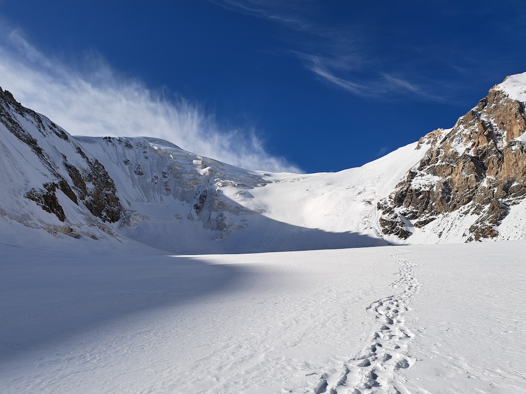
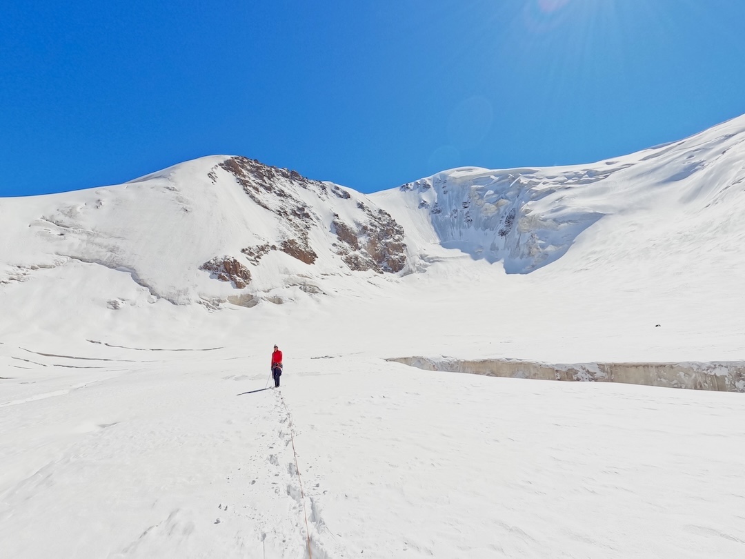
We followed the main glacier south and, upon reaching the base of Howard-Bury Peak (4,766m), turned west to take the far right branch of the glacier. We had found no report suggesting this westernmost glacier branch had ever been visited. [The eastern branch of the western Djangartynbashi has been explored extensively by climbers, starting in 2010.] We entered a glacier tongue locked between two rock barriers, getting increasingly steeper. The upper part of the glacier was very dense with crevasses and ended with a beautiful cirque, presenting us with great untouched faces. After we had spotted an ice line that we liked, we went to the bottom of the face to check how big a challenge the bergschrund crossing would pose. We noticed then that the face was covered with patches of unpleasant rock-hard black ice. After a night spent on the glacier, we headed back to base camp due to heavy snowfall coming.
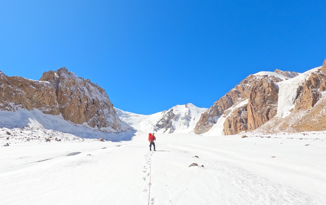
After a few days, we decided to get back out there. Crossing the glacier through the deep snow was tiring; however, thanks to the snowfall and favorable temperatures, a pleasant firn layer had developed on the face we hoped to climb, while black ice below promised great protection for ice screws.
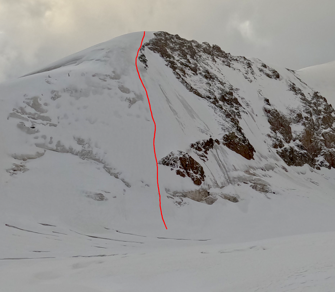
On September 20, we climbed the steep northwest-facing slope. After a few hundred meters of steep snow and ice, we climbed onto a ridge, then reached a top at 41°37’09.3”N, 78°50’59.5”E. Our altimeter showed 4,730m. [This top is on a ridge that extends south to a higher peak of at least 4,900m that is likely unclimbed.]
We called our summit Line Peak, in memory of Dutch alpinist Line van den Berg, and named the route White on Black (D- 70°). We abseiled the line using V-threads.
—Maciej Nieścioruk, Poland
Media Gallery