Energia Peak, Northeast Face, Ski Descent
Tajikistan, Pamir Alai, Fann Mountains
Admittedly, all I knew about Tajikistan was that it’s the most mountainous country on Earth, with 90 percent of its landmass over 3,000m in elevation. None of this turned out to be exactly true, but it convinced Robin Hill and me to go. Robin has a kid, my wedding was six months away, and neither of us wanted to be gone for long. Eyeing a 19-day trip, we chose an objective in the eastern Fann Mountains, about 50 miles northwest of Dushanbe, Tajikistan’s capital, on the recommendation of Daniel Birdwell at the Archa Foundation, our in-country fixer.
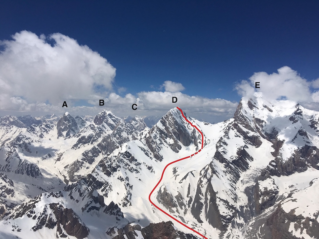
Energia Peak (5,120m) sits in an elevation band where Robin and I have found frequent success on this sort of timeline, and the northeast face, first climbed in 1979, looked like a good target for a ski and snowboard descent. (The mountain’s first ascent was from the north in 1936.) The AAC Library helped our research immensely in a range where the peaks have innumerable spellings and some information is found only in the Cyrillic alphabet. Library staff also lent us some of the area’s (outdated) Russian maps.
Like other ranges in that part of the world, the Fann Mountains were most notably climbed and documented by early Soviet climbers. And as elsewhere, the Soviets erected a “climbers’ camp” at the end of the road, consisting of numerous buildings, basic electrical and water systems, and fences. While now in disrepair, the semblance of infrastructure lends itself to both an undeserved level of comfort for climbers as well as a tourist attraction, as visitors flock toward the Chapdara Valley’s impossibly blue glacial lakes and nearby hiking opportunities each summer.
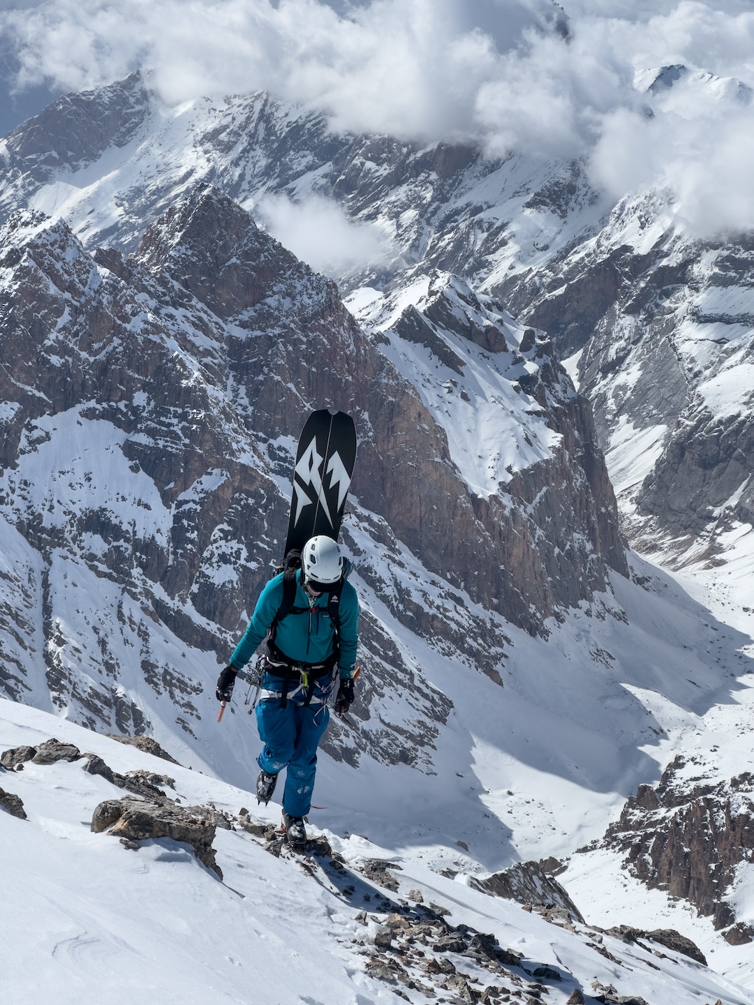
We didn’t die on the half-day drive from Dushanbe in late April, though it felt like we might. Robin and I were left at the abandoned climbing camp “Vertikal Alauddin,” situated at the end of a very rough 4WD road, and started carrying a load uphill. By the time we returned to gather our remaining gear, a few rural Tajiks had appeared for a mountain barbecue. They were already vodka drunk and invited us to kill their evening’s meal: an erratic pigeon trapped in a very small cage. As a lifelong vegetarian who doesn’t drink, I suggested to Robin that we quickly gather the rest of our gear and leave before things got any weirder. With 80-liter frontpacks and 120-liter backpacks, we hiked uphill until we could each hide one pack amid sparse trees to await our return.
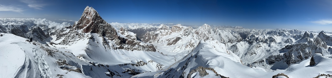
 We built an advanced base camp at 3,510m, just above Mutnye Lake (various spellings), below the shoulder of the Fann Mountains’ high point, Chimtarga (5,489m), just north of Energia. We then had a week of bad weather and some misfortune, as a poorly mounted binding tore out of my ski during an acclimatization day. Following an emotional breakdown, 1,500 vertical meters of single-leg skiing, defeat, re-emergence, a lot of hiking, and heavy reliance on our local fixer, my binding was remounted, albeit eight centimeters in front of the other.
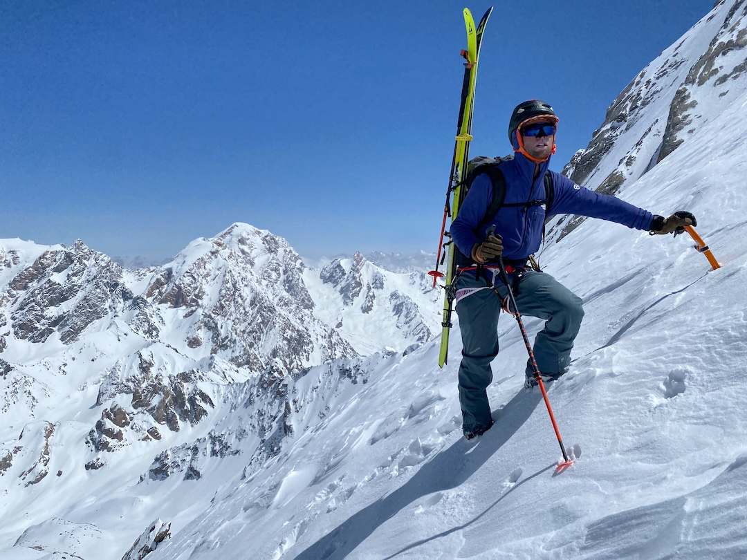
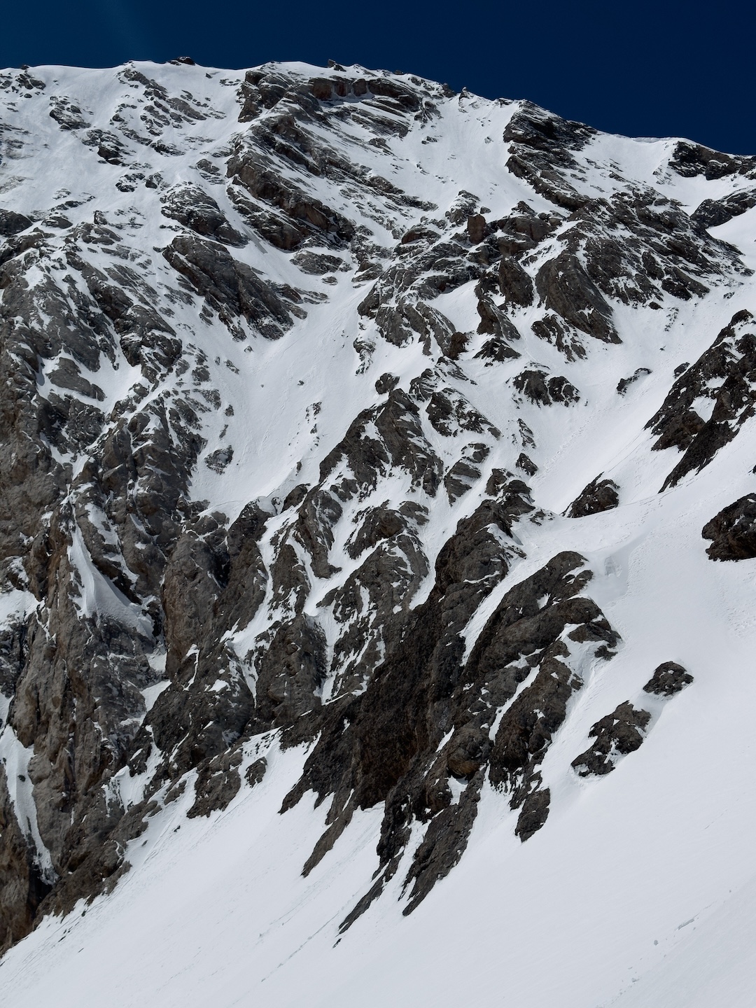
The apparent line on the northeast face of Energia was a slightly disconnected couloir and face combination featuring a skier’s left traverse over a 450m cliff. Acclimatized to nearly 4,500m, we planned to gain the summit of Energia by climbing the northeast face up to the final 350m of the north ridge, then on to the top.
However, having shot most of our time and motivation during the binding debacle, we decided to leave at a casual 8 a.m. on May 1, intending only to retrieve our gear cache from 4,500m, then bail to return home. Then, when we reached our cache under clear skies, we decided to continue. The lower couloir harbored considerable avalanche hazard, the bottom of the northeast face was faceted, the smooth north ridge was windblown, and the final 150m had low-angle, calf-burning ice. Nevertheless, we found ourselves at
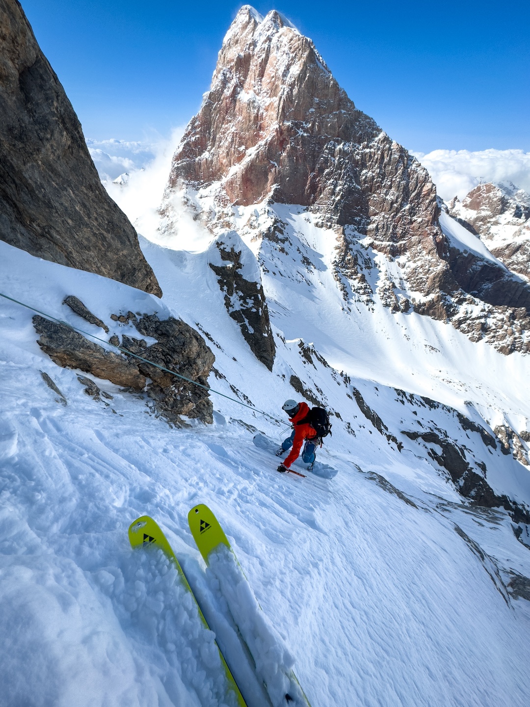
3 p.m. standing atop Energia’s darkly shaded northeast face, which was quickly forming a crust. The summit was large enough for us to stand shoulder to shoulder, or for one of us on skis, but not both.
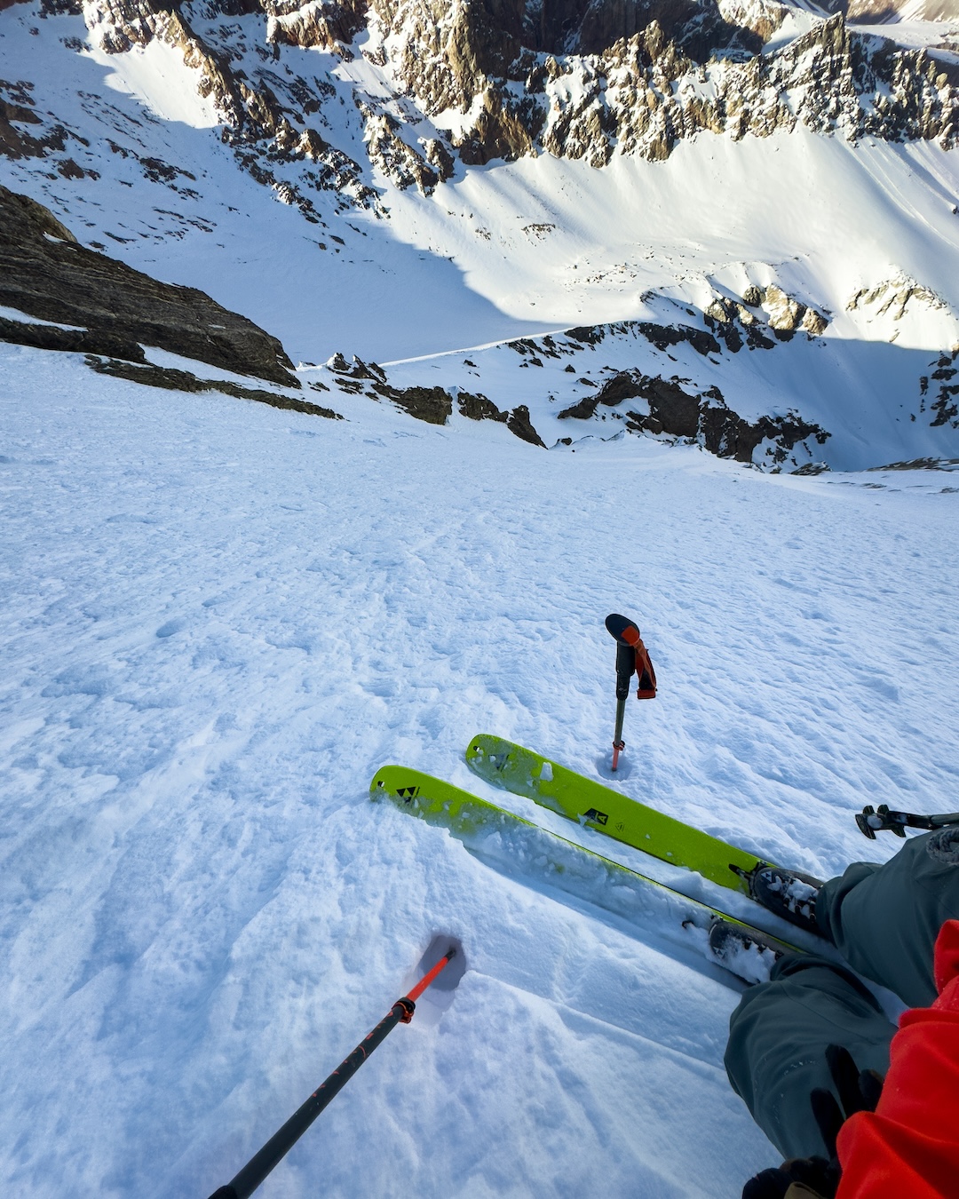
The first turns were the steepest and featured exposure of more than 850m to the snowfields below. Only a dozen turns into the couloir, we made our only rappel, over rocks and very shallow snow. At the end of our 40m ropes, I measured the remaining slope at 52°. We descended the lower, slightly left-trending face and fall-line couloir.
At the bottom, we were rewarded with 900 vertical meters of the worst breakable crust imaginable to reach our tent. Robin, a snowboarder, couldn’t understand why I was making half-kilometer-wide traverses across the low-angle glacier before almost falling while executing a jump turn on nearly flat ground.
The following day, a disconcertingly drunk Tajik man in an SUV arrived to pick us up in the meadow at the end of the road. Noticing the man’s intoxication as he loaded our gear, Robin told me that, no matter what, we were not getting in that car. Completely conflict-averse, I was prepared to ride with that man as he drove the SUV directly into the rapids of the dark gorge’s raging river if it meant avoiding any awkwardness. Robin, a real adult—and also taller than my 170cm—handled the situation perfectly, and another man drove us the six bumpy hours back to Dushanbe.
We didn’t see that much ski potential in this area, though there certainly are additional descents available on nearby 5,000m peaks for the creative steep skier. Huw Kingston (Australia) and David Cowell (U.K.) were generous with beta following their 2018 ski traverse of this part of the Fann, and Daniel Birdwell at the Archa Foundation was extremely helpful.
—Brody Leven, USA
Media Gallery