Ennedi Massif, Many First Ascents of Towers and Arches
Chad, Ennedi Massif
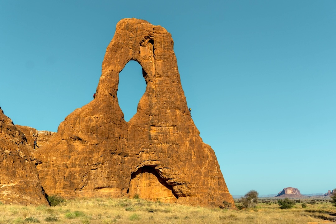
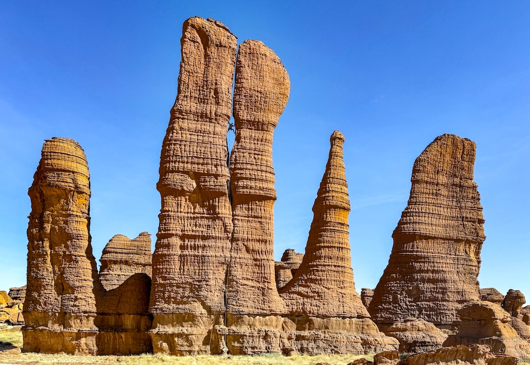
Mid-November of 2024 found me and four friends in two Land Cruisers, hurtling at breakneck speed through the Sahara Desert along dirt roads, rutted-out sand tracks, and sometimes no trail at all. Our destination was the Ennedi Massif, an expansive region in northeastern Chad consisting of more than 10,000 square miles of rugged terrain. The swaths we visited were rife with sandstone towers, buttes, and arches, reminiscent of Utah’s Arches National Park, but we were only able to access a minuscule portion of the massif and cannot attest to what awaits elsewhere.
After landing in Chad’s capital, N’Djamena, and uniting with our outfitter, Adolfo Guasti of Eyte Voyages, we crammed the two vehicles full of gear, food, and a meager ration of 36 bottles of wine, and embarked on the four-day, 600-mile journey toward our destination. Our self-inflated perceptions of grand adventure were tempered by the reminder that, up to this point, we were simply tourists on a safari, but that didn’t quell our enthusiasm. It wasn’t until the fourth day of driving that we finally laid eyes on rocks of any size, and we watched with anticipation as they grew into a Martian landscape of epic proportions. It truly was a climbers’ paradise.
Our team consisted of myself (Cedar Christensen), Natalie Afonina, Sam Stuckey, and Dakota Walz, all from the United States, and Bosco Bonilla from Spain. Adolfo’s team was completed by an indispensable Chadian translator, driver, and all-around badass named Andjami Ali, as well as a local chef, Djamila Kodndebe. Together, we spent the next two weeks moving camp almost daily, exploring the territory by Land Cruiser and on foot, and pausing to climb the wild formations that most captured our imagination. [Visits to the Ennedi by European climbers began in 2000, and an American team climbed in the area in 2010 (see AAJ 2011).]
The Ennedi Massif, like much of rural Chad, is divided into cantons, each of which is ruled by a tribal chief. Arrival to a canton necessitated a visit with the chief to negotiate the terms of our visit, pay a small fee, and secure permission to climb. Oftentimes, the chief would appoint a “guide” to keep eyes on us as we visited the area, and in one case the chief himself accompanied us for two days. Our exploration took us through four different cantons.
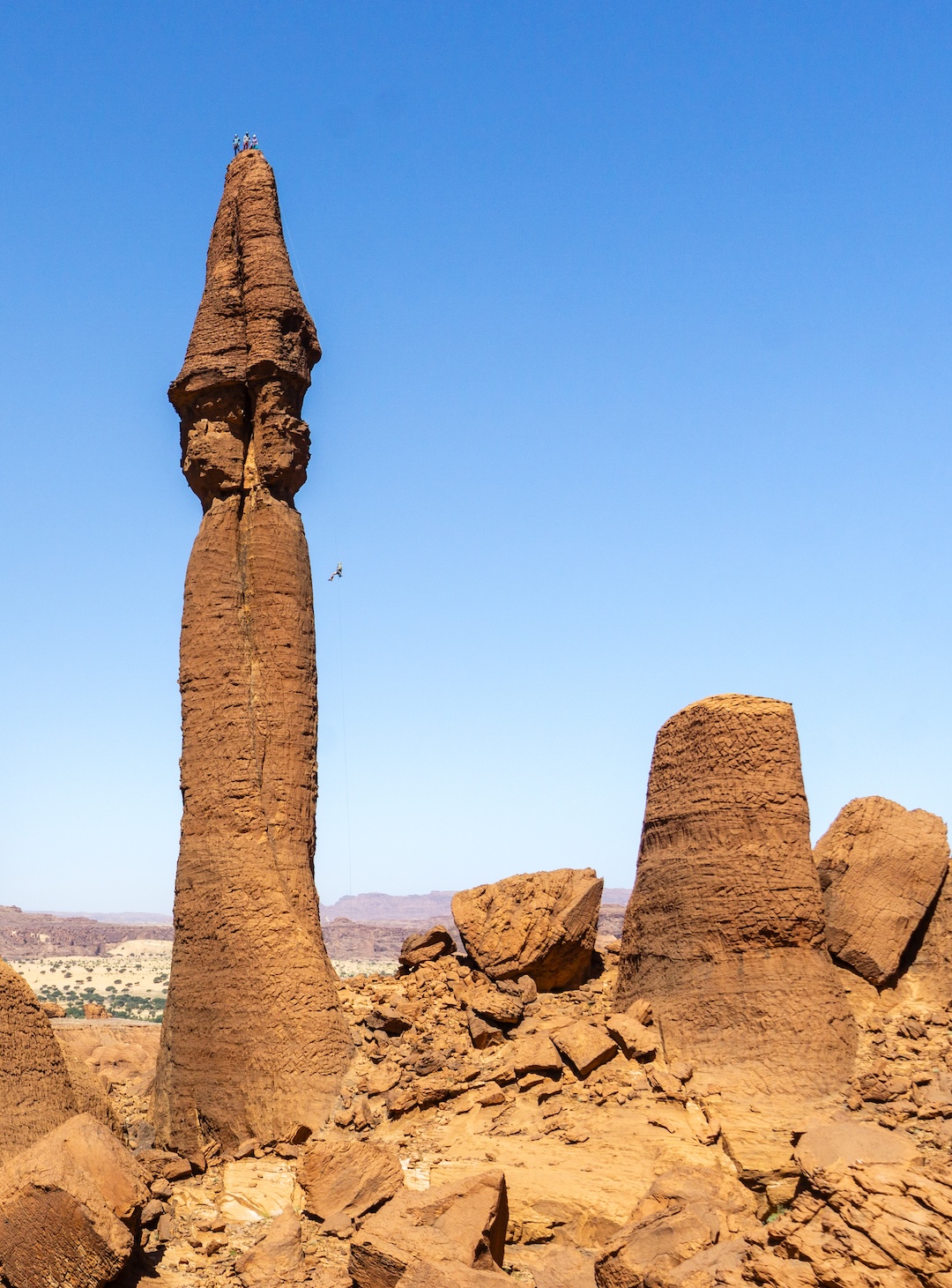
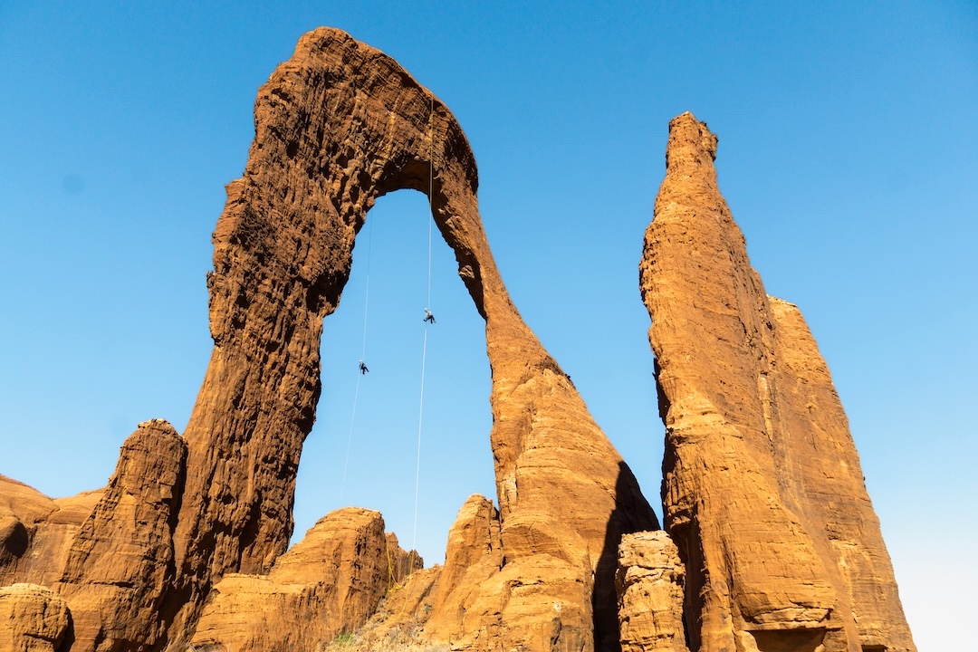
In total, not including free solo scrambles, we climbed 23 unique lines on 20 different unclimbed arches and towers. The difficulties for our routes ranged from fun 5.6 to 5.10 X and splitter 5.11. The tallest formation we climbed was a 140m tower, but the majority of the features were shorter than 80m.
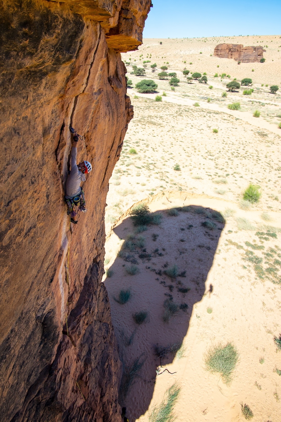
Grading routes presented a challenge, as often we found ourselves avoiding alluring holds in fear of the sandstone exploding in our hands. I regularly expended 5.12 effort to climb routes that may have been graded 5.9 elsewhere, contorting my body to avoid treacherous-looking features, and gripped with fear that a jug might crumble into refined sugar.
In addition to routes on 20 unclimbed formations, we also established a new line on the previously climbed Arch de Julia (also known as the Arch de Bachikele). (Our outfitter referred to it as the former, but a previous climbing expedition in the Ennedi, a 2011 team from The North Face, dubbed it Bachikele. This is the name of the nearest village, and we were told it means “Out of the Well” or the “Well Tribe.” Since a lot of our communication involved translating from a local dialect to Arabic to French to English, there is plenty of possibility we erred in our multilingual telephone games.) Though we would have loved to explore more untracked terrain, we kept largely to the same region accessed by the TNF expedition. The deeper into the massif you go, the harder it becomes to navigate. There were so many formations that were easy to access that it didn’t make sense for us to use a significant portion of our time trying to get to remote areas that may or may not have had rocks that inspired us.
Our goal was not to develop the area into a climbing destination, bur rather to leave features as pristine as we found them, preserved for future teams to have their own exploratory climbing adventures. In this spirit, we placed zero protection bolts, and on 18 out of 20 formations we were able to descend by simul-rappelling off either side of the summits, leaving no trace of our ascents. We exclusively climbed ground-up, and only one line required any aid.
All told, the Ennedi ranks as one of the most memorable landscapes I have ever laid eyes upon, and we all left full of gratitude for the opportunity to visit such a magical corner of our planet. [Following the expedition, Dakota Walz researched and prepared a climbing guide to the Ennedi, replete with historical, cultural, and environmental information on the area, along with logistical info and dozens of photos, maps, and topos. Click here to go to Walz’s website and download this remarkable 100-page PDF.]
—Cedar Christensen, USA
Media Gallery