Gruber Mountains, Seven First Ascents
Antarctica, Queen Maud Land, Eastern Wohlthat Mountains
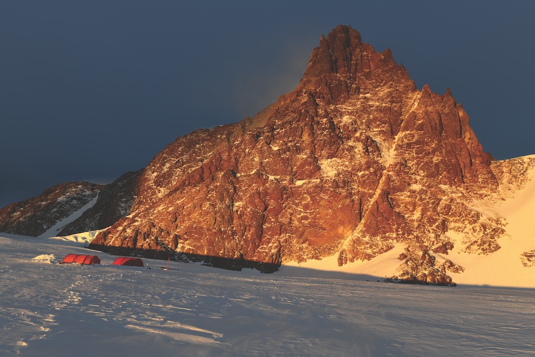
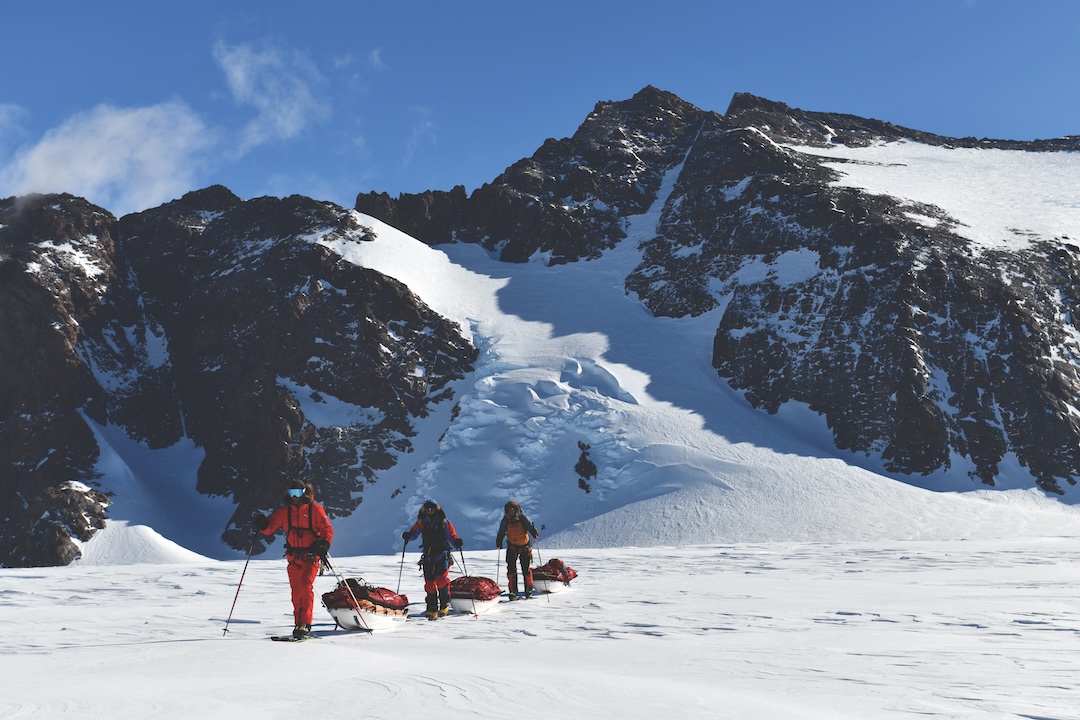
In November 2024, I made my eighth expedition to Queen Maud Land, this time with fellow IFMGA guides Robert Miller and Tom Rabl and medic Katrin Oertel. We explored the rarely visited Gruber Mountains of the Eastern Wohlthat Mountains and climbed nine peaks, seven of which were first ascents.
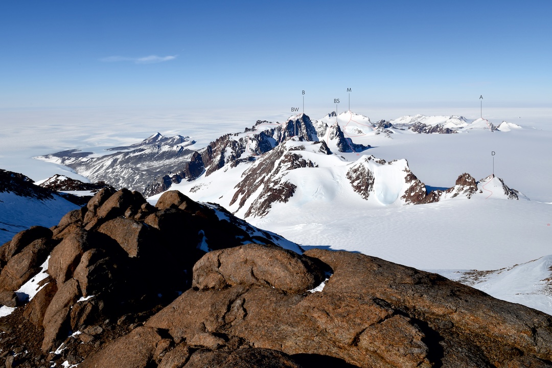
The most prominent peaks of this group are Ritschergipfel, Bastei, Mentzelberg, and Zuckerhut. These and other notable geographical features, such as the frozen Untersee and Obersee lakes and the Schirmacher Oasis, were discovered and named in 1939 by the Deutsche Antarktische Expedition on reconnaissance flights using Dornier Wal flying boats, catapulted from the ship Schwabenland. Our expedition climbed and named several previously unnamed peaks and also has proposed a new name for the stunning peak of Mentzelberg.
During a break in a raging katabatic storm on November 4, we ascended the little Däumling (Tom Thumb, 2,193m, 71.403°S, 13.452°E) to get a better overview of the surrounding mountains. On November 6, exactly one year after my second ascent of Ritschergipfel (2,791m, 71.406°S, 13.348°E) with New Zealand mountain guide Mike Roberts (see AAJ 2024), we made a new route up the mountain following an ice couloir (max. 55°) on the eastern side to reach the unclimbed east peak (Ritscher-Ostgipfel, ca 2,700m, 71.407°S, 13.358°E). Ritschergipfel was first climbed on December 17, 1991, by German scientists Wieland Adler and Gerold Noack from the former Georg Forster research station (GDR) at the Schirmacher Oasis. In 2023, I found their notes in a metal tube in a cairn on the summit and added a little summit booklet with updated notes in 2024. Ritschergipfel has now been climbed three times via three different routes. It was also visited by helicopter on February 9, 1996, by German geologist Joachim Jacob and Austrian mountain guide Joe Rainer.
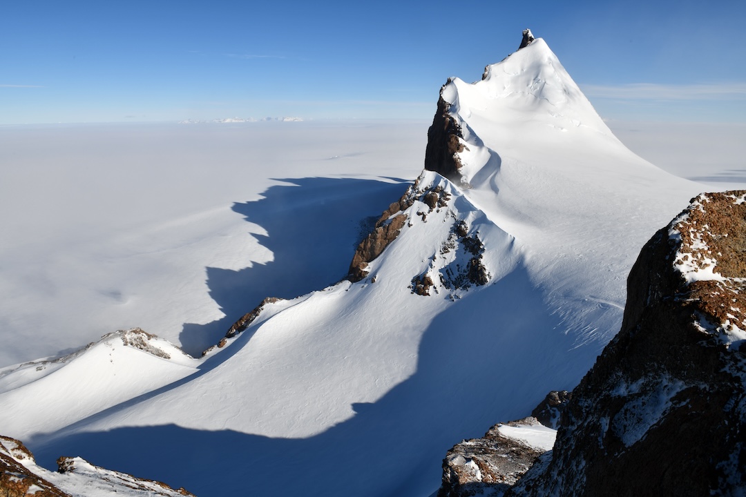
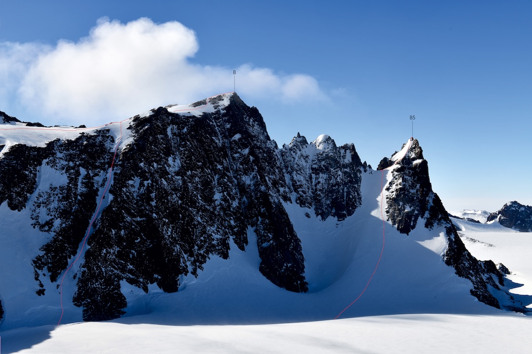
On November 8, we did the second ascent of the north (snow) peak of Zuckerhut (Sugarhat, 2,468m, 71.422°S, 13.453°E) up its 60° northern ridge, following the Finnish route. The south (rock) peak and main summit of Zuckerhut (2,525m) was first climbed by Patrick Degerman and Pekka Holma from Finland on December 4, 2013. The mountain was named by the 1939 expedition due to its beautiful shape and color, which reminded the discoverers of a white sugar cone; in a descriptive play on words, we called the brown rock peak Kandisturm (Rock Candy Tower); however, we did not climb it.
Two days later, we climbed the highest peak in the massif between Zuckerhut and Bastei over 45° firn, scree, and a rock step of UIAA Grade III, naming it Breitwand (Broad Wall, 2,362m, 71.386°S, 13.466°E).
On November 11, Miller and Rabl climbed a distinctive tower southeast of the Bastei massif via the southwest couloir. Later, on November 17, Rabl and I climbed the east glacier up to the saddle and joined the upper section of the southwest route. Both routes involved 60° ice and an exposed UIAA Grade III climb to the narrow, rocky summit needle. As the peak was climbed by three Austrian IFMGA mountain guides, we called it the Bergführerspitz (Mountain Guide Peak, 2,325m, 71.381°S, 13.548°E), in tribute to the many achievements of all mountain guides in the exploration of Antarctic mountains and their contributions to the research programs.
On November 12, all four of us climbed beautiful Mentzelberg (2,330m, 71.370°S, 13.657°E) via a crevassed icefall and the 50° west face, with Rabl breaking the trail as usual. On the pointy summit, there was neither space to stand nor build a cairn. Instead of commemorating a former Nazi official, a member of the SS who backed the 1939 German expedition, I would propose renaming the peak Friedensgipfel (Peace Peak), recognizing a quality needed today more than ever, even in Antarctica, the continent of peace and international cooperation.
On November 14, all four of us ascended Bastei (2,460m, 71.372°S, 13.542°E) despite stormy weather and bad visibility. We went up the easiest route via the saddle of Windeck (Windy Corner), followed by a 45° firn slope and crevasse-free plateau glacier to the summit, where we built a cairn to mark the highest point. On the evening of November 17, Miller and Rabl climbed Bastei a second time via a 55° diagonal couloir through the southwest side, while Oertel and I repeated the first ascent route, enjoying the low polar sun, marvelous light, and fantastic views down to Untersee 2,000m below.
Earlier that same day, while Rabl and I climbed the new route from the east on Bergführerspitz, mentioned above, Miller and Oertel walked about seven kilometers from camp and climbed an easy unnamed peak above the Azimut Glacier, which was named Azimutgipfel (Azimuth Peak, ca 2,130m, 71.396°S, 13.727°E).
As Germany and the USA plan to “protect” (practically close) almost the whole mountain range as an Antarctic Specially Protected Area (ASPA), our team might be the first as well as the last private expedition to climb these majestic peaks. I would like to raise awareness about amending the ASPA boundaries to keep these high mountains accessible for private expeditions in the future.
—Christoph Höbenreich, Austria
Media Gallery