Four First Ascents During Southeast-Northwest Crossing
Greenland, West Greenland
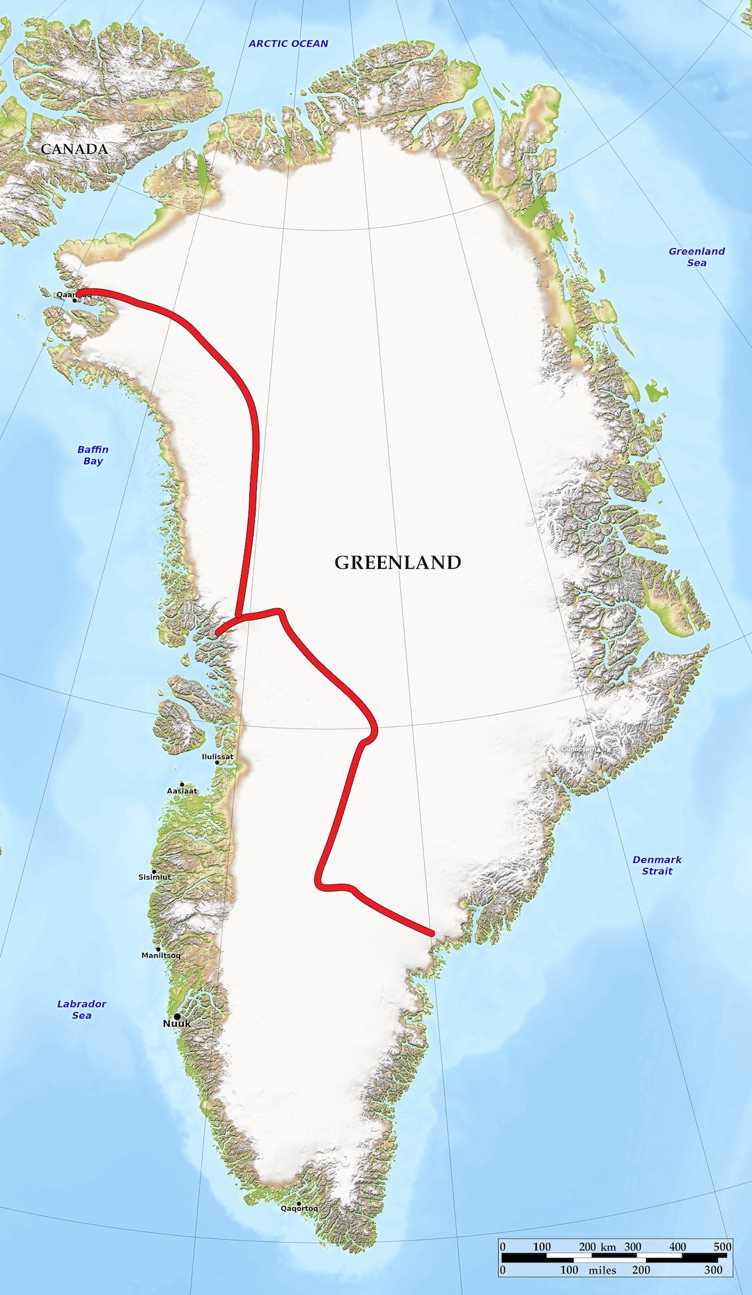
The Umiammakku Nunaat region of western Greenland contains many remote unclimbed peaks in a rugged strip of land between coast and ice cap. We learned about these mountains from historical AAJ reports by teams that approached by boat and climbed near the coast. [AAJ 1968 reported the first ascent of three coastal peaks in Umiammakku Nunaat by an Italian team; other reports are vague or describe ascents on nearby peninsulas or islands.] We were interested in climbing less-accessible peaks farther inland as part of a 1,539-mile southeast-to-northwest, coast-to-coast traverse of Greenland.
According to Greenland experts, including polar guide Lars Ebbesen, such a traverse had not been done before, though there have been various crossings by other routes from east to west. Of the two of us, Branden was an experienced kiter, having previously kited across northern Scandinavia, but I was just learning. Neither of us had been to Greenland.
We flew to Kulusuk, in southeast Greenland, in mid-June. After 16 days of waiting for favorable sea ice and weather, we reached Isortoq village on June 27. From there, a local hunter took us by boat to a point on the coast near the ice cap. The katabatic winds on the west coast of Greenland, blowing reliably from the southeast, made it sensible for us to begin here.
Over the next week, we each manhauled 400 pounds of gear, distributed in four sleds apiece, up to safe kiting terrain (flat and snowy, with no crevasses or filled-in slots) above 4,000’. This section involved traveling 35 miles up icy and at times heavily crevassed, steep terrain. Sometimes we only made five to ten miles per day.
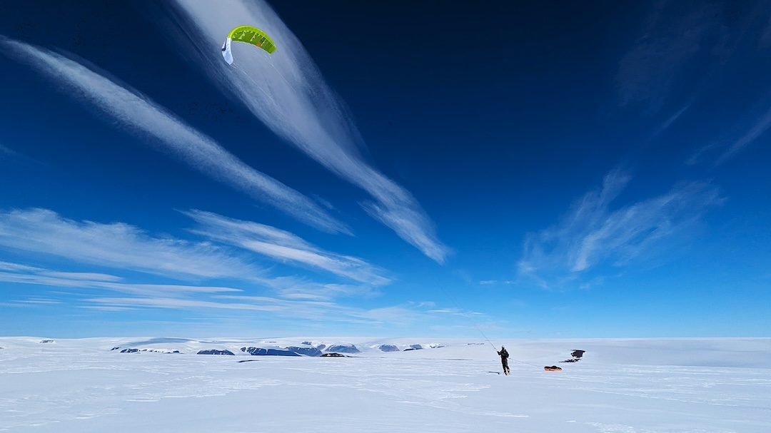
Once on the ice cap, we kite-skied west for 10 days, roughly along the Nansen Route. (This is the route of Fridtjof Nansen and five companions, who in 1888 spent six weeks making the first crossing of Greenland’s interior, east to west, via skis and sledges.) We each towed sleds in two-by-two grids, with around 100 pounds in each sled.
We encountered one set of polar bear tracks 15 miles from the coast, and we slept with guns close at hand. The terrain felt flat, but in fact gradually rose to a pass at around 8,000’. We encountered some sections of difficult sastrugi, which at times got us briefly airborne as we hit the icy ridges at 20+ mph.
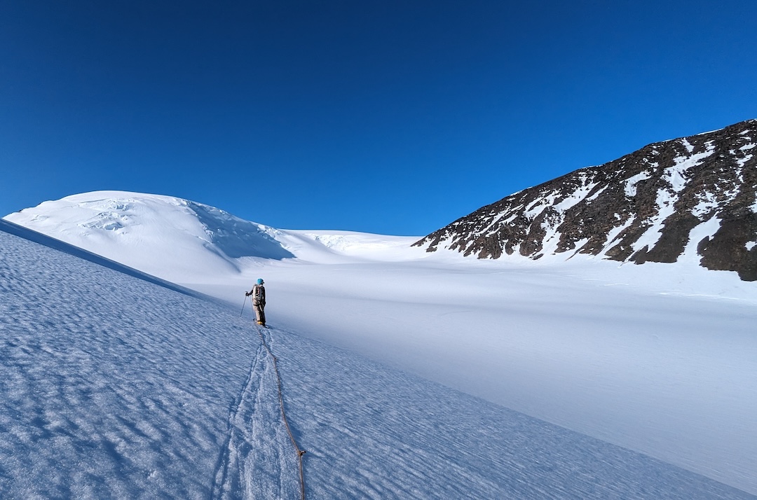
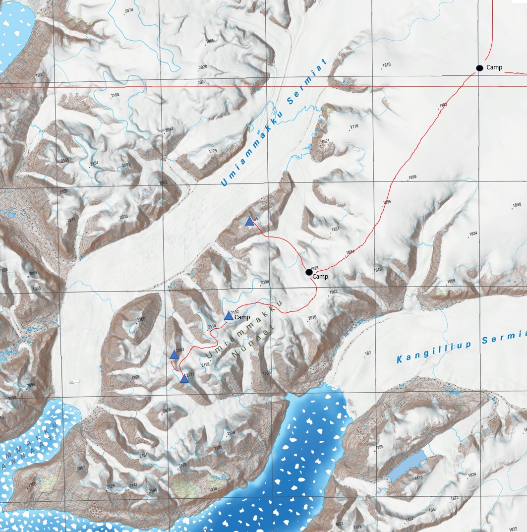
Near the west coast, we hit the predicted favorable winds and kited for five days, covering up to 200 miles per day, to reach Umiammakku Nunaat, a peninsula of rugged peaks sandwiched between the Umiammakku Sermiat and Kangilliup Sermia glaciers. When the terrain got too complex and crevassed for kiting, we established camp atop a 6,000’ snow dome, surrounded on three sides by rugged peaks, with the huge, flat ice cap extending to the east.
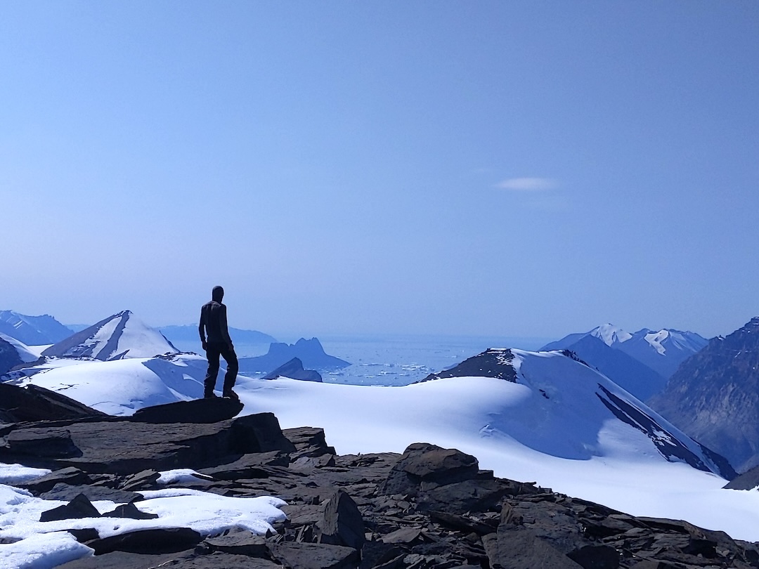
On July 18, we descended north, crossed an unnamed glacier, then scrambled up bare rock on the southeast face of Peak 1,857m to the ice-capped summit, at coordinates 71.885, -51.914.
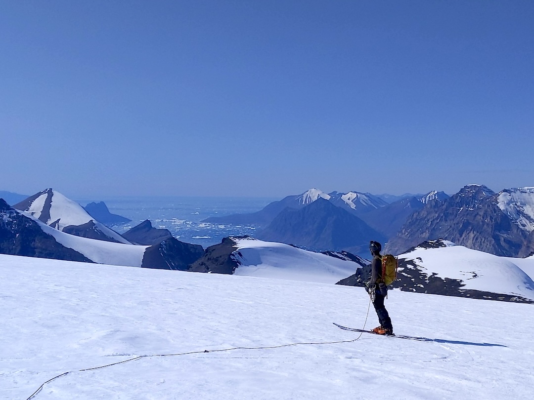
We rested the next day to untangle kites, then manhauled two sleds each farther into the mountains and camped atop the rounded, snowcapped Peak 2,152m (71.804, -51.97), having left our remaining sleds and gear cached in a snow cairn.
On July 21, we skied west and climbed Peak 2,171m (71.751, -52.094). First, we attempted an eastern aspect in the sun, but slushy snow bridges collapsed when we touched them. We then diverted to the steeper, shady north aspect, which required frontpointing and weaving through seracs to a gentle summit ridge, from which we got our first views of the ocean since June. From there, we skied northwest and scrambled the rocky south ridge of Peak 2,063m (71.772, -52.12). Icebergs floated in the distant sea, with no boats or other signs of civilization. We felt very remote, in an area perhaps no other people had visited. Our journey was now just halfway complete.
We returned to camp on Peak 2,152m, then spent a few days manhauling back to kiteable terrain on the ice cap. Before we could resume kiting, we had to wait out a two-day blizzard.
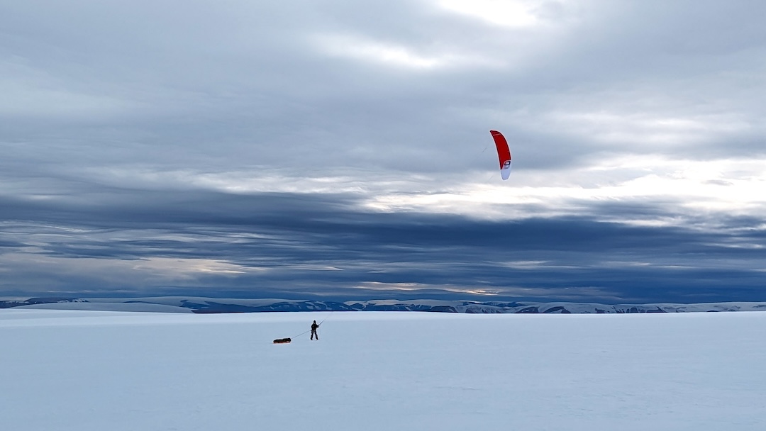
When the weather cleared, we continued north in favorable winds, covering up to 218 miles per day, to reach the edge of the ice cap near Qaanaaq, on the northwest coast. It took three days to triple-carry our gear five miles from the ice cap down to the sea, with packs up to 115 pounds. We then got a boat ride with a local hunter to town. After waiting 17 days in Qaanaaq for a flight, we returned home to Seattle on August 22.
—Eric Gilbertson and Branden Joy, USA
Media Gallery