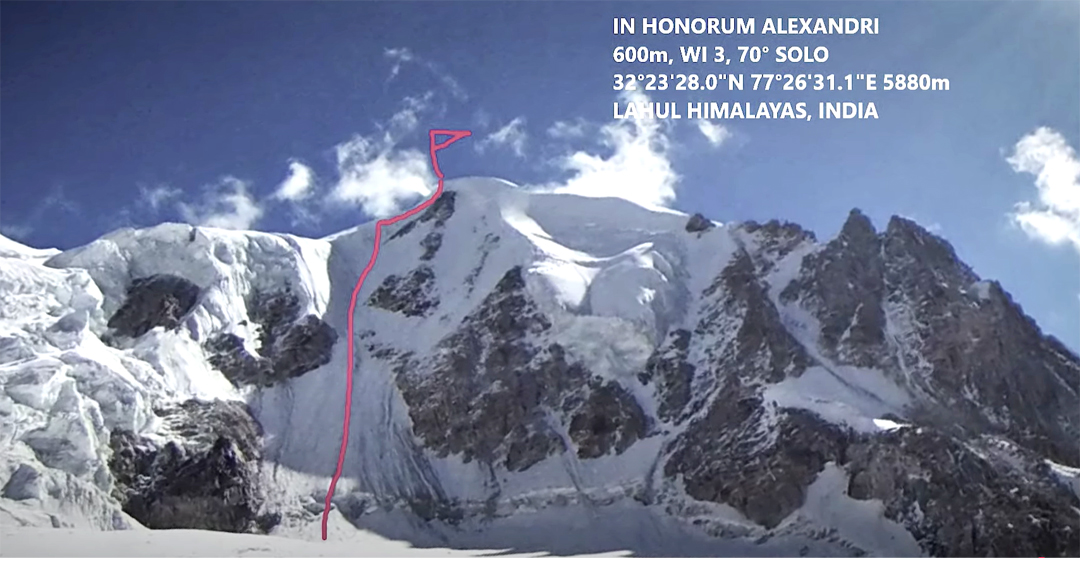
Chandra Bhaga Range, CB26, Northwest Face
India, Himachal Pradesh, Lahaul
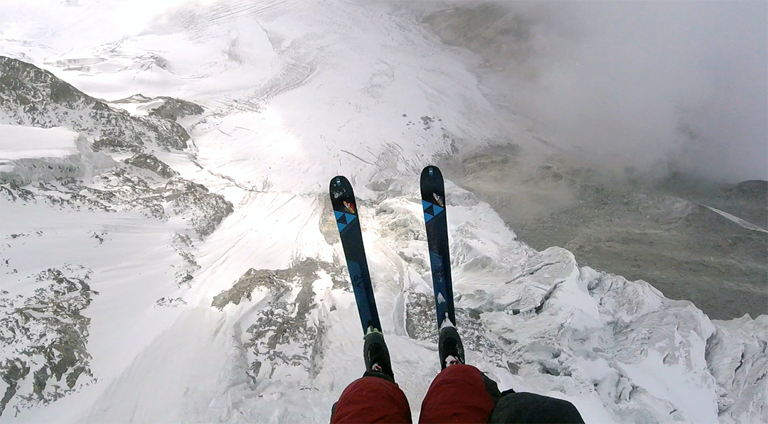
Photo: Juraj Koreň
Seven years ago, Michal Sabovčík and I started a project where we aimed to ascend a previously unclimbed mountain or route on each continent and then descend by paraglider. We did this in Antarctica in 2018 (AAJ 2019) and in Greenland in 2019. Although we then went our separate ways, the desire to finish the project continued. I tried in India, Pakistan, and Nepal, yet somehow the mountains always defeated me.
I returned to India alone in October 2024 and first focused on acclimatization, which, with a wing, can be rather less energy-intensive. It’s great to sleep at altitude and in the morning glide down to the valley in ten minutes, instead of many hours of hiking downhill with painful knees.
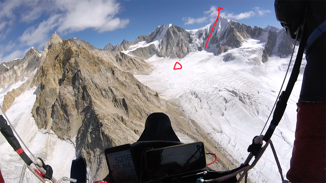
Hungry for adventure, I packed light skis, ice tools, crampons, and one screw and flew around 40km to the northwest of Manali, heading first for a 5,300m summit at 32.3230°N, 77.06311°E, around 2.5km southeast of Hanuman Tibba (5,928m). I landed to the north at around 5,000m, left my tent, went up the north face of this peak, and skied down. After a night in the tent, I flew down to 3,800m for a rest.
On October 31, I set off flying 25km toward a preplanned goal, but from a distance I could see the face I wanted to climb was too dry and the peak too sharp for a takeoff from the top. I decided instead to aim for a summit at 32.3914°N, 77.44086°E and landed on the glacier to its southwest at 5,000m. [This peak is CB26, or more explicitly the southern and highest top of CB26; that label is applied on some maps to the lower peak to the north. The peaks sandwiched between the Chandra and Bhaga rivers, south of Mulkila, are mostly referred to by numbers. The general feeling is that most or all of these have been climbed; however, there appears to be no recorded ascent of CB26.]
I set off on foot for the northwest face, carrying the paraglider, a harness, a down jumpsuit, a stove, a liter of water, and skis. The face is about 600m, starting at 50° and rising to 70° before it reaches the northeast ridge. Ideal conditions took me to the top at 5,880m in late afternoon. After a short moment of joy, I started my descent. At high altitudes, the thin air increases the minimum takeoff speed, and it is difficult to run in deep snow—that’s why I brought the skis. After a freezing night in the tent, I skied down the glacier until I found a suitable launch site. I was soon in the warmth of the valley.
I named the route In Honorum Alexandri (600m, WI3 70°). Mountaineers could say the peaks I climbed were too small, paragliding pilots could say I only flew a little, and skiers could say, well…it really doesn’t matter. I achieved my goal of making a solo first ascent on this continent, and in addition I carried everything to the mountain with me. Not expedition style, not alpine style, but paragliding-alpine style. Per ardua ad astra!
—Juraj Koreň, Slovakia
Media Gallery