Shingo South, East Face and South-Southeast Ridge
India, Himachal Pradesh, Lahaul
 The Shingo La (5,090m) is a high pass on an old trekking route from Lahaul to Zanskar. More recently, the route has been converted to a motorable road. The planned Shingo La Tunnel, beneath the pass, should ensure the road will be usable in all weathers.
Close to the pass lie three peaks, often unofficially called Shingo East, West, and South. All are a little over 6,000m and have received multiple ascents. Shingo South is known to have been climbed on a number of occasions dating back to 1994 (likely at least once by the northeast ridge). In 2015, Bill McConachie, from an Anglo-American expedition, reached the top via the southwest face and south ridge. At the time he believed he was making a first ascent but was disappointed to find bamboo wands on the summit (AAJ 2016).
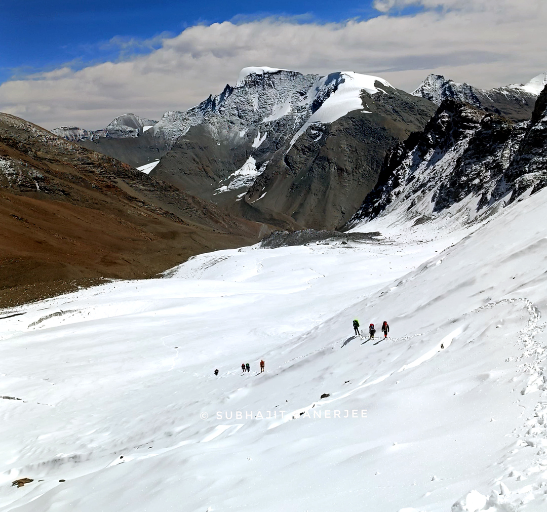
Our team planned to climb a new route on this peak, and on September 4 set up base camp near the Shingo La at 5,010m. The rapid ascent by vehicle took its toll, and we needed the 5th and 6th to recover and acclimatize. On the 7th we cached gear at 5,327m, and were prepared to set off on the 8th when our cook started to exhibit severe AMS. We administered dexamethasone, evacuated him to the road, and sent him back to Manali for urgent medical attention. The full climbing team occupied Camp 1 at 5,327m on the night of the 9th.
The next day, we climbed a rocky gully and broken terrain on the east face to reach the upper south-southeast ridge, fixing a total of 700m of rope. Heavy snowfall stopped movement on the 11th, but the next day, using the ropes, we moved up and camped at 5,856m. With scarce snow and water, we had to ration our water supply.
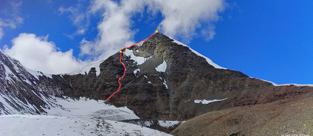
On the morning of September 13, we climbed 45°–60° snow and rock slopes on the south-southeast ridge to reach the rocky summit, arriving at 12:30 p.m. The mountain has two tops, and we found the higher to be 6,068m GPS (32°53’16.45”N, 77°8’43.25”E); a team climbing the northeast ridge will first reach a false summit of around 6,010m. We named the route Nirjala, a Sanskrit term meaning “waterless.” We think it should be graded around AD.
The full summit team was Prakruti Alagudekar, Joy Das, Avantika Kekan, Sabyasachi Samanta, Subhendu Sikder, Tem Tapung, Shubham Thapliyal, our high-altitude porters Chandrapal Danu and Narendra Singh Danu, and me.
—Subhajit Banerjee, India
Media Gallery