Chhogo Tokpo: Skarma Mindruk Ri, Antimatterhorn, Spao Ri and Ibex Peak
India, Ladakh, Zanskar
In recent years, the peaks of Zanskar have seen increasing popularity with mountaineering expeditions. Despite this, there are still plenty of unclimbed summits from 5,500m to 6,500m.
The scale here is quite friendly for the Himalaya and therefore suitable for a first Himalayan experience. Road connections are improving, so travel time is consequently shorter. Access to base camps is relatively short (one to three days), and very strong, well-acclimatized parties could climb some peaks in a single push from the road. The lack of quality maps in the area has partly been mitigated by navigation applications, but there is still confusion regarding peak names and, over the years, a general lack of systematic recording of activity. The IMF has a list of open peaks that includes geographical coordinates and altitudes, but they simply number the peaks; very few mountains on the list have names.
I also think the IMF expedition policy for foreigners and their system based on “peak permissions” is out of date and quite inappropriate for such areas as Zanskar and other mountain ranges north of the main Himalayan divide. A more suitable management model would set “park” boundaries within which climbers could choose any peaks they want to attempt. While it is relatively easy and practical to climb in Zanskar’s mountains without legal permission, in the future this will likely cause safety and ecological problems.
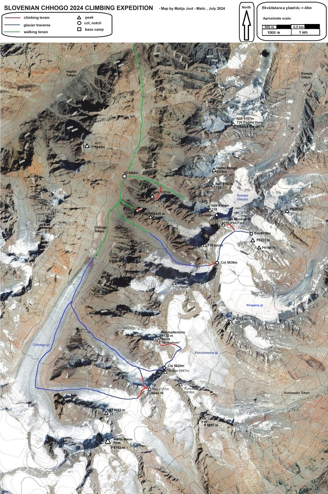
With our liaison officer and support staff, Uroš Cigljar, Tilen Cmok, Boštjan Dečman, Nejc Škrablin, Tomaž Žerovnik, and I arrived on July 7 at base camp (4,482m, 33°23.984’N, 76°46.558’E) in the Chhogo Tokpo (valley), the eastern branch of the Haptal Tokpo. While several parties had visited adjacent valleys and climbed a few peaks on the watershed ridges with the Chhogo, the only prior reported climbing expedition to visit the Chhogo valley was an Indian-Romanian team in 2016 that climbed one peak and attempted another (AAJ 2017).
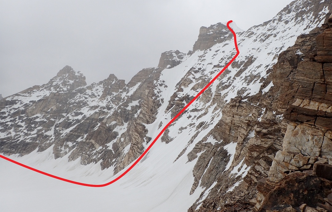
A very complex 6,431m mountain known as T16 (as designated by Kimikazu Sakamoto, who numbered the prominent peaks in his topographical sketches of the area) was our main objective. The lower south summit was climbed by Romanians Cosmin Andron and Cristina Pogacean in 2016, but the easiest approach to the main top (33°23’12.13”N, 76°48’45.67”E) appeared to lie up the south slopes above the Khapang Glacier, east of the Chhogo valley. The big riddle was finding a suitable passage from the Chhogo to the Khapang, and we devoted part of our acclimatization to solving this problem.
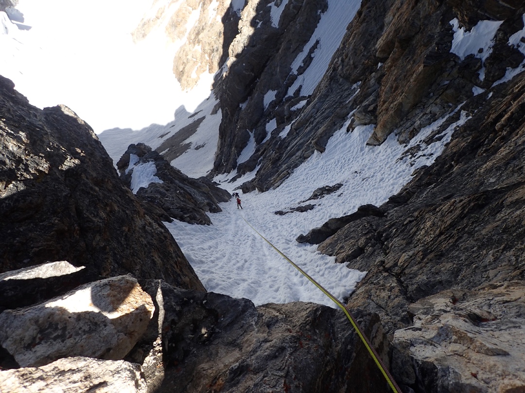
Aiming for a col on the ridge south of T16, we hiked up a side glacier, passing the route climbed by the Romanians, and climbed a 300m west-facing gully (300m, D+ M3 60°) to reach the col (5,836m). From there, it would be easy to descend to the gentle Khapang Glacier and traverse to T16’s north peak.
The whole team returned to the col camp on the 14th, and the next day, in perfect weather, we climbed south-facing slopes above the Khapang Glacier and along the east ridge to the summit of T16 (600m, D+ 60°). Our expedition had been organized by a club from the Slovenian town Šentjur, so we named our route Šentjurka (900m, D+). We later encouraged people in the nearest village, Tungri, to suggest a name for the peak, and they came up with Skarma Mindruk Ri (Skarma is “star,” and Mindruk is a specific star in the constellation of Pleiades). Maybe the name will catch on.
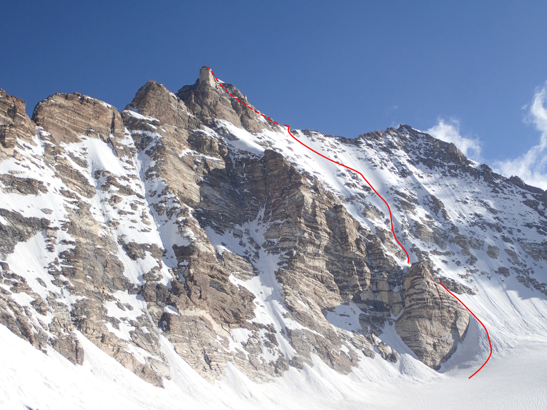
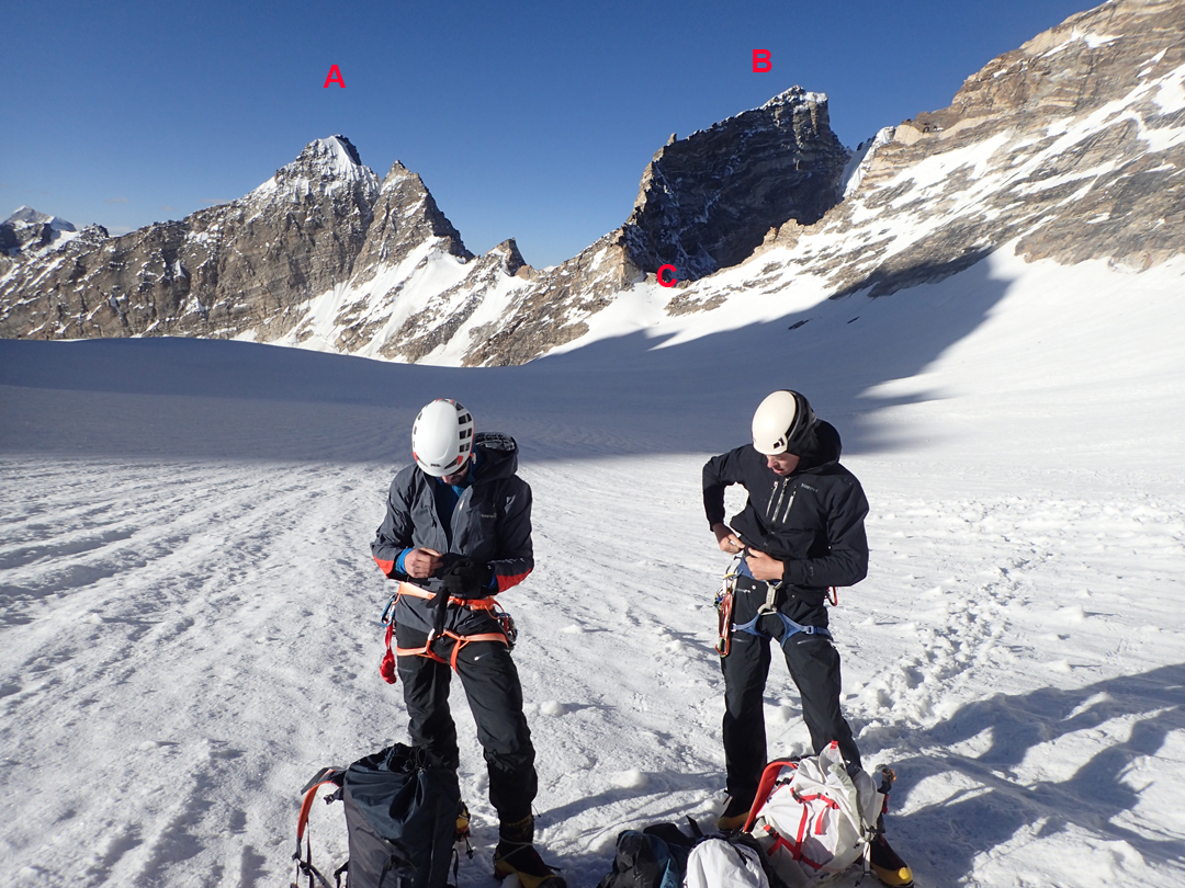
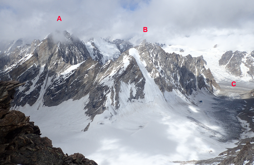
In 2015, a British team climbed in the adjacent Korlomshe Tokpo, which drains to the south and east of these mountains, and attempted a “Matterhorn-like peak.” Tomaž was keen to investigate, so on the 20th we two set off, moving up the main Chhogo Glacier, then turning east up a side glacier. We climbed to a col at 5,620m to the south of the Matterhorn peak, descended around 200m on the far side, then moved northeast to camp on the upper Korlomshe Glacier at 5,615m, nine hours after leaving base camp.
The next day, we climbed the east face and finally the south slopes to reach the summit at 9:30 a.m. (6,130m, 33°20.987’N, 76°47.273’E). We named the route Charlatan De Balkan (500m, D+ 60° ice) after an album by a popular Slovenian group. As the peak was absolutely nothing like the famous Swiss mountain, we named it Antimatterhorn.
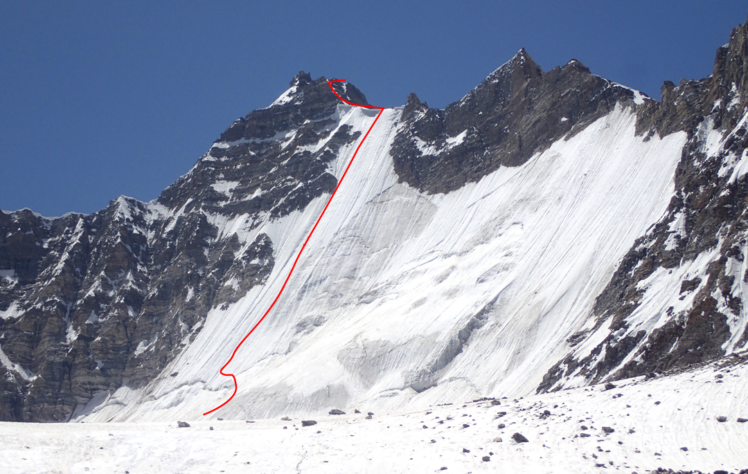
In the meantime, Tilen and Uroš attempted the 400m west face of unclimbed Peak 5,435m, close to base camp at the end of the long west ridge coming from the south summit of Skarma Mindruk Ri (T16). After they had climbed around 250m (up to VI), Uroš was making a belay anchor when a large flake broke, injuring his right hand. The pair descended, and then, with other team members, went down to Padam for medical attention. Separately, Boštjan made the first ascent of a rock tower east of base camp, which he called Ibex Peak (5,321m). He climbed a straightforward 30° snow gully on the north flank.
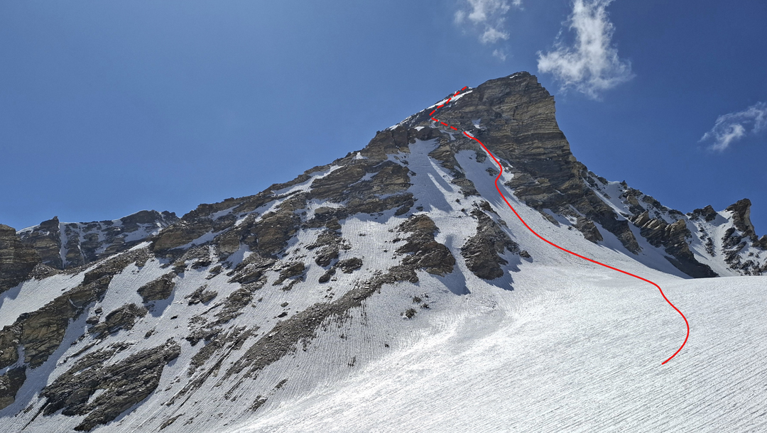
By July 24, most of the team had left base camp. Although I’ve been climbing around 45 years, I don’t have much experience with soloing, but I decided to try the north face of T9 (6,107m, 33°20’6.63”N, 76°47’5.93”E), which I had seen from the Antimatterhorn approach. I left base camp at 1 a.m. on the 25th, carrying two axes but no rope. The north face became icier and brittle the higher I climbed, but at 8:30 a.m. I reached the west ridge. The upper section of this ridge was rockier, but in one hour I was standing on the summit.
Deciding I didn’t feel comfortable downclimbing the north face, I headed down a couloir on the southwest face to a neighboring glacier. Although I couldn’t see all the way, it looked passable. Everything went well, and I was back in base camp by 3 p.m. Only Tilen and our cook were there to greet me, and all three of us descended to the village that night.
The locals suggested the name Spao Ri for the peak. It means “Brave Mountain.” I named the route Old and Abandoned (700m, TD II–III 75° ice). Why? Because I’m not young anymore.
The expedition is grateful to the Alpine Association of Slovenia for financial support. [A comprehensive report on this expedition, with additional maps and photos, can be downloaded here.]
—Matic Jošt, Slovenia
Media Gallery