Peak 6,124, Peak 6,128, and Rale
India, Ladakh
In September, Mayukh Banik, Sujit Kushe, and I, supported by Dorje Bhutia, Pasang (Paste) Bhutia, Pemba Bhutia, Angchuk Sherpa, Ang Tshering, and Lang Tshering, explored a group of mostly unnamed mountains east of Leh and just southwest of the Shyok River. From Karu, southeast of Leh, we drove north via Sakti, over the Wari La (ca 5,300m), and down toward the Shyok as far as Tangyar village and gompa (3,912m, 34°15’13.40”N, 77°52’20.28”E). On September 9, we set off up the valley to the southeast.
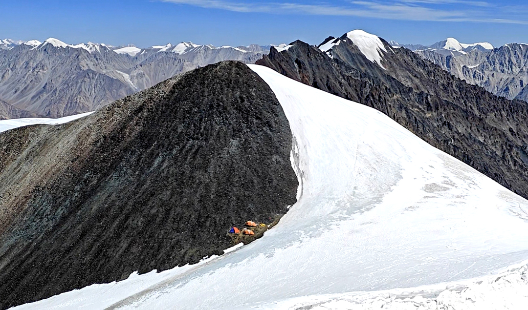
After a seven-hour trek, we established a base camp at 4,772m, and after two days here due to bad weather, continued up valley to establish our Camp 1 at 5,361m, the only flat place available in an area of loose, rocky slopes. We occupied this camp on the 17th, and on the 22nd, after more bad weather, carried large loads over tiring loose rock and scree to Camp 2 at 5,566m. On the ridge above us, at the head of the valley, were our chosen peaks. Only Rale (6,132m) was named on the Survey of India map.
We spent a few days fixing rope toward the ridge over steep snow and ice, and on the 25th moved up to a summit camp at 6,071m, on the col between Peak 6,124m to the northeast and Peak 6,128m to the southwest. While camped here, we regularly faced severe winds.
We first decided to climb Peak 6,128m, and on the 26th our climbing team of Lang Tshering, Pasang, Ang Tshering, Sujeet, Mayukh, Pemba, and I reached that summit via the northeast ridge. It was a straightforward ascent, but we needed to be careful due to hard snow. We’d assumed ours was a first ascent, but on the summit we discovered old prayer flags left by previous climbers.
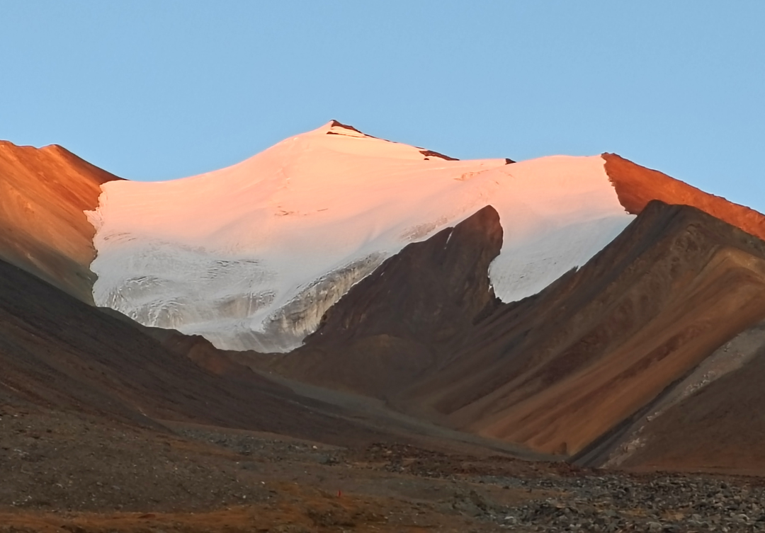
Next day, we were kept in camp by strong winds, but on the 28th, despite the weather still not being conducive to action, we set out for Peak 6,124m. The ascent was steep but short, and after fixing a couple of ropes, we reached the top in less than 1.5 hours. There was no sign of a previous visit to this rocky top, and we built a cairn. The view south gave us a better idea of the route toward Rale (34°11'56.21"N, 77°59'57.32"E), our third objective.
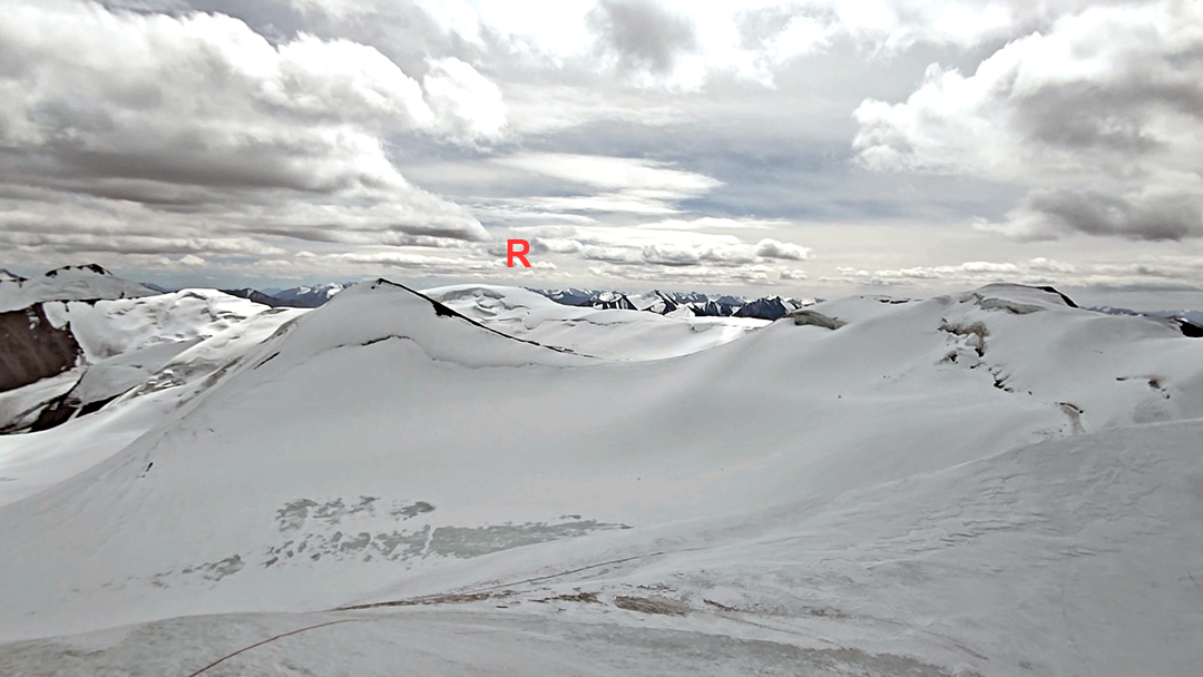
The 29th dawned clear but windy. We reascended Peak 6,128m and, after crossing the summit, descended the south-southeast ridge for about half a kilometer, at one point narrow and rocky. From our low point, the ridge became broad, turned east, and rose steadily toward Rale. At the summit, although a previous ascent is nowhere recorded, earlier climbers had constructed a massive rock cairn. It had taken eight hours and everyone was exhausted, but the sky was clear and we were rewarded by a plethora of recognizable peaks in every direction.
Over the next couple of days, we cleared the route and returned to the valley, where mules arrived to take us down to Tangyar.
—Rajesh Gadgil, India
Media Gallery