Queen Peak, South Ridge
Canada, Yukon Territory, St. Elias Mountains
Sleep-deprived and sorting gear and food on the floor of an Icefields Discovery airplane hangar in Silver City, Yukon, Nick Aiello-Popeo and I were attempting to finalize our packing before flying onto the Quintino Sella Glacier. We forgot the spatula.
On May 26, we enjoyed a scenic flight with Icefields Discovery from Silver City, Yukon, passing by Mt. Logan before landing on the Quintino Sella Glacier at 2,743m. Our pilot, Sam, bid us farewell and took off before the weather closed in again. The plan was to ski about eight miles up the King Trench route (MacCarthy et al., 1925) toward Mt. Logan and establish a high camp below the unclimbed north face of King Peak (5,172m). Five days later, after shuttling loads and taking our time to acclimatize, we were comfortable in our camp at just above 4,000m. Feeling ready, we packed our bags for an attempt on King.
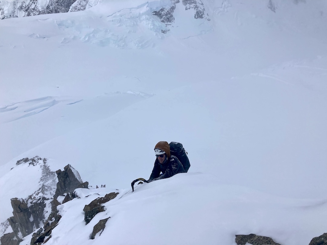
We trudged up 300m of snow, taking a roundabout way to avoid triggering a large slab. We’d chosen this part of the wall to avoid serac hazard, but finding a spot to cross the bergschrund proved difficult. The area of wall we could reach had unsupportive sn’ice and rock mostly devoid of gear. As Nick tried to aid through some steep rock, I began to dig a bivy ledge while still belaying. Then Nick ripped a Tricam out and came flying off. Shovel in one hand and brake strand in the other, I caught him. I guess the Grigri was worth the weight.
Bivy ledge half completed, we sat looking across the valley at the unclimbed south ridge of Queen Peak (5,380m). Joe Josephson, a veteran of Yukon climbing, had suggested it as a consolation prize, in case our plans for King Peak didn’t work out. Shining in the evening sun, the south ridge looked magnificent and less frightening than what we were currently trying. We descended and found ourselves back in camp four hours later.
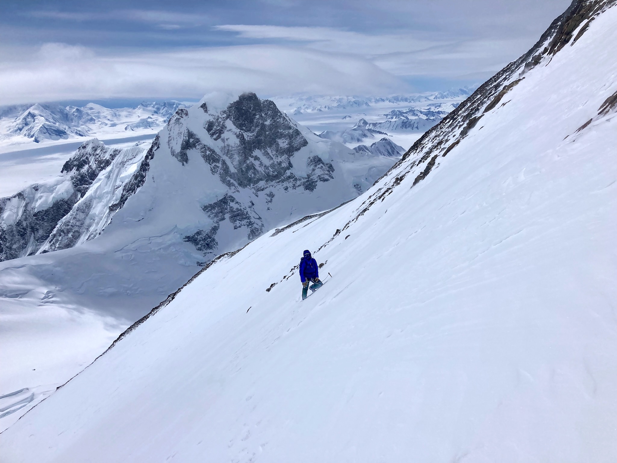
After a day of rest, we packed our bags with the bare minimum: three ice screws, six nuts, and a 50m twin rope. Our emergency kit was a belay jacket and a pair of mittens each. We left camp at 7:45 a.m. and skied northeast for a little over a mile to the base of the route at 4,580m, stuck our skis in the snow, and put on crampons. The skies were totally clear, and we were confident in the forecast.
Once on the south ridge, we tried to avoid chossy rock and hard, calf-burning low-angle ice by linking sections of thin, sugary snow. The wind was whipping at us a lot harder than we’d anticipated, and the sky was looking increasingly cloudy. Nonetheless, we continued to the summit, never once using the rope or protection. As we pulled through the final couloir, we could hear the wind roaring like a freight train above.
On the summit, visibility dropped to less than 50’. It was unclear if we were in a storm or just a low cloud; either way, a whiteout at high altitude on a rarely climbed peak was less than ideal. We tied in and both took coils, ready to navigate the ridge eastward to the saddle between Queen Peak and AINA Peak (5,630m).
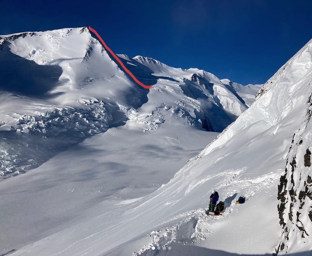
Hours of slow progress finally brought us to the saddle. We descended the slope to the south and walked southwest by feel for hours back to our skis. Multiple crevasse falls and a few sketchy rappels later, we were back on skis. It only took about ten minutes for us to realize we would almost certainly fall to our deaths in a crevasse if we continued in this style. Skis back on packs, we roped up and fumbled our way through the whiteout. Fifteen hours after leaving camp, we crawled back into our relatively sheltered home and made some dinner. The following day, with wind-burnt faces and tired legs, we skied eight miles west to reach the landing zone, then flew back to the airstrip in Silver City.
We named the route Wizard’s Ridge (800m, Alaska Grade 4) in honor of our friend and mentor Rick Wilcox (nicknamed “The Wizard”) from New Hampshire. Rick spent months on Mt. Logan in the 1960s doing altitude studies for the U.S. military, and his images and advice were crucial to our success. [The first ascent of Queen Peak was by the southeast ridge, starting from King Col, in 1966. The climbers, Ed Nester and Pete and Tom Hall, were members of an American expedition that also traversed King Peak from west to east en route to the summit of Mt. Logan; see AAJ 1967.]
—Ryan Driscoll, USA
Media Gallery