Tanpa Lungma and Kuru Lungma, Exploration and Ascents
Pakistan, Karakoram, Shimshak Mountains
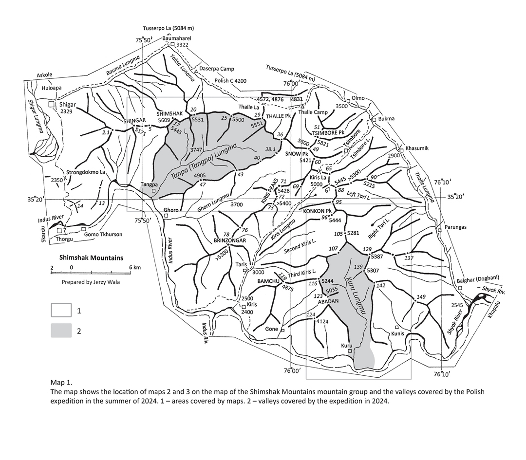
The little-known Shimshak Mountains, southeast of Shigar, are described in a booklet published in 2021 by Janusz Majer and Jerzy Wala. From this information, it appeared that only two valleys—Ghoro and Kiris—had been visited by trekkers and mountaineers. We decided to investigate the other two: the Tanpa Lungma and Kuru Lungma.
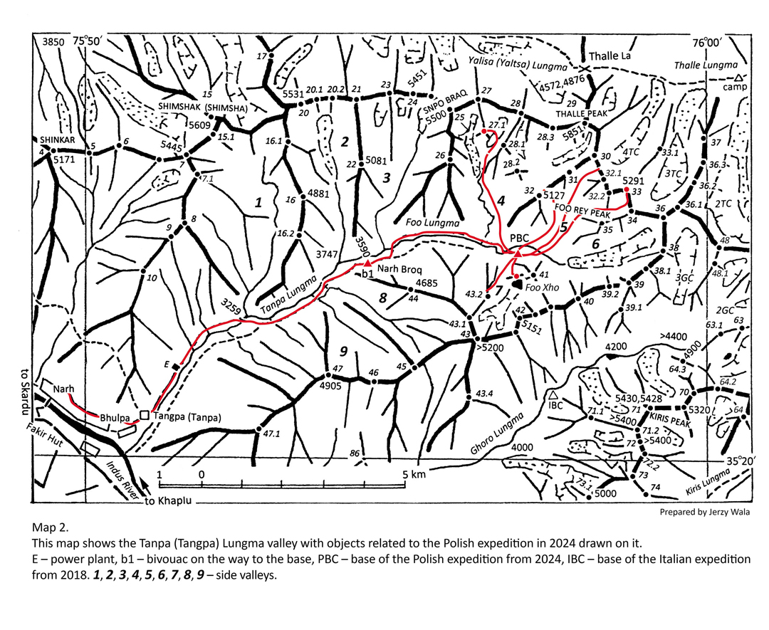
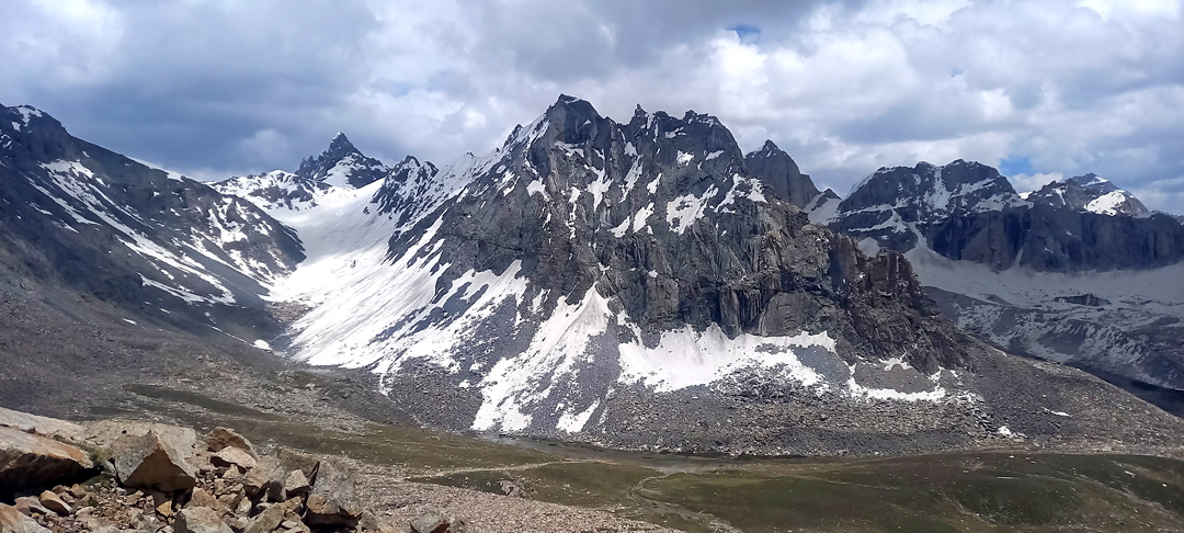
From July 19 to 27, Stanisław Pisarek, Voytek Walas, Mateusz Winkler, and I visited the Tanpa Lungma valley. Starting from the village of Narh (2,400m), reached by road from Skardu, we walked for two days to a base camp at 4,447m (approx. 35°22’47.91”N, 75°56’38.15”E). At this time of year, only the gullies and cirques of the higher peaks were snow-covered. The highest peak on the valley rim is Thalle (5,851m).
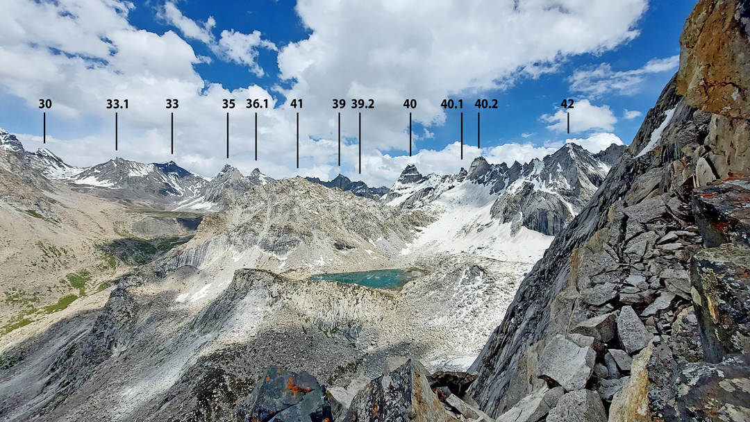
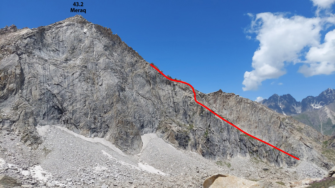
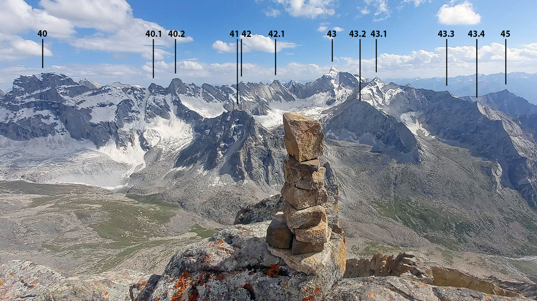
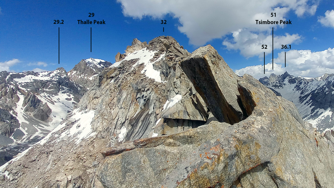
Mateusz climbed Peak 5,206m (dubbed Mateo Peak, 27.1 on the Wala map) and Peak 5,273m (33 on the map), finding no technical difficulties. All four of us climbed Peak 4,802m, south of base camp and near to Peak 41. Voytek and I tried Meraq (43.2) from the northeast, retreating from high on the mountain (UIAA III). We also reached a 5,197m pass between Peaks 30 and 32.1 on the watershed ridge south-southeast of Thalle Peak. We hoped this might provide a connection between the Tanpa Lungma and Thalle valleys, but on the far side of the pass there was a big drop over a cliff.
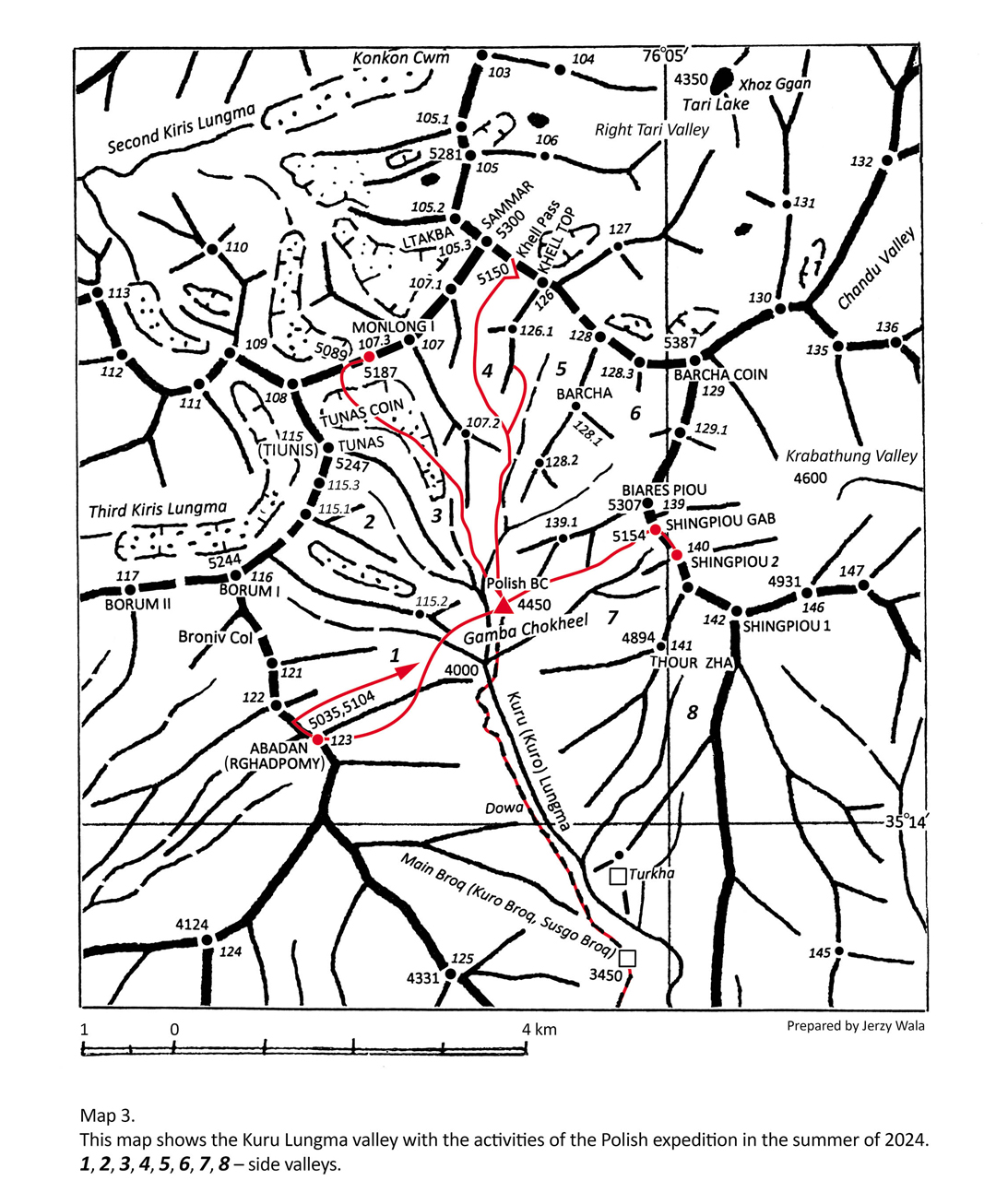
From July 30 to August 4, we operated in the Kuru Lungma valley, farther to the southeast. The road to Kuru village at the entrance to the valley crosses a rope bridge over the turbulent Shyok River.
On the first day, we walked through the deep, rocky gorge of the lower Kuru River, camping at 3,450m, then walked another five hours the next day to a vast pasture called Gamba Chokeel (4,450m, 35°15’29.63”N, 76°3’42.37”E), where we established base camp.
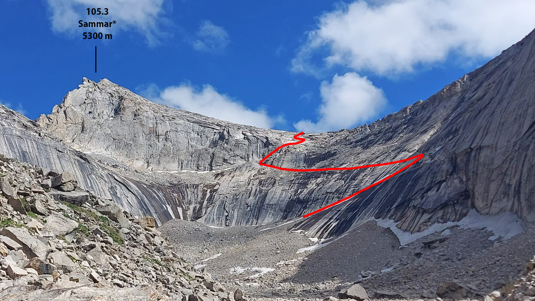
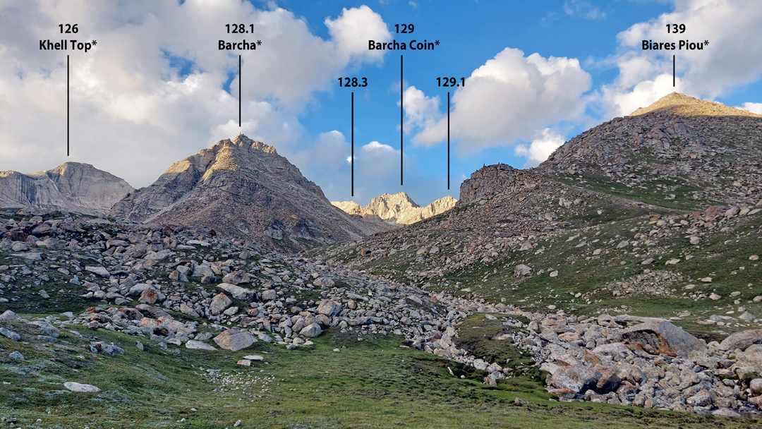
From here, Stanisław climbed three nontechnical summits: Peak 5,187m (Wala map 107.3), north-northwest of base camp; Peak Shingpiou Gab (5,154m, 139.2), east northeast of camp; and Shingpiou II (5,146m, 140). Mateusz climbed Abadan (5,011m, 123), southwest of base camp, and Voytek and I reached the Kheel Pass (a.k.a. Kuru La, 5,150m, UIAA III) at the head of the valley.
The day after our ascent to the pass, local men Ghulam Mehdi Kurovi, Muhammad Khan, and Muhammad Saleem Bargoli also reached the pass and then descended the far side to the Thalle Valley, the first people to do so. Ghulam Mehdi wants to popularize the valley as a trekking destination.
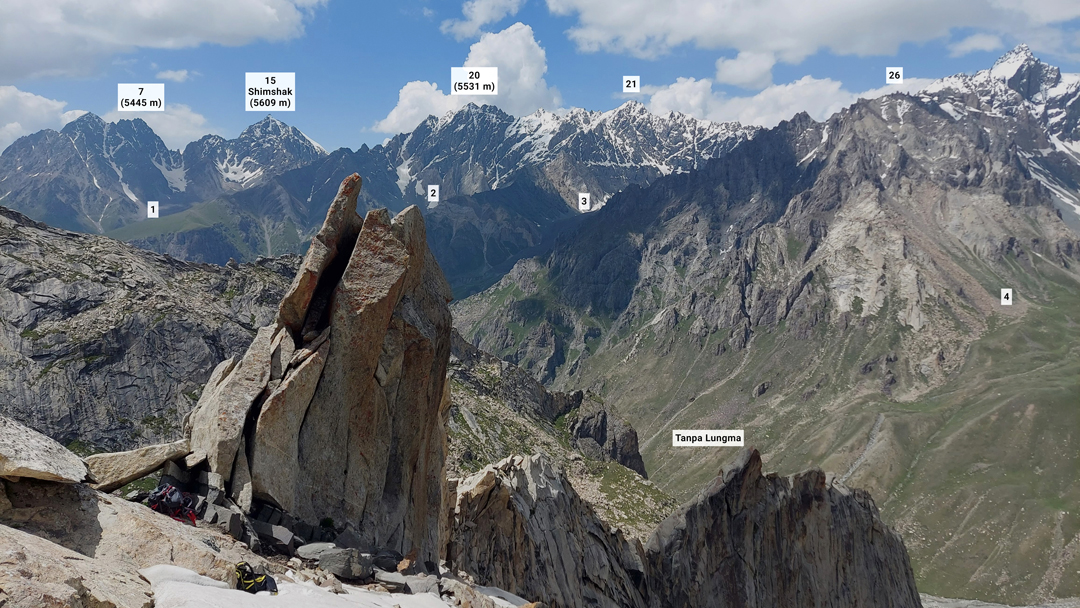
According to locals, we were the first foreigners to visit the two valleys, and we were able to learn local names for around 15 peaks. However, it was difficult to determine definitively which peaks and passes had previously been visited; we found cairns on some of them. The peaks that require difficult technical climbing, such as Thalle and Shimshak (5,609m), remain unclimbed. [Editor's Note: An Italian team visited the Ghoro Valley, south of the Tanpa Lungma, in 2018 and reached a couple of peaks, including the first ascent of Kiris Peak (5,428m) by a difficult wall. See AAJ 2019.]
—Grzegorz Chwola and Voytek Walas, Poland
Media Gallery