Mashallah Sar, Shams Sar, and Pozeve Sar, First Ascents
Pakistan, Karakoram, Ghujerab Mountains, Karun Koh Group
In July, inspired by lines on a Jerzy Wala map, together with ample opportunities for first ascents in a less explored area of the Karakoram, Oswaldo Freire, Joshua Jarrin, Jacques Sturm, and I traveled to the Karun Koh group of the Ghujerab Mountains. We came with the mindset of exploratory climbing, looking to visit the area north of the Malungutti Glacier, where there was also a possibility of trying the unclimbed southeast ridge of Karun Koh (6,977m).
Having more or less no photos of the approach to the Southeast Karun Glacier, we traced a route on Google Earth, hoping to access base camp via a steep but seemingly passable valley north of the bridge next to Shams Sar Shrine at Ziarat (Shimshal Valley). Once we were on the ground, the physical valley bore little resemblance to its digital twin. It was a steep and narrow, scree-covered canyon, cut by raging river flows.
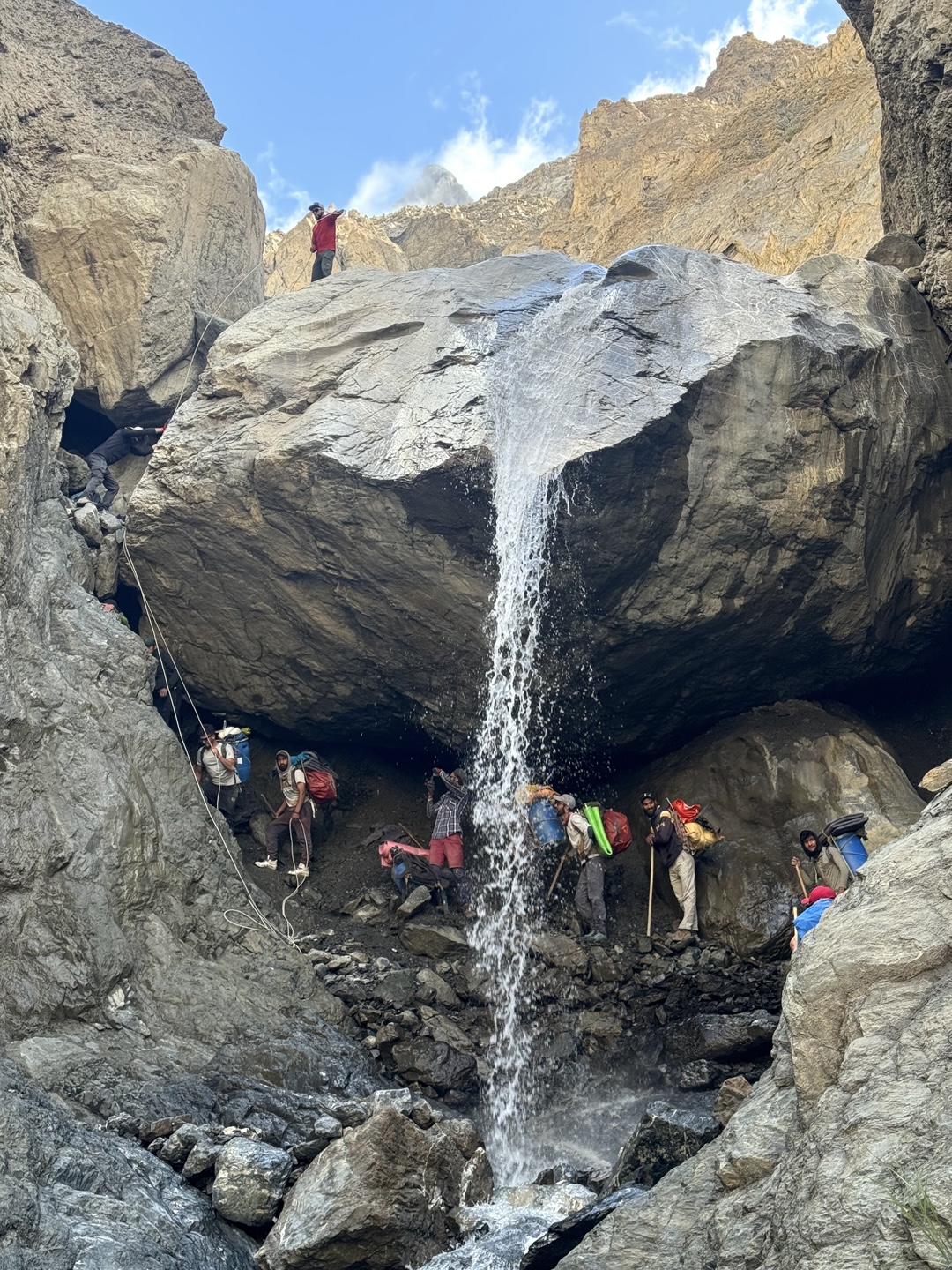
After a few days of drone research and hiking, we managed to find a difficult but plausible access route via a wider canyon east of the Southeast Karun Valley, starting opposite the Malungutti Glacier; this is the West Kuk Dur Valley on the Wala map. The route involved Houdini-like vertical rock passages next to two 20m waterfalls, and trekking over a previously uncrossed 5,000m pass, reached via 1,200m of steep scree. Though we celebrated our success, the next crux was to convince a small army of Shimshali porters to venture into the unknown with some 600kg of gear. On July 10, a week after leaving Europe, we finally were able to set up base camp at 4,250m, around eight kilometers from the southeast ridge of Karun Koh.
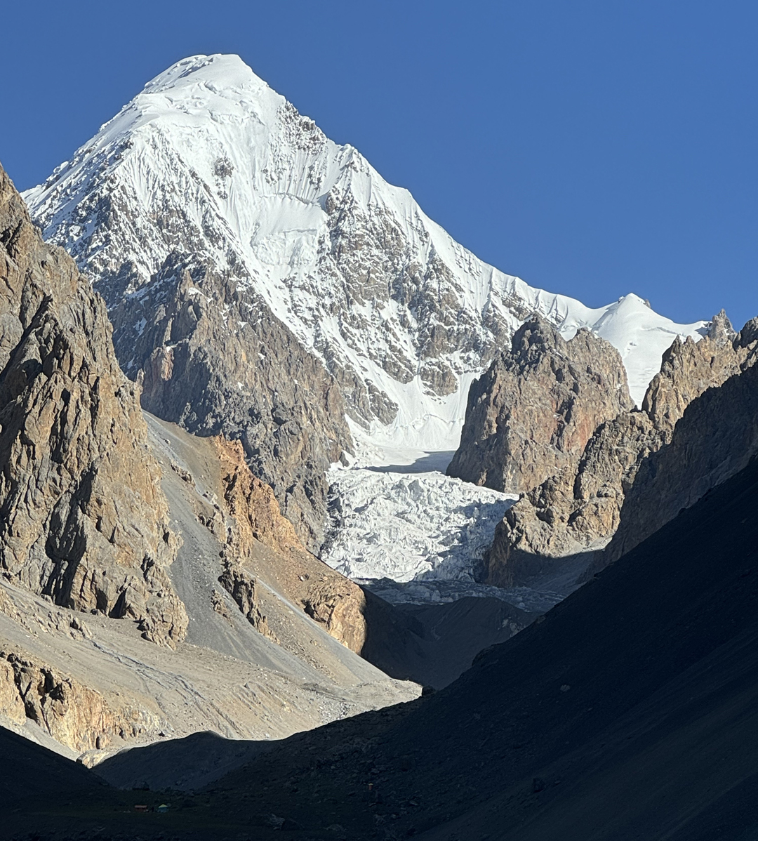
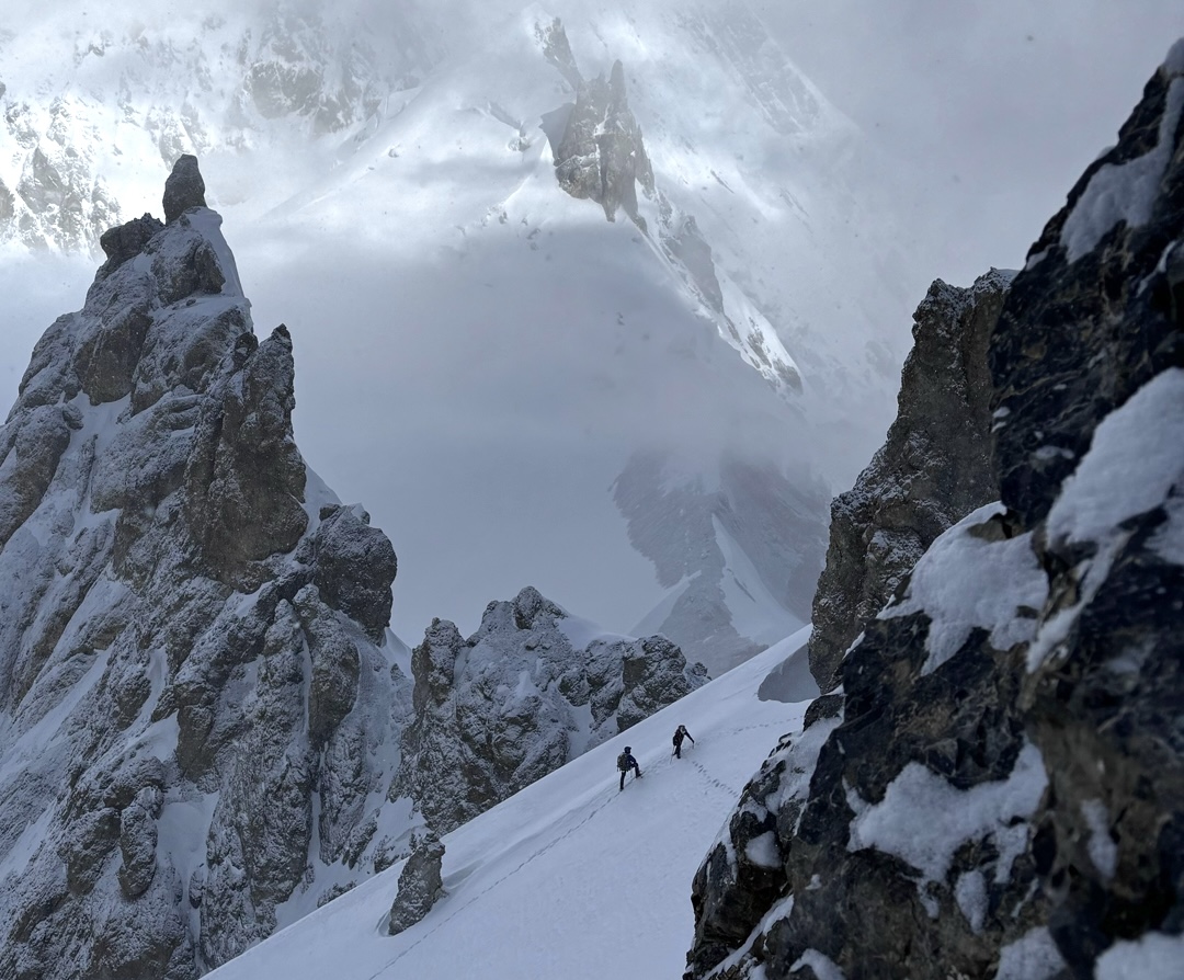
We spent the next few weeks acclimatizing by hauling gear up the Southeast Karun Glacier to the base of the ridge at 5,450m. This involved passing through a broken 250m icefall. In temperamental weather, we did not get a good view of the route during this period, but eventually we saw a heavily corniced, three-kilometer-long ridge bejewelled with seracs. This, combined with the warm temperatures and short weather windows, made us rule out any attempt.
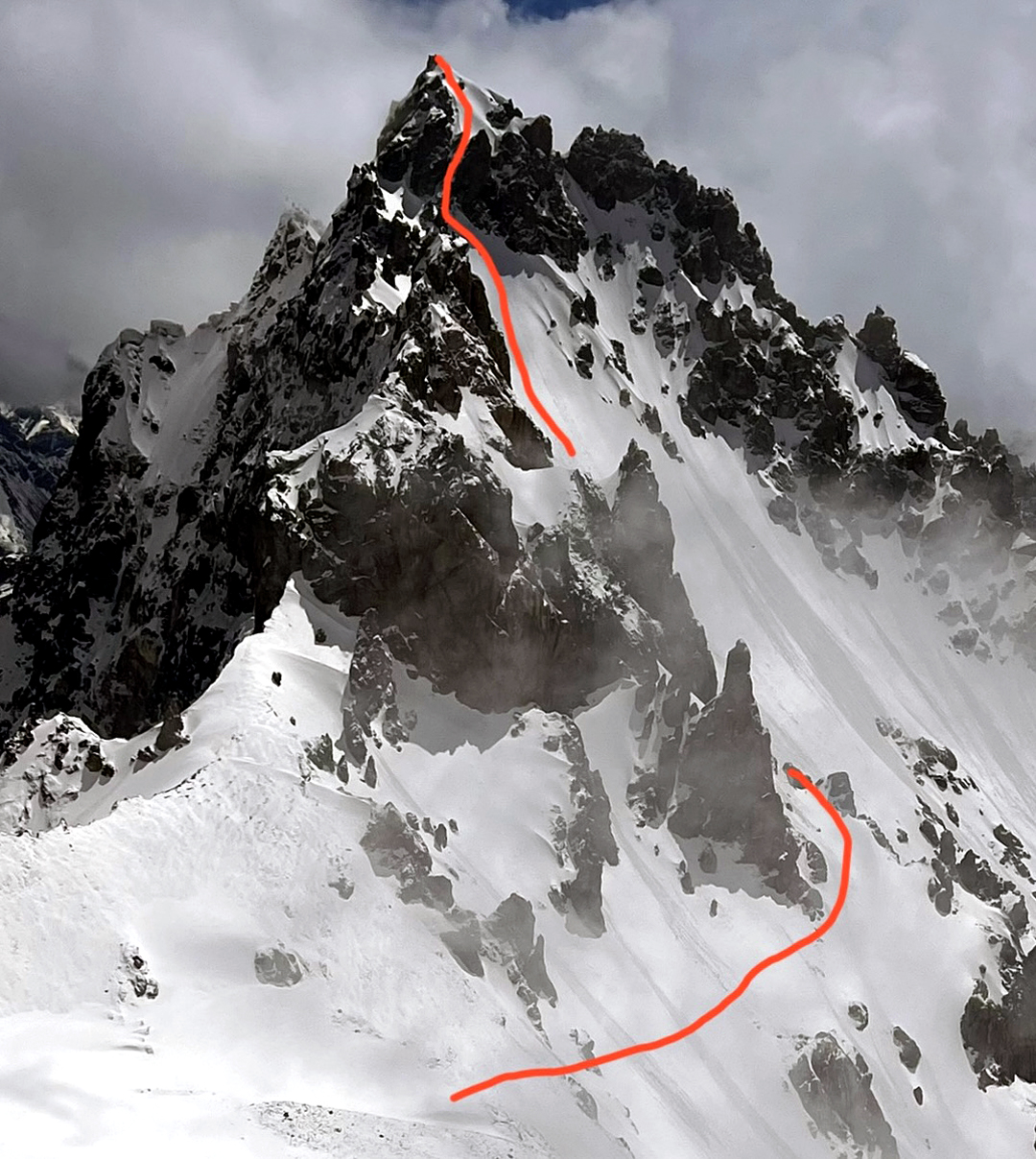
We decided to try some lower unclimbed peaks. On July 21, we climbed rocky Peak 144 on the Wala map (5,750m, 36°35’58.34”N, 75°6’14.33”E, near the foot of Karun Koh’s southeast ridge). We climbed snow ramps on the northwest flank (F, 40°) and named it Pozeve Sar due to its heart shape.
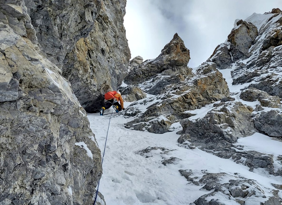
The following day we climbed nearby Peak 143 (5,859m GPS, 5,792m Wala map, 36°36’8.38”N, 75°6’58.27”E) via the southwest face (500m, D+). Starting at sunrise, we simul-climbed steep snow slopes to a rock band where pitches of M4 led to the rocky summit. We named the peak Shams Sar after the local saint. The same day, we descended the icefall and back to base camp.
After a few days of rest and reconnaissance of the Hidden Glacier, northeast of camp, we decided to attempt the attractive Peak 132 (6,043m on the Wala map, 36°34’47.40”N, 75°10’33.14”E, attempted by Polish climbers the previous winter; see note below); we had spotted this mountain from the summit of Peak 143.
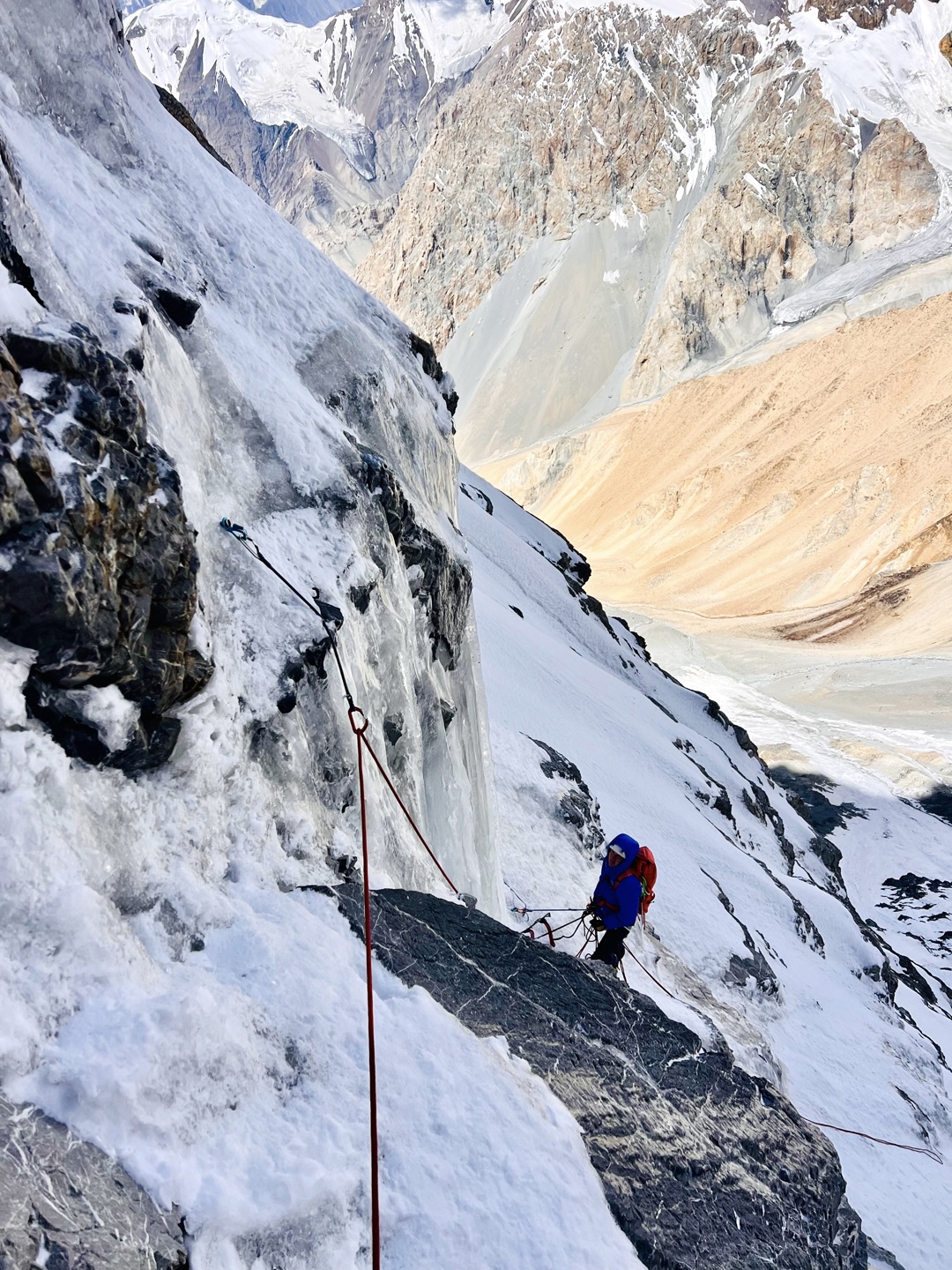
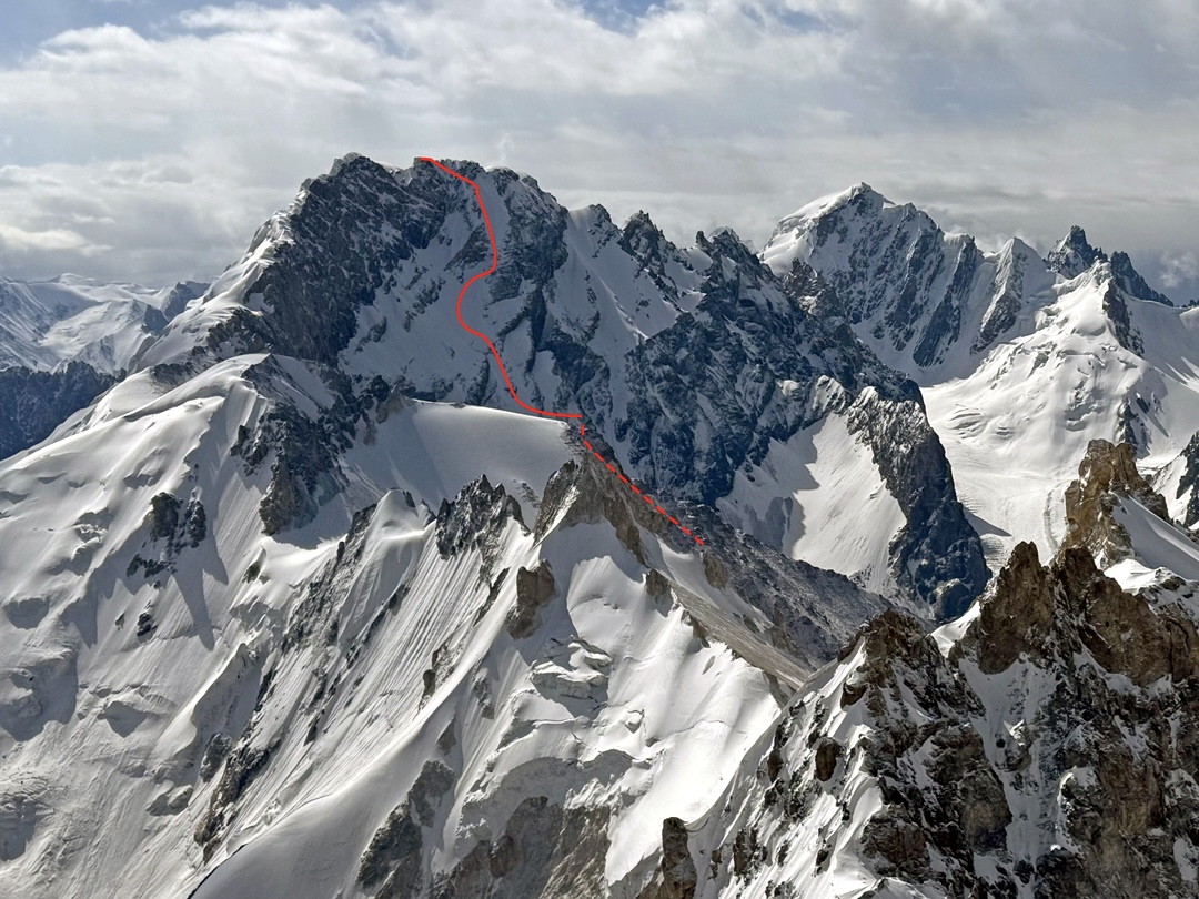
On the 26th, after spending a night at 4,900m on the Hidden Glacier, we left at 3 a.m. to climb the west face. After a steep snow ramp of 700m with sections of 70°, a few pitches of WI3-4, and then four pitches of steep mixed climbing (M4), we reached a corniced summit, which we recorded as 6,060m.
With the freezing isotherm at 7,000m, the rapidly warming temperatures made for a harrowing descent. Snow stakes would not hold, and we had to dig almost a meter into the snow to find rotten ice we could use for Abalakovs. Late that evening, we were safely back in base camp. We called the peak Mashallah Sar—Mashallah means “God has willed it”—to express gratitude for ending our expedition with a beautiful peak in a remote yet hospitable part of the world. We rated the ascent TD (1,000m, WI4 M4).
—Masha Gordon, U.K.
Media Gallery