Naseer Baig I and II, First Ascents
Pakistan, Karakoram, Hispar Muztagh
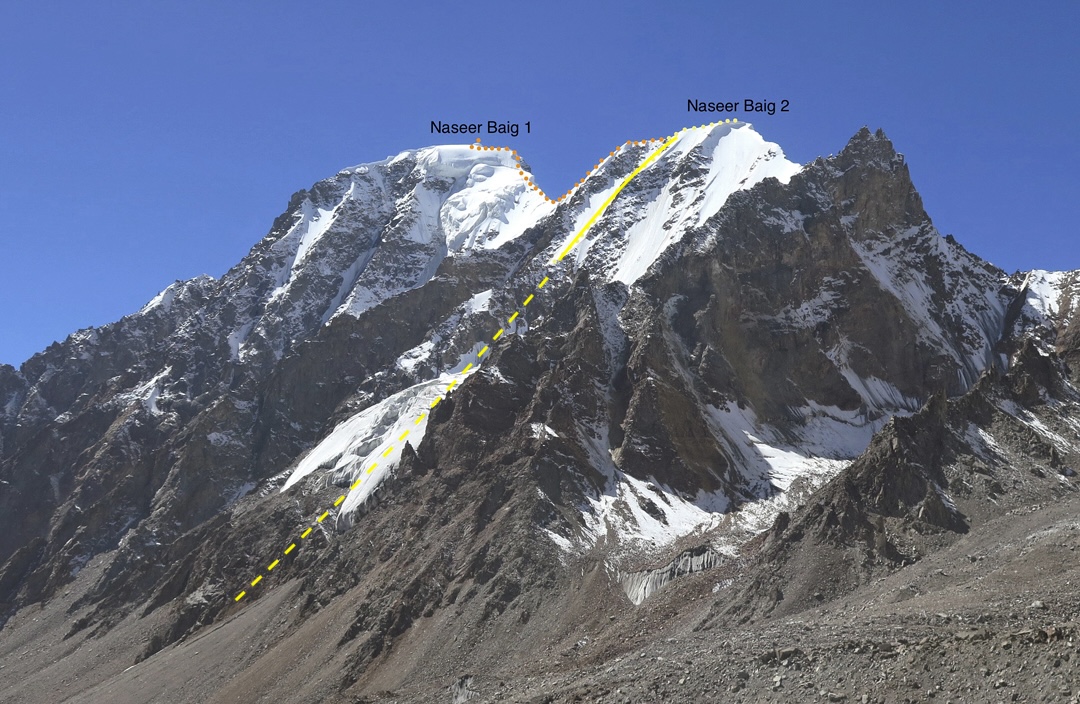
Adam Bielecki (Poland) and I were inspired to investigate the potential of the Gharesa Valley, which rises northeast from the village of Nagar and has been traveled in the past by expeditions attempting the Lupghar peaks and Momhil Sar. From an advanced base at around 5,000m on the lower South Lupghar Glacier, we climbed two peaks.
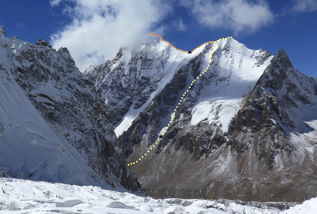
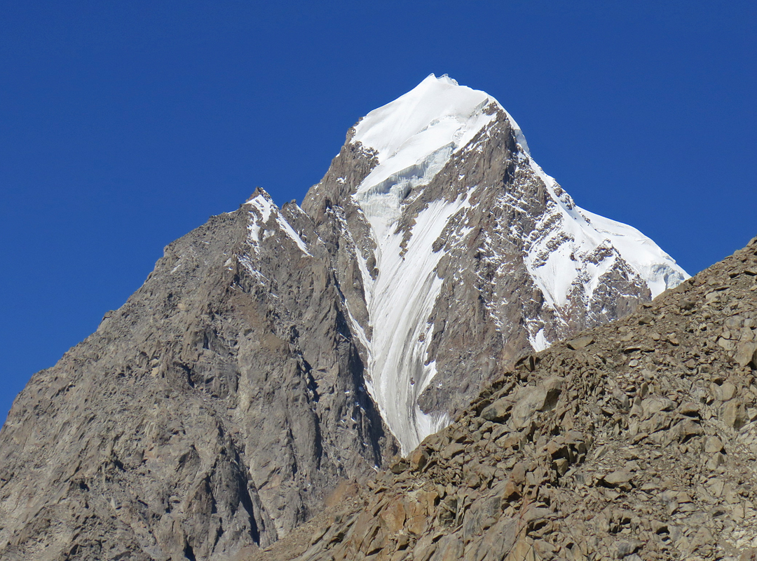
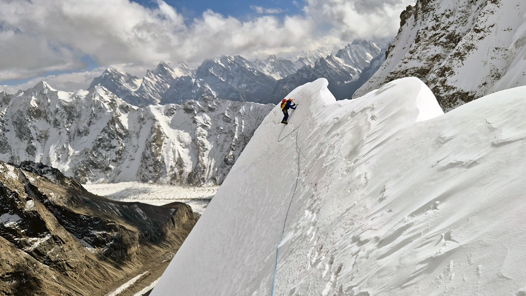
On September 29, we spent five and a half hours ascending a large couloir (60°) on the east face of a summit of around 5,800m (36°16’59”N, 74°57’16”E, Peak 9 on the Jerzy Wala map, south of the previously climbed 6,453m Borondo Sar). After reaching the south ridge, we followed the corniced arête to the top. Believing the peak to be unnamed, we called it Alu Sar (“Potato Peak” in Balti). The 1,030m ascent was D.
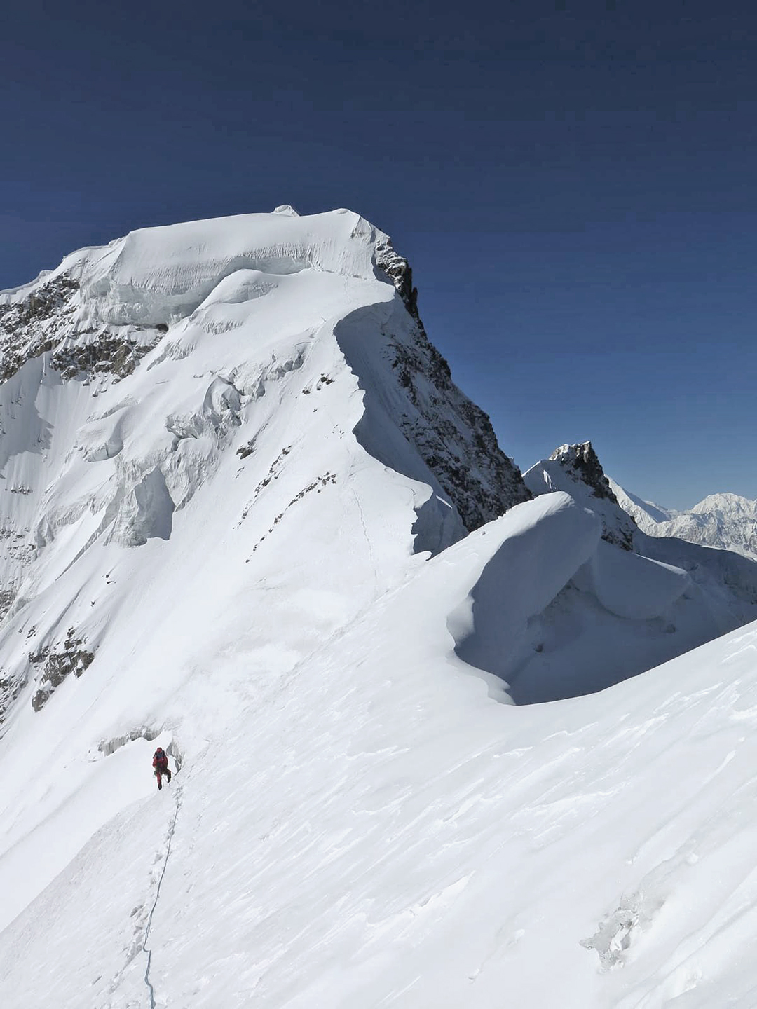
We descended the ridge to a col at 5,700m and bivouacked. Next morning, after a comfortable but cold night, we continued along the ridge to the southwest, overcoming complex terrain to reach a higher summit of around 6,100m (36°16’32”N, 74°57’02”E, Peak 8 and 6,134m on the Jerzy Wala map). We graded this ascent D+ and named the summit Zang Sar (“Rusty Peak”).
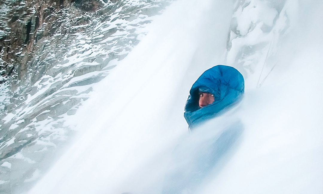
A subsequent attempt to climb a more difficult, higher peak was thwarted on October 11 due to the cold and increasing avalanche hazard. We endured a bad bivouac with serious spindrift until a lull enabled us to descend. Once on the glacier, we witnessed a medium-sized avalanche sweep our descent route.
On our return to Nagar, we showed villagers pictures of the two mountains we’d climbed. They told us the higher peak was called Naseer Baig I and the smaller one Naseer Baig II. The name Naseer Baig refers to the campsite at the foot of the higher peak.
—Louis Rousseau, Canada
Media Gallery