Langdak, North Face, Bande Organisée
Nepal, Rolwaling Himal
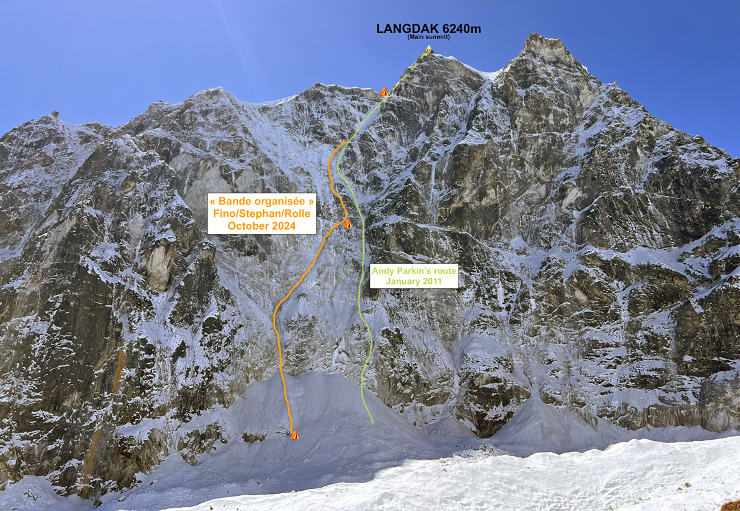
After travel complications caused by intense flooding in Nepal, Antoine Rolle, Mathieu Stephan, and I reached Namche Bazaar on October 12. Another three days of trekking to the northwest brought us to our base camp at 4,560m on the Chhule Plain, north of Marlung in the Bhote Kosi Valley. Ascending the Chhule Valley to the west, then the Langdak Glacier, we reached the north face of Langdak (6,220m, 27°55’1.43”N, 86°33’40.65”E), our objective, and quickly identified a line that was not particularly exposed to objective risks.
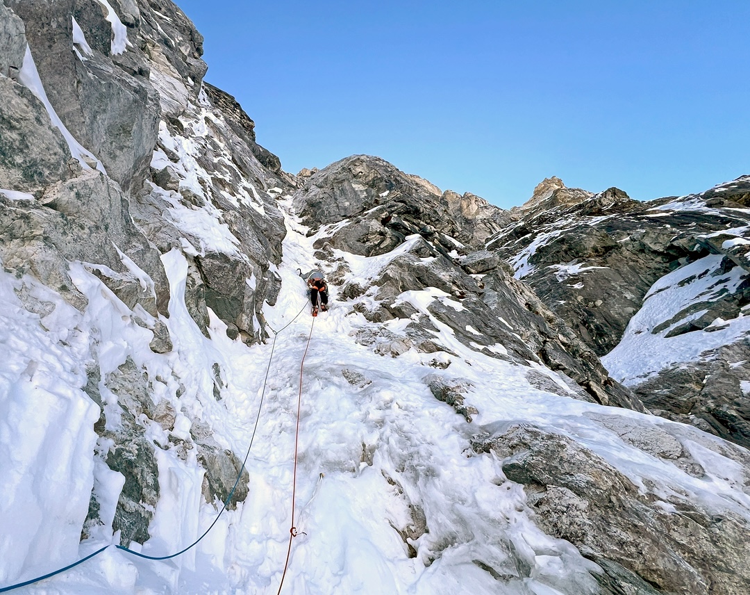
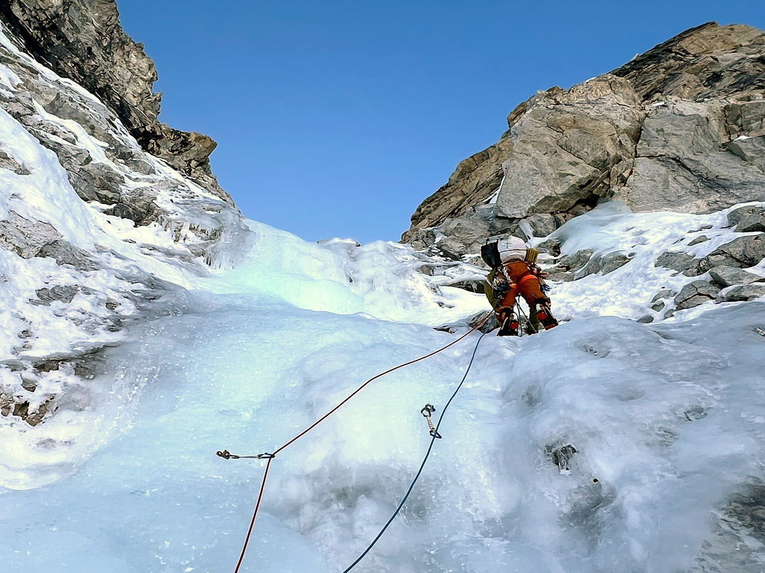
We acclimatized on an unnamed 5,500m summit just in front of Langdak, then took two days’ rest before walking the three hours to the foot of Langdak, where we bivouacked. We had time to fix the first two rope lengths (ice and loose snow) before going to sleep. The next morning, October 26, we climbed mixed terrain and snow of varying quality to an altitude of 5,640m, where a narrow bank of snow allowed us to pitch a tent. We were able to fix two ropes in the superb ice gully above before dark.
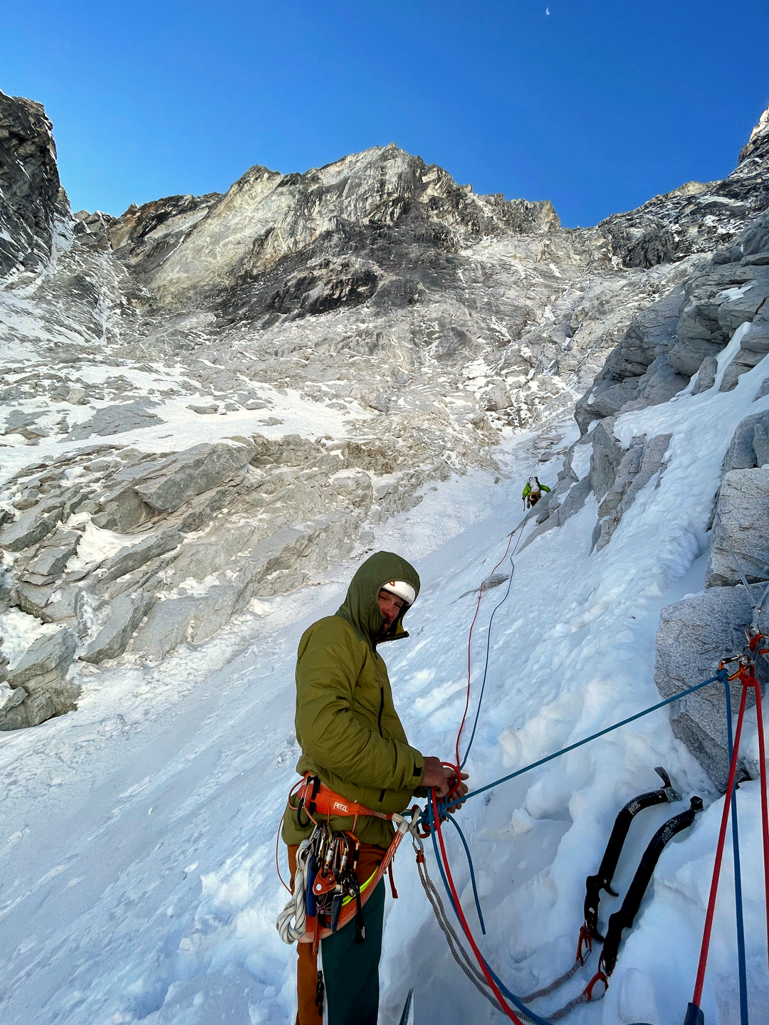
The following morning, having regained our high point, we were forced to use aid for a few meters on a pitch in poor condition. A beautiful gully then led to the upper couloir, which turned out to be more difficult than expected. At 5:30 p.m., we reached the top of the couloir and the col on the east ridge, setting up our bivouac at 6,140m.
At 7 a.m. on the 28th, we began climbing the easy ground above. One hour later, after a few mixed sections and the final snow slopes, we stood on the summit. The weather was perfect, allowing us to enjoy a fine panorama before starting down the standard route on the west ridge and southwest face. Rappelling the north face would have been quite complicated, because the route had several traverses, and poor rock and ice would have made it difficult to set up anchors. One hour later, we reached the upper Drolambo Glacier, which we descended painfully until 4 p.m. Our final bivouac was on the Rolwaling side of Tashi Lapcha Pass, where we used up our last supplies and gas.
The next morning, October 29, we roped up to cross the 5,753m pass, then put all the technical equipment in our packs and walked down to Thame. On the 30th, four hours of walking up the Bhote Kosi Valley took us to base camp. The loop had been completed. We called our route on the north face Bande Organisée (1,000m, 26 pitches from 30m to 70m, AI4+ M5 A1).
—Jérémy Fino, France
Historical Notes on Langdak: In January 2011, Andy Parkin made the first ascent, solo, of the north face of Langdak, which he estimated to be around 850m high. The 2024 route starts left of the line climbed by Parkin, then joins it for the upper couloir. Langdak was the name given to the peak in spring 2014 by the Nepalese government. Before that, it had several names: Trident, used by the first ascensionists in 1952; Singkar, the name most commonly used by many Sherpas until around 15 years ago; and Rima Mancho, which was the name given to Parkin by local Sherpas. For more history of this peak, see AAJs 2012 and 2016.
Media Gallery