Mt. Barnard, East Rib
California, Sierra Nevada, Sequoia National Park
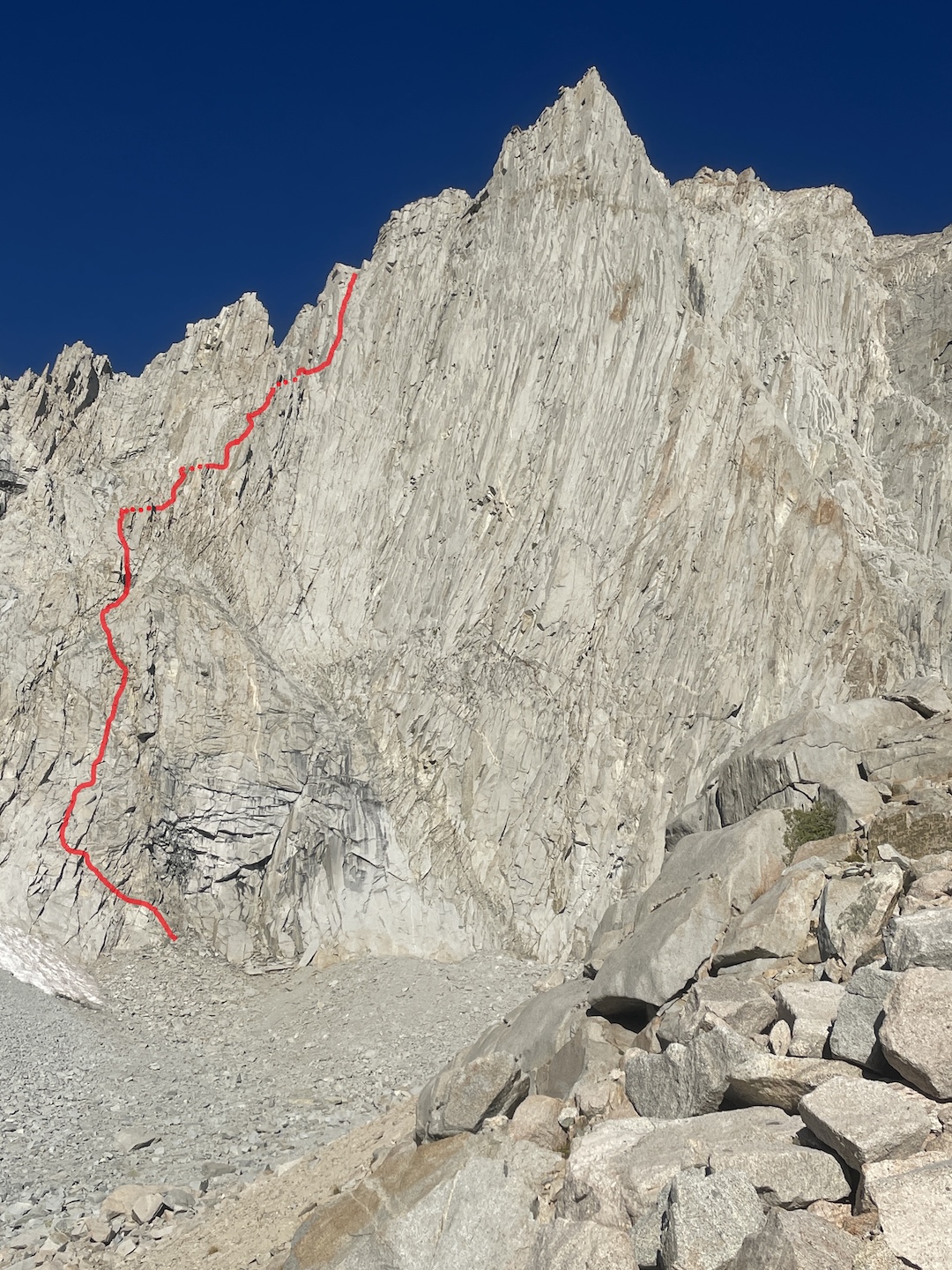
I had long heard about the classic 1972 East Pillar route on Mt. Barnard’s east peak (ca 13,680’): It has a reputation for quality rock and movement, guarded by a big, brushy approach. (Its name also has a convoluted history, having been variously called the East Pillar, the East Face, and the Rowell-Auger, after first ascensionists Galen Rowell and Tim Auger.) Looking at photos of the route and face, I saw potential for a new line up a subtle ridge to the left of both the East Pillar and the 2013 Maiden-Tomczik route (which is itself to the left of the East Pillar). This ridge feature tends to blend into the larger face in pictures. In mid-September, Jake Terry and I hiked in six miles on the abandoned Vacation Pass Trail along George Creek, hoping to climb the classic route and maybe put up our own.
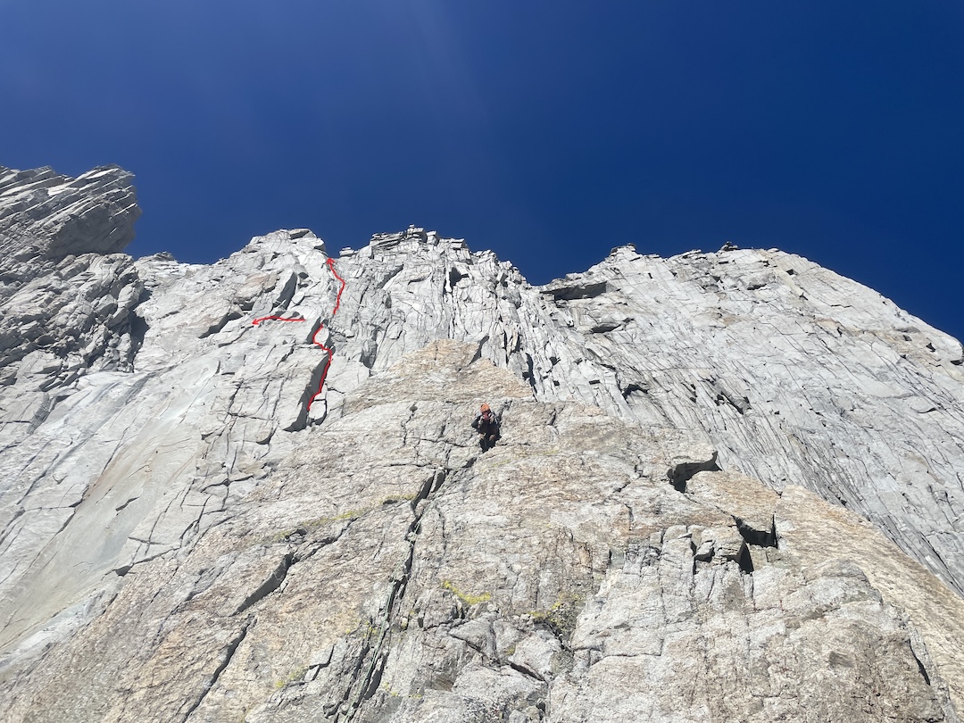
The East Pillar was as good as I had heard, and it gave us a decent vantage point from which to view the unclimbed ridge. The next day we started up this subtle feature. Our first few pitches wandered along the path of least resistance through mediocre rock. Once the ridge feature became more defined, we found typical Sierra ridge climbing, replete with towers and fun trundling. Jake led us up a cool orange face on the second tower. Our eighth pitch was 50m up the last tower on good gray granite. A sharp left here took us to a huge, sandy ledge, where the ridge intersected the larger east face perpendicularly.
We had several options for finishing our new route: Far left was an unappealing gully; center-left looked cool—but also hard. We opted for a weakness on the right. To get there, we climbed a short, shallow, left-facing corner, with thin moves and thin pro right off the sandy ledge. This pitch—a 30m rightward traverse—proved to be the crux of the route. It led us to a crack system that we followed to the top, and a quick hike brought us to the summit. The descent by the northeast slope took us down sand, through a beautiful little meadow, past a remarkably large boulder, and right to our camp. We called our route the East Rib (1,500’, 5.10a). [Editor’s Note: The author pointed out that, per High Sierra Climbing, Volume 1, by Vitaliy Musiyenko and Roger Putnam, a route on the right side of Barnard’s east face—The Good, The Bad, The Awesome (AAJ 2015), reported by Doug Tomczik—followed some or all of a 1990 route known as the East Dihedral, established by Ken Kanega and Pat Brennan.]
—Ian McEleney
Media Gallery