Sejong, Southwest Couloir and West Ridge
China, Sichuan, Northern Shaluli Shan, Zhuqing Range

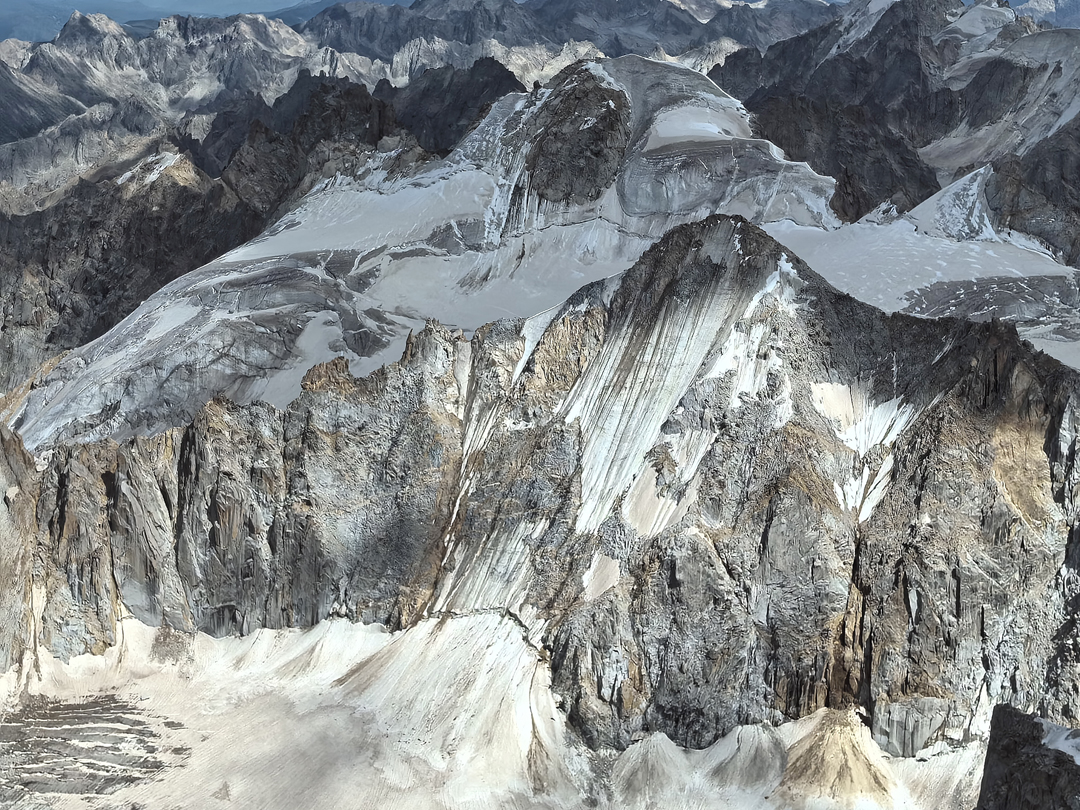
During a reconnaissance of the northwest end of the Zhuqing Range, south of the town of Zhuqing, Fu Yongpeng noticed the unclimbed peak of Sejong (5,816m, 32°2'9.62"N, 98°48'42.29"E) and neighboring Peak 5,680m. Sejong had been labeled Nobyugya on Chinese maps, but this was a mistake, subsequently confirmed by the local survey office.
In August, Fu returned with Cao Xinyue and approached the northeast side of these peaks via the valley directly behind the monastery at Zhuqing. They established a 4,850m camp at the base of the east branch of the glacier and on August 31 set off for the northwest face of Peak 5,679m (32°2'3.52"N, 98°50'27.96"E). The upper section of the glacier was badly crevassed.
After a pitch of AI3 to get established on the ice face, the two climbed four or five pitches before meeting a wide crevasse that seemed endless in both directions and only crossed by fragile snow bridges. They flew a drone to see if there was a feasible way through but found none and retreated to camp and Zhuqing.
On September 2, they drove around to the south side of the range and made base camp in a rented house at 4,300m. The following day, they walked up-valley to camp southwest of Sejong. The next day, they reached the far left side of the south face of Sejong and started up rocky terrain that was loose, with a section of 5.10. They descended and instead went straight up a southwest-facing snow and ice couloir to the left. As it was near the end of the rainy season, the ice was thin and poor, but after 300m the angle eased. At 4:30 p.m., they were hit
by a strong hailstorm. The two continued until Cao found a crevasse for a sheltered but uncomfortable bivouac. The following morning, after two hours of climbing through mist, they reached the exposed summit ridge and continued along the steep flanks and over a subsidiary top to the main summit.
To descend, they retraced their steps a short distance along the ridge and then dropped directly down the south face in a snow/ice couloir. Eleven rappels, with some sections exposed to rockfall due to the strong afternoon sunshine, took them to the remains of the upper glacier. They regained camp a little before dark.
Their ascent to the summit ridge had involved around 900m of climbing at AI3 60° snow.
— Xia Zhongming, Germany
Editor's Note: With new information from a Chinese climber who also has climbed in this area, a number of corrections and updates to this report were made in May 2026.
Media Gallery