

Cerro Redondo, South Face, Corta Corriente
Chile, Southern Patagonia, Sierra Baguales
 In October, the Torres del Paine National Park was still closed due to the COVID-19 pandemic. We began to look at climbing objectives in the surrounding ranges. After a tip-off from local climbers who had just climbed the route Painakan (see report in AAJ 2021) on the approximately south face of Cerro Redondo (ca 1,850m, 50°38'47''S, 72°24'7''W), Antonia Aldunate, Nicolas Secul (Chile), and I set off to make the second ascent of the face.
Cerro Redondo is located about 50km to the northeast of Torres del Paine in the Sierra Baguales. This range is made up of volcanic and sedimentary rock—not ideal for climbing in summer but exploding with potential for mixed and ice climbing in the austral winter.
We approached from the Baguales River valley, hiking north then northeast, and set up base camp in a gauchos’ hut four hours (halfway) into the approach[2] . Leaving from the hut the next day, we reached the base of the south face at sunrise and got straight into stellar ice climbing. The first 60m pitch climbed solid, vertical water ice. After another steep ice pitch, we navigated up snow ramps and mixed sections, before traversing slightly east (right) to a runnel we had noticed from the base of the wall. The runnel proved to be quite technical, with ice no more than an inch thick. We alternated between mixed chimney climbing and technical ice hooking to make our way up these two crux pitches.
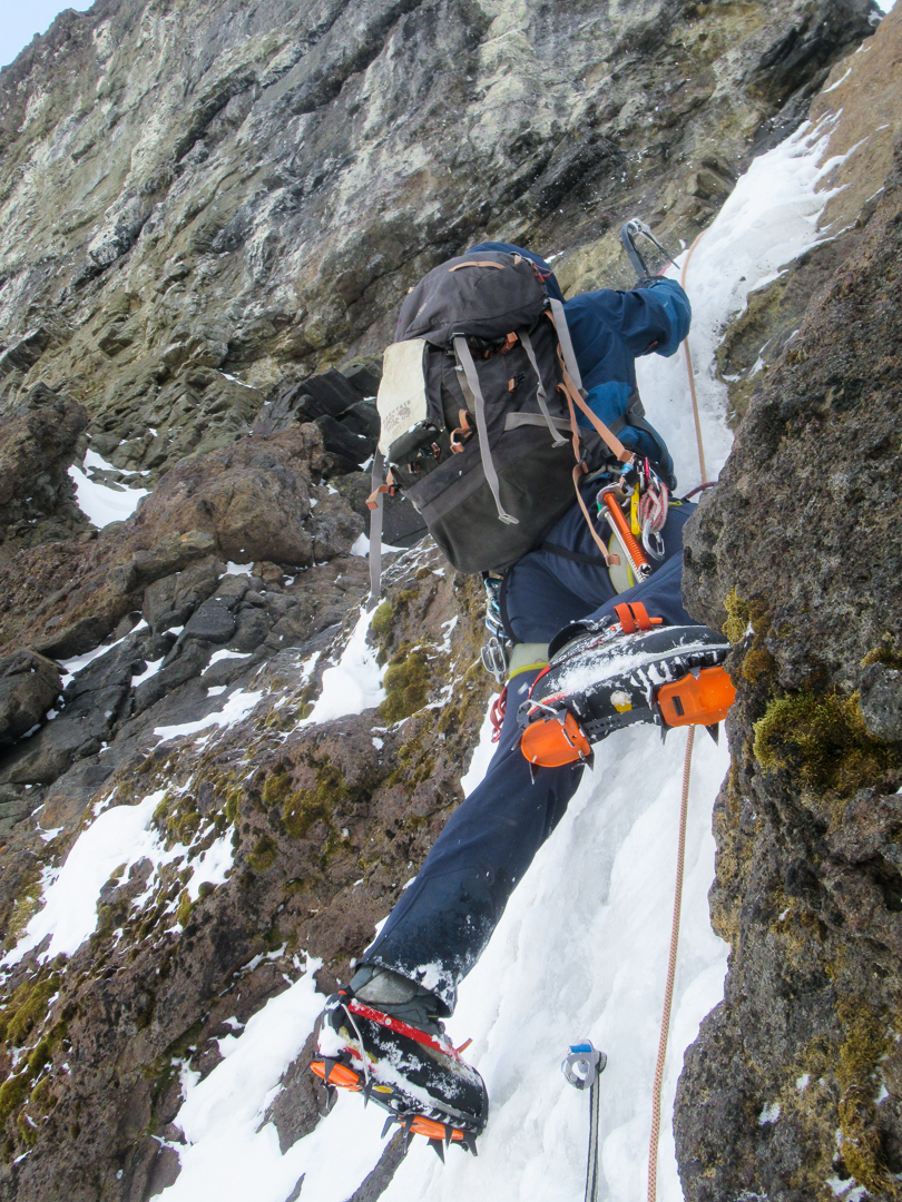 After pulling through the runnel, we simul-climbed another section of steep snow. A final mixed problem gained the summit ridge, which we followed for 300m west to the summit (approximately eight hours from the base).
The view from this range is astounding: Everything from the Torres del Paine massif to Fitz Roy and the Chaltén Massif can be admired amid a full panorama of the Southern Andes. We descended via the northwest ridge, following the ridgeline until low-angled snow slopes allowed us to loop around to the south (approximately two hours in all) and exit via the same valley we had hiked in. We named the route Corta Corriente (800m [climbing distance], WI5) after a pair of torrent ducks that we saw calmly cruising their way up the rapids of the Baguales River.
– Seb Pelletti, Australia
Media Gallery


