

Western At Bashi Range, Many First Ascents
Kyrgyzstan, Tien Shan

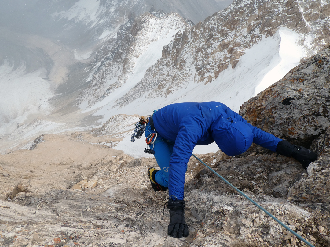
View east from the ascent of Pik Vulture to (A) White Lady, (B) Rabbit Ear, (C) Twin Towers, (D) Yellow Tower, and (E) Black Spark. Photo by Mark Aitken |
THE AT BASHI RANGE is more than 100km in length and about 30km wide, a beautiful region of snow and rock peaks, many still unclimbed. The highest summit is Pik Rhianydd (4,801m), and average peak altitude across the range is around 4,300m. Our expedition was organized by the International School of Mountaineering (ISM), which has done many trips to the At Bashi, and was led by Adrian Nelhams. The goal was unclimbed summits in the far less explored western sector of the range.
From these camps we were able to summit a total of 13 peaks between 4,152m and 4,768m, of which 11 were previously unclimbed. Second ascents were made of Pik 4,152m and Pik Vulture (4,516m), which had been climbed by us in 2017 during a reconnaissance of this area (AAJ 2018); both are straightforward walks up scree and rock at F and PD-, respectively.Arriving in country during August, we first rock climbed (up to 5.9) on the limestone peaks near Tash Rabat. We then approached the At Bashi from the south, which required special permits due to its proximity to the Chinese border. We established base camp (3,762m) at 40°50'50.1"N, 75°36'01.8"E, and later an advanced base at 4,040m further up valley at 40°52'54.07"N, 75°35'45.07"E.
We were later informed by Vladimir Komissarov (president of the Kyrgyz Alpine Club) that one of our 11 new summits, Pik White Lady (4,768m), had previously been reached during the Soviet era using a helicopter to carry out a survey close to the Chinese border. He confirmed that no alpine ascent had been made until ours. We found a large tripod on this summit, but there were no signs of equipment or previous ascents on any of the other 12 peaks. Our climb of White Lady, the highest and most beautiful peak in this part of the range, was very satisfying. Our route crossed the moraines and glacier east of advanced base and then ascended steep snow. Another memorable summit was Pik Black Spark (4,520m), and two routes were made to its steep rocky summit.
Piks Rabbit Ear, Yellow Tower, and Twin Towers were also particularly rewarding summits. All three peaks initially appeared to require sustained technical rock climbing on very steep walls. However, good routes were found up each of these summits that avoided some of the wall climbing, particularly on Rabbit Ear.
Our team comprised the guides Adrian Nelhams, Max Cole, Tommaso Dusi, and Aleksey Potockiy, along with team members Mark Aitken, Tony Belgrave, Guy Burton, Vincent Gunnarsson, Kamal Kayat, Ruta Mikulenaite, Jason Sheldrake, Harry Wilson, and David Woods.
New peaks climbed were:
Pik Nomad (4,263m, 40°51'02.61"N, 75°34'24.15"E, August 24). This was a rocky ridge scramble after first ascending Pik 4,152m, heading north down to the col, and then continuing up the sawtooth south ridge (PD).
Pik White Lady (4,768m, 40°53'36.14"N, 75°36'20.41"E, August 27). From advanced base we crossed moraines to the lower glacier, then climbed the steeper northeast glacier on good snow (up to 45°) to the rocky summit (PD+).
Pik Rabbit Ear (4,420m, 40°53'14.54"N, 75°35'42.71"E, August 27). After descending from White Lady we traversed to a col low on the glacier and then climbed up a scree slope to a rocky ridge. Two pitches of moderate rock climbing led to the summit (AD).
Pik Black Spark (4,520m, 40°52'44.59"N, 75°36'34.71"E, August 28 and 29). On the 28th one team approached from the south, climbing the rocky south ridge to a narrow, northerly, rock tower. Continuing toward the main summit they were forced to retreat due to an electrical storm. They retraced their route the following day and continued to the small steep main summit (AD). Also on the two 28th two different teams approached the peak directly from advanced base. This involved crossing a prominent bergschrund and then climbing several pitches of steep ice (60°), followed by the steep black rock above. This led to a slightly lower subsidiary summit, from which they descended to a col and followed a very steep ridge, with moves of British 4b, to the main top (AD+). Both teams quickly left the summit when electricity was felt charging the nearby air.
Pik Yellow Tower (4,550m, 40°52'54"N, 75°36'47"E, August 29). A team used the same approach as for Pik Black Spark but then climbed several pitches of ice up to 60° to a col between Yellow and Twin Towers. We then climbed four pitches of sometimes very loose rock up to 5.5 to the summit (AD+). Rappels were needed on the descent.
Pik Twin Towers (4,585m, 40°53'00"N, 75°36'43"E, August 29). From the col between Yellow and Twin Towers we climbed five pitches (5.6) up sometimes very loose rock to the summit of the lower south tower. We crossed this, rappelled into the gap beyond, and finished up the east side of the higher north tower. The overall grade was D-.
Pik Rider (4,608m, 40°52'40.37"N, 75°34'14.03"E, August 29). We approached up a small glacier to its top corner, which sits just to the south of, and on the same ridge as, Pik Black Spark (AD+).
Pik Striped (4,504m, 40°52'43.12"N, 75°34'15.07"E, August 29). After Pik Rider the team continued along more rocky terrain to climb the north ridge of Pik Striped (AD).
Pik Isolation (4,455m, 40°52'60.03"N, 75°37'87.07"E, August 30). A long easy walk from base camp, across vegetation, scree, and rock, to the summit. Great views of the entire range (F).
Pik Castle (4,614m, 40°52'43.12"N, 75°34'15.07"E, August 30). The stream from advanced base was followed north to the upper reaches of the valley, above which the main ridge leading to the Castle was gained by the scree slopes and rock of the west face. This ridge was then followed south to the summit and offered good scrambling and climbing on compact rock (5.5), particularly in the last 100m (AD).
Pik Keep (4,608m, 40°52'40.37"N, 75°34'14.03"E, August 30). The north ridge from the Castle was descended, partly by rappel. After this, slopes of good rock were climbed at 5.5, with some tricky moves, to the summit (AD).
After leaving the mountains, we traveled to the limestone canyons of Son Kul, where we put up several first ascents of over 200m in length (six pitches) up to British E1 5b (5.10b).
Editor’s note: Additional information and photos can be found in this expedition journal at the ISM website.
– Mark Aitken and Adrian Nelhams, U.K.
Media Gallery


