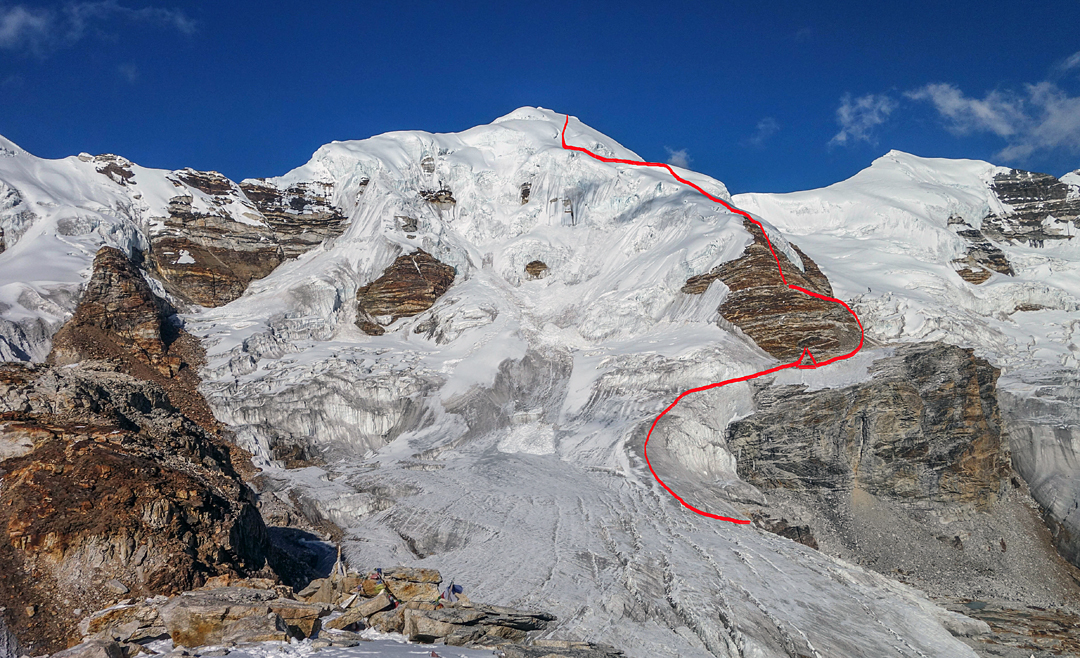
Yanme Kang, South Face
Nepal, Ohmi Kangri Himal

Approaching via Yangma and the lakes of Nangamari Pokhari and Pabuk Pokhari, Grégoire Lestienne and Floriane Pugin (France) established base camp on October 24 at 5,400m. On the 28th they moved up to a bivouac at 5,800m on the south face of unclimbed Yanme Kang (6,206m, 27°56'59.64"N, 87°50'29.08"E), a peak opened in 2003 that lies on the border with Tibet to the northwest of Nangamari. On the following day they climbed the south face to the summit, comparing the route to ascending the Dome du Goûter in the Mont Blanc Range. There was little danger except for a large crevasse that cut across the whole face at 6,000m and was passable via a snow bridge. Their GPS measured 6,220m on the summit.
On the 30th they attempted the first ascent of Lang Chung Kang (6,475m), another border peak at approximately 27°56'20.19"N, 87°51'32.28"E, between Yanme Kang and Nangamari. The western flank of this fine pyramid is objectively very serious, and the access to it is very exposed to huge serac falls, as shown by a drone reconnaissance. Instead, the two tried to climb the peak by crossing the border north of Nangamari and reaching the east face. They climbed 500m to an altitude of 5,300m, where it began to snow and they retreated.
They left base camp and moved south of Pabuk Pokhari, then on November 2 climbed a 400m northeast-facing ice/mixed couloir that led to a col at about 5,700m on the east-southeast ridge of Senup (6,265m). They named this ascent Les Brasseurs Savoyacks (M3 75°).
– Lindsay Griffin, from information provided by Grégoire Lestienne, France, and Rodolphe Popier, the Himalayan Database, France


