Peaks Around Boesam Pass
Pakistan, Karakoram, Ghujerab Mountains

James Lawson, Will Smith, and I initially planned to visit the Yashkuk-Yaz Glacier in northwest Gilgit-Baltistan, near the Afghan border. Unfortunately, our permit was denied at the last minute. Inspired by a report from Pete Thompson in AAJ 2016, we subsequently planned to visit the Virjerab Glacier and attempt unclimbed Khurdopin Sar (6,310m). However, on arrival in Shimshal we found that during the previous months the Khurdopin Glacier had advanced by a kilometer, preventing all access to the Virjerab Glacier. A Pakistani Army geological survey confirmed this and also noted a 100,000-square-meter glacial lake, which burst in late July, shortly after our trip finished, damaging farmland and a key road. Fortunately, no one was hurt.
Needing a new objective in the Shimshal Valley, we were informed of an area of unclimbed peaks a little under 6,000m, close to Boesam Pass (ca 5,000m). We arranged porters from Shimshal and reached base camp (36.53042°N, 75.33411°E), southwest of the pass, on our third day of trekking from Shimshal. Over the next three and a half weeks, we made seven attempts to climb peaks, completing what we believe to be four first ascents.
Having set up a high camp on the pass, we climbed the northwest face of the snowy 5,700m peak at 36.53440°N, 75.36591°E in order to acclimatize (PD). The next day we attempted to climb up the basin opposite but found the ridge at the back of the cwm impassable.
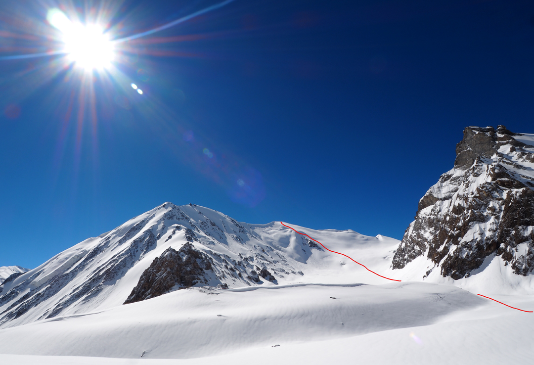
Several days later, we attempted Koh-e-Brobar (6,008m), which had been summited in 2001 by Samina Baig and her brother Mirza Ali, although we were not aware of this at the time. We headed up the long, sweeping ridge which at first runs northeast then north-northwest to the summit, a different route than Samina and Mirza’s. We abandoned the route at a shoulder due to poor snow conditions. The roughly 3km ridge was beautiful but heavily corniced throughout its length (PD). We topped a high point on the crest of 5,625m.
We next climbed the 5,503m peak immediately southeast of the pass at 36.53891°N, 75.34747°E, summiting via the 500m northwest face (AD). The snow was extremely poor in parts, with sections of chest-deep powder. We turned back approximately 3m below the true summit, finding an extremely unstable tower of choss at the top of the ridge.

After a frustrating period tent-bound in poor weather, we made the most of more settled conditions by setting up a camp in the basin to the north of our base camp, from which we made a successful ascent of the 5,930m peak at 36.56241°N, 75.31744°E by its south ridge (AD). We named this peak Imtiaz Sar after our excellent guide, who supported us at base camp.
We were then forced to remain in base camp for almost a week, as more heavy snow set in. When this eventually cleared, we established another camp at 36.56601°N, 75.35483°E in one of the valleys on the north side of the pass (west of Koh-e-Brobar). From here we climbed the 5,970m peak at 36.572875°N, 75.319553°E by its impressive east ridge, passing a number of rocky pinnacles and safely negotiating two cornices to reach the summit (AD). The instability of the snowpack following recent snowfall was made very clear during our descent, with significant slab avalanches from the crest of the ridge. We named this peak Arman Sar, after our equally excellent cook.
The following day, Will and I attempted the ca 6,000m peak to the north of Arman Sar at 36.581233°N, 75.316892°E, but turned back on the east ridge at 5,700m due to poor snow conditions and warming temperatures.
Tim Seers, U.K.
Media Gallery