Asia, India, Himachal Pradesh, Miyar Valley, Tamadonog, Doomed to Miyar; Geruda Peak, First Ascent

Tamadonog, Doomed to Miyar; Geruda Peak, first ascent. The Tharanga, the local population of the lower Miyar Valley, are mainly shepherds and farmers. They gladly help expeditions visiting their valley and were of great assistance to our second Polish trip to the area.
From the beginning we had difficulty reaching base camp. Our first obstacle was a broken bridge on the way from Manali to Tingrad. Travel beyond became impossible in our off-road vehicle, so we had to carry our baggage across a footbridge and on the far side arrange a second truck to Tingrad. There we encountered another unpleasant surprise. We could not use horses to transport our gear, as I did in 2005. The bridge at Chaling was broken, and we had to hire porters to carry our 300kg of equipment. After five hours of negotiations we brought down the price by 50 percent and hired 11 men. We left Tingrad the next morning and arrived at base camp two days later, after a walk of 30km.
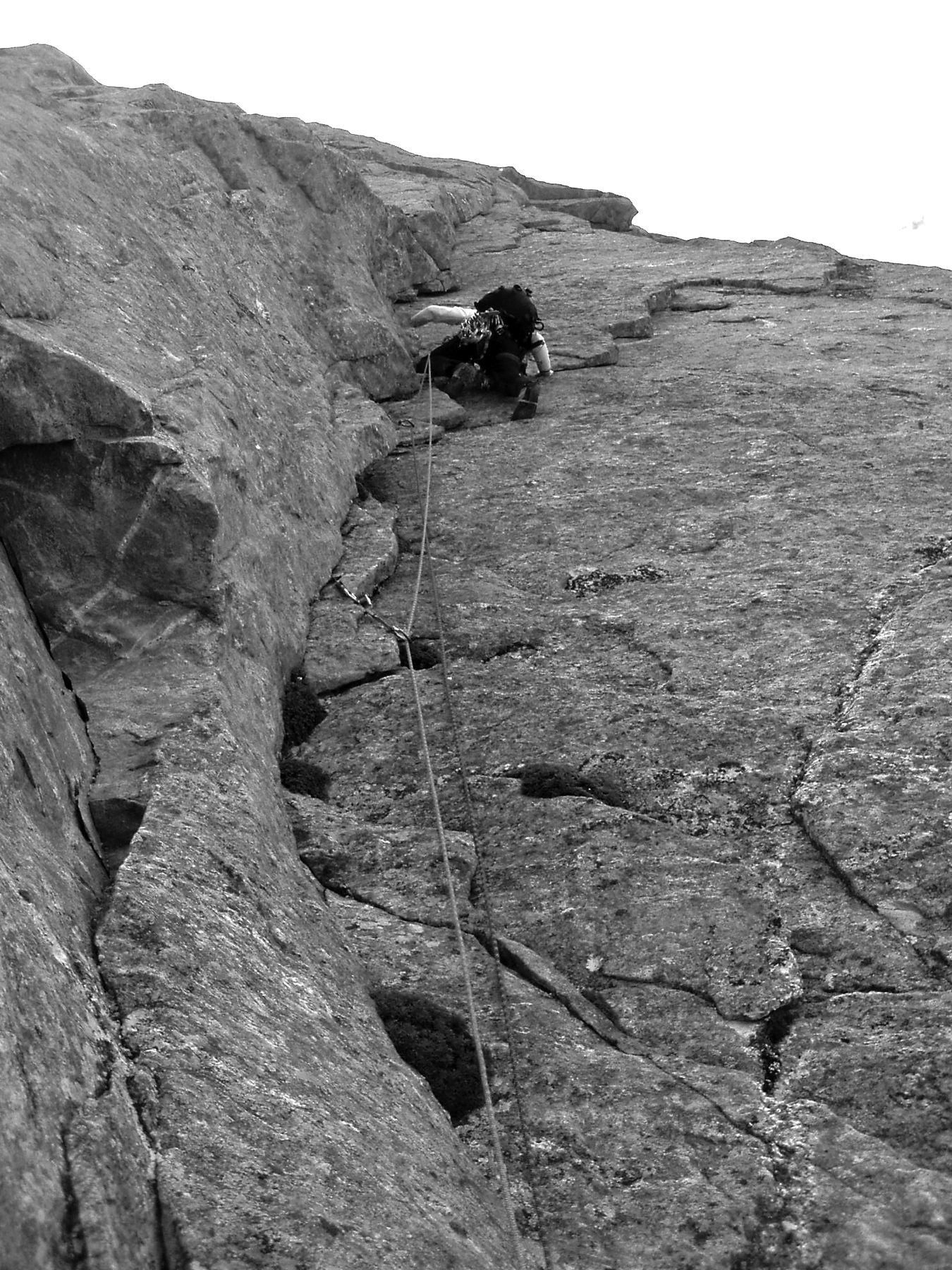
During the first three days the weather was unkind,but despite the rain we thought we ought to try something. To acclimatize, Przemek Wojcik and I went to the northwest face of Tamadonog (ca 5,245m; the name given by local porters) overlooking the Takdung (a.k.a. Nameless) Glacier valley. We set up advanced base at 4,240m. The next day, after looking at the face for the best line, we started climbing, covering 500m, mainly in cracks, until the weather broke. We had a cold camp that night, and the next day, August 14, climbed the remaining 500m of easier terrain, largely up an arête, to the summit. Our 1,000m new route, Doomed to Miyar, took 31 hours, with a crux of VIII- and every pitch climbed onsight. We think this peak was climbed by a Spanish party in 2005, and ours was probably the second ascent.
Bad weather kept us in base camp until the 21st, when we set off up the Tawa Glacier. It took two days to establish an advanced base at 4,860m, at the site used by Italians in 2005 (Francesco Camilucci and friends, see AAJ 2006, pp. 384-385). Our main goal of the expedition had been the unclimbed east pillar of Three Peaks Mountain, but after a reconnaissance we decided that the chimney system forming the obvious line was too brittle and dangerous. On the 27th the weather finally improved, so we decided to go for the virgin summit immediately right of Lotus Peak (climbed by David Kaszlikowski and me in 2005). This summit was also attempted in 2005 by Massimo Marcheg- giani and Massimo Natalini, who completed a route, Million Indian Stars, to the top of a tower. To this tower they assigned an altitude of 5,650m, though it was obviously much lower.
Our route started up the west face to the right of the couloir used on the 2005 attempt. After a 250m ice/mixed gully, we negotiated a further 250m of relatively friable but easy rock. Above came the steep headwall forming the second half of the climb. Vertical cracks and chimneys led to a point three pitches below the summit, where the weather broke. We continued with some difficulty through snow and rain, but the conditions meant I was forced to climb the last pitch using aid. Our 900m route took 21 hours and led to the summit of what we have christened Geruda Peak (ca 5,640m). Difficulties were VII+ A0 50-60°.
Our two friends Michal Apollo and Marek Zoladek made an ascent of Masala Peak (ca 5,650m) via an 800m route of WI4. All our routes were climbed alpine style, without bolts.
Michal Krol, Poland
Media Gallery